Croudace’s Paddock (Jesmond Park)

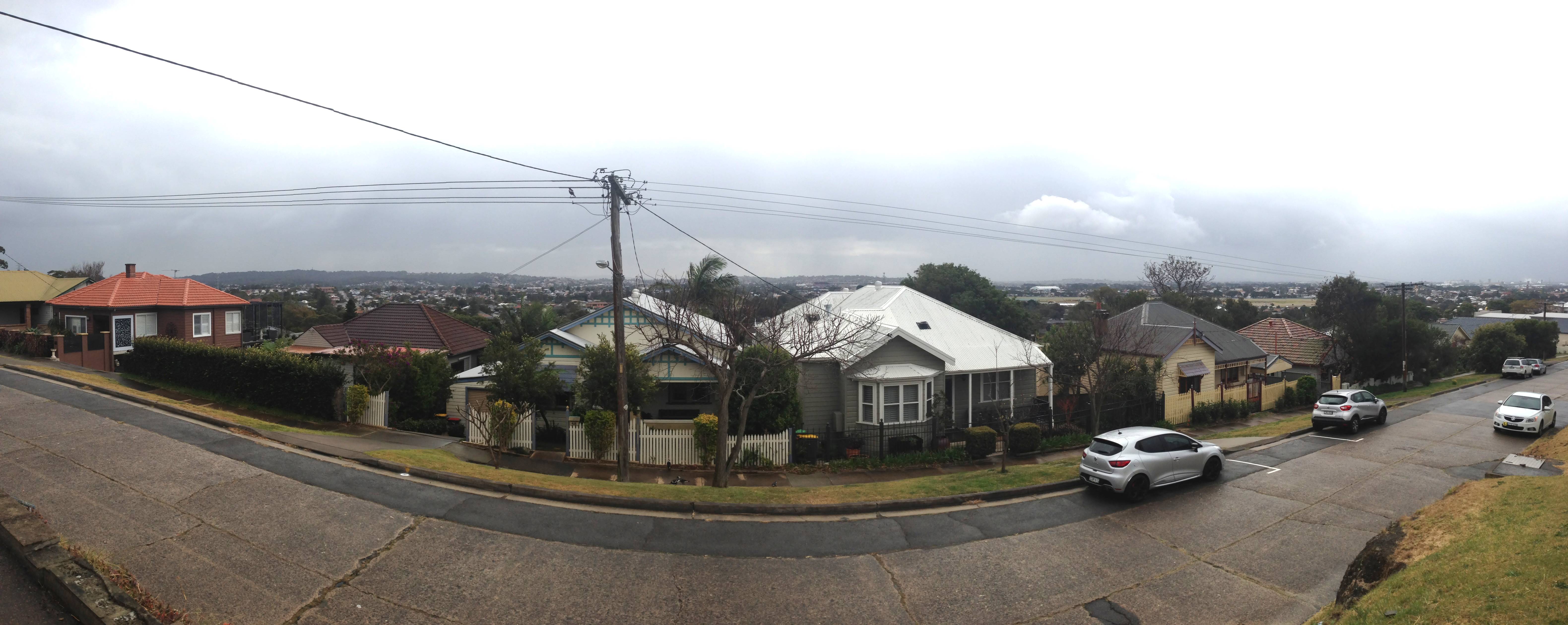
The Scottish Australian Mining Company, owner of the Lambton colliery, was pivotal in the establishment of three of Newcastle’s finest recreation reserves – Lambton Park, Blackbutt Reserve, and Jesmond Park.

Although not officially dedicated until 1924, the Jesmond Park site had a long history of recreational use. From Lambton’s earliest days, this low-lying area at the northern extremity of the company’s mining lease, with Dark Creek running through it, was used for competitive pigeon shooting. It soon also became a popular picnic site, known as “Croudace’s Paddock” presumably because the permission of Thomas Croudace, the colliery manager, was needed to use the area.

Churches, schools, and community groups regularly held picnics there, sometimes with hundreds of attendees. The site was within easy walking distance from Lambton, North Lambton and Jesmond. It became even more accessible when the Newcastle to Wallsend tramway was constructed in 1887. Around this time, the idyllic bushland nature of the picnic site was altered somewhat with the establishment of Campion’s soap and tallow works adjacent to Dark Creek.

As early as 1908, Lambton Council and local residents began petitioning the Lands Department to have the area formally set aside as a public park. Their efforts were rewarded in 1923, when Frederick Croudace (son of Thomas) as manager of the colliery, gifted to the council the 22 acres of land that become Jesmond Park.

Even before the park was officially acquired, the Jesmond Cricket Club was asking permission to lay a wicket, and the park soon became a popular venue for other sports such as football and soccer. A tennis court was constructed in the north-east corner of the park in 1925, and a new Jesmond Park tram stop, in line with Steel St, was opened in 1926.

In 1938, control of Jesmond Park passed from Lambton Council to the newly formed Greater Newcastle Council, who maintain the park to this day.

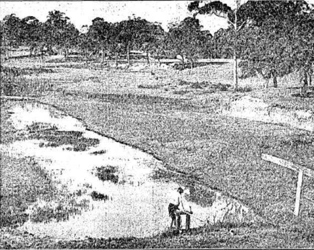
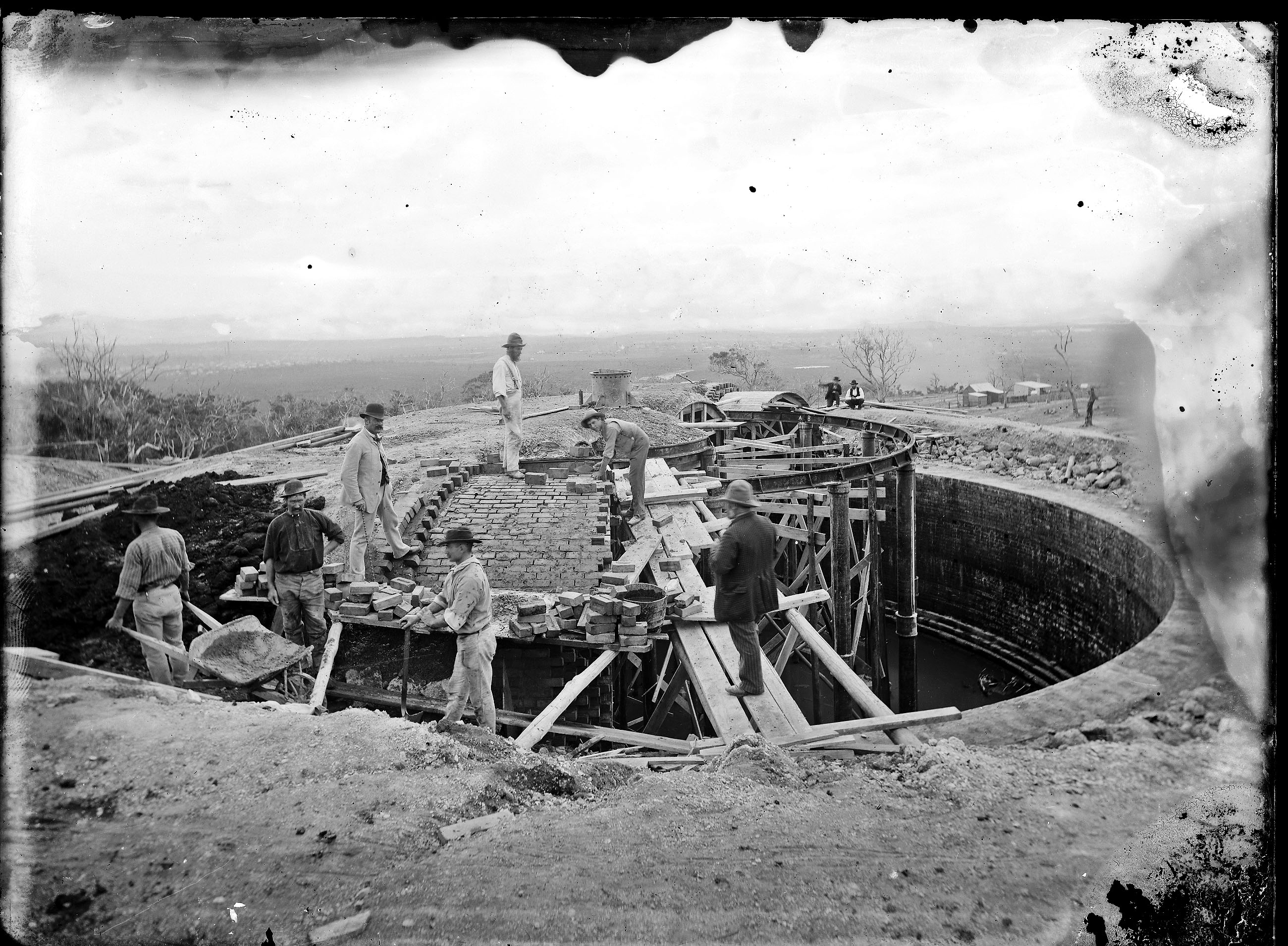
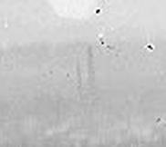
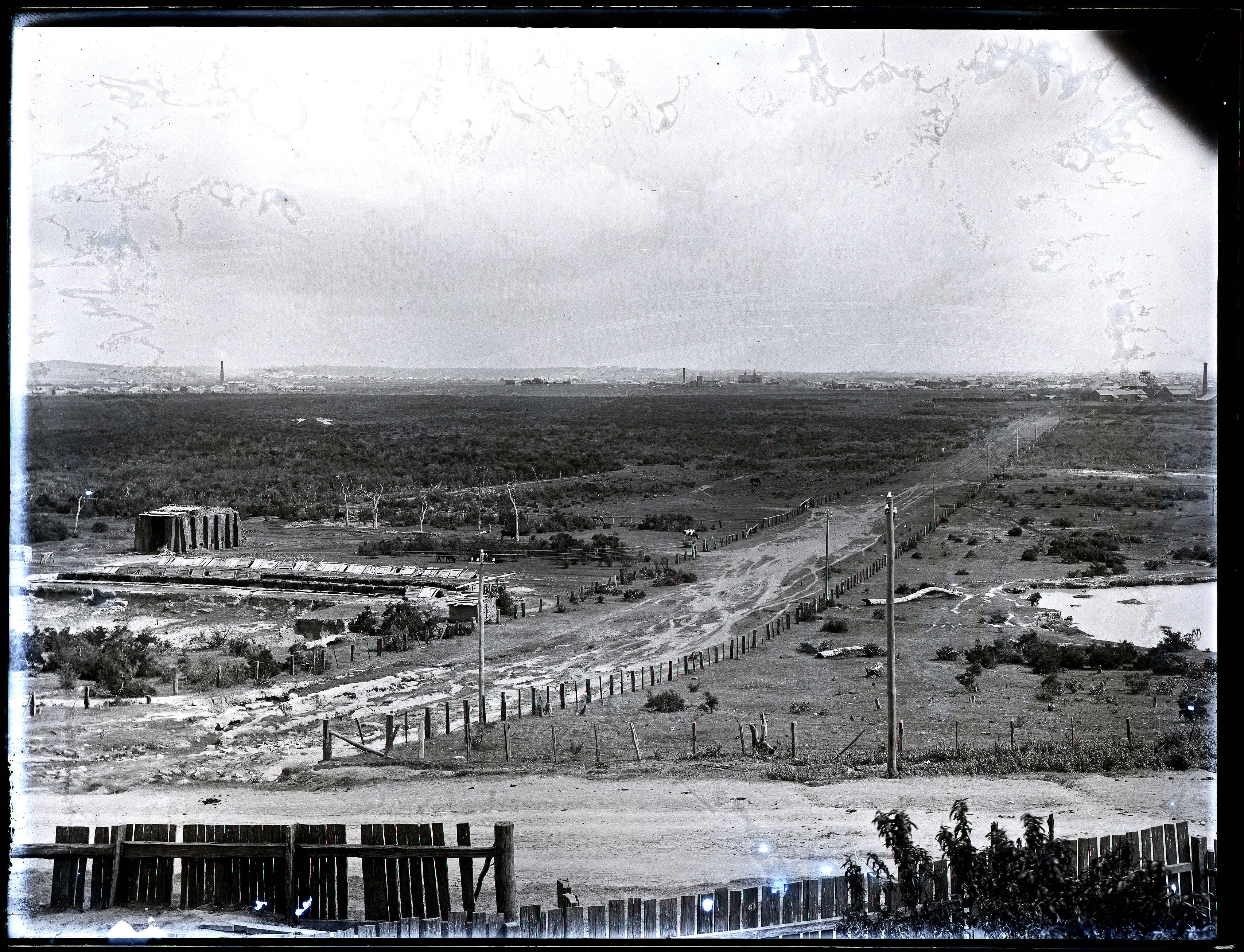
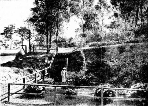
Jesmond Park in 1934, overlooking a dam on Dark Creek that provided water to Campion’s soap and tallow works.

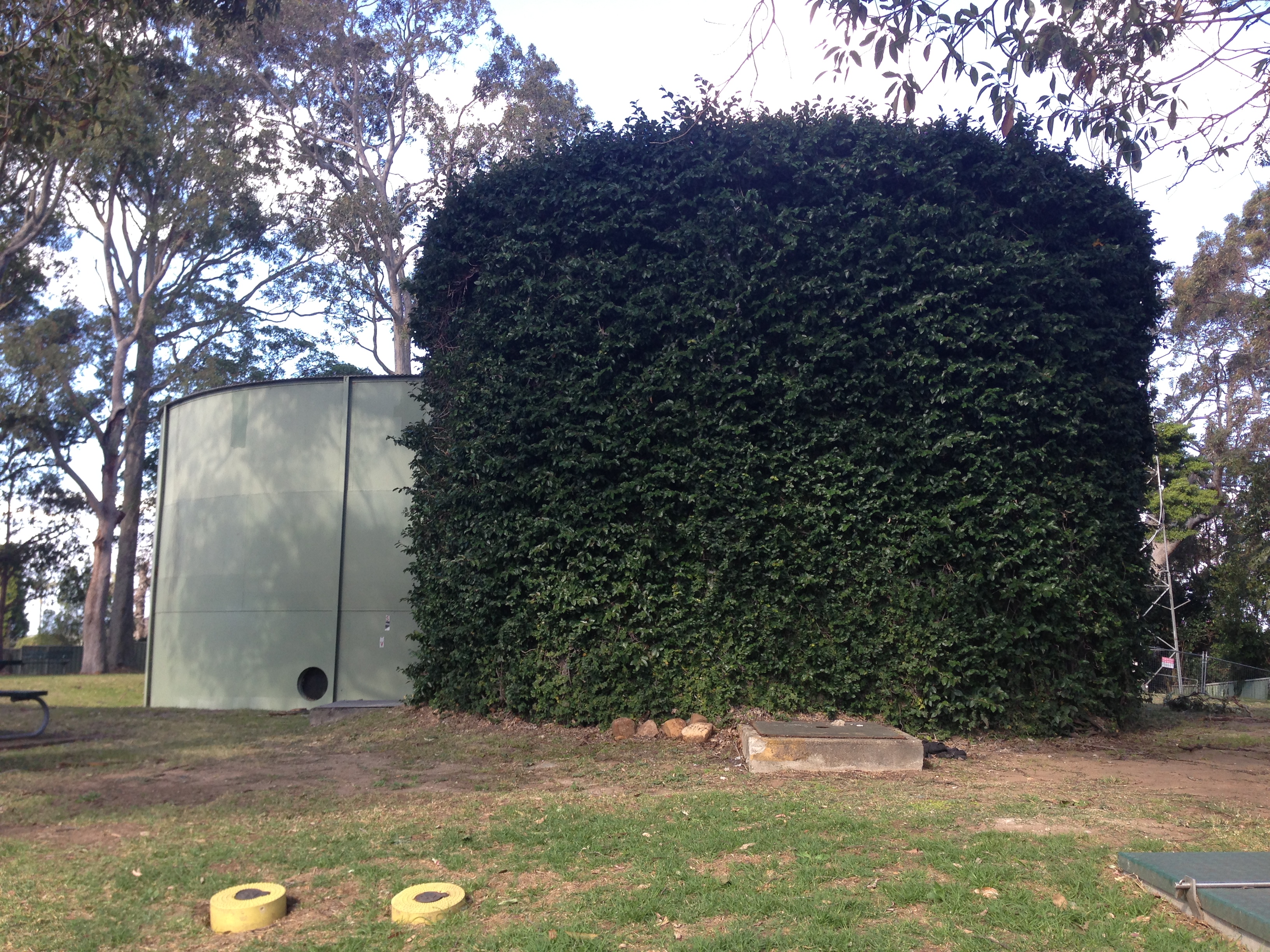
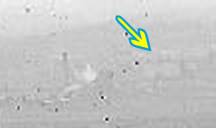
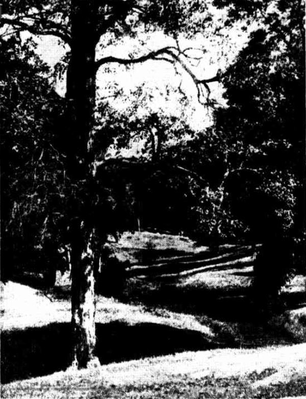
The same location in Jesmond Park, 2017.


The article above was first published in the September 2017 edition of the Lambton & New Lambton Local.

Additional information

  • When the Newcastle to Wallsend tramway was first constructed, there was no tram stop at Croudace’s Paddock, however by request, trams would stop there on special occasions. By 1905 residents were petitioning to have a permanent stopping-place at the site. A new tram stopping place in line with Steel Street was opened in 1926.
  • The area known as Croudace’s Paddock was larger than just the Jesmond park site, but encompassed much of the flat area adjacent to Dark Creek. A 1904 article describes the seven acre sanitary depot as being in Croudace’s Paddock. The sanitary depot was located where the Skyline drive-in theatre would later be constructed, and where Drysdale Drive and Rees Way is today.
  • A November 1938 article on the park noted that the “portion of the park now used as a recreation area was once a cultivation paddock. On it fodder was grown for the mine horses. The land flattened out with the passing years; signs of plough furrows disappeared and a cricket oval was formed.”
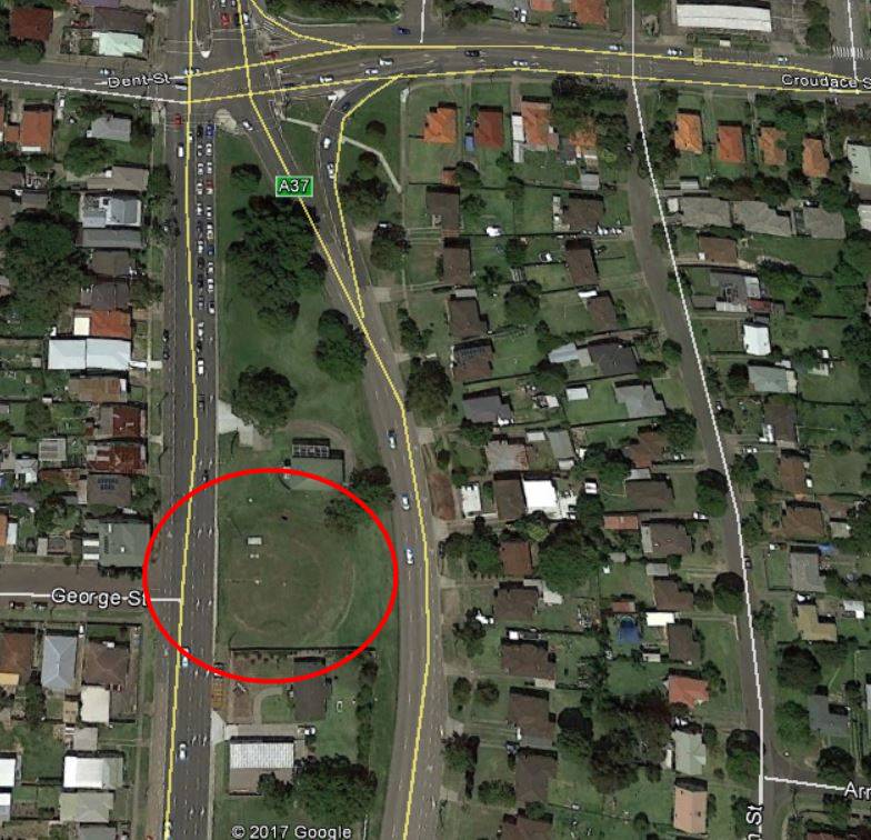
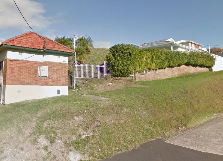
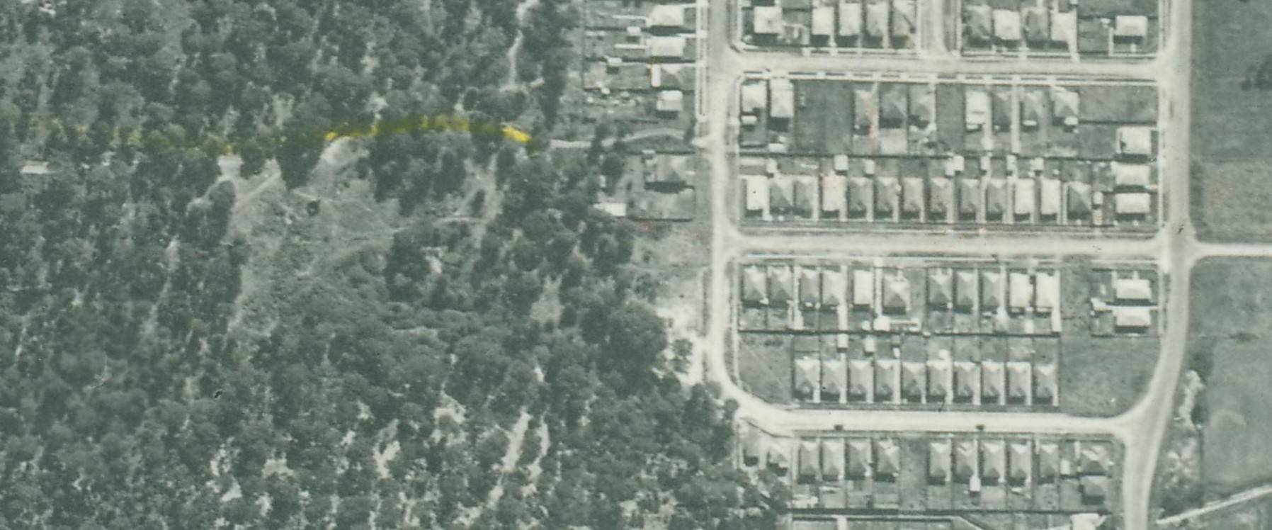
  • The Tennis Court opened in 1925 was situated in the north east corner of the park.

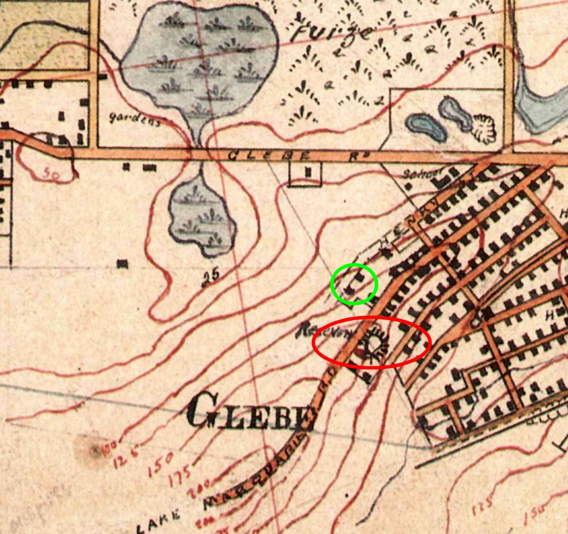
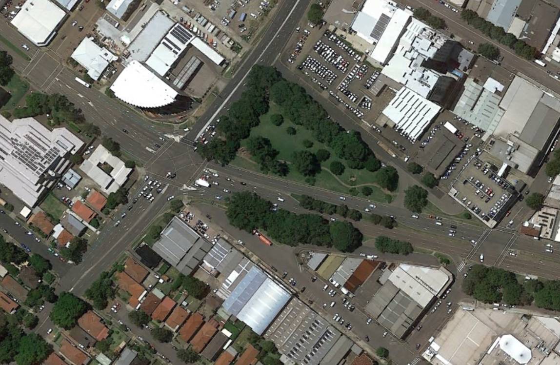
    Location of Jesmond Park Tennis Court. 1944 aerial photograph superimposed on Google Earth.

  • Croudace’s Paddock was occasionally used for purposes other than recreation, such as first aid classes, or military encampments.

“Jesmond Park, showing the trees in profuse foliage and forming a delightful rural scene – approximately four miles from the ocean beaches.” Newcastle Morning Herald, 16 Dec 1933.

Campion’s Soap and Tallow Works

According to the Jesmond Public School 1887-1987 Centenary booklet, John Campion arrived in Australia from England c1880. Around 1887 Campion began refining tallow for miner’s lamps, in partnership with his brother-in-law Ben Cunnington. The photo below, from the University of Newcastle Cultural Collections, shows Campion & Cunnington’s Soap and Tallow Works in 1892.

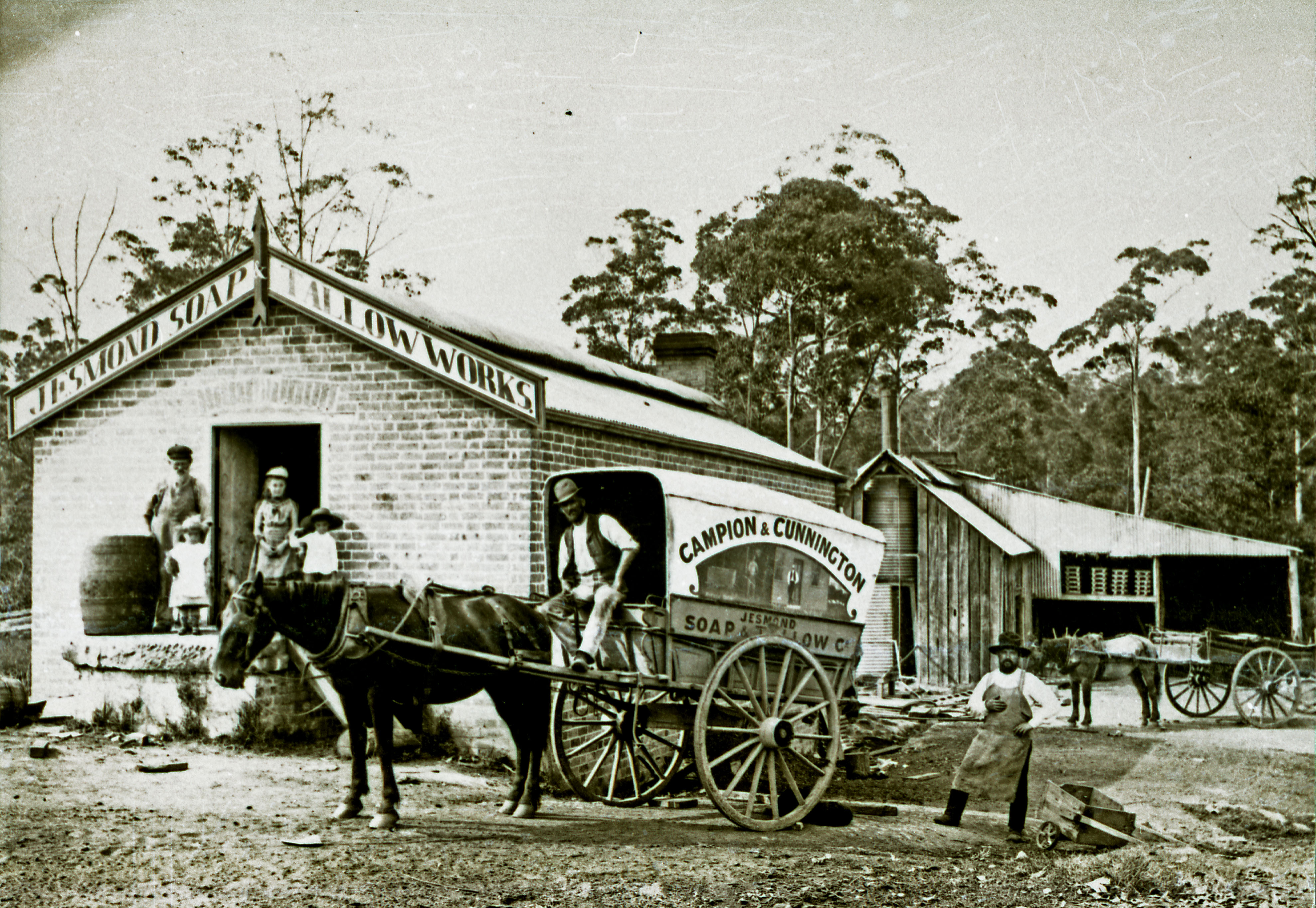
Campion and Cunnington’s Soap and Tallow Works, Jesmond, NSW, February 1892. Photo by Ralph Snowball. University of Newcastle Cultural Collections.

The nature of soap manufacture meant that the works were susceptible to fire, and a number of incidents of destructive fires were recorded over the years.

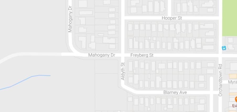
A 1944 aerial photograph shows the soap works building sitting astride the remnants of Dark Creek, just to the north of the concrete storm water drain. Just to the east of the building is the dam that appears in the 1934 newspaper photograph.

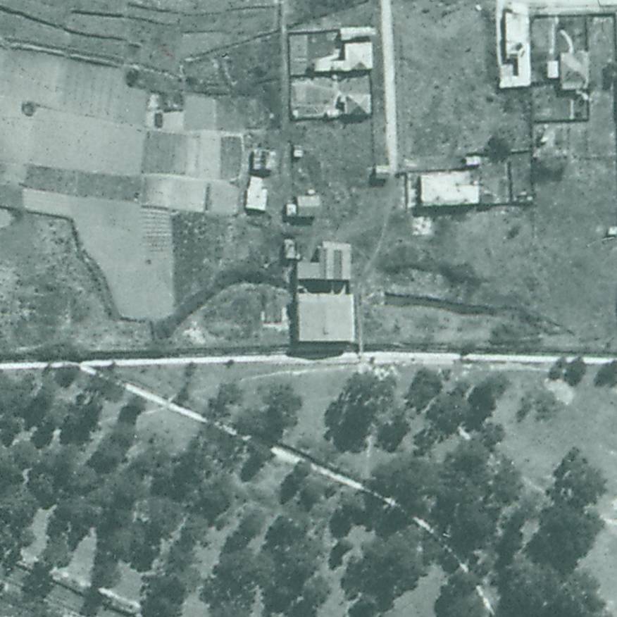
Campion’s Soap and Tallow Works in 1944.

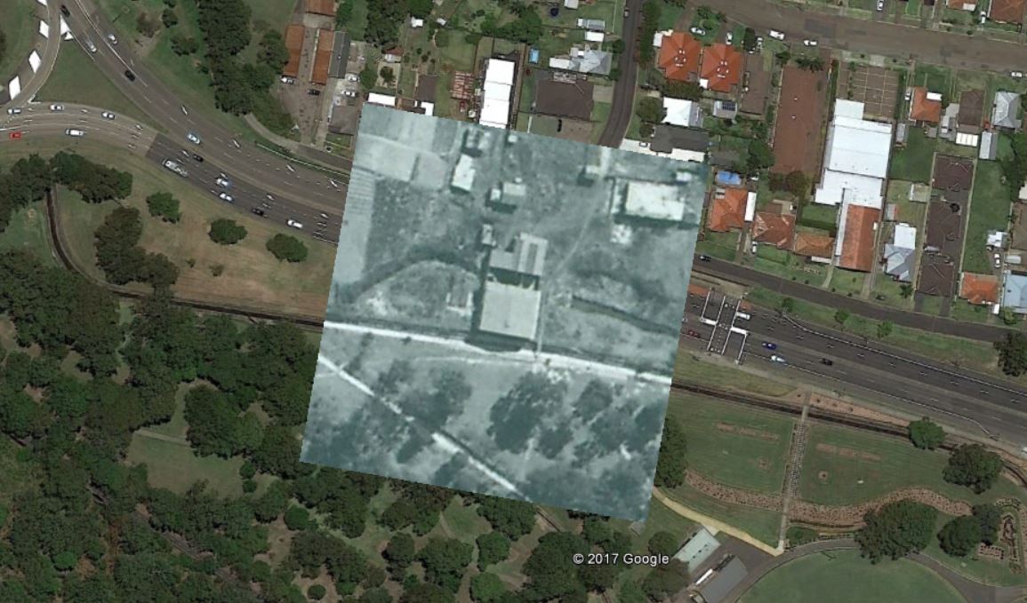
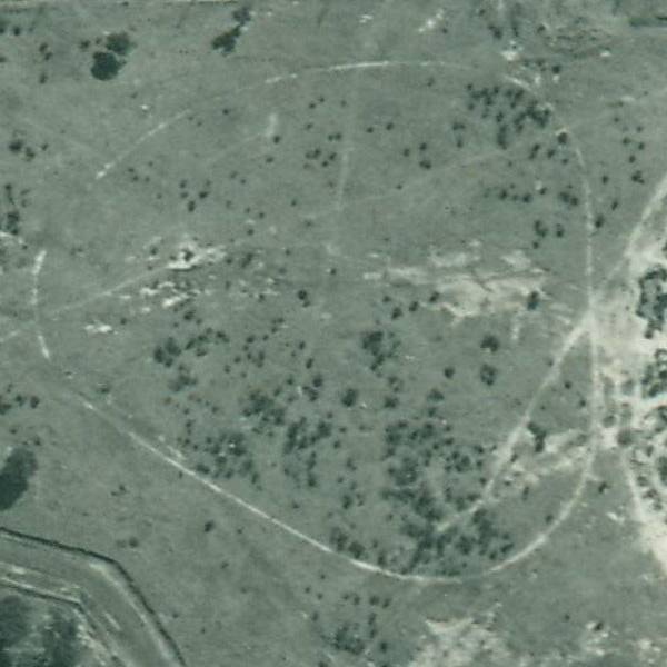
1944 aerial photograph overlay in Google Earth, showing location of Campion’s Soap Works, Jesmond NSW.

Newspaper articles

Article Date Event DateNotes
13 Jun 1871
10 Jun 1871
First mention of "Croudace's Paddock" in the newspaper. Inquest into the accidental shooting death of a young lad, Charles Blim, after a pigeon shooting match.
23 Sep 1871"A grand pigeon shooting match is to come off between two old knights of the trigger, in Mr. Croudace's paddock, at Dark Creek, on Saturday (three weeks) between Blacket Richardson and John Ferguson, for £10 aside."
11 Nov 1871Picnic in "Croudace's Paddock" of the Lambton Band of Hope, with 300 attendees.
20 Sep 1873Remarks on the naming of Dark Creek … "Jesmond is the correct, and more suitable name of this locality. It derives its title of Dark Creek from the men and days of thirty years ago, when the place was remarkable for its thickly, woody, and consequently shaded appearance."
6 Jun 1879Incident of cruelty by youths towards a "native bear" (koala) at "Croudace's Paddock.
19 Oct 1895Advertisement for the Lambton Primitive Methodist Sunday School picnic in Croudace's Paddock, advising that "the Traffic Manager having been written to, the trams will probably stop at the paddock."
26 Oct 1897
23 Oct 1897
"The members of the Wallsend and Lambton Government ambulance classes assembled in Croudace's Paddock, Lambton, on Saturday, and were examined in squads by Drs. Nash and Stapleton as to their knowledge of the principles of rendering first aid to the injured."
5 May 1900"The Newcastle, Lambton, and Wallsend companies of the 4th Infantry Regiment went into camp at Croudace's Paddock, Jesmond, last night, while it was raining heavily. It is intended to "take" Charlestown this morning."
3 Aug 1900
1 Aug 1900
A fire at Mr. J. Campion's tallow refinery.
23 Oct 1902
22 Oct 1902
"Croudace paddock is fast getting into favour as a holiday resort. There were no less than five parties of picnicers on the ground and the immediate vicinity yesterday."
1 Feb 1905Residents petitioning for a tram stopping-place in Croudace's Paddock.
23 Apr 1908
21 Apr 1908
The Minister for Lands rejects Lambton Council's application to have Croudace's Paddock dedicated as a public park.
5 May 1909
4 May 1909
Jesmond Progress Committee asks Lambton Council "to approach the general manager of the S.A.M. Company, with a view of getting a grant of the land known as Croudace's paddock as a public park for Jesmond."
15 Jul 1910
14 Jul 1910
Fire in Campion's Soap Works, Jesmond.
23 May 1917The tramways department asks Lambton Council to suggest a name for the stopping place near Croudace's paddock. The Council recommends the name "Charlton", however there is no evidence that this name was ever adopted.
23 May 1917"The Council decided to suggest that the stopping place be named Carlton Place, and recommended that the stopping be shifted a few chains easterly."
1 Aug 1919Lambton Council asks the Lands Department to resume Croudace's paddock, Jesmond, for a recreation reserve. Alderman Bell said that "for many years the area, by permission of the S.A.M. Company, had been largely availed of for picnic purposes, and as a ground for cricket and football. The situation was on ideal one, and with very little expense it could be converted into one of the best parks in the district."
5 Oct 1920Alderman Hardy, Mayor of Lambton, raises with the Minister of Lands the question of resuming an area of land at Jesmond, known as Croudace's paddock, for a park. "The Minister assured the Mayor that this matter had not been overlooked. The papers had been referred to the district surveyor."
23 Mar 1921
22 Mar 1921
Frederick Croudace, meets with the district surveyor and a representative of the council to inspect the land known as Croudace's Paddock, for the proposed park at Jesmond.
25 Jul 1923"The matter of the acquisition of an area approximating 22 acres of land at Jesmond had been brought to a successful conclusion by an interview with Mr. Robinson, general manager of the Scottish Australian Mining Company, who agreed to grant the land to the council for park purposes, the only obligation on the part of the council will be the survey transfer and fencing costs. The thanks of the council were due to Mr. Robinson and Mr. Croudace for the fairness and courtesy shown during the negotiations and to the company for its generous gift."
22 Aug 1923
21 Aug 1923
"A. Barrie, on behalf of Jesmond Cricket Club, asked Lambton council last night for permission to lay a wicket on Jesmond park. The Mayor said that the application was premature, as the council did not yet have control of the park. It was resolved to refer the matter to the Scottish Australian Mining Com pany."
20 Feb 1924
19 Feb 1924
"The S.A.M. Company had dedicated to the municipality Croudace's paddock as a public park. Efforts were made to obtain a grant from the Government to improve the area, but so far without any good result."
30 Apr 1924
29 Apr 1924
Various mentions of Jesmond Park at Lambton Council meeting, including that a site for a tennis court had been decided on.
14 Sep 1925
12 Sep 1925
Opening of tennis court in north east corner of Jesmond Park.
17 Feb 1926
16 Feb 1926
Lambton Council to ask the tramways department to have the "tram stopping place at Jesmond Park extended in a line with Steel-street."
9 Jun 1926
8 Jun 1926
"A petition was received from the residents of Jesmond, bearing 42 signatures, asking that the Jesmond loop be retained as a tram stopping place in addition to the new stop at Steel-street."
23 Sep 1929"Some time ago the Jesmond Progress Association approached the council with a view of having a water service connected to the Jesmond Park. They offered to carry out the work providing the council would bear the cost of the material … Voluntary labour was forthcoming to dig and cover in the trenches, the whole of the work being completed during the week. The [water] board granted a free supply of water on the condition that it would be used for drinking purposes only."
22 May 1934Photograph of Jesmond Park, 1934.
25 Nov 1938"Within a four-penny-tram ride of the city is Jesmond Park - a natural playground which has been saved for posterity by a council now extinct. Practically unknown by many people, the park provides ample facilities for sporting activities amid the quiet surroundings of the silent bush."
17 Mar 1948A motion is defeated in Newcastle Council that would have seen Jesmond Park renamed to Johnson Park, in honour of Alderman J.T. Johnson, who served on Lambton Council for many years.

Glebe Hill Reservoir

The University of Newcastle Cultural Collections site has a Ralph Snowball photo with the caption “Construction of the water reservoir, New Lambton, NSW 1917”. In tracking down the location of this photo, thanks to Robert Watson I somewhat surprisingly ended up in a different suburb and a different year.

Construction of Glebe Hill Reservoir, 1886. Located at 65 Macquarie St, Merewether. Photo by Ralph Snowball, University of Newcastle, Cultural Collections.

Part 1: Ridgeway Road?

Given that the photo is taken from an elevated position overlooking a flat plain I had always assumed that the location was where the reservoir now is at the top of Ridgeway Road, New Lambton Heights.

Water Reservoir site, corner of Ridgeway Rd and Lookout Rd, New Lambton Heights.

A search of Trove appeared to confirm my assumption, with a 9th January 1917 newspaper article reporting that

“The construction of the New Lambton reservoir was completed on the 3rd instant, and after satisfactory tests were made the reservoir was brought into use.”
Further investigation however cast serious doubt on this being the site of the Snowball photo, for none of the other details matched up.
  • the topography of the land wasn’t right – there is a deep gully below Ridgeway Rd, but in the photo the land slopes down more gently.
  • the reservoir in the photo was of brick construction, but the New Lambton reservoir was of reinforced concrete.
  • the reservoir in the photo was large (from estimates of the dimensions in the photo I calculated the capacity to be 350,000 imperial gallons) whereas the New Lambton reservoir was only 50,000 gallons.

Visiting the site of the Ridgeway Rd reservoir revealed that the 50,000 gallon 1917 reservoir is still there, covered in ivy, beside the new 1954 steel reservoir. It is clearly not the reservoir in the Snowball photo.

The 1917 ivy covered concrete reservoir, Ridgeway Rd, New Lambton Heights.

On the horizon of the Snowball photo there is a very faint outline that appeared to me to be the outline of Shepherd’s Hill on the coast. What other reservoirs on the hills around the Newcastle would provide a view eastwards over the flatlands towards the coast?

A 1940 map of Newcastle shows reservoir locations as small blue circles. Having ruled out the Ridgeway Rd site [1], I then considered Lambton Reservoir [2], St James Rd Reservoir [3], and Lookout Reservoir [4].

1940 map of Newcastle, showing reservoir locations.

Part 2: Lambton?

Lambton Reservoir was built in 1885 and sits in the middle of Newcastle Road at the top of the hill.

Lambton Reservoir, Newcastle Road.

Interestingly, a drawing of the Lambton Reservoir shows that it is the same design as the reservoir in the Snowball photo, with a central dome and two concentric rings of arches to form the roof.

Design of Lambton Reservoir, 1885.

But despite the similarity of design, the topography of the land in the photo doesn’t match. If the photo was of Lambton Reservoir we would expect to see the township of Lambton (including the very prominent Post and Telegraph Office building) before us.

Part 3: St James Road?

The reservoir (marked 3 in the map above) in New Lambton, between St James Rd and Queens Rd was built soon after August 1926. It didn’t seem to match up too well with the shape of the land in the Snowball photo – the St James Rd reservoir appears to have a slight ridge to its right, which is absent in the old photo. Also in 1926 we would expect to see the growing suburb of New Lambton below the reservoir, instead of the large expanse of scrub land that we do see.

Reservoir, between St James Rd and Queens Rd, New Lambton.

Part 4: Lookout?

The reservoir marked 4 on the map above was known as the Lookout Reservoir. It also was constructed on 1926, and its location can still be seen in the empty circular space between the two newer above ground steel reservoirs.

Location of the “Lookout Reservoir”, corner of Grandview Rd and Lookout Rd, New Lambton Heights.

The “Lookout Reservoir” seemed to be a better candidate for the Snowball photo in terms of the shape of the land and size of the reservoir, but it led me to an impossible conclusion … the “Lookout Reservoir” was constructed in 1926, but Ralph Snowball had died in August 1925, before construction had begun!

Part 5: Merewether?

At this point, Robert Watson came to my aid, and with some inspired thinking rescued me from my impossible conclusion. He deduced that the reservoir in the Snowball photo is actually situated in Macquarie St, Merewether.

Location of Glebe Hill reservoir on the 1940 map.

I had led myself astray in too quickly assuming that the Snowball photo was looking east towards the coast. It is in fact looking north-west, across the Broadmeadow flatlands towards Waratah.

Glebe Hill Reservoir, Merewether.

Panorama from the site of the Glebe Hill reservoir.

Glebe Hill Reservoir in Macquarie St Merewether is now part of a private residence. Google Street View.

A newspaper article from May 1886 states that the construction of the reservoir began in November 1885, only three months after the Lambton reservoir was completed in August 1885. The article contains a detailed description of the design that matches the photo very closely.

The roof is formed of two concentric arched rings and a dome carried by cast-iron girders, supported by iron columns resting on stone foundations some two feet square.
A March 1887 article describing the Hunter River District Water Supply shows that the Glebe Hill reservoir was almost identical to the size to the Lambton reservoir.
The reservoir at Lambton is built on the hill above the Public school, a distance of twelve and a half miles from. Buttai. It will hold 402,600 gallons. At fifteen and a third miles from Buttai a 15-inch branch pipe, a mile and a quarter in length, is connected with a reservoir having a capacity of 403,000 gallons, to supply Hamilton, Adamstown, the Glebe, and other towns along the line.
Note that although the reservoir is located within the modern day suburb boundaries of Merewether, it is sometimes called the “Hamilton Reservoir”, as that was the principal township it served.
Some other hints that confirm that the Snowball photo is of the Glebe Hill reservoir are the faint outline of smoke stacks in the distance. At the right are two stacks of different size, close together.

Broadmeadow copper smelter stacks.

These are the stacks of the English and Australia Copper Company smelter at Broadmeadow.

To the right is a single stack of one of the A.A. Company pits in Hamilton, and the very faint outline of the roof of St Peters Church in Denison St, Hamilton.

The Glebe Hill reservoir photo is taken from a spot only about 400 metres away from another Ralph Snowball photo taken in 1897, which shows the same landmarks in the distance.

The Newcastle lowlands. 1897. Photo taken from intersection of Beaumont St and Glebe Rd looking north towards Hamilton. University of Newcastle Cultural Collections.

1886 Glebe Hill Reservoir photo (top) and 1897 Glebe Rd photo (bottom)

The Glebe Hill reservoir is marked on Corporal Barrett’s 1910 map of Newcastle, situated on Lake Macquarie Rd. Quite possibly the two buildings marked at the end of Henry St are the two buildings we see in the Snowball photograph.

Glebe Hill reservoir, on 1910 map. University of Newcastle Cultural Collections.


Acknowledgements

My thanks to Robert Watson who had a substantial input into the content of this article. Thanks also to Brendan Berghout of Hunter Water, who pointed me towards some useful information on early water supply infrastructure, and who helpfully reminded me that imperial gallons (220 gallons/m3) are not the same as U.S. gallons (264 gallons/m3). It was a casual conversation with Brendan on a bicycle commute to work one morning that was the genesis of this journey of discovery.

Jesmond Hill horse racing track

Ever since I obtained a 1944 aerial photograph of the Lambton region from Newcastle Library, I was intrigued by this loop of track to the south of Newcastle Road.

My guess was that it was used as a training track for horses.

While researching another unrelated matter in Trove today, I found a 25 June 1921 newspaper article on the Jubilee of Lambton that solves the mystery. The article, in reminiscing on times past, reports that

“Many horse racing events were held at the road known as the Jesmond Hill, from the Dark Creek bridge to the present site of the reservoir.”

Adamstown Mechanics’ Institute

In researching the history of Adamstown Council I discovered that the first council meeting was held in the Adamstown Mechanics’ Institute building on Wednesday 10th March 1886. Newcastle Library has undated photo of the institute building, but there was no immediate information on where this building was located.

Adamstown Mechanics Institute. Photo by Ralph Snowball. Hunter Region Library.

After consulting my index of historical real estate maps I found a 1921 map that shows that the building was on the west side of Union St, just to the south of Victoria Street. (Union St was the early name of the section of Brunker Rd south of Glebe Rd.)

Location of Adamstown Mechanics’ Institute, from a 1921 real estate map. University of Newcastle, Cultural Collections.

The Adamstown Mechanic’s Institute started in August 1879, making use of rented rooms in Mrs Fennessy’s house. A year later, at the first annual meeting, the institute was still renting premises, but plans were afoot to erect their own building. These plans came to fruition the following year, and the new wooden building on Union Street was officially opened on 6th August 1881. The building measured 66 by 165 feet, with the inner hall being 40 x 20 feet, and was erected at a cost of about £120, in the short contract time of twelve weeks.

The wooden Mechanics Institute building was removed in 1928, as part of the widening of Union Street, and a new brick building was erected on the same site, and officially opened on 25th August 1928.

Many grand speeches were made that day expressing high hopes for the future of the Mechanics Institute, hopes that were soon dashed. Within eight years, dwindling of membership meant that the institute was unable to meet the repayments on the loan for the building. In 1936 the trustees appealed to Adamstown Council to take over the institute, but the impending Greater Newcastle Council scheme stalled negotiations.

In March 1936 the town celebrated the jubilee of Adamstown municipality. Part of the celebrations was a reunion of old Adamstown residents held on Thursday 19 March 1936, at which photos were taken of the residents in front of the Mechanics’ Institute building, one of which was printed in the Newcastle Morning Herald and Miners’ Advocate on 20 March 1936.

Adamstown Jubilee, old residents reunion, 19 March 1936. Photo courtesy of Paul Zuljan.

Adamstown council only lasted another two years after this jubilee photo. When the Greater Newcastle Council which came into being in 1938, they were uninterested in assisting the Adamstown Mechanics Institute, and by April 1939 it was clear that there was no hope for the future. “Unable to carry on through lack of finance the committee of Adamstown Mechanics’ Institute has decided to advise the trustees of the institution’s inability to meet liabilities.” The committee thus recommended “that the creditor bank be invited to foreclose and dispose of the property.”

Subsequently the Adamstown RSL purchased the building in April 1942, and was officially opened as RSL club room by the State Secretary of the RSL (Mr A. R. Cutler, VC) on Saturday 18th July 1942.

The Adamstown Mechanics’ Institute building is officially opened as the Adamstown RSL club room by A.R. Cutler, VC. Newcastle Morning Herald, 20 July 1942.

The 1928 Mechanics’ Institute building, photographed July 2017.

Newspaper articles

Article Date Event DateNotes
2 Aug 1879"Mechanics' Institute, Adamstown. We are glad to announce that the above institution is now fairly started. The committee have secured excellent rooms, and their carvass for subscriptions has been liberally responded to. The roll now numbers sixty members, and the institution will be formally opened on Monday next."
20 Aug 1880First yearly meeting. The institute is still renting premises, but is looking to erect their own building.
9 Aug 1881
6 Aug 1881
Official opening of the new wooden building for the Adamstown Mechanics' Institute.
12 Mar 1886The Mechanics' Institute is also known as the "School of Arts".
25 Aug 1927"Plans and specifications of the proposed new institute have been approved, and immediately sanction has been obtained the present building will be removed to fall into line with the widening scheme of Union-street."
5 Sep 1927Adamstown Council grants the building application for the new Mechanics' Institute building.
25 Oct 1927"Union-street, Adamstown, is nearly normal again after the widening operations. An important improvement to the street will be the new Mechanics' Institute, which the committee hopes to erect as soon as details have been finalised."
2 Feb 1928A new Mechanics' Institute building "is to be erected at a cost of £2220."
24 May 1928"The secretary of Adamstown Mechanics' Institute wrote the local council last night, agreeing to the removal of portions of the Institute."
"It was decided that the council should approach the Main Roads Board for £30 compensation for the land given by the Institute for the improvement of Union-street roadway."
2 Aug 1928
31 Jul 1928
Annual meeting of the Adamstown Mechanics' Institute - "now the new institute was nearing completion the membership was increasing."
"The chairman said the new building would be ready for occupation in a few weeks. The opening was fixed for Saturday, August 25."
27 Aug 1928
25 Aug 1928
Official opening of the new building for the Adamstown Mechanics' Institute/School of Arts.
20 Aug 1936"A special meeting of Adamstown Council will be held to consider a proposal by the trustees of the Adamstown Mechanics' Institute that the council should take over the institute and accept responsibility for the £1600 owing on the building."
The President of the Institute (Mr. H. P. Townsend) said "the days of mechanics' institutes as previously constituted had passed."
6 Apr 1939"Unable to carry on through lack of finance the committee of Adamstown Mechanics' Institute has decided to advise the trustees of the institution's inability to meet liabilities." A recommendation will be made "that the creditor bank be invited to foreclose and dispose of the property."
14 May 1942
30 Apr 1942
Report that the Adamstown Sub-branch of the Returned Soldiers' League "had taken possession of the School of Arts on April 30 and documents had been completed for the final transfer."

Power Station Plaque

In 1890 Lambton became just the third town in New South Wales to have electric street lighting. To power the lights a generating station was constructed in a disused quarry on Newcastle Road. The opening of the station was commemorated with a plaque above the door reading:

Lambton Electric Light Station

 W.T. Dent Mayor 1890

The electric light scheme was a commercial failure, the power station was shut down, and the building removed in 1904. Thirty-four years later in 1938, the Newcastle Herald reported an interesting discovery.

When a house was being demolished in Kendall-street, Lambton, some time ago, workmen found beneath it an old cast iron plate. It was rusted and slightly the worse of wear, but it told the story of a venture undertaken by Lambton Council 48 years ago, when a desperate attempt to leap to prosperity ended in a glorious failure.

When the electricity undertaking failed the power-house, which had been erected near the quarry, was demolished. The cast iron plate telling the date of the undertaking and the nature of the industry was removed and taken by the former Town Clerk (Mr. T. Johnson) to his home in Kendall-street. It was there that the workmen found it, leaning against a stone pile beneath the house. A treasured memorial, that old plate. Outside the debt it was all the council had left to remind it of the commercial venture. Taken to the council chambers some weeks before the council disbanded the plate was cleaned up and lettering picked out in white. It still leans against a wall in the silent interior of that abandoned room.

Subsequently the Newcastle Herald reported in 1975, that the plaque was “now on public display at Nesca House”. Last heard of 42 years ago, does anyone know where the plaque is now?

The Lambton Electric Light station on the day of the official opening, with the plaque displayed over the front entrance, 9th September 1890. Photo by Ralph Snowball. Hunter Region Library

The Lambton Electric Light Station plaque in 1938, when it was rediscovered underneath a Kendall St house.

Excerpt from a 1975 Newcastle Herald article by Louise Boon, indicating that the plaque was now on display in Nesca House.

After the publication of this article in the Lambton and New Lambton Local, Ed Tonks posted to the Lost Newcastle Facebook page a photo of the plaque on display in a meeting room of Nesca House in 1985.

The plaque in Nesca House in 1985. Photo kindly supplied by Ed Tonks.


The article above was first published in the August 2017 edition of the Lambton & New Lambton Local.

The plaque is found!

In June 2021 the plaque was located in storage at Ausgrid’s Wallsend depot, and was on display at Lambton library in June 2021 as part of the Love Lambton 150 year celebrations.

Additional information

The rediscovery of the plaque in 1938 is also mentioned in a 16 Feb 1938 article which states:

About a month ago, a grandson of Mr. H. Noble, a former Town Clerk, found, while lifting the foundations of his house a metal plaque, bearing the inscription, “Lambton Electric Light Station. W.T. Dent, Mayor, 1890.” The tablet had been placed there for safe keeping after the demolition of the substation that once supplied Lambton with electricity.

Further information on the Lambton Electric Light scheme can be found in my previous articles:

Blackbutt Reserve

Blackbutt Reserve today owes its existence to a strange combination of business prosperity, national adversity, and private tenacity.

The current area of the Reserve lies wholly within the boundaries of a coal mining lease of the Scottish Australian Mining Company. The eighteen hundred acre lease extended from Kotara South to Jesmond. Mining commenced in 1863, and apart from occasional downturns, the colliery prospered. Therefore, above ground there was little development apart from buildings such as pumping stations, required to support underground mining operations.

However, with the depletion of coal, and rising land taxes, the S.A.M Company looked for other income, from real estate. Between 1915 and 1928 the company developed and sold a few small subdivisions in Lambton, New Lambton, and Kotara. In June 1932, they attempted to auction a large parcel of land, in what is now the southern part of Blackbutt Reserve. The nation at this time however, was suffering the adversity of economic depression. There was little appetite for land purchases, and only five of the 52 lots on offer were sold. The failure of the auction thus left open a window of opportunity for local councils to purchase the land for a nature reserve, starting with 17 acres on Lookout Road in 1938, and increasing to 144 acres by 1940.

In 1956, Newcastle Council bought another 270 acres from the S.A.M. Company, in what is now the northern part of Blackbutt Reserve. Council wanted to subdivide all this land for housing, but through the tenacious opposition of private citizens and community groups, this development was blocked. Instead, the land was added to Blackbutt Reserve. Community opposition had to swing into action again in 1966 to prevent the Department of Main Roads building an expressway through the Reserve.

Many individuals worked tirelessly for the establishment and preservation of Blackbutt Reserve. One in particular, Joe Richley, president of the Northern Parks and Playgrounds Movement for 20 years, is commemorated in the name of Richley Reserve.

Middle Pit pumping shaft, 1894. Located where the entrance to Richley Reserve is today. Photo by Ralph Snowball. University of Newcastle, Living Histories.
The approximate site of Middle Pit in 2017, at the entrance to Richley Reserve.

The article above was first published in the July 2017 edition of the Lambton & New Lambton Local.

Acknowledgement

One of my main sources in researching and writing this article was “A History of Blackbutt Nature Reserve” by John Ramsland, University of Newcastle, a manuscript written for the Blackbutt Reserve Local Committee as a contribution to the Australian Bicentennial Celebrations. A copy of this manuscript is held in Newcastle Region Library Local Studies Section, Q719.32/RAM.

Additional Photos

From the Newcastle Morning Herald, 12 Jan 1937.

Two views of Blackbutt Reserve, which is being acquired by the municipal councils of the district for retention as a public park. From the shelter shed there is a commanding view of Newcastle.

Newcastle Morning Herald. 12 Jan 1937.

Development on the S.A.M. Co Mining Lease

The 1888 map below, held by the NSW Land and Property Information, shows the 1840 acres of mining lease held by the Scottish Australian Mining Company in the name of “Morehead & Young”, in the following lots:

  • Lot 23 – 320 acres
  • Lot 167 – 320 acres
  • Lot 171 – 320 acres
  • Lot 172 – 240 acres
  • Lot 173 – 320 acres
  • Lot 174 – 320 acres
1888 map showing mining leases of Scottish Australian Mining Company. NSW Land and Property Information.

Fifty years after mining commenced in 1863, a 1913 War Office map shows that the only area of the 1840 acre mining lease with residential development is the township of Lambton in the north west corner.

Portion of 1913 War Office map of Newcastle, with 1840 S.A.M. lease outlined in blue. National Library of Australia.

From 1915, the Scottish Australian Mining Company started developing and selling residential subdivisions, starting with 24 blocks of “Lambton Park Estate” fronting Howe St, in May 1915.

Twenty five blocks on Russell St New Lambton were offered for sale in June 1915. (All real estate posters are from the University of Newcastle, Cultural Collections.)

Fifty seven blocks surrounding Chilcott St Lambton were offered for sale in January 1920.

Twenty eight blocks in New Lambton Heights were offered for sale in October 1920.Ten blocks on Curzon St and Carrington Pde, New Lambton were offered for sale in December 1921.

191  blocks in Kotara were offered for sale in 1925.

Twenty six blocks on Turner St Lambton were offered for sale in 1928.

In 1932, the Scottish Australian Mining Company attempted to auction 52 blocks of land, totalling 480 acres. With the country in the grip of the Depression, the auction was a failure, with just five of the 52 blocks selling.

Poster for auction of land in Blackbutt Reserve area, 1932. University of Newcastle, Cultural Collections.

One of the blocks that sold was Lot 51, on Lookout Rd. This was bought by the Newcastle Branch of the Returned Sailors and Soldiers Memorial Institute. It was this block that became the first officially gazetted portion of Blackbutt Reserve in March 1938.

The 17 acres and 3 roods of Lot 51 on Lookout Road, was the first portion of Blackbutt Reserve to be officially gazetted. University of Newcastle, Cultural Collections.

By September 1940, the size of Blackbutt Reserve had been increased to 144 acres, as shown on this Parish Map of Newcastle. The 144 acres consisted of Lots 48 to 52, and part of lot 47 of the 1932 subdivision.

Parish map of Newcastlem showing the boundary of the 144 acres of Blackbutt Reserve as of 13th September 1940. University of Newcastle, Cultural Collections.

It is interesting to see how the modern boundaries of Blackbutt Reserve fall entirely within the S.A.M. Company’s mining lease, an indication of how the underground mining activities there in the 19th century left large areas of the surface undeveloped, and available for a nature reserve in the 20th century.

Blackbutt Reserve in relation to the S.A.M. Company mining lease.

Middle Pit

The first reference in Trove to the Middle Pit is from January 1875, in relation to driving “two narrow bords four yards wide for water standage.”

It is uncertain when the Middle Pit pumping shaft ceased operation. It was still in use in June 1913, as an article refers to the damage done to Orchardtown Road in the course of carting coal to Middle Pit, presumably to fire the engine boilers. A December 1937 article reported on the attempted rescue of a dog that had purportedly fallen down the shaft. The site had obviously been unused for quite a number of years, judging by the description …

The disused shaft is known in the locality as Middle Pit, and was formerly used in connection with the workings of the Old Lambton mine. Pit top gear, including an old rusted winding wheel, is still there, but the pit itself has fallen into disuse. It is in a deep gully, and nobody would suspect its presence when more than 100 yards away. Thick lantana has grown almost to the edge; briar bushes form a barrier between the outside world and the old shaft. The only sound is the sighing of wind in the gum trees. In the interests of safety the shaft has been enclosed by a tall galvanised iron fence. The ground at the foot of portion of the fencing has worn away, and through this hole the dog probably slipped in.

In this 1944 aerial photo the location of Middle Pit can be seen in the bare area to the west of Freyberg St. Newcastle Region Library.
Google Maps. Location of Middle Pit.
Google Earth. Approximate location of Middle Pit.

State Highway 23

The Hunter Living Histories site has a scanned PDF of a booklet “Save Blackbutt – the case against State Highway 23 violating Blackbutt Reserve”.  This booklet was published by the Blackbutt Action Committee in opposing the construction of the highway.

Figure 1 below, from the Federal Government December 1974 report, “The Impact of State Highway 23 on Blackbutt Reserve, Newcastle, New South Wales” shows how much of the western part of the reserve would have been severed had the highway proposal not been blocked by staunch community opposition.

Proposed route of State Highway 23 through Blackbutt Reserve in the 1960s.

Newspaper articles

Article Date Event DateNotes
9 Apr 1931First mention of the name "Blackbutt Reserve" in the newspapers.
12 May 1931Thirty to forty aldermen of the city and district inspect the Blackbutt area. The Mayor of Newcastle (Ald Parker said that they "were definitely impressed that if acquired for a reserve it would be an asset to the district."
11 Jun 1932Advertisement for auction of 52 blocks of land, in the area of the south part of Blackbutt Reserve.
11 Aug 1932"An area of 17¾ acres in Blackbutt Reserve imnmediately below the Look-out, has been bought by the Returned Sailors and Soldiers' Memorial Institute. The purchase will serve a dual purpose, for not only will returned men willing to work for any relief they may obtain from the Institute carry out their undertaking there, but the Institute will settle a few ex-service men there on small allotments." This block became the first official part of Blackbutt Reserve in 1938.
5 Jan 1937Convinced that Blackbutt Reserve is inappropriately named, the Mayor of Newcastle (Ald. H. Fenton), in his capacity of Chairman of the Local Govern ment Coordination Committee, is urging the adoption of a more attractive title. He suggested last night that if the reserve was dedicated as a memorial to King George V., it could be called the "King George V Memorial Park." Or there might he support, Ald. Fenton added, for a proposal that the area be known as the "Duke of Windsor Reserve."
4 Mar 1938Official resumption of 17 acres of land (Lot 51) for Blackbutt Reserve.
14 Sep 1966A public meeting will be held to protest against the Main Roads Board decision to route a six-lane highway through Blackbutt Reserve.

A few hundred metres from the site of Middle Pit, in the bush adjacent to Richley Reserve, lies this rusting coal bucket, a poignant symbol of the way in which the decline of coal mining gave rise to a nature reserve.

Rusting remains of a coal bucket, lying in the bush close to Richley Reserve.

Birdwood Park

In this weekend’s article in the Newcastle Herald, Mike Scanlon writes about the restoration of the Birdwood Flag, made in 1917 for General Sir William Birdwood. In the article Mike mentions that

“The now truncated Birdwood Park in the West End is probably named after this popular WWI general.”

Searching Trove I found that the park was constructed by Newcastle Council in 1892, was originally called “West End Park” and covered three acres.

Newcastle Morning Herald, 14 Apr 1892, p4.

Newcastle Morning Herald, 17 Nov 1892, p8.

Corporal Barrett’s 1910 map of Newcastle shows the trapezoid shaped park adjacent to the brewery, with the modern King and Parry streets yet to be built.

Overlaying the 1910 map into Google Earth we can see that the park originally extended further to the south of present day King and Parry streets.

1910 map overlaid into Google Earth, showing location of West End Park.

Using Google Earth Pro’s area measurement tool, the area of the park in the 1910 map shows as 3.2 acres, which corresponds well with the three acres mentioned in the 1892 newspaper article.

Area of West End Park in 1910.

In August 1920, Newcastle Council renamed the park to “Birdwood Park”.

Newcastle Morning Herald, 1 Sep 1920, p6.

Although it is not explicitly stated that this renaming is in honour of General Birdwood, that is almost certainly the reason for the name change. In just the year before, New Lambton Council had renamed one of their streets in honour of the WW1 general.

A real estate poster from 1924 shows that the construction of Parry St (and a narrow diagonal section of King St) has truncated the park, reducing its size to about 2.6 acres.

Real Estate Poster from 1924, showing Birdwood Park.

An aerial photograph from 1944 nicely shows the shape of the park at that time.

Birdwood Park, 1944. Newcastle Region Library, Local Studies.

A later re-alignment and widening of King St resulted in a further truncation of the park, down to its present size of about 1.8 acres.

Birdwood Park in 1944, with the outline of the present day streets.

Birdwood Park 2016. Google Earth.

Resources