Prior to 1860, communication between Newcastle and Sydney required either a sea voyage or an arduous road journey. It could take days or weeks to receive a reply to a message. That situation changed radically in January 1860 when the electric telegraph service to Newcastle was inaugurated. The telegraph line was erected along the Great North Road, running through Wisemans Ferry, Wollombi and Maitland, and enabled short messages to be instantly transmitted using Morse code.
In 1883 Newcastle’s first telephone exchange opened with 25 private and commercial subscribers. The local telephone network gradually expanded and in 1896 the government allocated funds to provide a trunk connection between Newcastle and Sydney. Arthur Espley of Hamilton won the tender to supply 3000 ironbark poles, and John Elder was contracted to install the poles and wiring along the rail line from Milson’s Point to Newcastle. Construction commenced in March 1897 and by September had reached Gosford.
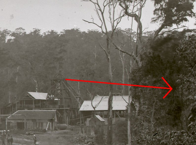
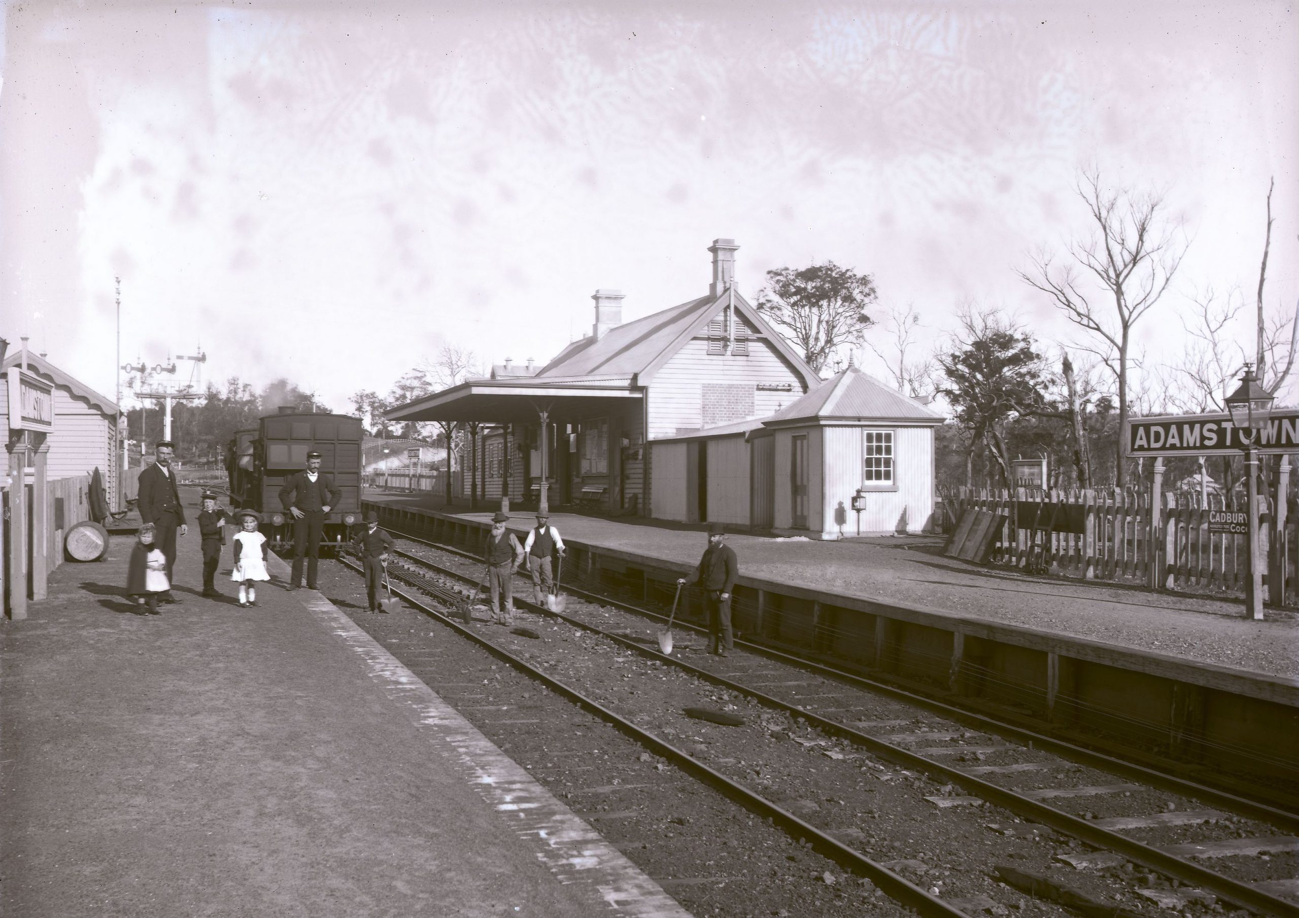
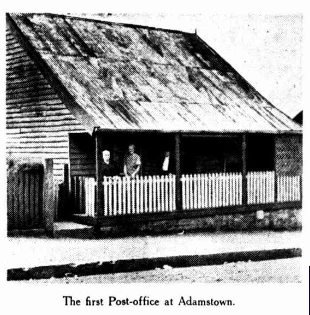
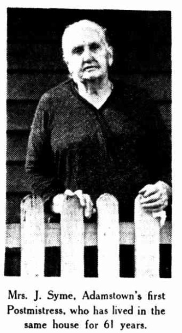
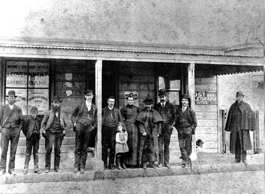
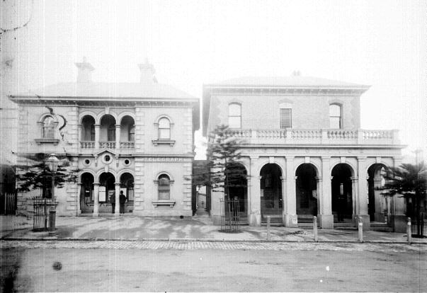
While constructing the northern part of the line, Elder’s workmen set up camp for four months at Adamstown near the railway level crossing. Ralph Snowball photographed the camp on 30 December 1897, four days before the service commenced on 3 January 1898. The Newcastle Morning Herald and Miners’ Advocate reported that “Mr. Arthur Fenwick was the first person to use the new telephone line … the gentleman spoken to in Sydney could not at first believe that a resident of Newcastle was speaking to him.” Calls to Sydney could only be made by attending the telegraph office in Hunter Street Newcastle, and just one person could use the line at any time. At a cost of 3 shillings for a 3 minute conversation, and with miners earning 6 shillings a day at that time, it is somewhat astonishing to consider that a phone call to Sydney cost half a day’s wages! Amid our current inflationary pressures, it’s worth remembering how ridiculously cheap phone calls are today compared to 125 years ago.


The article above was first published in the December 2022 edition of The Local.
Additional Information

The cost of phone calls
In the article I wrote that a three minute phone call from Newcastle to Sydney 125 years ago cost half a day’s wages, and that today the same phone call is 125,000 times cheaper.
In considering the average wage in Newcastle 125 years ago I chose the occupation of miner, as this was the dominant employment at the time. The average wage of miners could differ considerably depending on the mine being worked, the various kinds of mining jobs, and the productivity of the individual miner, as noted in this article from 1896 showing daily earnings of a miner as low as 3s 10d per day, and up to 13s per day. Despite this spread of earnings, report on strike action by miners during 1896 consistently mention a push for earnings around the 6s per day mark. Thus a 3s phone call to Sydney would have been half a day’s wages.
- 12 Mar 1896 – Glebe colliery wheelers asking for an increase of 6d on their current rate of 5s 6d per day
- 19 March 1896 – Borehole wheelers asking for an increase to 6s per day.
When it comes to the cost of phone calls today, the comparison is somewhat muddied in that basic phone plans today are fixed cost per month and include unlimited and untimed phone calls within Australia. Notwithstanding that difficulty, let’s do some maths …
If we take an average wage today to be $92000 per annum, that translates to $353 per working day. If we assume that a person is awake for a maximum of 18 hours in a day, then there about 32400 minutes in a month they could be making a phone call. Thus a 3 minute phone call is 0.0000926 of the usable phone minutes in a month. As a basic phone plan can be obtained for $15 a month, a 3 minute phone call evaluates to just 0.14 cents $15 x 0.0000926). This correlates to 0.0000039251 of the average daily wage (0.14 cents / $353).
Comparing the relative costs of a 3 minute phone call (0.5 of daily wage in 1898, and 0.0000039251 of daily wage in 2022) we arrive at a ratio of 127384 times cheaper in 2022, which rounds out to 125 thousand to nicely match the 125 year time span!
Now I realise that some of the assumptions I made above are a bit arbitrary (and I may have even chosen some assumptions to get me to a nice round figure), however the point is still clear – phone calls today are vastly and almost unimaginably cheaper today than 125 years ago. Are there any other consumer services whose price has decreased so dramatically in the same time?
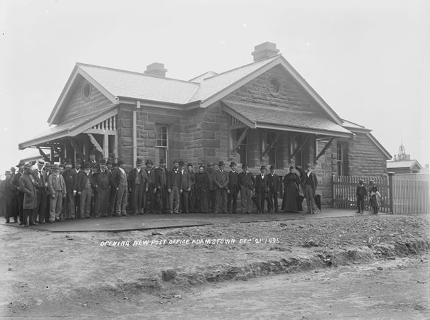
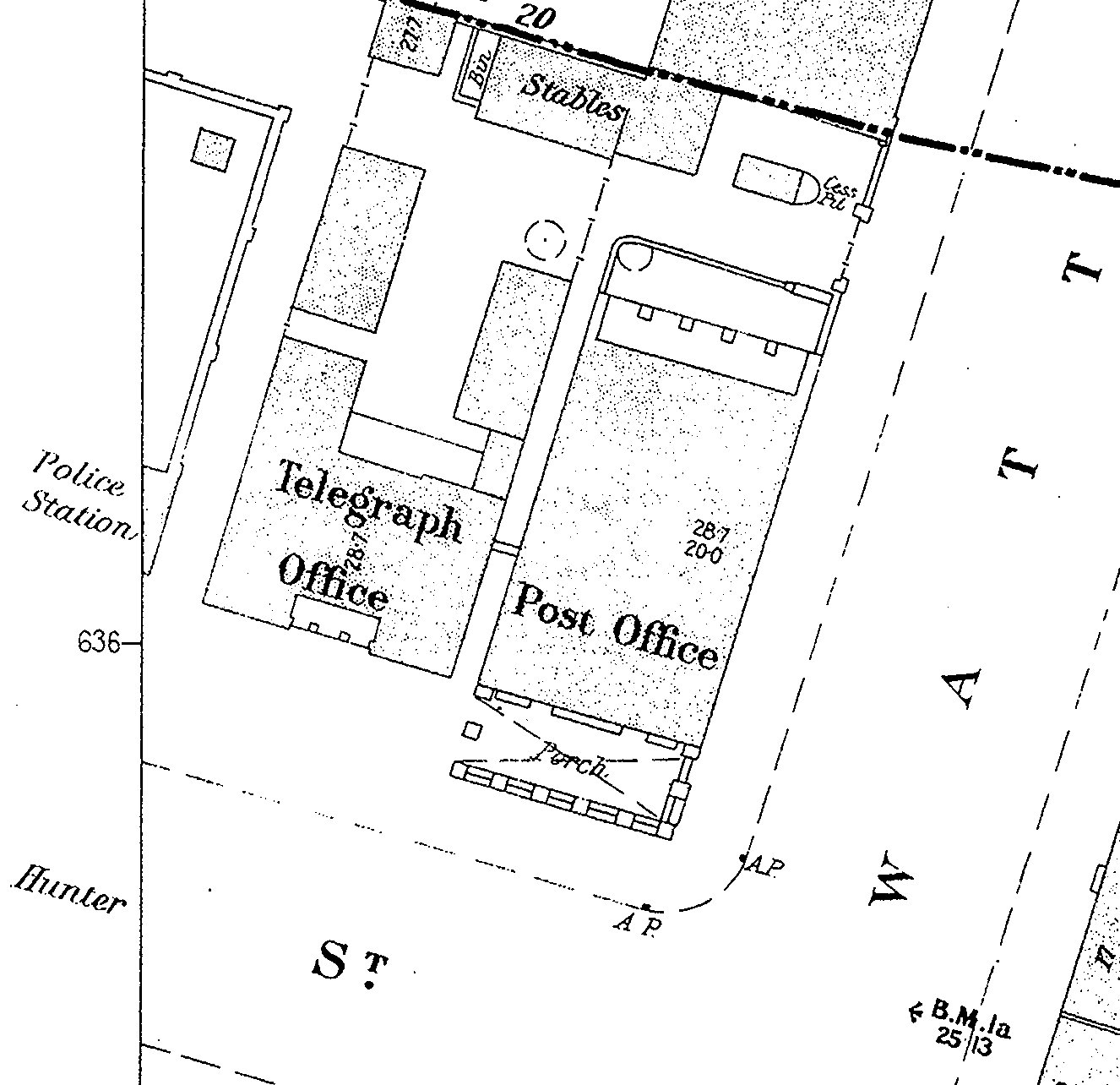
Newcastle telegraph office
In Newcastle, the trunk telephone line from Sydney was connected to the Telegraph Office in Hunter Street, near the intersection of Watt Street.
Evolution of the telephone service
The original telephone service installed between Sydney and Newcastle in 1897 and inaugurated on 3 January 1898, consisted of 4 wires, allowing for two complete circuits. The reports at the time do not explicitly say so, but I get the impression that one circuit was used for phone calls initiated from Newcastle to Sydney, and the other circuit for the opposite direction. The advertisement for the service on 1 January 1898 speaks of “the line” (singular) and says …
In cases where the line may be engaged applications will be registered and connection will be made in the order of priority of application.
This queuing of applicants would be more easily managed with one circuit dedicated to each direction.
By 1907 the limitations of the initial service were being felt.
Numerous complaints have been made by business houses in the city of the frequent congestion which occurs on the telephone trunk lines between Newcastle and Sydney. There are at present only two direct lines connecting Newcastle with the metropolis … tenders have been called for the supply of material for the construction of another line.
Sydney Morning Herald, 26 August 1907.
Four more lines were added, but their capacity was soon used up. In 1919 it was noted that …
There are six lines at present in use, but the congestion that occurs in the business almost every day of the week is becoming intolerable. The Postal Department hopes to begin immediately the erection of two new telephone trunk lines.
The Newcastle Sun, 17 May 1919.
In 1924 the Postal Department expressed their intention to “put all telephone and telegraph cables between Sydney and Newcastle underground”. However like a number of other Newcastle infrastructure projects in the last century, this was the first of a series of announcements followed by nothing being finshed.
In October 1928 bushfires exposed the vulnerability of the overhead telephone wiring system …
The raging inferno, along the Sydney railway line played havoc with the Sydney-Newcastle telephone lines. Suddenly, late yesterday afternoon, 15 trunk lines between Newcastle and Sydney went out, and Newcastle was completely isolated. This morning subscribers were told that there was no possibility of communication with Sydney by phone.
The Newcastle Sun, 8 October 1928.
In June 1929 the Deputy Postmaster-General announced that work had commenced on the laying of underground cable between Sydney and Newcastle, at a cost of £500,000. The length of the cable required was 117 miles, and the first cable to be laid would provide more than 120 pairs of wires, with each circuit allowing telephone conversations and telegraphic messages simultaneously.
Very little was done and by 1935 it was time for another announcement that …
Preliminary work has begun on the laying of an underground telephone cable between Sydney and Newcastle. Conduit to carry the cable has already been laid between Sydney and Peat’s Ferry, it was stated this morning, and survey work along the main Newcastle-Sydney highway is in progress.
The Newcastle Sun, 10 January 1935.
Progress must have been slow, because four years later there was opportunity for yet another announcement when …
The Deputy Director of Posts and Telegraphs Mr Butler at Gosford yesterday afternoon turned the first sod for the laying of the underground telephone and telegraph cables which will link Sydney, Newcastle and West Maitland.
Sydney Morning Herald, 1 April 1939.
By mid 1941 the underground cabling had been completed, and ancillary equipment was being installed at the exchanges. Mr. E. S. Butler, senior mechanic attached to the Taree Post Office, in addressing the Taree Rotary Club on the development of telephone communication, stated that …
The [underground] cabling from Sydney to Newcastle has been completed, and the equipment is being installed. To date the test results have exceeded the requirements of the contract. The completion of this work will be a boon, especially in summer, when storms and bushfires will no longer work havoc on the overhead wiring system, with the consequent interruption to traffic. There is provision in this cable for 28 systems of 17 channels — a total of 470 plus 4 programme relay lines, but equipment is only being provided for a portion of this, and can be added to us required. Both systems are based on frequency or tuned circuits, as we know it on our radio, the difference being that the radio is transmitted at a much higher frequency and with a high power. The frequencies used on the telephone systems are much, lower, and do not radiate from the wires unless excessive current is used. Even then it could not be picked up by the commercial radio.
The Northern Champion, 26 July 1941.
Although the cables installed between Sydney and Newcastle potentially allowed for up to 470 channels, war conditions delayed the delivery of the carrier wave equipment needed to make use of that potential. In May 1945 there were only 42 channels available on the intercity trunk line. After the war, additional modern carrier wave equipment was installed as telephony needs increased.
One of the most significant advances in inter-city telephony occurred in 1967, when Subscriber Trunk Dialing (STD) became available in Newcastle. This allowed users at home to dial direct to a destination number in another city without having to get a telephone operator to manually connect them.
Brunker Road Buildings
In Snowball’s photograph of the workmen’s camp, there is double story shop and a church on the horizon at the right hand side.
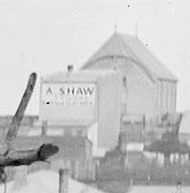
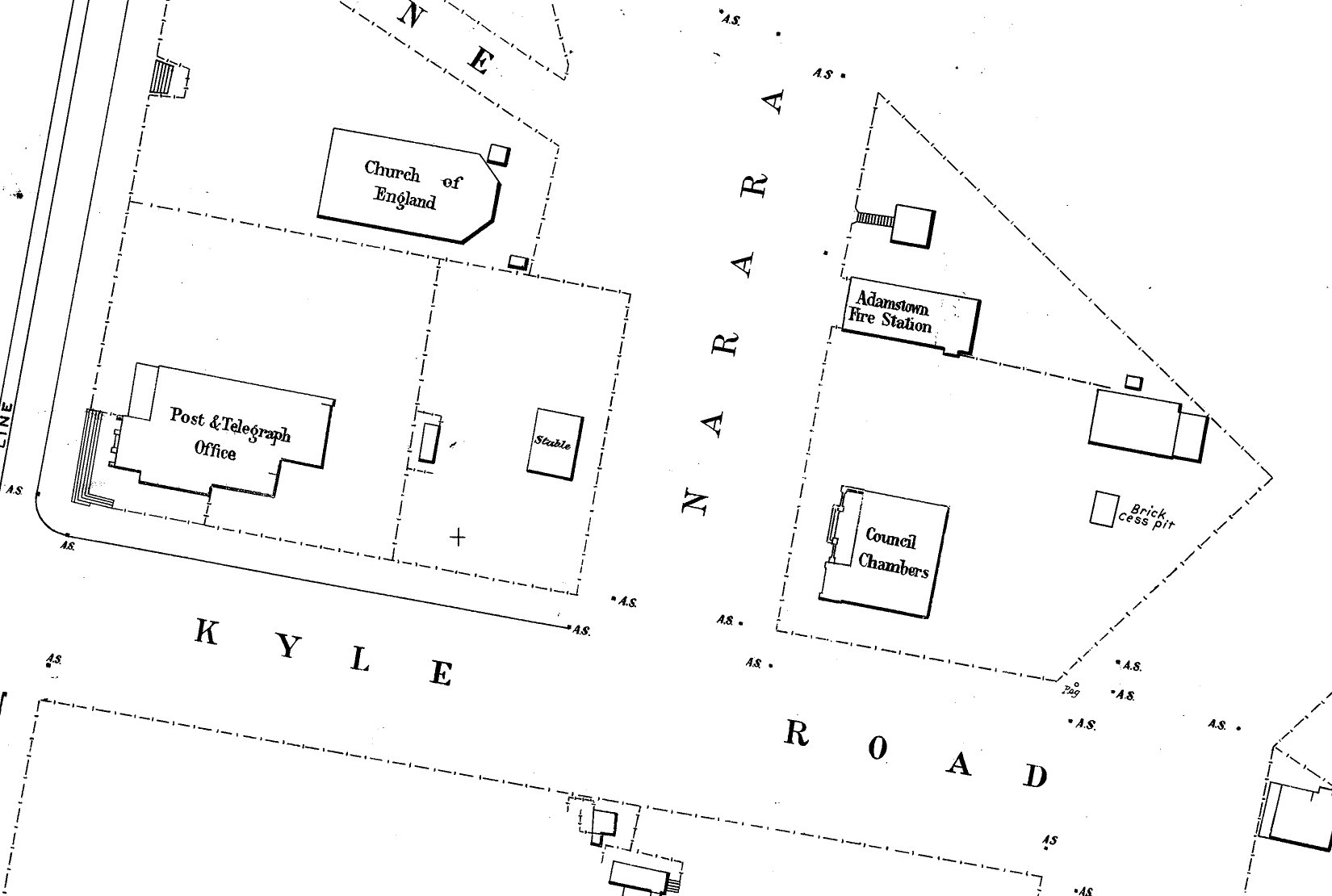
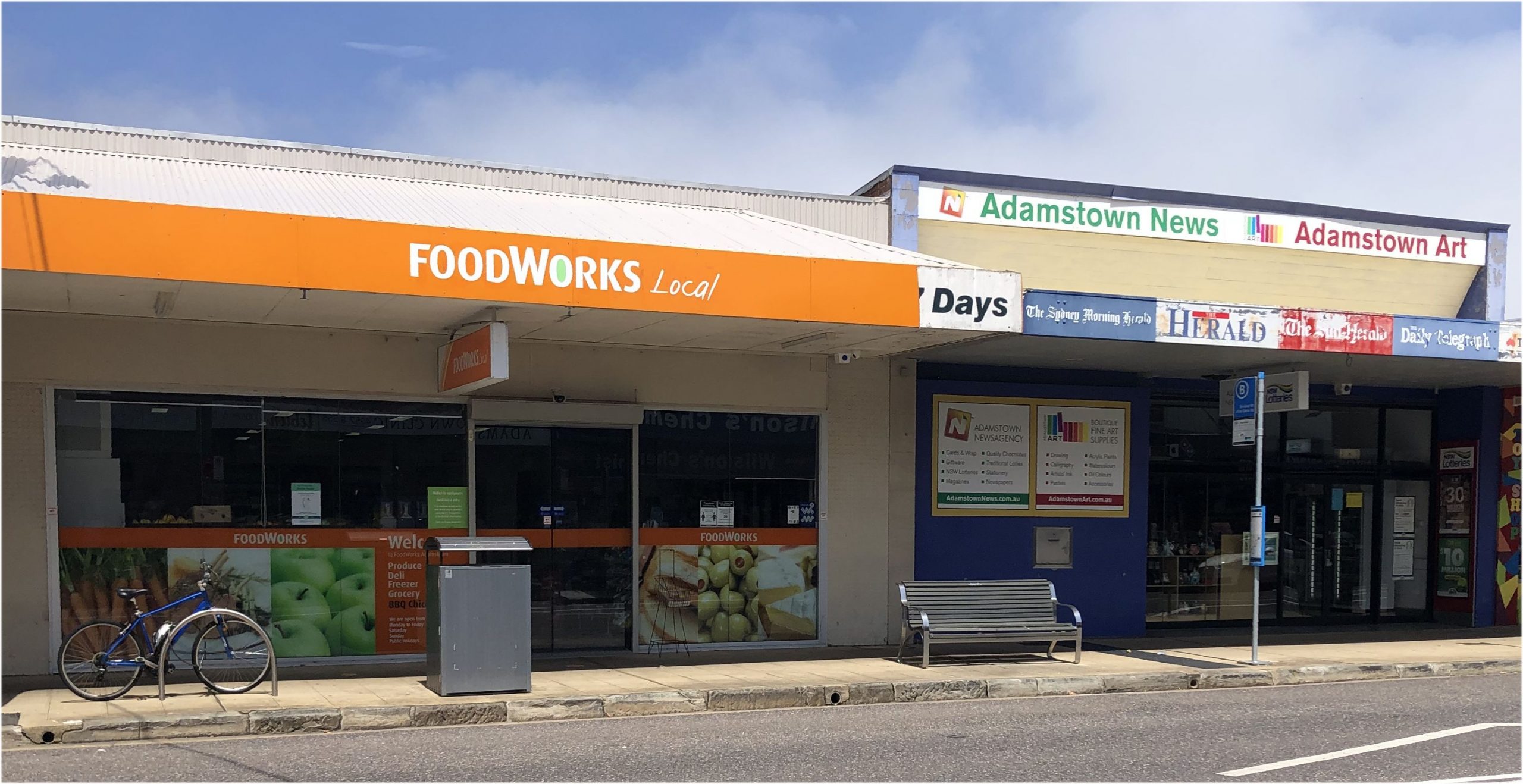
These buildings are on Brunker Rd. The church is the original wooden building of St Stephens Church of England located at 191 Brunker Rd.
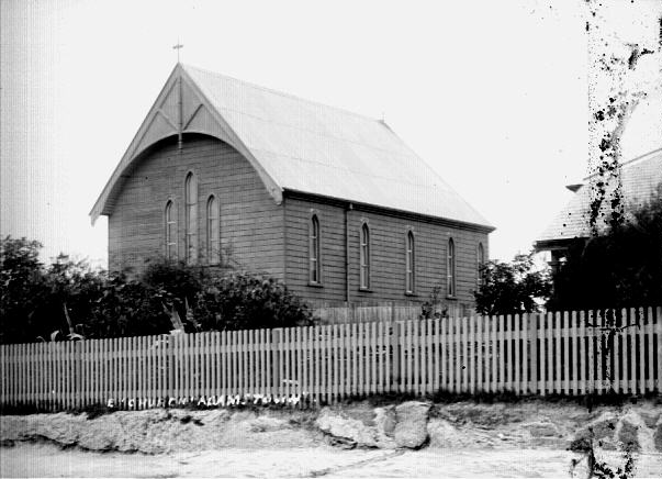
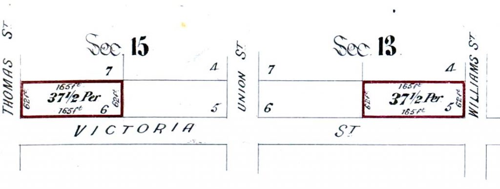
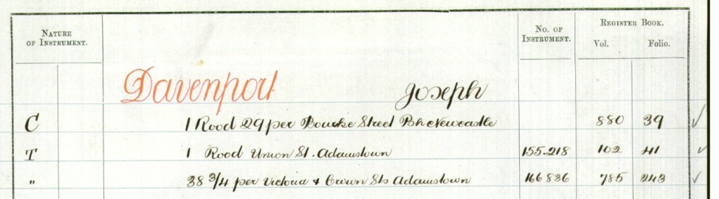
The shop in the photo is the tailoring business of Anthony Shaw, whose premises were located opposite the Post Office, at 208 Brunker Road. (See also Vol-Fol 1051-29 for Portion 1651 of the Newcastle Pasturage Reserve.)
Newspaper articles
| Article Date Event Date | Notes |
|---|---|
| 8 Mar 1859 | Tenders invited "for the supply of material (wire excepted), and for the workmanship necessary for the erection of line of Electric Telegraph from a point upon or near the Blacktown Road to Windsor, and thence via Wiseman's Ferry, Wollombi, West Maitland, and Maitland to Newcastle." |
| 5 Dec 1859 | "The [telegraph] line to the Hunter was commenced on the 6th June last ; starting from the Blacktown road it passes through Windsor and Richmond via Wiseman's Ferry to Wollombi and West Maitland, and thence to Morpeth, and along the railway line to Newcastle." |
| 11 Jan 1860 | "The electric circuit between Maitland and Newcastle was tested yesterday. Mr E. C. Cracknell came hither to effect the experimental process, and a message was successfully transmitted through the Northern telegraph line. We believe the working of the line will not come into active operation until some slight arrangements have been considered relative to the general telegraphic line from Newcastle to Sydney from each intermediate station. In the course of the week we believe all will be prepared for the sending of telegrams." |
| 26 Jan 1860 22 Jan 1860 | "On Monday last communication with Sydney by electric telegraph was opened to the public of Maitland." This article has some interesting details on the technical implementation of the telegraph service. |
| 24 Jan 1860 | "On Tuesday last, a ball took place at the Caledonia Hotel in this city, in commemoration of the establishment and the opening of telegraphic communication between Sydney and the Hunter River district." |
| 18 Sep 1877 | "The Contractor for the Newcastle Telegraph Office additions having completed his work, the building now presents a very neat and creditable appearance, and will, we understand, be occupied in the early part of next week." |
| 26 Oct 1883 | "Operations in connection with the Newcastle Telephone Exchange are now, we are glad to learn, on the eve of completion. Yesterday the contractor (Mr. Kinshela, of Parramatta) commenced the operation of "wireing," and has so far made very satisfactory progress with his work. Half a dozen large ironbark poles, forty feet high, have been set up; and when finished, there will be upwards of fifty wires in use, connected with the various subscribing offices and private residences." |
| 6 Dec 1883 5 Dec 1883 | "The new Telephone Exchange of Newcastle was formally opened at noon yesterday in the presence of a few influential citizens ... There are at present twenty five subscribers, and the system of working is an excellent one." |
| 5 Aug 1896 | "During the past few weeks Messrs. Dick and Fegan, Ms.P., have had several interviews with the Postmaster-General concerning the advisableness of providing immediate telephonic communication between Newcastle and Sydney. As a result of their representations the Minister has instructed his officers to prepare specifications at once." |
| 19 Nov 1896 | "Since Parliament voted £20,000 for connecting Newcastle, Maitland, and Bathurst by telephone with Sydney an advertisement is said to have appeared in the Government Gazette calling for tenders for 3000 poles, to be laid between here and Sydney. This looks as if the proposal is to become an assured fact sooner or later." |
| 27 Nov 1896 | Tender accepted : "Mr. A. B. Espley, Hamilton. 3,000 Wooden Telegraph Poles (ironbark), 30 feet long (to be delivered along the railway line from Milson's Point to Newcastle), 6s. 8d. each." |
| 1 Dec 1896 | "A little time ago the Postmaster-General decided to establish certain trunk lines for telephonic purposes between Sydney and some of the larger inland towns. Already the department has accepted a tender for the 3000 wooden poles necessary to carry the wire between the metropolis and Newcastle, and the work is to be put in hand at once." |
| 8 Mar 1897 | "The work of establishing telephonic communication between Sydney and Newcastle is being rapidly proceeded with, and will be completed within the course of a few months." |
| 12 Apr 1897 | "In connection with the construction of a telephone line between Sydney and Newcastle, Mr. W. T. Dick, M.L.A., has been advised by the Postmaster-General that the poles, as far as Hornsby, are up, and ready for the wires, and on arrival of the latter the work will be pushed on expeditiously." |
| 19 Jun 1897 | "The Newcastle telephone line, which is under construction, has reached Peat's Ferry. Some trouble has been experienced with the cumbersome wooden posts being used." |
| 7 Sep 1897 | "The Sydney to Newcastle telephone line is now completed to the Gosford Post-offioe. Overseer Elder and men are now camped at Ourimbah, and the poles have been erected past Narara." |
| 30 Sep 1897 | "The work of connecting Newcastle by telephone with Sydney is now being pushed on with, the poles having been erected some distance beyond Gosford." |
| 20 Oct 1897 | "By the end of next month telephonic communication between Sydney and Newcastle will have been established. The work is now well on, and the question of what the charge shall be for its use is engaging the attention of the Postmaster-General." |
| 25 Dec 1897 | "In order to avoid the influences of the earth, the wires are being so arranged as to form a complete circuit. To do this, it has been necessary to have a double wire right through ... The communication has been found to be most complete, Mr. John Elder, the constructing overseer at this end, hearing distinctly the voice at the Sydney Telephone Exchange … Those who are not subscribers will be provided with a little room, at the end of the general room at the telegraph office, in which to carry on their limited conversation." |
| 29 Dec 1897 | "A gang of men under Mr. John Elder, constructing overseer, were engaged yesterday fixing up the aerial cable which is to carry the Sydney telephone wires through the city from the rear of Ireland's bond … Mr. Elder spoke to Sydney yesterday from the rear of Ireland's bond, and he says he could hear the replies to his questions just as distinctly as if the conversation was being held with a person only a few yards off." |
| 30 Dec 1897 3 Jan 1898 | "The Sydney-Newcastle telephone will be open to the public on Monday next. The charge will be 3s for the first three minutes, and 1s for each subsequent minute." |
| 4 Jan 1898 3 Jan 1898 | "Mr. Arthur Fenwick was the first person to use the new telephone line between Sydney and Newcastle. The gentleman spoken to in Sydney was surprised, and could not at first believe that a resident of Newcastle was speaking to him." |
| 1 Mar 1898 3 Mar 1898 | Advertisement for the opening of the Newcastle to Sydney telpehone service. |
| 5 Mar 1898 | "The gang of men who were employed laying the telephone line from Sydney to Newcastle have been camped at Adamstown for the past four months. During their residence in Adamstown they proved themselves a genial, well-conducted body of men and, consequently, gained the respect of the trades men and all they came in contact with. They broke up camp yesterday, and removed to Morrisett." |
| 26 Aug 1907 | "Numerous complaints have been made by business houses in the city of the frequent congestion which occurs on the telephone trunk lines between Newcastle and Sydney. There are at present only two direct lines connecting Newcastle with the metropolis ... tenders have been called for the supply of material for the construction of another line." |
| 17 May 1919 | "The commercial community of Newcastle, as well as many Sydney business firms, will learn with relief that the Postal Department 'hopes to begin immediately the erection of two new telephone trunk lines.' There are six lines at present in use, but the congestion that occurs in the business almost every day of the week is becoming intolerable." |
| 26 Jun 1924 | "It is the intention of the Postal Department to put all telephone and telegraph cables between Sydney and Newcastle underground. Conduits will be run along the railway line, and it is stated that the mid-way testing station will be at a point near Lisarow." |
| 8 Oct 1928 | Bushfires cut the Sydney-Newcastle telephone line. |
| 12 Jun 1929 | The Deputy Postmaster-General, Mr. Kitto, said to-day that work was commenced at the beginning of this week of laying the underground cable between Sydney and Newcastle. This will improve the telephone and telegraphic service. Mr. Kitto said the new 'system would cost approximately £500,000.' " |
| 13 Jun 1929 | "Preliminary work has been commenced in connection with the laying of underground telegraph and telephone cables between Sydney and Newcastle. It is anticipated that the estimated cost will be £500,000, and the length of the cable will be 117 miles. The first cable will provide for more than 120 pairs of wire, and there will be a circuit by each for telephone conversations and telegraphic messages simultaneously." |
| 10 Jan 1935 | "Preliminary work has begun on the laying of an underground telephone cable between Sydney and Newcastle. Conduit to carry the cable has already been laid between Sydney and Peat's Ferry, it was stated this morning, and survey work along the main Newcastle-Sydney highway is in progress." |
| 1 Apr 1939 | "The Deputy Director of Posts and Telegraphs Mr Butler at Gosford yesterday afternoon turned the first sod for the laying of the underground telephone and telegraph cables which will link Sydney, Newcastle and West Maitland. Two cables will be laid and although each will contain only 24 pairs of comparatively small gauge copper wires, special apparatus will enable more than 200 channels of communication to be provided. Repeater stations will be established at intervals of from 14 to 20 miles." |
| 4 Dec 1939 | "Already a cable was being laid between Sydney and Newcastle, and 408 people in Newcastle could talk simultaneously with the same number of people in Sydney." |
| 26 Jul 1941 | Mr. E. S. Butler, senior mechanic attached to the Taree Post Office, gave a speech to the Taree Rotary Club on the development of telephone communication, over the past two decades. There is a brief mention of the upgrade of the Sydney to Newcastle trunk line, including a few technical details. |
| 3 Dec 1953 | "Seven extra trunk channels will be available between Sydney and Newcastle from next Wednesday. The improved telephone service will follow the installation of a modern carrier-wave telephone system which shortly will undergo tests. When the carrier telephone equipment was connected to a trunkline two or more calls could be completed simultanously over one pair of wires without the callers overhearing other conversations. According to the type of equipment installed, up to 17 extra circuits could be provided on each pair of wires." |
| 18 Nov 1967 | Subscriber Trunk Dialling - Newcastle Exhange already upgraded and ready for the service. |