I encounter all sorts of weather when cycling to work. For some reason, when it comes to wet weather, I describe the level of wetness on a three part scale based on the liquid effect on rodents – the three levels being ‘damp rat’, ‘soggy rat’, and ‘drowned rat’. (I suspect Mark Maclean and his interest in things found in the drain may have been the inspiration for my metric.)
Thanks to the pioneering work of Michael Leunig it is now a well known fact that shopping trolleys are not made in factories, but have a complex life cycle that traverses the seas, rivers, canals and drains. When it comes to mating season not all trolleys make it all the way back to sea, and occasionally they are forced to lay their eggs in the drains. Today on an expedition to photograph the Chatham Road bridge I spotted this infant trolley emerging from the mud at the bottom of the Styx Creek drain in Hamilton North.
A newborn shopping trolley emerging from the slime.
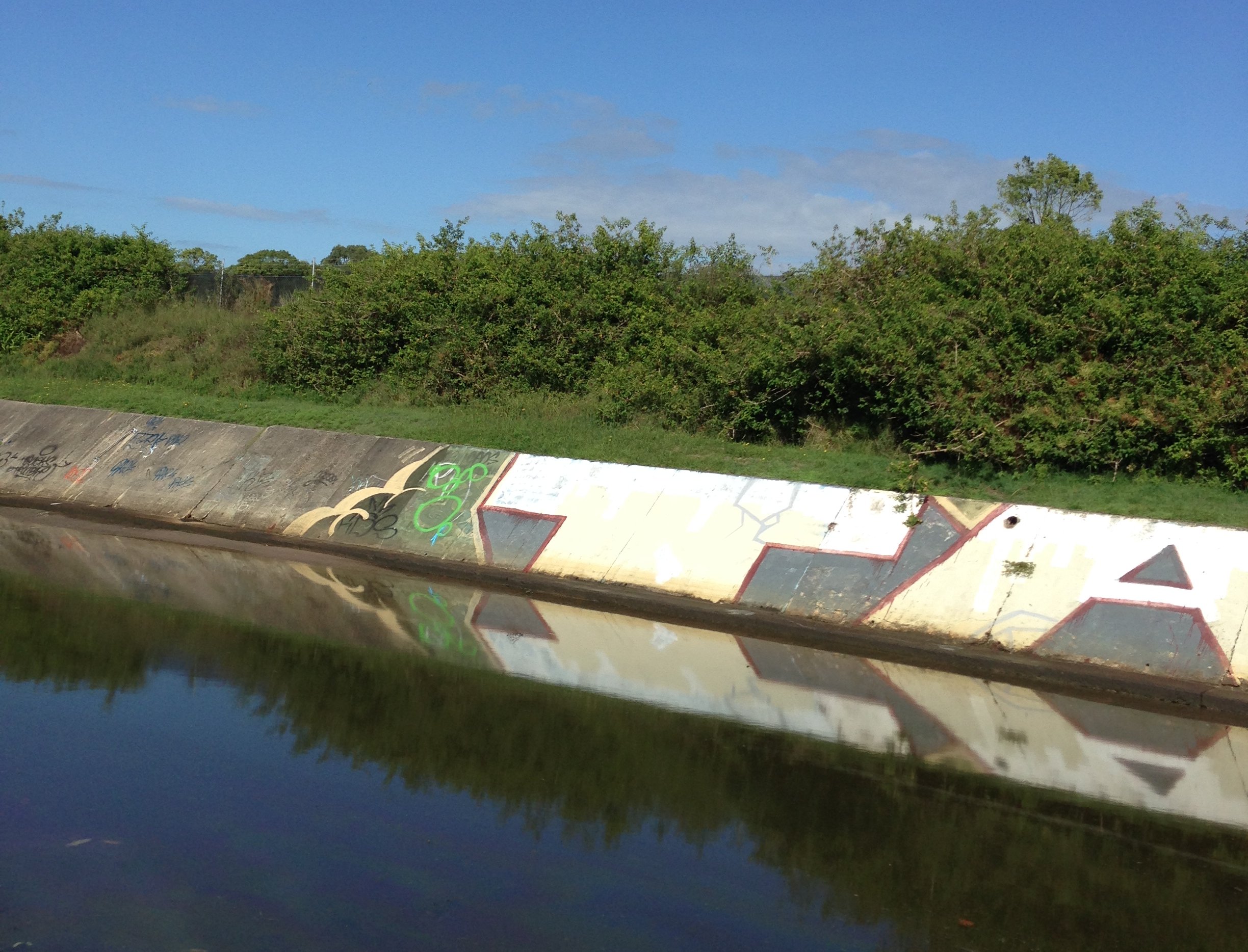
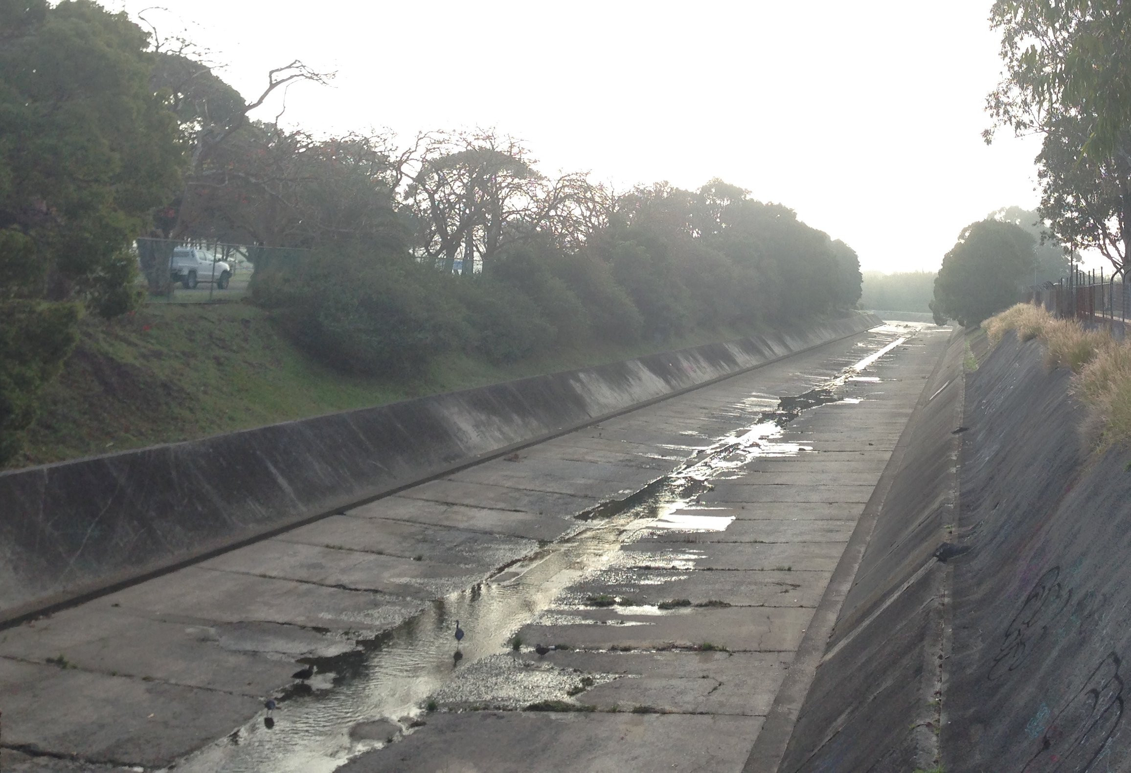
Having established with reasonable certainty that Ralph Snowball’s 6 April 1900 drain photo was located in Hamilton North adjacent to the old gasworks site, I visited the spot yesterday to take a modern photo.
Drain construction workers, 6 April 1900. Photo by Ralph Snowball. University of Newcastle, Cultural Collections.
The stormwater drain at Hamilton North, March 2017.
Update – July 2018
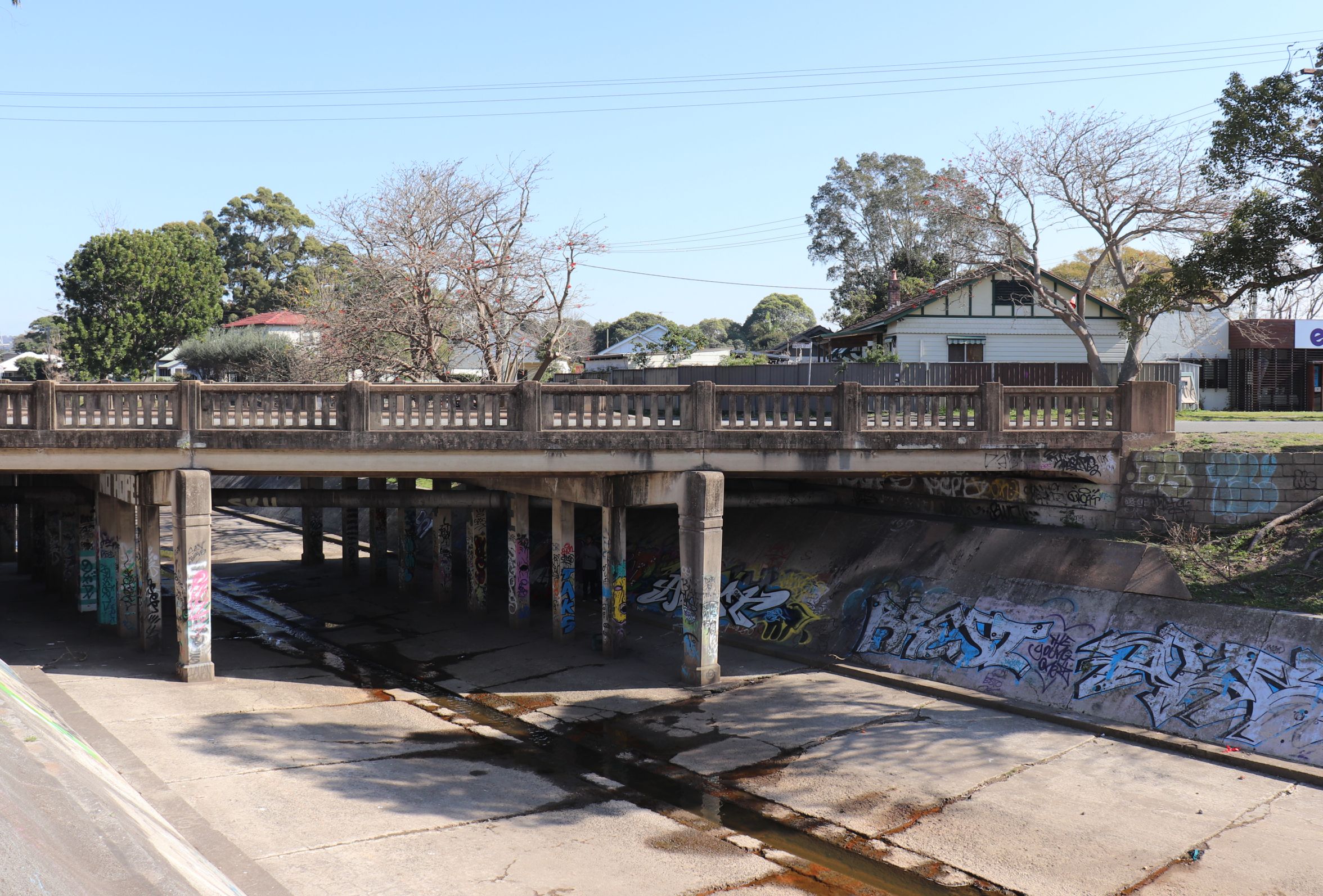
Based on some helpful observations from Tony Steinbeck, I now believe that is more likely that the 1900 photo was taken at the site where Chatham Road crosses the drain. See my storm water drain page for further details.
Chatham Rd bridge over the storm water drain in Hamilton North. July 2018.
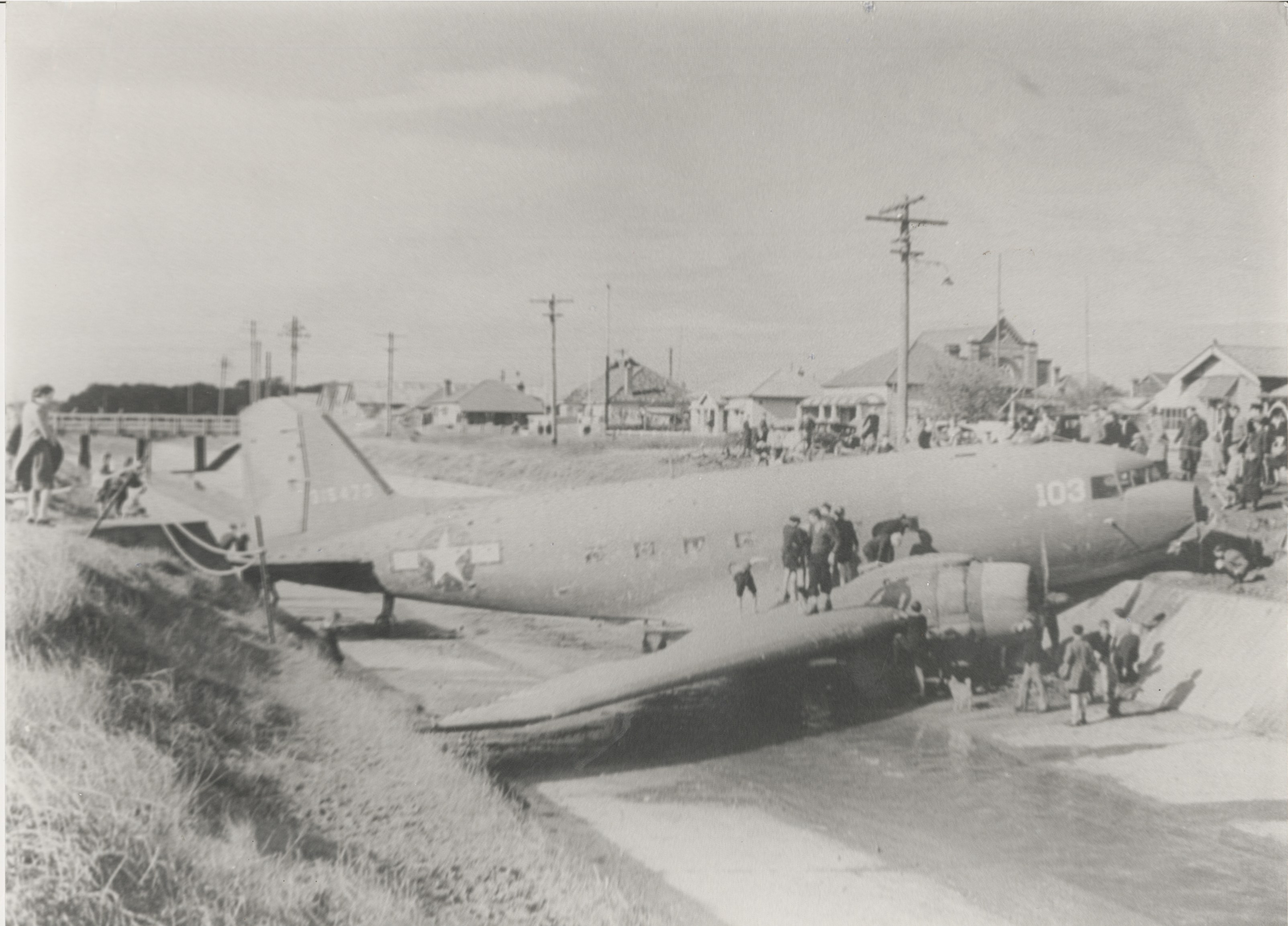
A couple of years ago I posted an article and some photos of a Douglas C47 transport aircraft that ended up in the storm water drain beside the Broadmeadow aerodrome during World War 2.
Last year I was examining an old black and white aerial photograph of the Broadmeadow area, and spotted something interesting …
… could that be the crashed C47 in the drain?
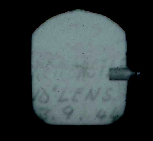
The aerial photograph has an information panel along the bottom, and in the white shape next to “RUN 5” there is some very faint writing.
The writing is too faint to decipher with any certainty in this “RUN 5” photograph, but in a similar photograph from “RUN 7” the date of the photograph is clearly 3rd September 1944.
This is just three weeks after the 10th August 1944 crash of the aircraft, and confirms that it is indeed the C47 plane we can see in the aerial photograph.
Photograph of the crashed Douglas C47 transport plane, from the Newcastle Morning Herald, 12/8/1944. New Lambton can be seen in the background.
A D.C. 47 Army transport plane, with 25 men on board, skidded 200 yards on a wet runway, hurtled through a fence and then crashed into a stormwater channel at Broadmeadow aerodrome.
Spotted this week in Hamilton North … a school of Ferrum Rotata return to their native breeding ground for spawning season, continuing the remarkable cycle of life.
When we think of the major contributors to health in our area, the hospital precinct at the top of the hill comes easily to mind. But another important and overlooked contributor lies at the bottom of the hill, in the storm water channels that snake through Lambton and New Lambton. Before they existed the flat expanse of Broadmeadow was a major hindrance in draining rainfall to the sea. An inquiry in 1893 noted that …
“On account of the defective drainage the water lay on the ground for days and weeks and even months in wet weather. It lay about the houses and became a nuisance not only in the way of locomotion, but was also productive of bad health and disease.”
The ill effects of stagnant water included respiratory infections, fungal infections, fevers, and mosquito borne diseases.
Work on the New Lambton branch was halted for several years however, because of a dispute with the Waratah Coal Company whose land the channel traversed. The work was resumed in 1901 and completed soon after. A few extensions in ensuing years resulted in the drainage system that has served us for over a hundred years.
Today, the storm water channel running across Broadmeadow carries away the rainfall from 1700 hectares across eleven suburbs. At full flow it can drain the equivalent of an Olympic swimming pool every 30 seconds. So the next time you think one of those ‘ugly’ open concrete drains, give a bit of respect, and a perhaps drink a toast to the health of the community.
Construction in 1901 of the storm water drain in New Lambton, near present day Mackie Ave. On the horizon, the rightmost hill is where the hospitals would one day be built. Photo by Ralph Snowball. University of Newcastle, Living Histories.
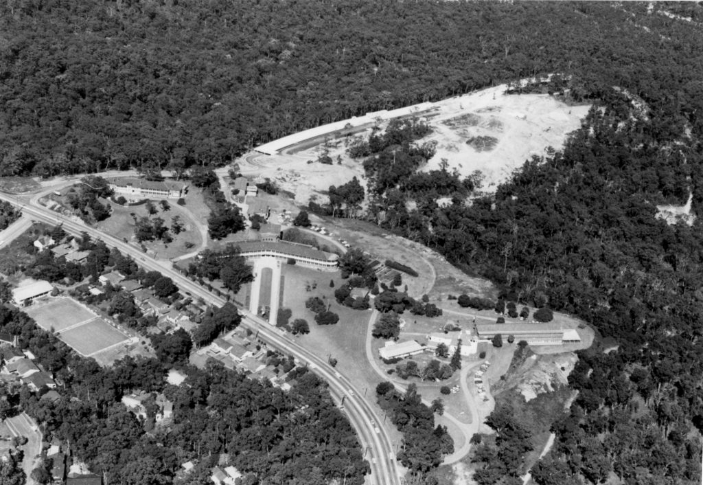
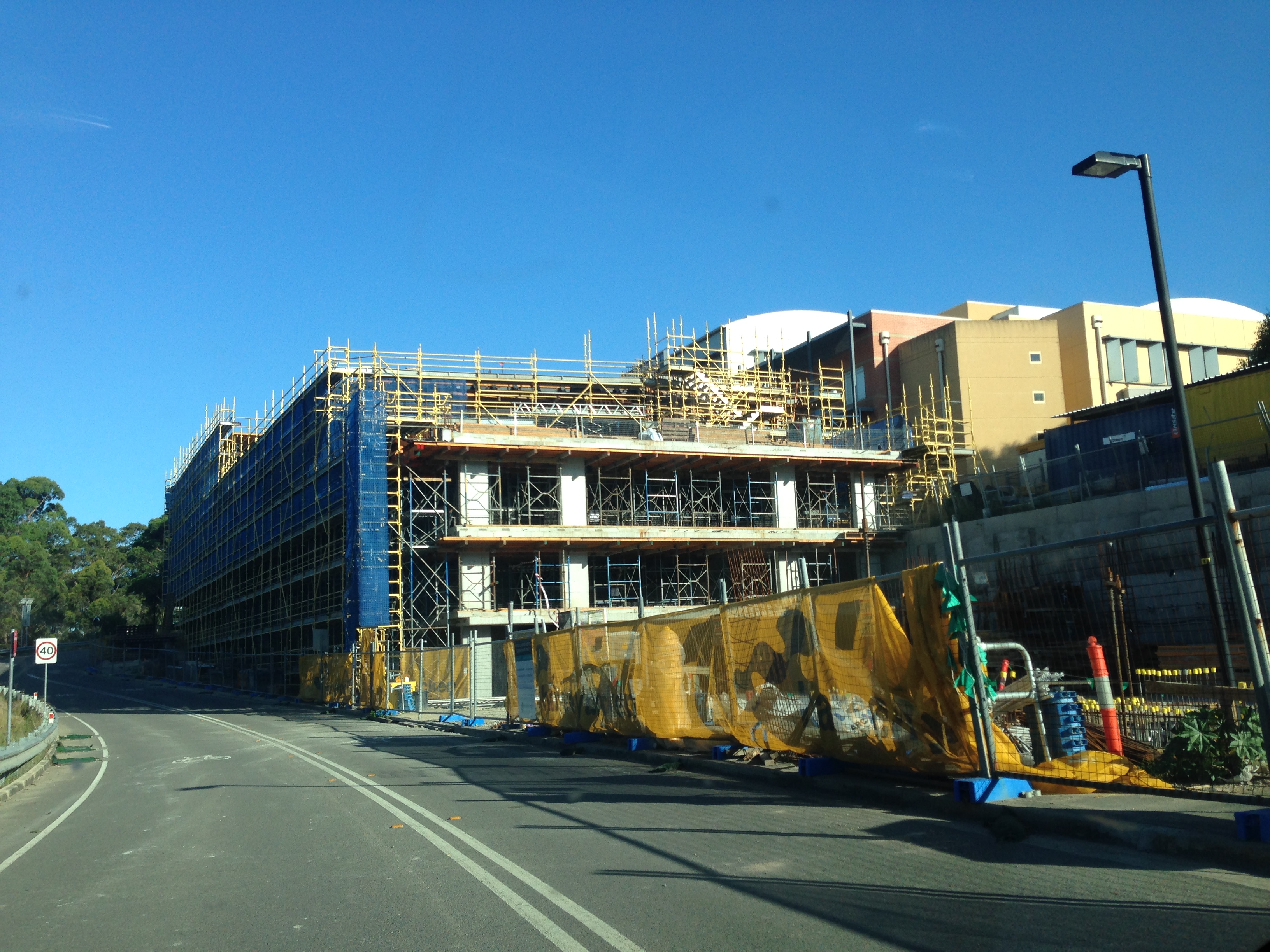
The aerial photograph above showing the early stages of construction of the John Hunter Hospital is from the University of Newcastle Cultural Collections. The photograph is undated, but is probably from 1987 as that is when construction by the McCloy Group began.
The article above was first published in the February 2017 edition of the Lambton & New Lambton Local.
Additional photos
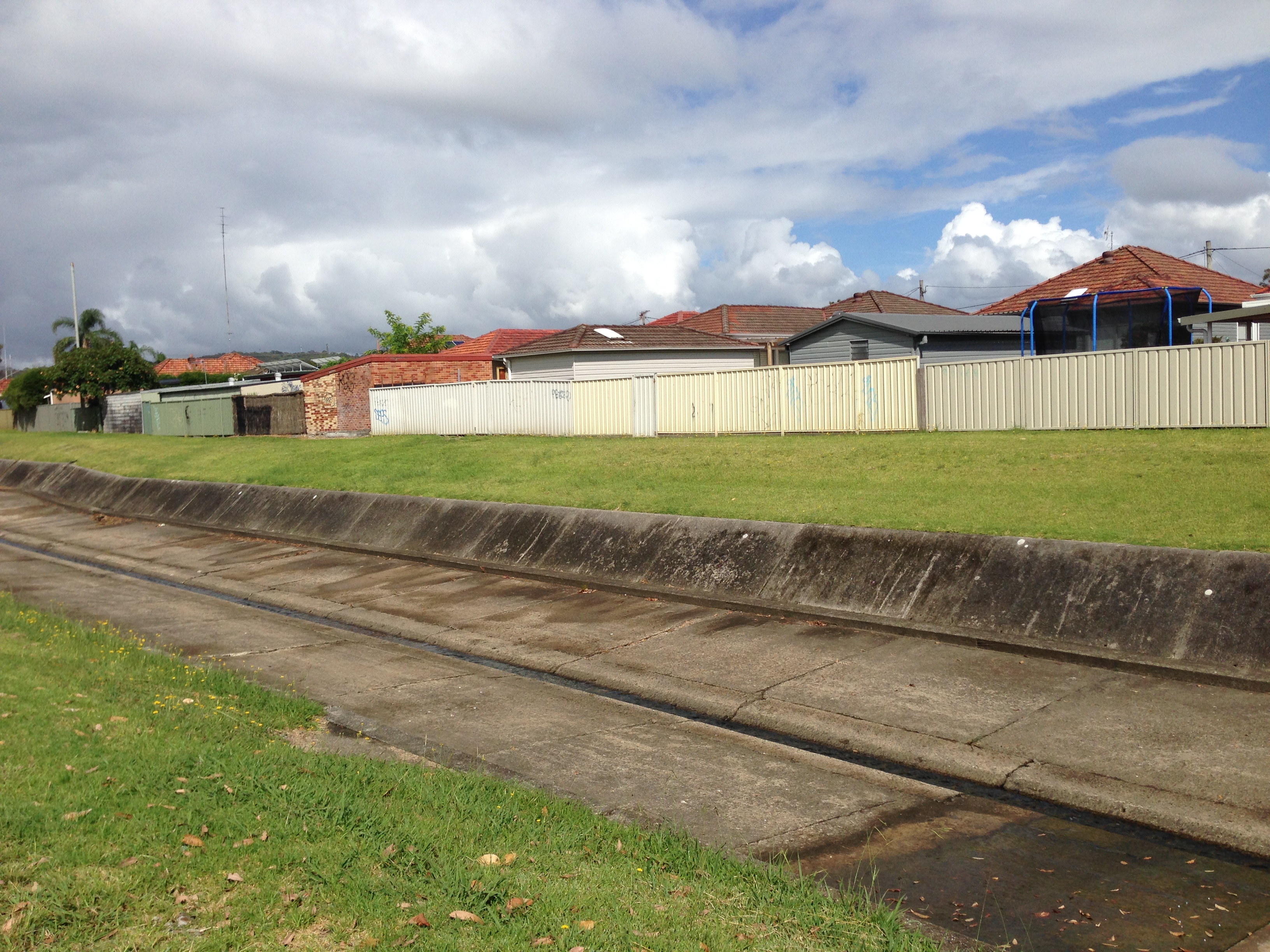
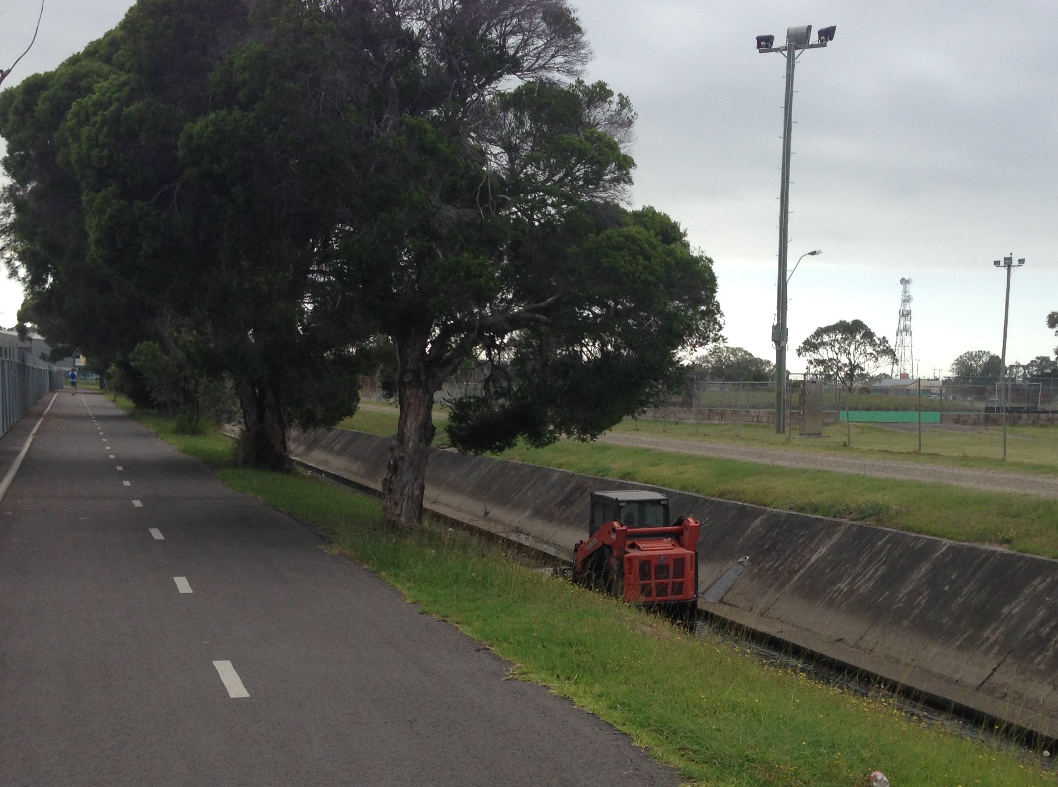
The storm water drain near Mackie Ave, New Lambton, January 2017.
Construction in the hospital precinct, New Lambton Heights, January 2017.
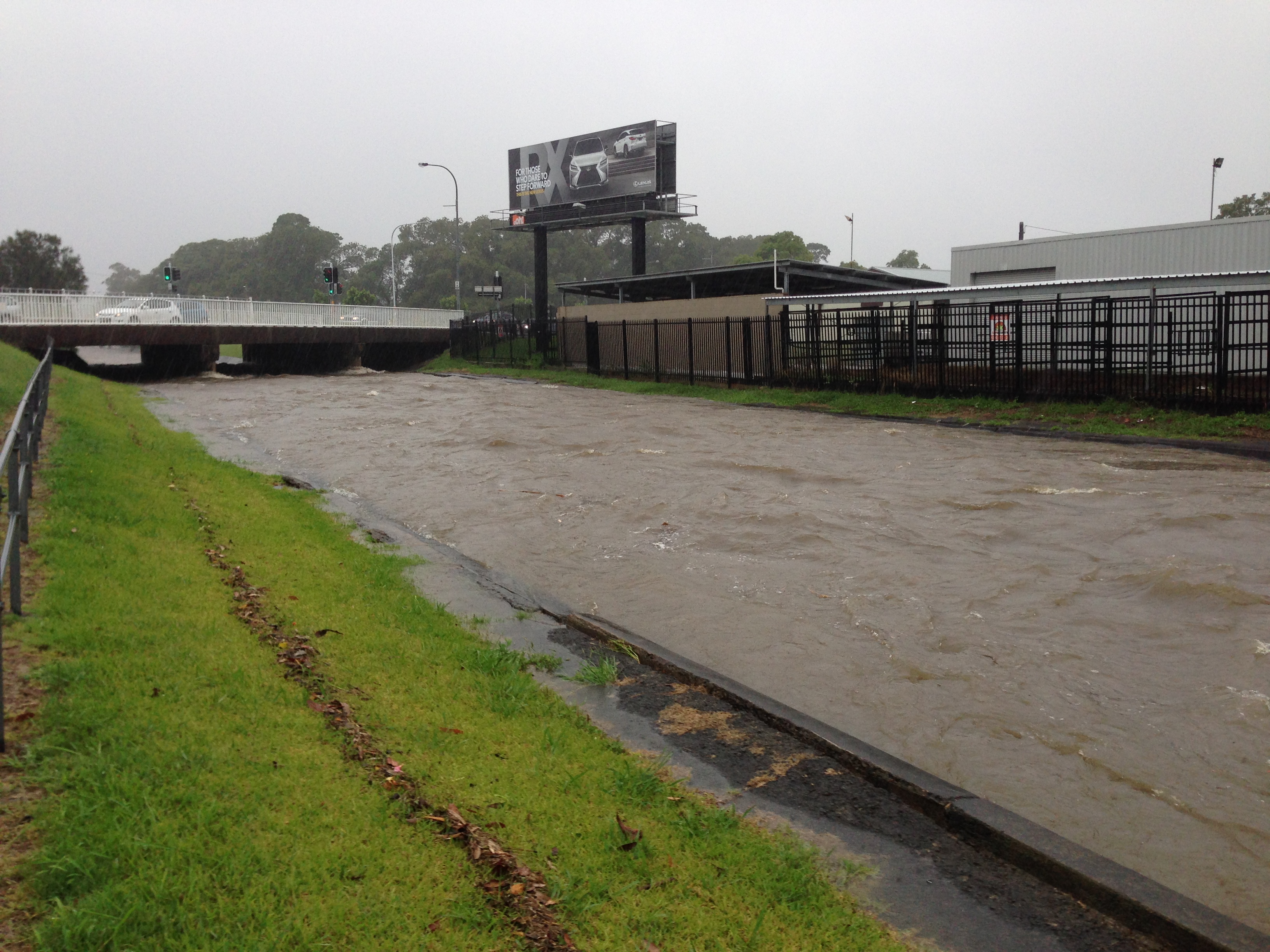
The storm water channel at Broadmeadow in full flow as it passes under Griffiths Road, 5th January 2016.
Acknowledgements
Thanks to local G.P. Doctor Catherine Hollier for medical advice on this story.
In the article I state that “the storm water channel running across Broadmeadow carries away the rainfall from 1700 hectares across eleven suburbs.” To calculate this I used Google Earth Pro and marked out in purple the area that drains into the storm water channel at Hamilton North where Griffiths Road passes over it. (KML download for Google Earth.)
This view from Google Earth shows how the surrounding hills form a half basin with Broadmeadow at the centre. Open storm water channels are marked in yellow, covered storm water channels are marked in red.
1700 hectare catchment area of the Broadmeadow storm water channel.
By using NSW Globe spatial data for Google Earth, I overlaid the suburb boundaries to see that rainfall from the following eleven suburbs drain through Broadmeadow:
North Lambton
Lambton
New Lambton
New Lambton Heights
Kotara
Kotara South
Charlestown
Adamstown Heights
Adamstown
Broadmeadow
Waratah
Rainfall from eleven suburbs drains into the Broadmeadow storm water channel.
The 1900 drain photo
The University of Newcastle Cultural Collections site has two very similar Ralph Snowball photographs captioned “Drain construction workers at Broadmeadow, NSW, 6 April 1900” (photo 1, photo 2). Given that the paper reported in February 1899 that “the last pick has been driven in the Pasturage Reserve drainage scheme” (apart from the New Lambton branch), it raises the question as to whether the location and date on these photos is correct.
Drain construction workers, 6 April 1900. Photo by Ralph Snowball. University of Newcastle, Cultural Collections.
Regarding the location of the photo we can see that the water in the drain is flowing left to right, and with the hills in the background it is clear that the photograph is taken from the eastern side of the drain, looking towards the west. An important clue is the large smoke stack behind the pile of dirt – this is almost certainly the stack of the English and Australian Copper Smelting Company, located in Broadmeadow, where UGL Limited (formerly Goninans) is now located.
1910 Barrett map overlaid on Google Earth, showing the location of the copper smelter near Waratah.
Along the hill in the background we can see what I believe to be Russell Road, New Lambton.
Russell Rd, New Lambton.
Towards the top of Russell Road there is a house with a dark line in front of it.
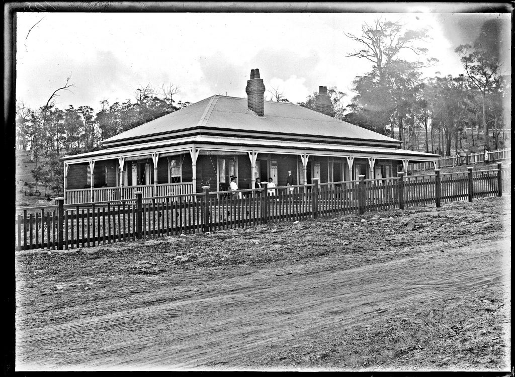
I believe that this is Hunter P Brett’s residence with a dark fence in front of it, as shown below in a 1908 photograph. This house still exists today, at 168 Russell Road.
Hunter P Brett’s residence, Russell Road, New Lambton, NSW 1908. University of Newcastle, Cultural Collections.
With two points in the background of the 1900 drain photo established, the range of possible locations for the photo are narrowed down to the yellow shaded area below, that is between Broadmeadow Rd and where the drain passes under the railway at Islington.
Possible location of 1900 drain photo marked with yellow shading.
Its difficult to be certain, but the angles in the photo suggest that it was probably taken from Hamilton North, somewhere near the old gasworks site.
Corroborating this location is a newspaper report on 30 April 1900 “concerning the death of a middle-aged man named Michael Powell, who, in the forenoon was accidentally killed by a fall of earth at the storm-water drain at Newtown, near Hamilton.” Newtown was the original name of Hamilton North.
It is somewhat sobering to realise that it is quite possible that Michael Powell is one of the men in the 6th April 1900 photograph, just weeks before he was killed in a workplace accident at that site.
Having established with reasonable certainty that the photo location is Hamilton North, the question remains as to what work was being done on the storm water drain there, as work was supposedly finished a year earlier. Possibly the drain at that point needed to be widened, deepened, or strengthened to handle the increased flows resulting from the addition of the New Lambton, Adamstown and Hamilton branches of the drainage system.
Tony Steinbeck helpfully pointed out to me that the tall structure on the far bank appears to be a pile driving tower, used to drive foundations into the ground.
Pile driving tower
The obvious candidate in the Hamilton North area that would require foundations alongside the drain is the Chatham Road bridge. So the photo from 1900 is possibly showing construction of an earlier bridge across the drain. The current bridge has no plaque indicating a date of construction, just an an empty spot with sawn off bolts where the plaque would have been placed. However the Chatham Rd bridge is of similar construction to the Broadmeadow Rd bridge which was opened in 1957.
Chatham Rd bridge over the storm water drain in Hamilton North. July 2018.
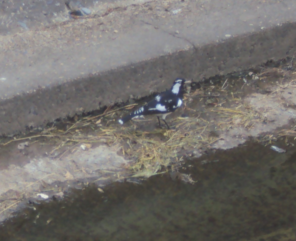
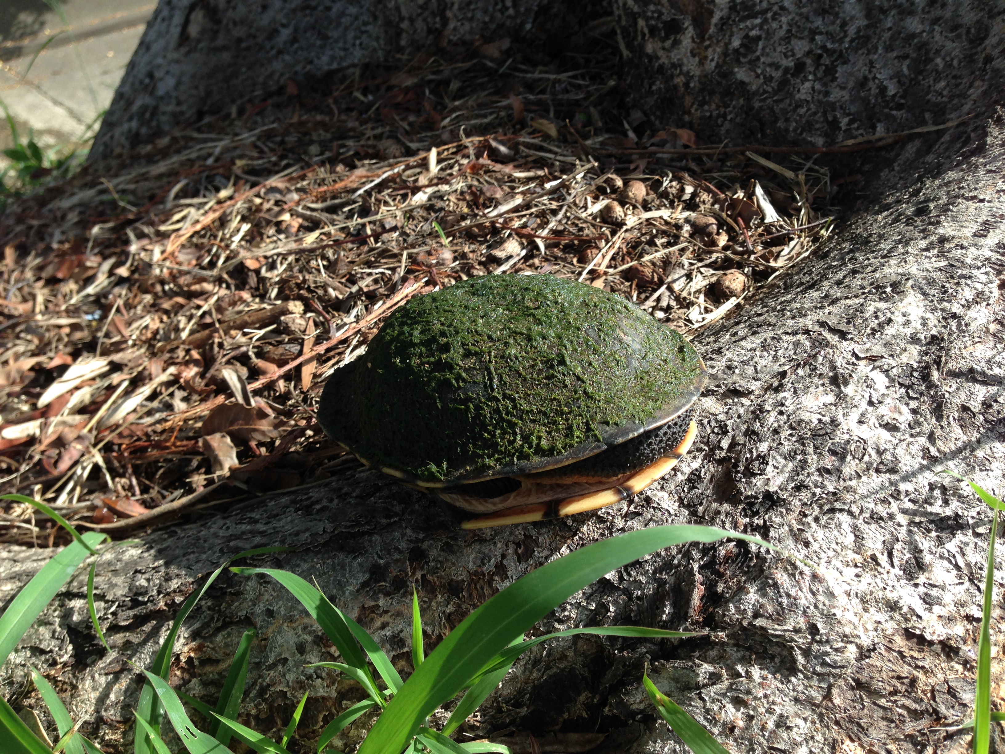
Creatures in the drain
The storm-water channel is not only good for humans – all sorts of creatures can be found there.
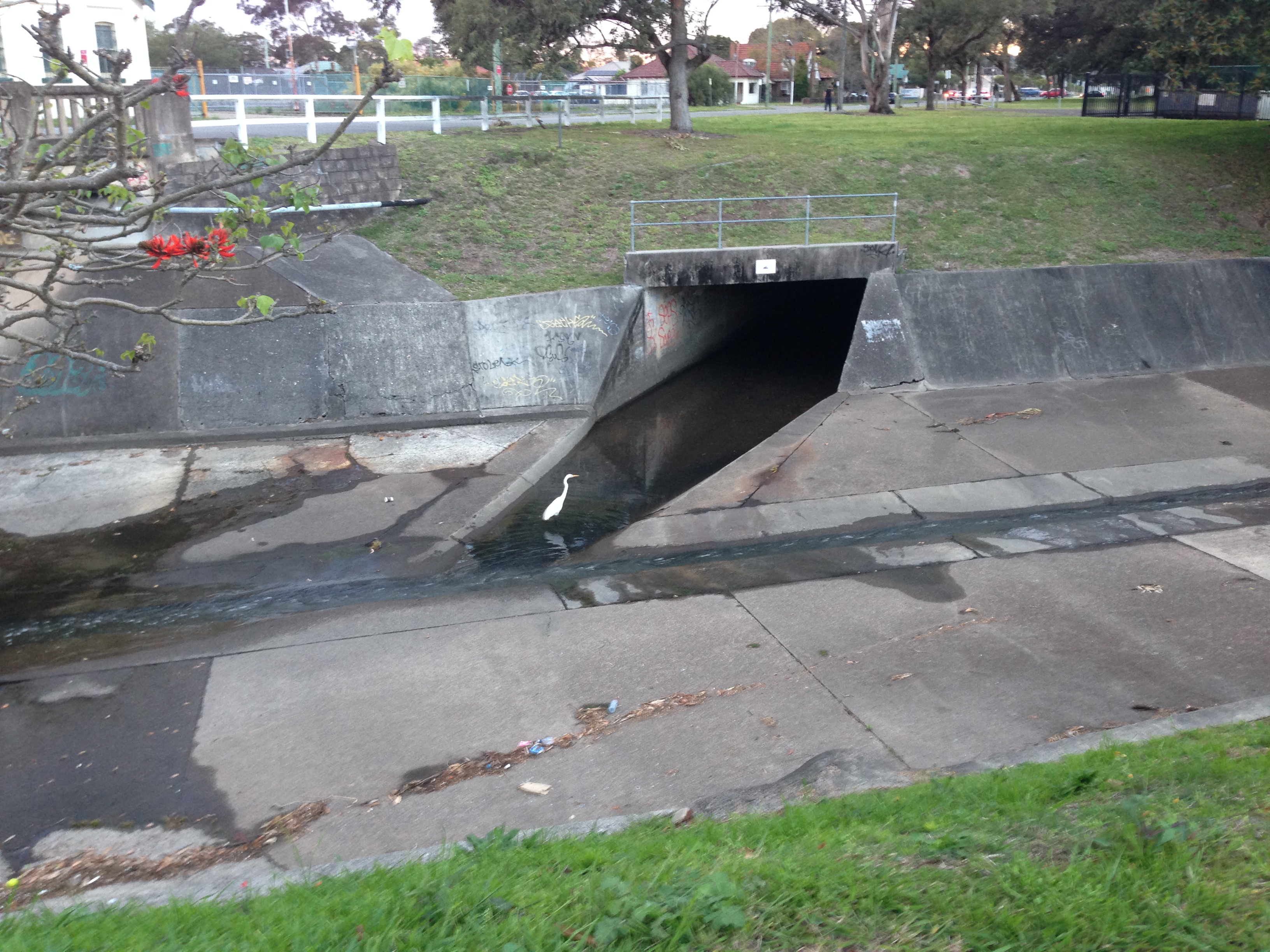
Egret in the drain at Hamilton North.
Egrets in the drain at Hamilton North on a misty winter’s morning.
Bird in the drain
Tortoise found near storm water drain in Hamilton North.
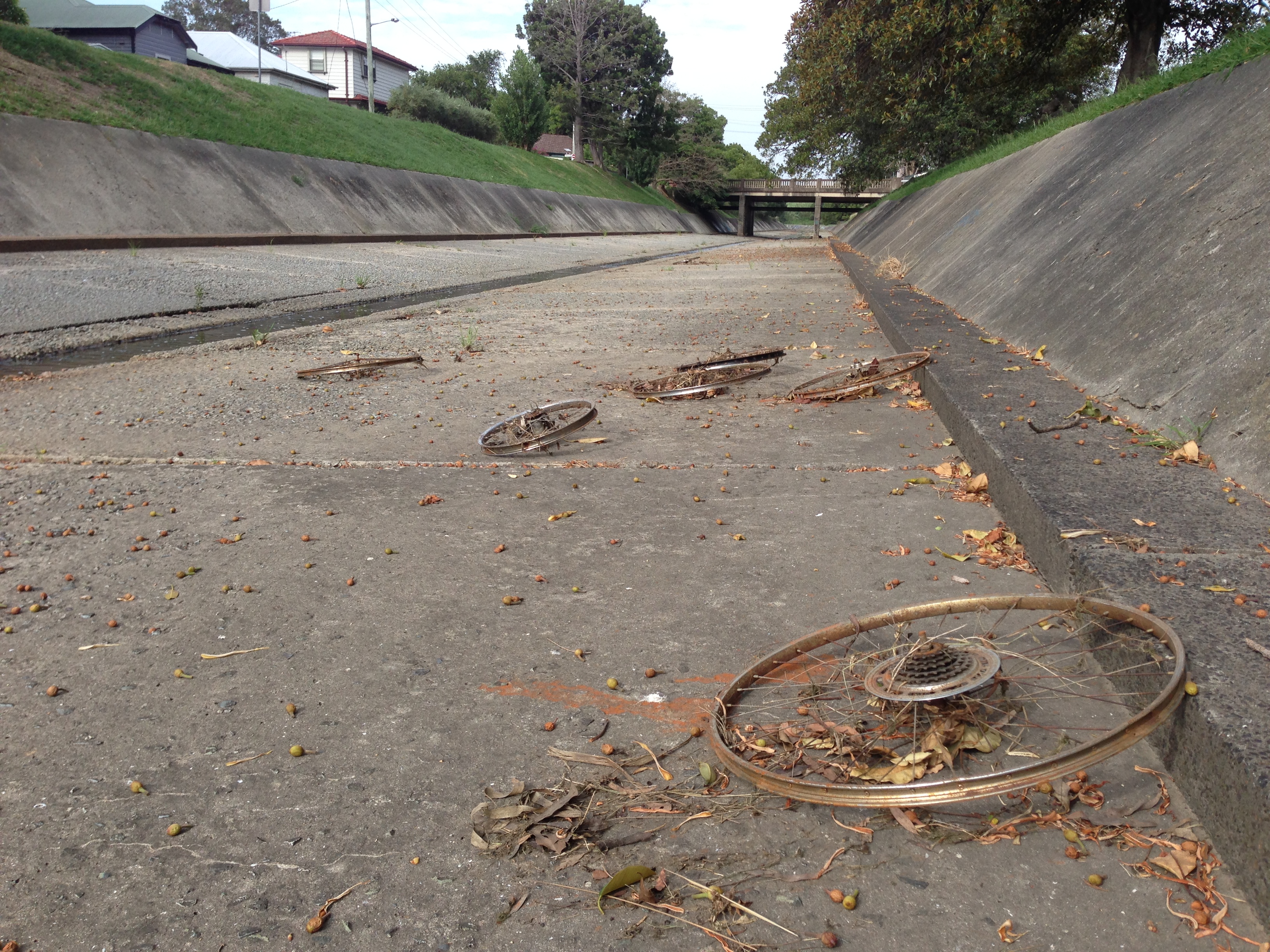
A mechanical creature of the drain.
Other drain things
Probably the strangest thing I’ve spotted in the drain is my own letterbox. In October 2019 our letterbox mysteriously disappeared one night. The next day, cycling home from work through New Lambton Park, near Ford Oval I glanced down and spotted my letterbox – dumped in the drain over one kilometre from my home. It was broken into multiple pieces, but I managed to retrieve, repair, and reinstall it.
Links
In February 2016 I wrote a longish blog post about the drainage system, where, amongst other things, I calculated how fast the drain could empty an Olympic swimming pool.
"The recent rains have proved the drainage of Lambton to be very defective … there is nothing so injurious to the public health as bad drainage, to say nothing of the damage done to property by flood water."
Mr Griffiths, in nominating for New Lambton council promises that he would work to "prevent fevers and the like by strict attention to the drainage, and he would advocate co-operation with other Councils for
a general system of drainage."
"A thorough system of drainage at the lower end of the district from New Lambton downwards, through Hamilton, is necessary to prevent these periodical floods, as the water then would have an opportunity of
free access to the main channels to the sea."
New Lambton Council - A decision about making another watercourse through the New Lambton railway embankment, is held over pending the result of the deliberations on the proposed combined councils' drainage scheme along the Australasian railway.
Call for the government to keep its promise to drain the Commonage. The lack of drainage meant that "in very wet weather the low-lying portions present the appearance of miniature lakes, in which the small houses of the residents appear like islands."
Hamilton council receive a letter from the Public Works Department regarding "the drainage scheme on the Commonage, stating that the survey had been completed, but that fully three months must elapse before the plans and estimate could be prepared."
The survey of the drainage scheme has been completed. "It is proposed to make the main trunk 50ft wide and 8ft deep, and to extend it from the Great Northern railway line past the Raspberry Gully line, a distance of about three-quarters of a mile."
Call for workers on the drainage scheme.
"GANGERS are requested to meet the undersigned at intersection of Broadmeadow and old Australasia line at 3 o'clock THIS (Monday) AFTERNOON,for the purpose of cavilling for sections of work to be done. H. D. WALSH, District Engineer."
Work commences on the drainage scheme. "The drainage works at Broadmeadow presented an animated appearance yesterday, upwards of 100 men being at work and quite double that number looking on."
Drainage works progressing. "The section now open extends from behind Kidd's boot factory, at Islington, or to be more explicit, from Styx Creek, six chains below the Newtown Bridge, along the old Australasian Company's railway to the Broadmeadow Lambton road, at the New Lambton railway. The distance is just on two miles, and when completed the drain will be as straight as a gun barrel over its first section."
"The work of completing the lining of the drain on the Lambton Park does not form part
of the Pasturage Reserve drainage scheme, and that no funds were available for that purpose."
"By the aid of two powerful steam pumps running day and night, the drainage from Lambton,
Adamstown, Mayfield, Waratah, and the surrounding suburbs, has been pumped out of the channel. This allows a larger number of men to be employed than formerly, and at present about 200 men, with horses and drays, are working perfectly dry at a level of 7ft below high water mark at Nobbys."
Drain is being extended up to Lambton Park. A tributary channel from Gregson Park Hamilton will soon be commenced. Tighes Hill footbridge nearly completed.
"At the beginning of the week 120 men were put on at the Lambton extension, which is to cover
a distance of a quarter of a mile." Estimated Expenditure on the drainage scheme is £39,500.
Work on the New Lambton section of the drainage channel has been suspended and 230 men thrown out of work. "The Government failed to resume the land before cutting the drain, believing that property-owners would only be too glad to have their land improved in value by means of the drainage. The Waratah
Company, however, take the view that the soil excavated in their estate should not be scattered over the grass, but should be taken away. The Government at present refuse to do this."
"The Lambton branch, costing £3600, is now nearing completion, less than 20 men being now employed upon it."
A dispute between the Government and the Waratah Coal Company "has resulted in the suspension of operations on the New Lambton branch of the main channel of the Pasturage Reserve drainage scheme."
Regarding the five month suspension of work on the New Lambton Channel, the Waratah Coal Company is not being co-operative, and the Government is forced to compulsorily resume the land.
"The last pick has been driven in the Pasturage Reserve drainage scheme, which was commenced some three years ago. There remains the New Lambton branch of the main channel to be completed, but, in
view of the opposition of the Waratah Coal Company, this extension seems to have been abandoned."
Prospects that work on the New Lambton branch of the storm water channel might recommence soon. A new survey for the branch channel has been made, so that instead of "the channel being constructed in a direct line it will take a sweep and miss the private property."
The importance of the drainage works is again emphasised for "on it depends to a great extent the health of the people of that locality. Typhoid fever made its appearance in that neighbourhood recently, and the cause could only be attributed to the want of drainage, for the majority of dwellings are damp."
The government is trying to pass off control (and the mainentance cost) of the stormwater channel to either the Hunter District Water and Sewerage Board, and/or the local councils. Neither are very happy with being saddled with the cost.