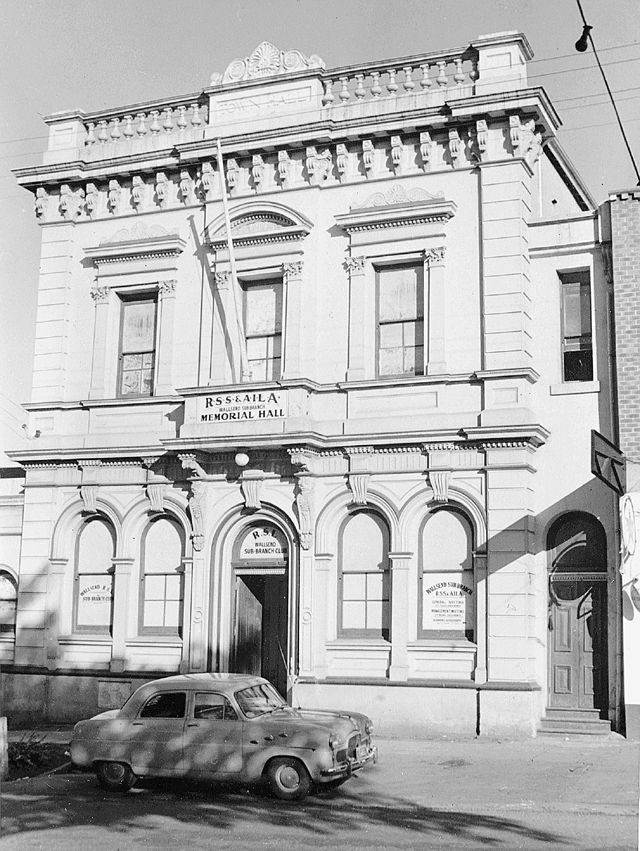
When the old Lambton colliery ceased operation, the pit paddock with its offices and buildings lay idle for a decade. Then 75 years ago, in 1947, a new enterprise began on the site with the opening of Leonora Glass Industries, founded by David Marr and three highly skilled Czechoslovakian glass workers.
Joseph and Henry Vecera and Josef Tvrdik came to Australia from Europe in 1934 to teach glass making at a Sydney factory. They later moved to Newcastle to work in the Electric Lamp Manufacturers Australia factory at Hamilton North. In 1946 the three men and their families became Australian citizens. The following year, along with David Marr (manager) and Alan Little (engineer), they set out to create their own glass making business, renting a portion of the Lambton colliery and setting up furnaces in the former colliery workshop.
In August 1947 they registered their enterprise as “Leonora Glass Industries”, possibly inspired by the town of Lenora in the Czech Republic, just 30km from Josef Tvrdik’s birthplace, where a famous glassworks had operated since 1834. Manufacturing commenced the following month and by December 1948 the works employed 23 people including several young apprentices. At this time they were making 2000 lamp shades a week. In the following years they produced many items such as wine glasses, dishes, ash trays, and car headlight lenses.
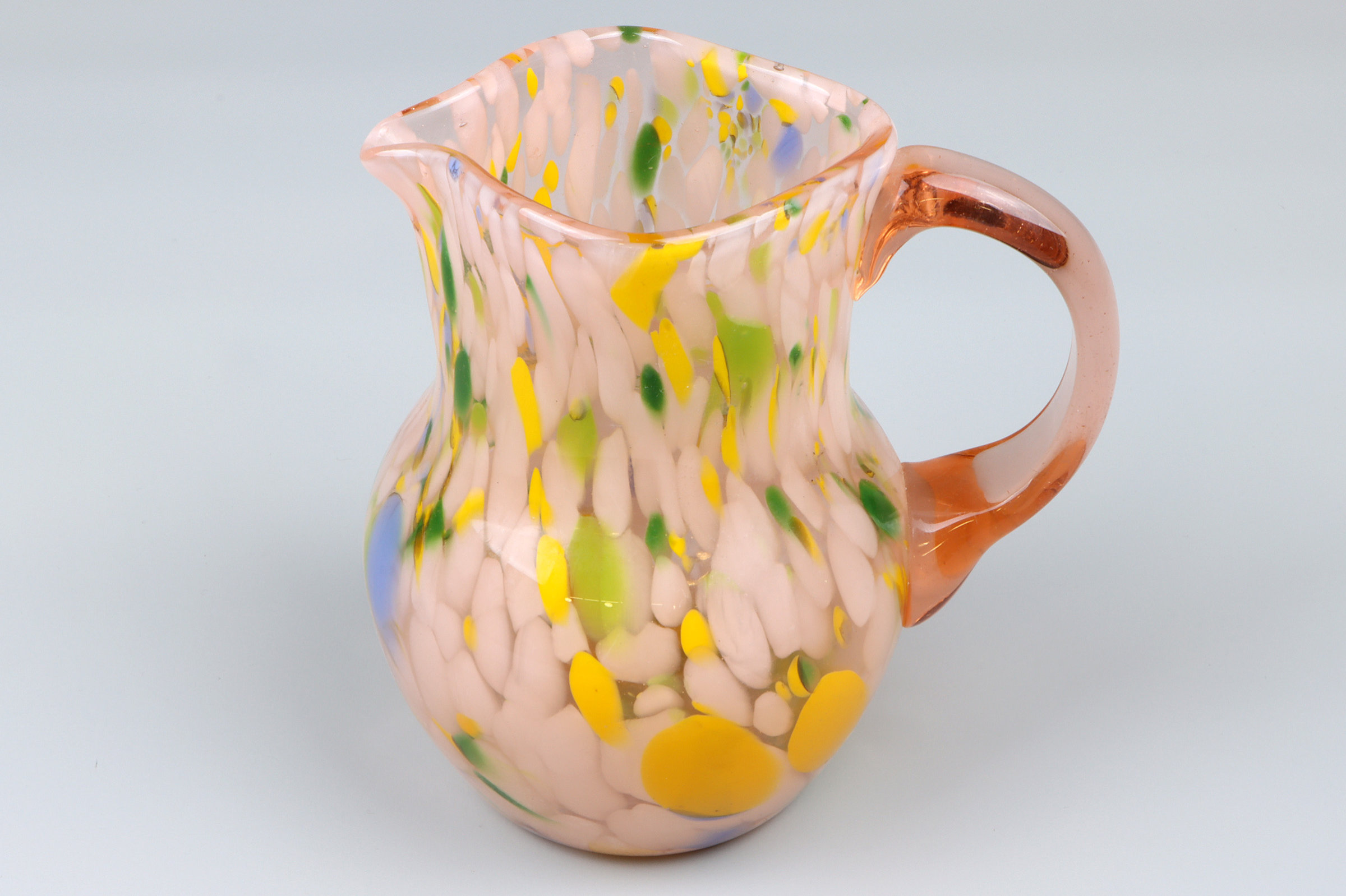
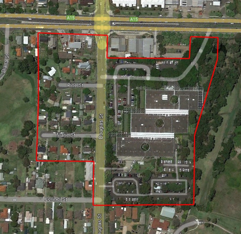
While the bulk of Leonora’s output was utilitarian in nature, they also handcrafted fine glassware such as jugs, vases, and decorative ornaments. Museums across Australia hold examples of these works in their collections. In July 1957 glassmaking in Lambton came to an abrupt halt when a fire destroyed the Leonora works. The company quickly recovered, purchasing 14 acres of land on Douglas St Wallsend to set up a new factory. In 1960 the multinational firm Philips Industries took over the glassworks to focus on the manufacture of light fittings. Although business expanded in the 1960s, increasing pressure from low cost overseas competitors in the 1970s led to the eventual closure of the works in 1982

The article above was first published in the October 2022 edition of The Local.
Additional photos

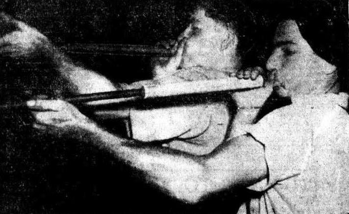
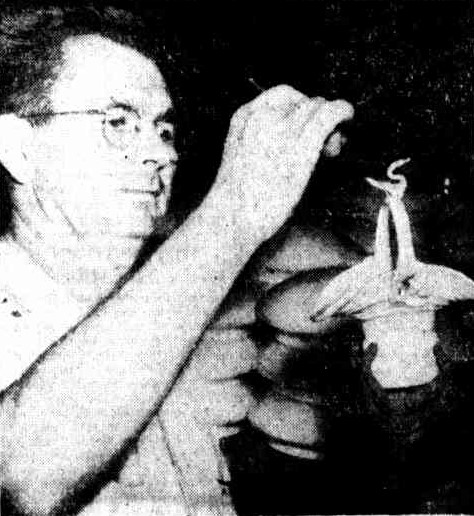
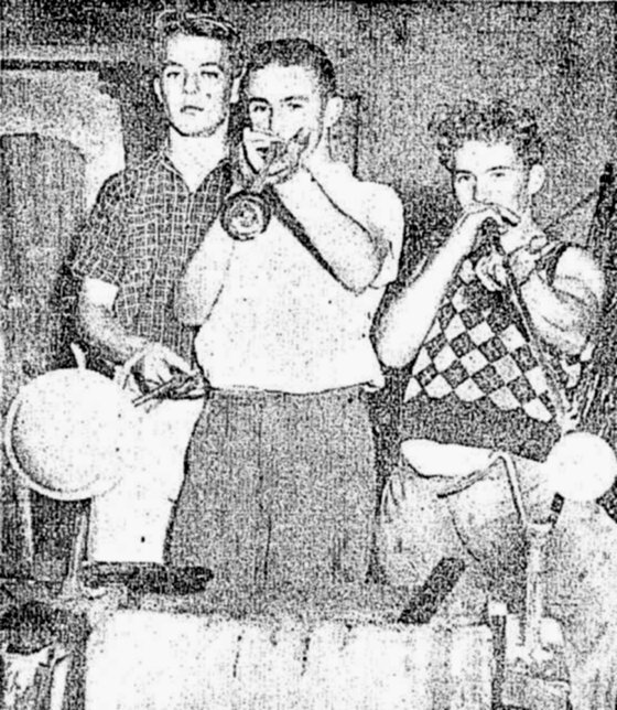
Newcastle Morning Herald and Miners’ Advocate, 26 May 1953.


Personal details
The following personal details of the three Czechoslovakian founders of Leonora Glass were extracted from National Archives of Australia records searches.
| Name | Henry Vecera | Josef Vecera | Josef Tvrdik |
| Birth | 15 Aug 1901, Uhrovec, Slovakia | 19 Mar 1899, Uhrovec, Slovakia | 12 Jan 1904, Nova Hut, Czechia |
| Arrival in Australia | 11 Nov 1934 | 9 Nov 1934 | |
| Naturalised | 30 Aug 1946 | 9 Dec 1946 | 3 Dec 1946 |
| Family | Wife, Julia; daughter, Henrietta Julia, born 1928 | Wife, Cecile; twin sons, Milon Edward and Joseph Henry, born 1931 | Wife, Coralie Violet Mary |
Company information
A search of the ASIC Registers shows that Leonora Glass Industries Pty Ltd was registered as a company on 11 August 1947.

Origin of the Name Leonora
I have no direct evidence for the naming of “Leonora Glass Industries”, and what follows is just a reasoned guess.
We know from the notification of intention to apply for naturalisation, that Josef Tvrdik was born in “Nova Hut” in Czechoslovakia. This is the village of Nové Hute in the Czech Republic today.

Just 17km away (28km by road) from Nove Hute is the village of Lenora. The tourism website for the Šumava region describes the origin of the town.
The village of Lenora was founded as a settlement around one of the last glass- works established in the Šumava mountains by Jan Meyer in 1834. Later on the glass-works were taken over by Meyer’s nephew Vilém Kralik. The village was named Eleonorenhain after the Princess Eleonora (1812-1873), the wife of the lord of the estates John Adolf of Schwarzenberg. Czech translation of the name is “Eleonora’s Paradise”. Later on the village adopted Czech version of the name, Lenora.
Sumavanet tourism website

Note that while there is Leonora Parade in Waratah West, it appears to have no connection to the Leonora glassworks. The street was formerly a section of Platt Street, and was renamed to Leonora Parade in 1968.
Newspaper articles
| Article Date Event Date | Notes |
|---|---|
| 6 Apr 1946 | Notice of intention by Henry Vecera, Josef Vecera, and Josef Trvdik to apply for naturalisation. Josef Tvrdik, born at Nova Hut, Czechoslovakia, resident over 11 yers. Josef Vecera, Born at Uhrovec, resident over 11 years, living in Adamstown. Henry Vecera, Born at Uhrovec, resident over 11 years, living in Pearson St Lambton. |
| 7 Oct 1947 | "A GLASS factory, now operating in a disused building which once was part of the Old Lambton coalmine, aims to produce the finest glass and crystal ware. The company--Leonora Glass Industries Pty. Ltd.- comprises Messrs. Jospeh and Henry Vecera, Mr. Jospeh Tvrdik. Mr. David Marr (manager) and Mr. Alan Little (engineer). Messrs Vecera and Tvrdik are Czech-Australians, who came to Australia in 1934 to teach glass-making at a Sydney factory." |
| 23 Nov 1948 | “The strange bulbous Dali-like shapes, coloured in streaky and marbled patterns, which yesterday made an appearance as part of the Christmas dressing of a Hunter-street store are not painted marrows or solid-seeming balloons ... they are made of glass. The result of a brain-wave on the part of the window dresser (Miss E. Ritchie), they were specially blown at the Leonora Glass Works at New Lambton.” |
| 3 Dec 1948 | The development of the fine glass industry in Newcastle by two Newcastle engineers and three Czechoslovakian glassworkers in a factory at Lambton is giving Newcastle boys an opportunity to learn the trade. The factory, which employs 23 after 12 months of operation, turns out 2000 lamp shades a week and some 400 water sets. Production of fine glass-wine glasses and ground glass-is starting. |
| 11 Dec 1948 | Photo of twins Joseph and Milon Vecera, on the steps of the old Lambton Colliery office, near to where they work in the Leonora Glassworks. |
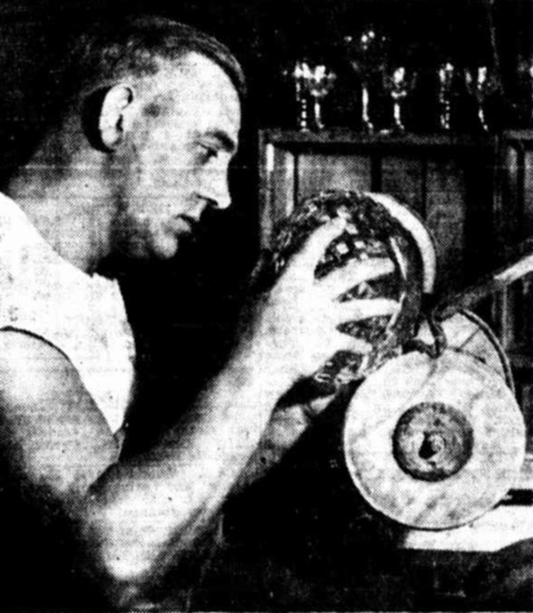
| 11 Dec 1948 | Story on Ernest Sandgren, immigrant from Sweden, and Australian weight-lifting champion for 7 years, working as a cutter of fine crystal at Leonora Glassworks. |
| 3 Feb 1949 | "It was planned with the Leonora glass factory at Lambton to make Newcastle a centre of the fine glass industry in Australia, the Managing Director (Mr. D. Marr) told Newcastle Business Men's Club yesterday. The factory was still in its initial development. It had been operating for 18 months. In the factory there were three Czechs of world-wide experience in the manufacture of hollow blown ware, including the art of stemware. They came from generations of art craftsmen." |
| 8 Mar 1950 | “The factory is now producing heat-resistant glass in large quantities. About 100,000 such articles have been produced for distribution throughout Australia, in the past 12 months. The Manager (Mr. David Marr) said he believed this was the first time pyrex-type glass had been made in Newcastle.” |
| 4 Jan 1952 | "MILON and Joseph Vecera, twin sons of Mr. and Mrs. J. Vecera, of Croudace street, Lambton, celebrated their 21st birthday, which was on New Year's Day,' with a party, on New Year's Eve. About 40 people attended the party. Milon and Joseph, who were born in Lausanne, Switzerland, came to Australia when they were four. They are both glass craftsmen at Leonora Glass Works, Lambton, and both play the piano, violin and piano-accordion." |
| 26 May 1953 | The factory is turning to a new type of glass manufacture for Newcastle. This is the manufacture of pressed glass. A glass moulding press has been installed to manufacture pressed glass dishes, car headlight lenses, ash trays and other goods. The machine is in trial production. When producing fully, it will turn out 1500 articles a day.” |