Marshall Street and the Inner City Bypass
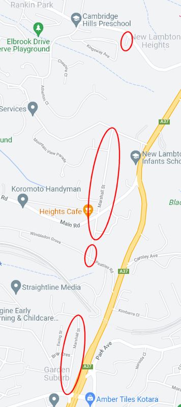
Some roads in our city snake across the landscape following ridges or valleys, while others cut expansive straight lines across suburbia. In the former category are roads such as Grandview Rd in New Lambton Heights. In the latter category are roads such as Chatham Rd/St in the Hamilton area, and the curious Marshall St which has four disconnected sections running through five different suburbs, from Rankin Park to Garden Suburb.
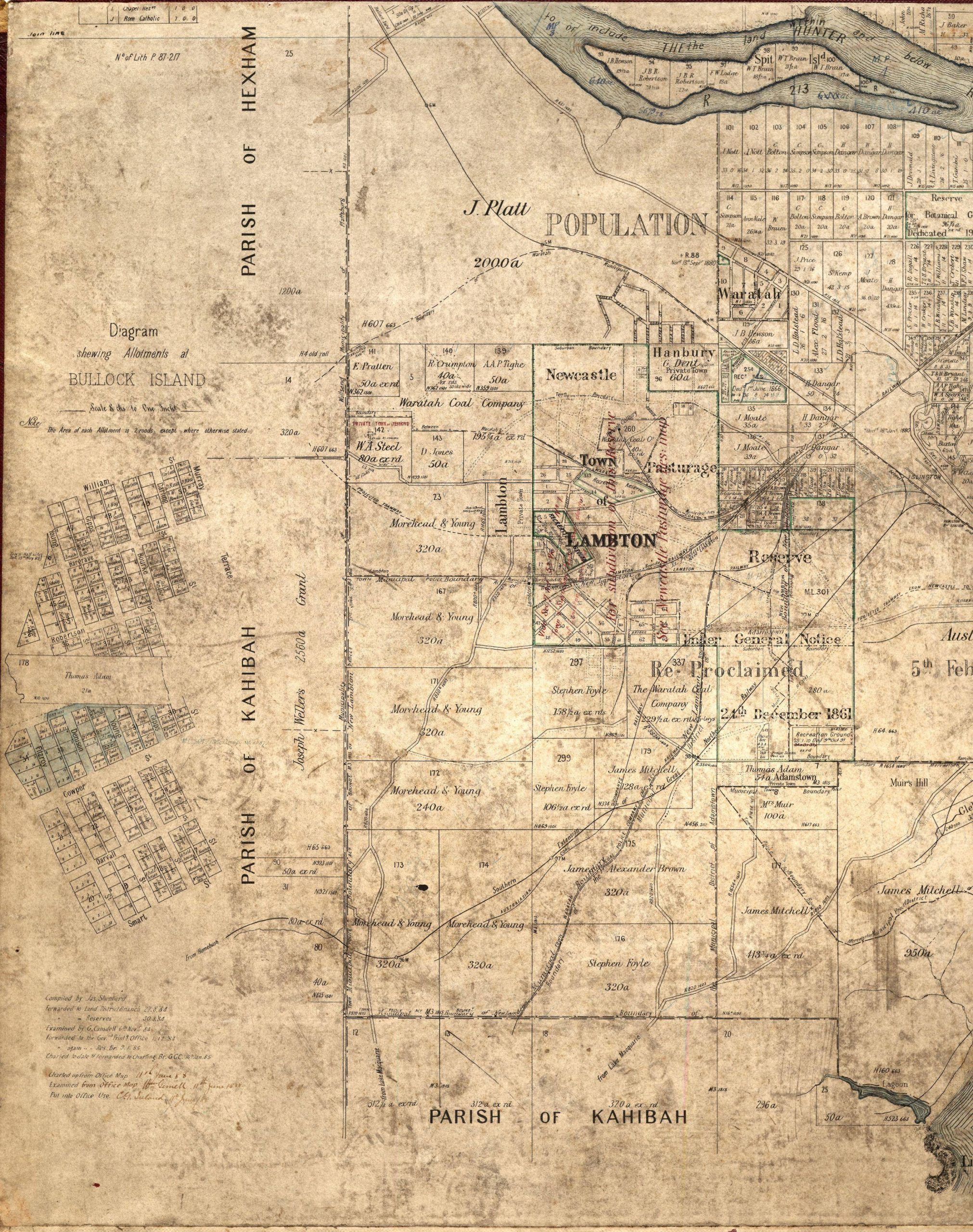
These long straight roads have more to do with geometry than geography. They originated from the patchwork quilt of rectangular land grants in the mid-19th century, where it was common for roads to be planned along property borders. Such is the case with Marshall St, where an 1884 map shows a three-mile un-named road separating the Scottish Australian Mining Company from Joseph Weller’s 2500 acre land grant.
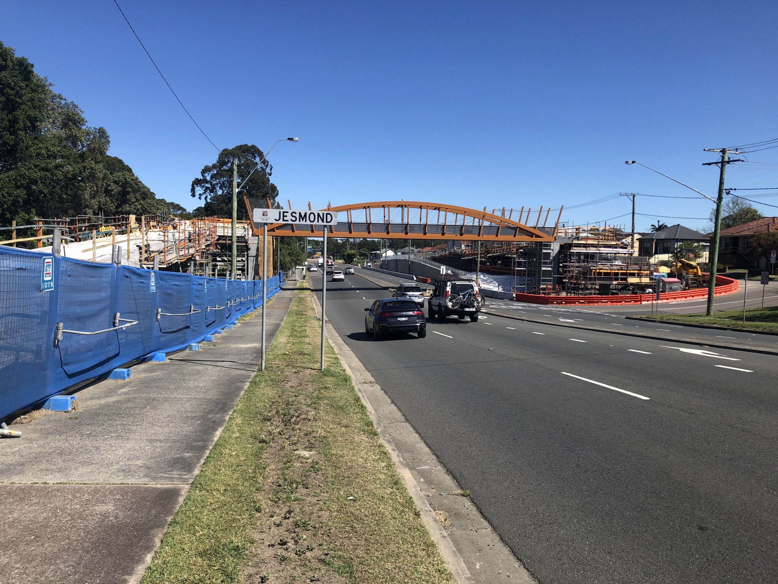
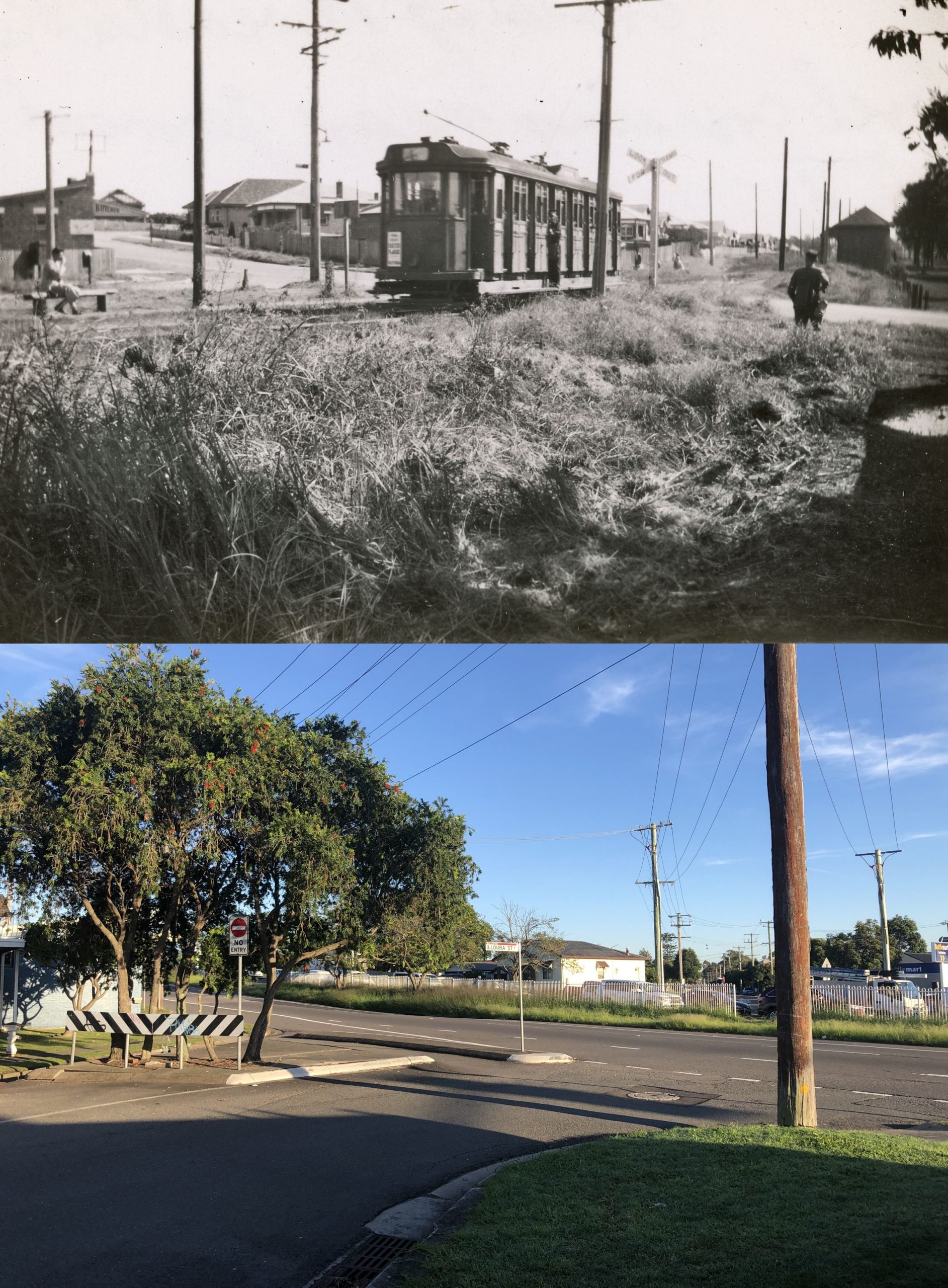
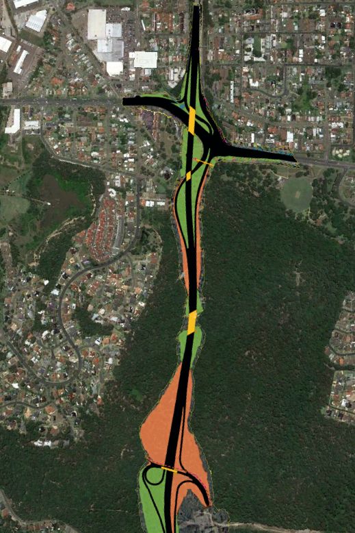
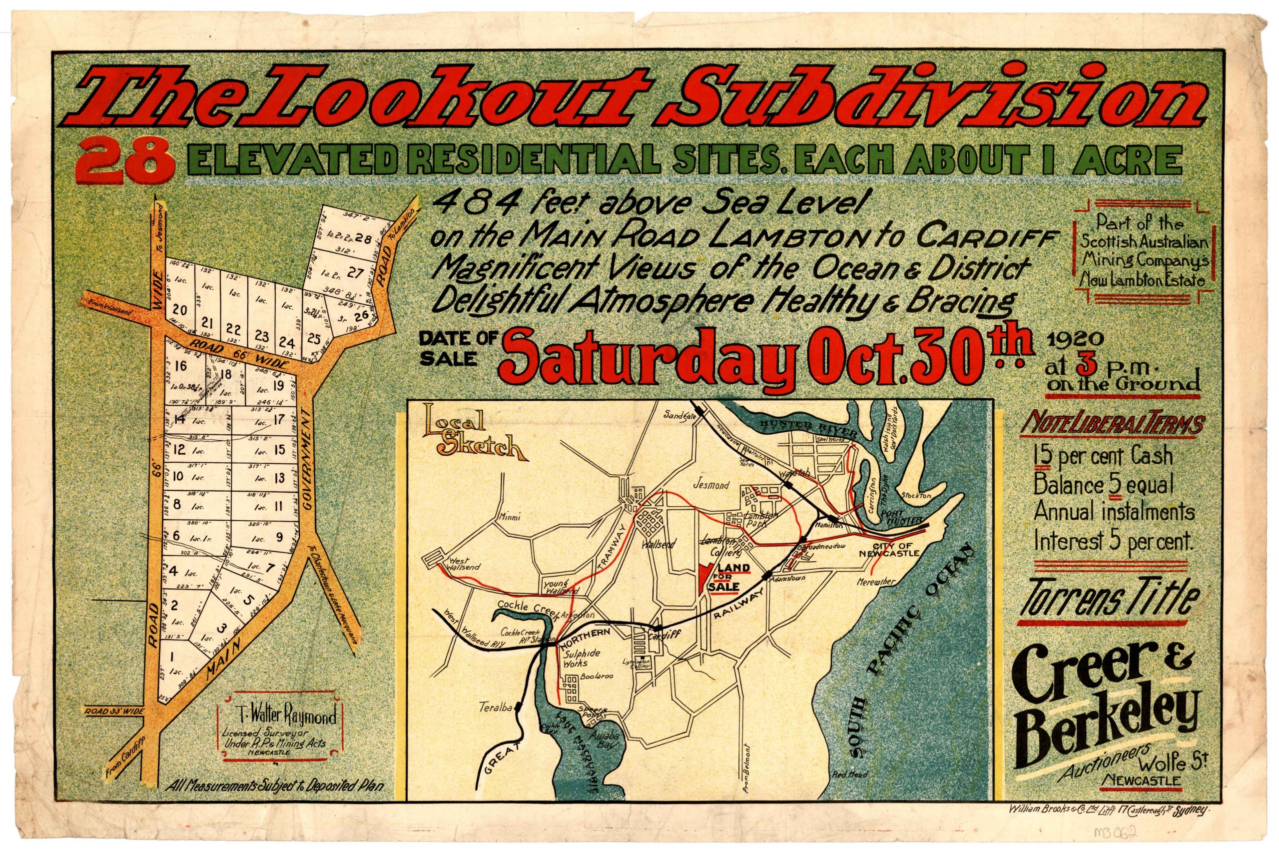
It remained a road in plan only until the 1920s, when the Scottish Australian Mining Company built the first section as part of “The Lookout Subdivision” in New Lambton Heights. In 1925 it was named “Boundary Rd”, an eminently suitable title as over the years various portions of it divided mining leases, parishes, suburbs, municipalities, and state and federal electorates. In 1933 New Lambton Council changed the name to Marshall St, in recognition of one of the road’s earliest residents, James Gordon Marshall. In 1945 the NSW government unveiled big plans for the road network in Newcastle, including a highway from Rankin Park to Jesmond traversing the bush where the northern section of Marshall St existed only as a line on the map. Plans for this highway then changed many times over many years. In September 2021, Transport for NSW called for tenders for the construction of the $450 million final section of the Newcastle Inner City Bypass, with work to commence in 2022. The expected opening in 2025 will be a final chapter in a 140-year story of a road, from nameless marks on a map to major motorway.

The article above was first published in the December 2021 edition of The Local.
Boundary Road
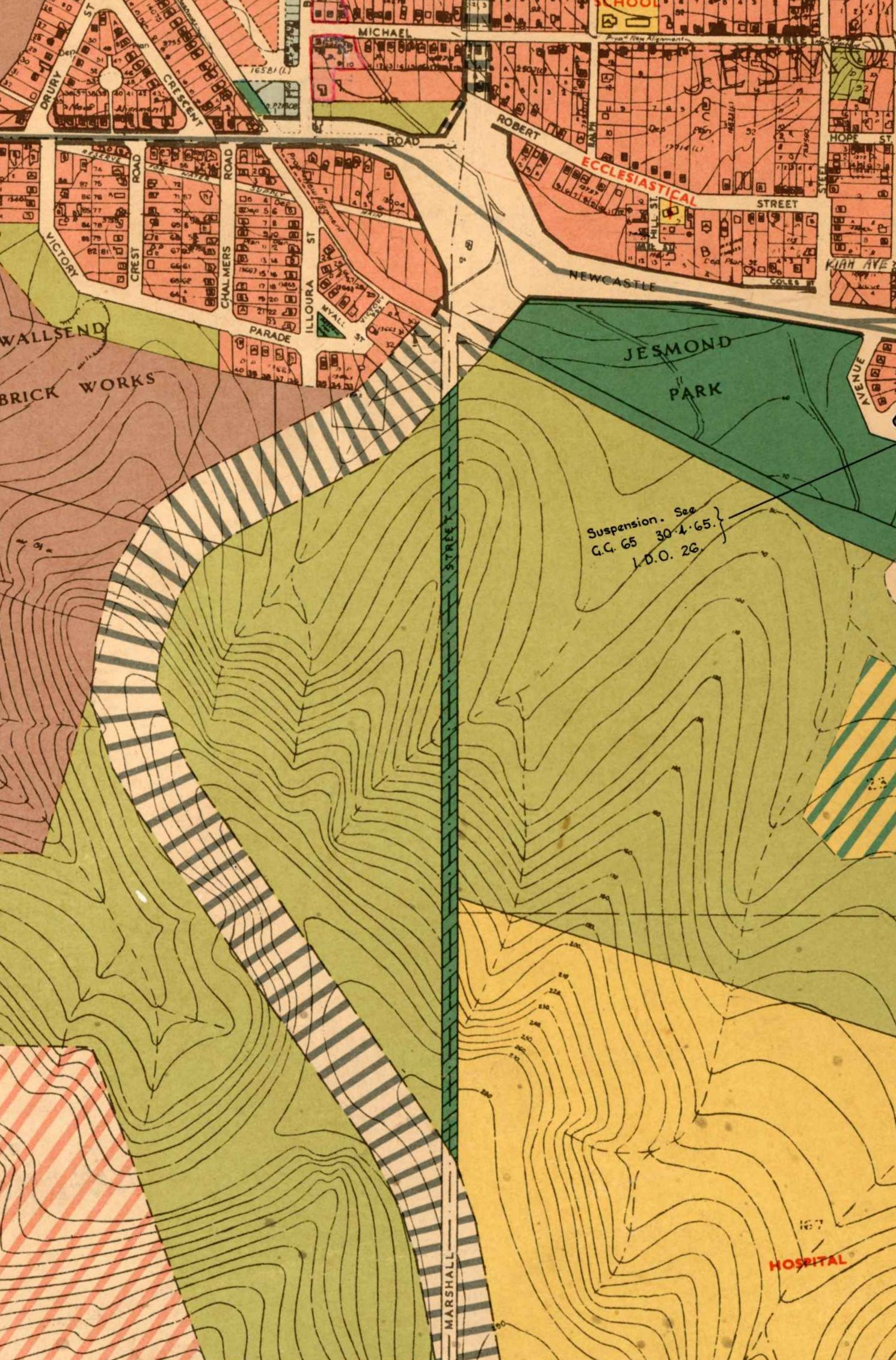
An historical parish map whose origins date back to 1884, shows that the road that was given the name Boundary Road in 1925, was aptly named. It incorporated the following boundaries:
- Parish of
- Hexham
- Kahibah
- Newcastle
- Municipality of
- Plattsburg
- Wallsend
- Lambton
- New Lambton
- Coal lease of
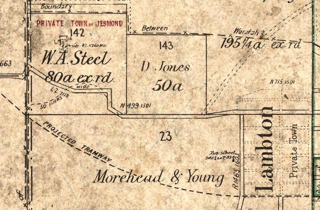
- Morehead and Young
- Joseph Weller
- Waratah coal
- Town Police boundary
Marshall Street
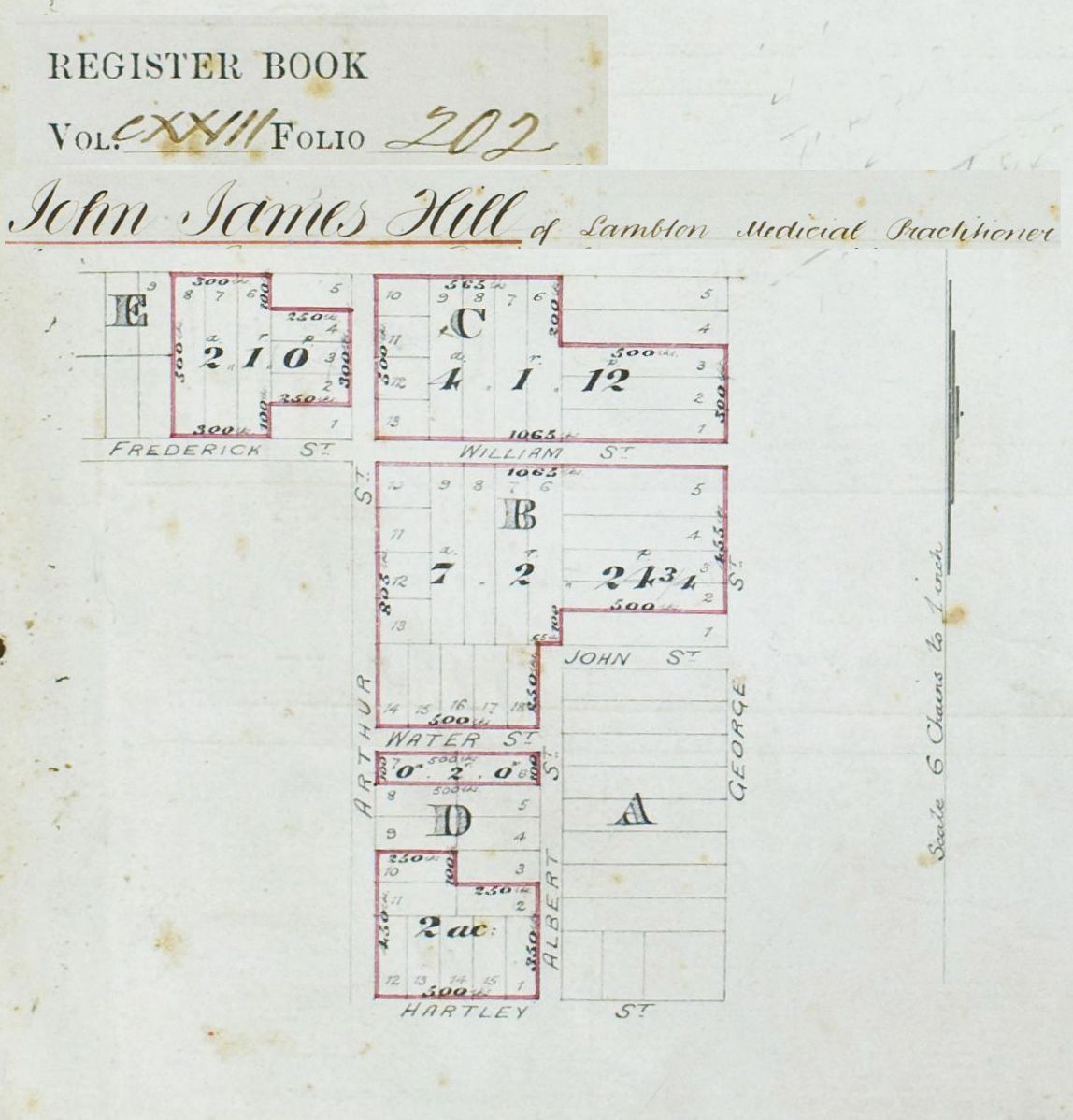
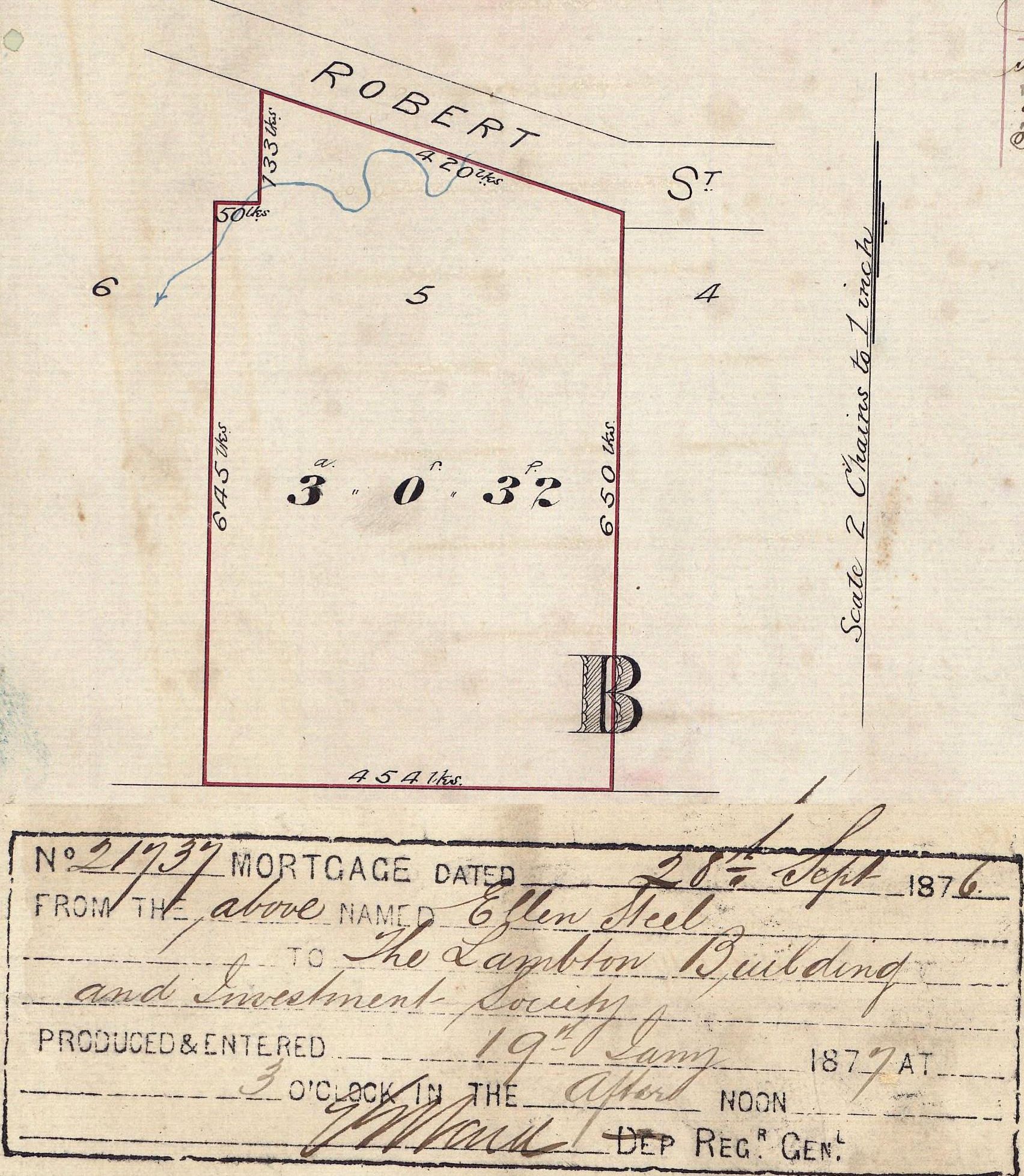
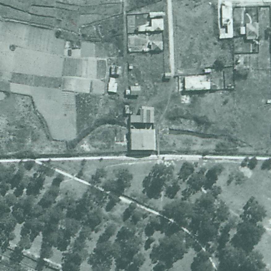
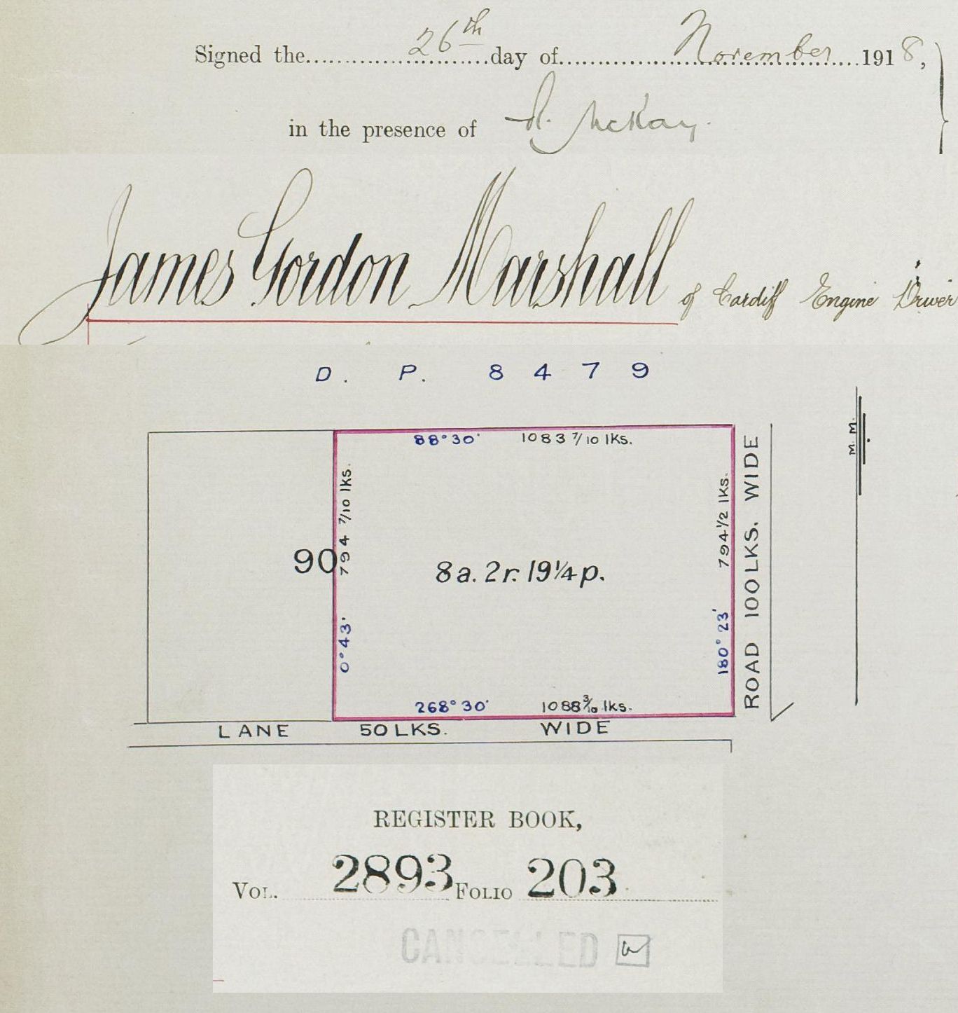
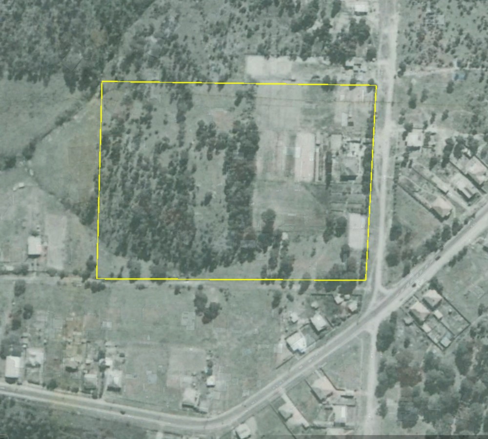
James Gordon Marshall of Cardiff, engine driver, purchased 8 acres of land in November 1918. The land title certificate shows an un-named road on the eastern boundary of his property. This road was the boundary between New Lambton and Lake Macquarie council areas.
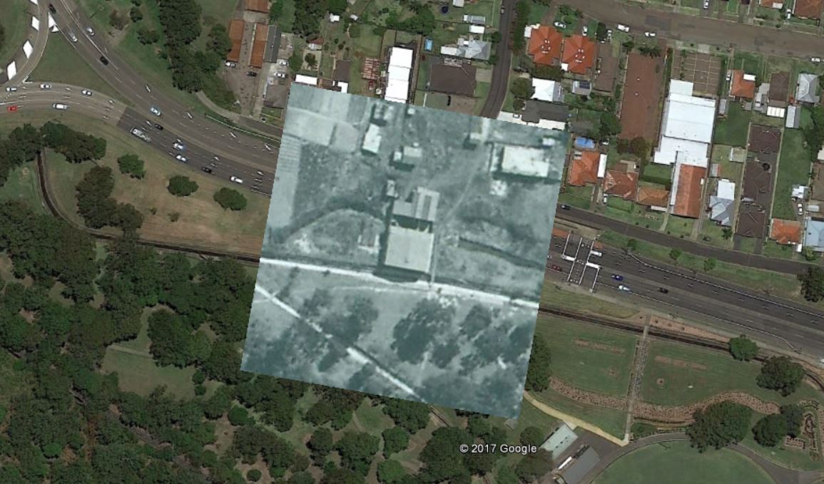
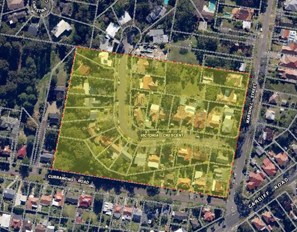
The location of Marshall’s land is shown below.
On the eastern side of the road, opposite Marshall’s property, the Scottish and Australian Mining Company subdivided a portion of their land to sell in October 1920.
In October 1925 Lake Macquarie Shire Council informed the Cardiff Heights Progress Association (James Marshall presiding) that the road at the east boundary of their council area was to be named Boundary Road.
In January 1927 James Marshall applied to Hunter District Water Board to have water mains extended to his property on Boundary Road.
In October 1933, at the suggestion of Lake Macquarie Shire Council, New Lambton Council agreed that the name of the road should be changed from Boundary Road to Marshall St. Despite the decision being made in 1933, it took another four years before the name change was made official in June 1937.


Newspaper articles
| Article Date Event Date | Notes |
|---|---|
| 29 Oct 1925 | "At a meeting of the Cardiff Heights Progress Association, Mr. Marshall presiding a letter was received from the shire council stating that the road on the boundary would be called Boundary-road." |
| 17 Jan 1927 | J G Marshall applies to Hunter District Water Board to have water mains extended to his property on Boundary Road. |
| 14 Sep 1933 | "Lake Macquarie Shire Council asked if [New Lambton] Council would bear half of the cost of constructing a boundary road between main road number 223 and Mr. Marshall's premises, Cardiff, a distance of about six and a half chains. The road was on the boundary of New Lambton municipality and Lake Macquarie shire. The total cost would be £29. It was decided to pay half the cost." |
| 26 Oct 1933 | At a New Lambton Council meeting, a letter was received from Lake Macquarie Shire Council in which they "appreciated the Council's decision to pay half the cost of repairs to Boundary-road, near Cardiff. The letter also suggested that the name of Boundary-road be altered to Marshall-street. The Council decided to approve the name selected." |
| 24 Sep 1936 | New Lambton Council meeting : "The Cardiff Heights Progress Association expressed dissatisfaction at the state of Boundary-road, and inquired if there was an agreement between the council and the Lake Macquarie Shire Council to form the road." |
| 18 Jun 1937 | Government Gazette with official name change from Boundary Rd to Marshall St. |
| 18 Sep 1945 | Long range road plans for Newcastle. |