This year marks 120 years since George Henry Dawkins captured a remarkable snapshot of our locality in 1904. Dawkins was born in Lambton around 1874. His interest in photography is first noted in 1900 when he demonstrated lantern slide making to the recently formed but short-lived Newcastle Amateur Camera Club. A few years later he was instrumental in the formation of a new camera club and served as a committee member for many years.
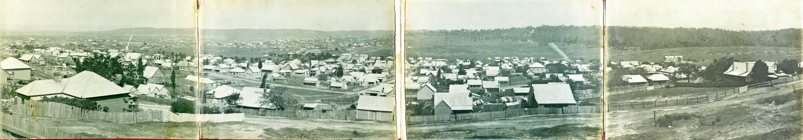
In 1904 Dawkins purchased a block of land on the heights above Lambton. From that property on the west side of First St (later renamed to Noble St) he photographed a four-frame panorama looking southwards. He then mounted the prints on foldout panels with an ornate burgundy coloured front cover with the title “A Peep at Old and New Lambton, NSW, from Lambton Heights.”
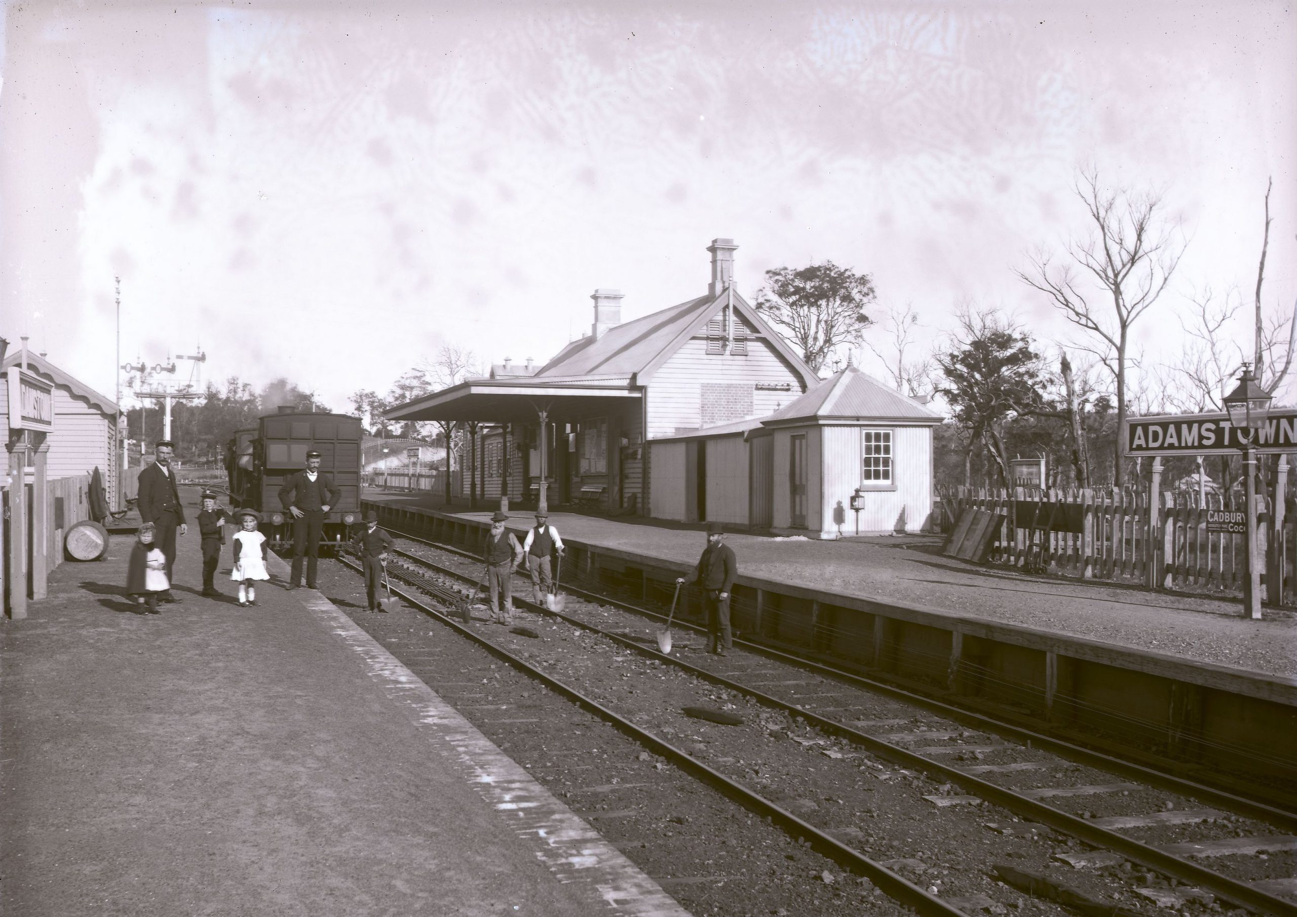
The panorama is striking in the detail it contains. We can observe prominent landmarks that remain to this day including the park rotunda, council building (now the library), Mechanics’ Institute building, and the stone church in Dickson St.
The photo also highlights how much has changed. Many of the houses in 1904 are basic wooden structures. While the Lambton mine pithead is hidden behind a hill, the colliery rail line and bridges can be seen running over Hobart Rd. In panels 3 and 4, we see large swathes of open land south of Howe St and wooded land on the hill, yet to be developed as it was mining company land.
While Dawkins’ paying job was as a printer, he also volunteered with many local organisations such as the Mechanics’ Institute, Bowling club, and the Wallsend hospital board. In 1907 he contributed photos to a Newcastle Tourist Guide, and during World War 1 he offered to take photos free of charge, of any men in Lambton enlisting as soldiers. George Dawkins died in Lambton in 1922 aged just 48, leaving us the legacy of a wonderfully fascinating panoramic peep into our past.
The article above was first published in the February 2024 edition of The Local.
Additional Information
The 1907 Tourist Guide
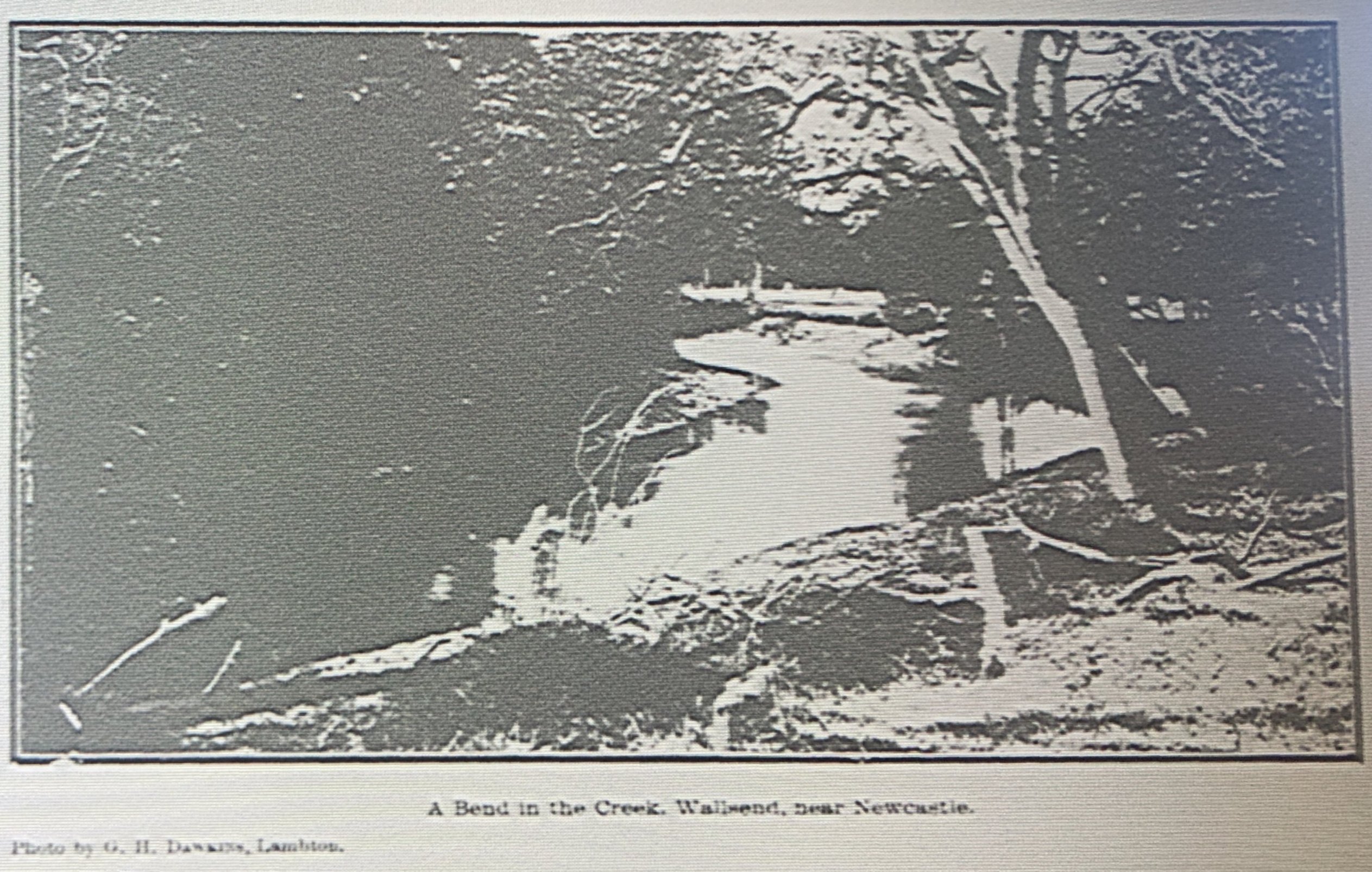
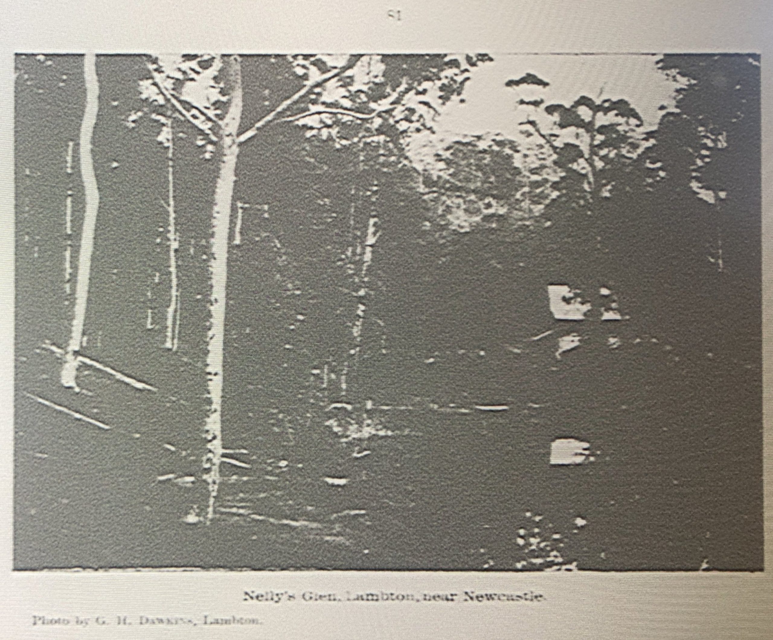
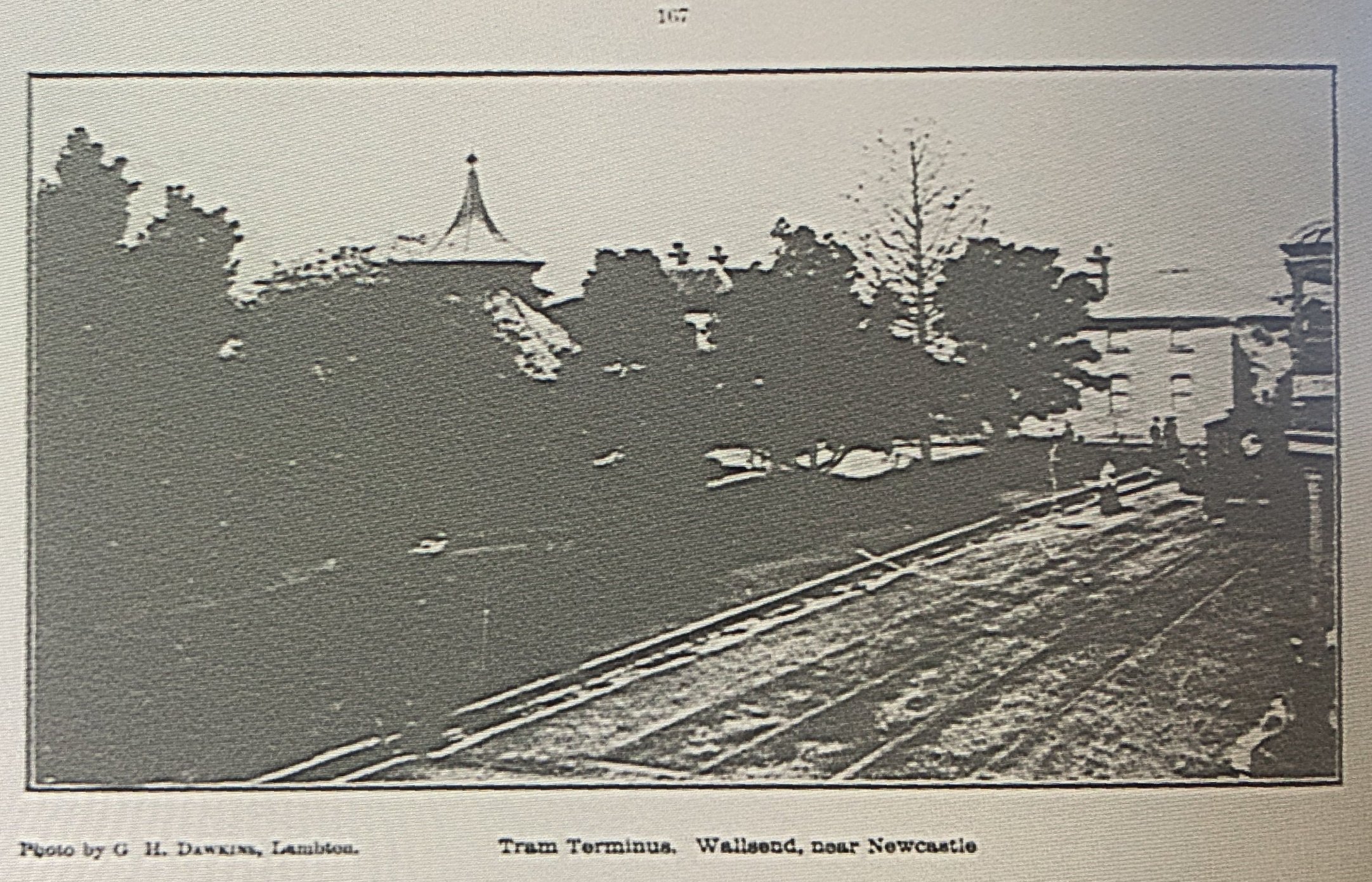
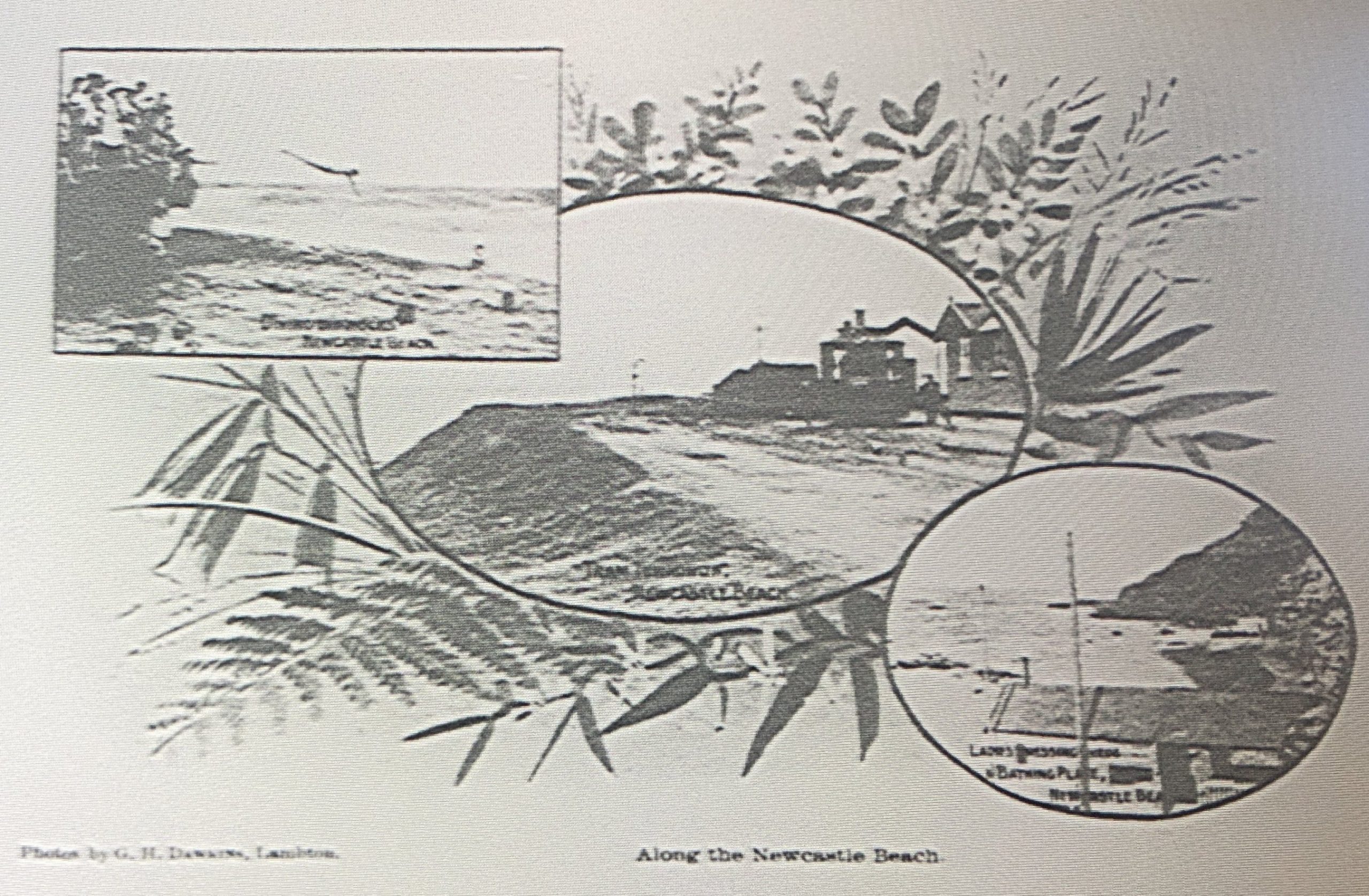
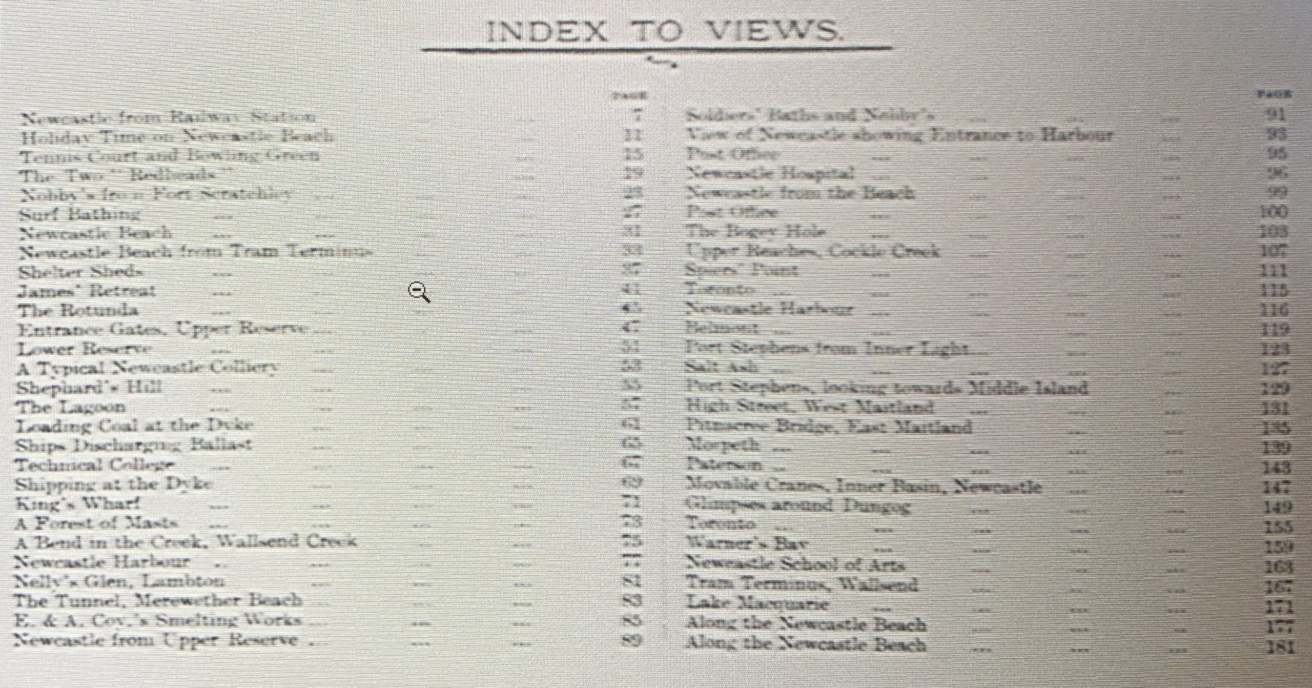
Dawkins contributed some photographs to a 1907 “Tourist’s Guide to Newcastle”. The National Library of Australia has a copy of this publication on microfiche (Bib ID 3542657), which I viewed during a visit to the Library in April 2024. Unfortunately the quality of the scanning/reproduction is poor and the photographs appear as little more than high contrast splodges of black and white. For what it’s worth, here are the photographs that Dawkins contributed. One minor note of interest is that the photograph of Nelly’s Glen on page 81 enabled me to identifier the creator of the image in the Newcastle University Living Histories site, which previously unattributed.

| Page | |
| PREFACE | 5 |
| NEWCASTLE | 9 |
| The Beaches | 29 |
| The Reserves | 42 |
| The Climate | 48 |
| Health of Newcastle and District | 49 |
| Newcastle from Without | 49 |
| Industries | 53 |
| Coal Mining | 53 |
| The Dyke | 58 |
| Other Industries | 59 |
| Churches | 59 |
| Literary, Scientific and Educational Institutions | 63 |
| Technical College | 67 |
| Schools | 67 |
| Municipal | 70 |
| Commercial | 74 |
| Military | 74 |
| Theatres etc | 78 |
| Musical and Kindred Societies | 79 |
| Debating Societies | 79 |
| Sports and Amusements | 82 |
| The Turf | 90 |
| Agricultural, H & I Association | 92 |
| Charitable Institutions | 96 |
| Public Buildings | 100 |
| Newspaper | 105 |
| Pleasant Bush Drives and Picnic Places | 105 |
| Accommodation for Visitors | 112 |
| Discovery of Newcastle | 112 |
| LAKE MACQUARIE | 117 |
| Toronto | 117 |
| Belmont | 120 |
| Swansea | 120 |
| Spiers’ [sic] Point | 120 |
| Warner’s Bay | 120 |
| Cockle Creek | 121 |
| PORT STEPHENS | 121 |
| Nelson’s Bay | 121 |
| Salt Ash | 121 |
| Anna Bay | 121 |
| Tea Gardens | 121 |
| Sawyer’s Point | 121 |
| Bulladelah [sic] | 125 |
| THE MAITLANDS | 128 |
| West Maitland | 128 |
| East Maitland | 133 |
| Maitland Coalfields | 133 |
| MORPETH | 133 |
| RAYMOND TERRACE | 140 |
| PATERSON | 140 |
| DUNGOG | 144 |
| STEAMER, COACH AND FERRY INFORMATION | 151 |
| TRAMWAY AND RAILWAY INFORMATION | 165 |
| RAILWAY TIMETABLES | 168-178 |
| OFFICERS OF NEWCASTLE & N.D. TOURIST ASSOCIATION | 182 |
| Page | |
| Newcastle from Railway Station | 7 |
| Holiday Time on Newcastle Beach | 11 |
| Tennis Court and Bowling Green | 15 |
| The Two “Redheads” | 19 |
| Nobby’s from Fort Scratchley | 23 |
| Surf Bathing | 27 |
| Newcastle Beach | 31 |
| Newcastle Beach from Tram Terminus | 33 |
| Shelter Sheds | 37 |
| James’ Retreat | 41 |
| The Rotunda | 45 |
| Entrance Gates, Upper Reserve | 47 |
| Lower Reserve | 51 |
| A Typical Newcastle Colliery | 53 |
| Shephard’s [sic] Hill | 53 |
| The Lagoon | 57 |
| Loading Coal at the Dyke | 61 |
| Ships Discharging Ballast | 65 |
| Technical College | 67 |
| Shipping at the Dyke | 69 |
| King’s Wharf | 71 |
| A Forest of Masts | 73 |
| A Bend in the Creek, Wallsend Creek | 75 |
| Newcastle Harbour | 77 |
| Nelly’s Glen, Lambton | 81 |
| The Tunnel, Merewether Beach | 83 |
| E. & A. Coy.’s Smelting Works | 85 |
| Newcastle from Upper Reserve | 89 |
| Soldiers’ Baths and Nobby’s | 91 |
| View of Newcastle showing Entrance to Harbour | 93 |
| Post Office | 95 |
| Newcastle Hospital | 96 |
| Newcastle from the Beach | 99 |
| Post Office | 100 |
| The Bogey Hole | 103 |
| Upper Reaches, Cockle Creek | 107 |
| Spier’s [sic] Point | 111 |
| Toronto | 115 |
| Newcastle Harbour | 116 |
| Belmont | 119 |
| Port Stephens from Inner Light | 123 |
| Salt Ash | 127 |
| Port Stephens, looking towards Middle Island | 129 |
| High Street, West Maitland | 131 |
| Pitnacree Bridge, East Maitland | 135 |
| Morpeth | 139 |
| Paterson | 143 |
| Movable Cranes, Inner Basin, Newcastle | 147 |
| Glimpses around Dungog | 149 |
| Toronto | 155 |
| Warner’s Bay | 159 |
| Newcastle School of Arts | 163 |
| Tram Terminus, Wallsend | 167 |
| Lake Macquarie | 171 |
| Along the Newcastle Beach | 177 |
| Along the Newcastle Beach | 181 |
Newspaper articles
| Article Date Event Date | Notes |
|---|---|
| 15 Aug 1900 | "A meeting of amateur photographers was held at Kettley's rooms, Hunter-street West, last night, when it was decided to form the Newcastle Amateur Camera Club." |
| 12 Oct 1900 | "At the last monthly meeting of the Newcastle Amateur Camera Club, lantern slide making by reduction was fully illustrated by Mr. Geo. Dawkins." |
| 10 Dec 1900 5 Dec 1900 | "Newcastle Amateur Camera Club held their monthly meeting and had for their subject Flashlight Photography. The members met at Lambton at 7.45 p.m., and proceeded to Lambton Colliery, where they were met by Mr. Noble, the underground manager, and his staff, who zealously looked after the comfort of the visitors, and explained every thing of interest." |
| 15 Apr 1902 14 Apr 1902 | At the celebration in Lambton of the return of Lieutenant Albert McEwan from the Boer war … "Mr. Geo. Dawkins took a flashlight photograph of the gathering." |
| 31 Aug 1905 29 Aug 1905 | Formation of camera club in Newcastle - George Dawkins elected to the committee. |
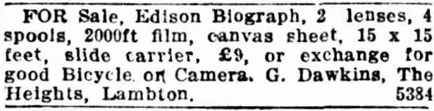
| 16 Oct 1907 | "... the guide to Newcastle and its neighbourhood has been issued by the Newcastle and District Tourist Association. The work, which comprises 180 pages, 8½, inches by 5½ inches, is copiously illustrated ... The photo-engravings are principally from negatives taken by Mr. Charleston, of Hunter-street, Mr. G. H. Dawkins, of Lambton, ..." |
| 15 Feb 1908 | Letter to the editor from George Dawkins, disputing claims about the time required to print Wallsend Hospital reports. |
| 28 Oct 1908 | The half-yearly competition and exhibition of pictures in connection with the Newcastle and District Photographic Society - George Dawkins awarded second place in "Best enlargement" section. |
| 2 Mar 1912 | George Dawkins to supply photographs for the "presentation" being prepared to honour J. W. Oldham. |
| 11 Mar 1912 9 Mar 1912 | "A concert, in aid of the Lambton Public School fund was held in the Coronation Hall … The coloured lights for stage purposes was under the direction of Mr. G. H. Dawkins …" |
| 19 Aug 1916 | "A meeting for the purpose of forming a branch of the Y.M.C.A. Snapshot From Home League was held at Mr. A. J. Plumridge's rooms on Thursday evening. Mr. G. Dawkins presided. The object of the league is to provide snapshot photographs of the homes and families of soldiers who have gone away into service, and give copies of these to the relatives for forwarding to soldiers at the front. It was decided to form a branch. Mr. G. Dawkins was appointed president." |
| 30 Jan 1917 | "A meeting was held in Lambton council chambers to devise ways and means to erect a suitable memorial to those who had given their services in fighting for their country ... Mr. George Dawkins, a member of the Camera Club, had agreed to take photos, free of charge of any soldier enlisting …" |
| 26 Sep 1922 23 Sep 1922 | "Mr. George Dawkins died at his residence, First-street, on Saturday, after a lengthy illness. He was in his 49th year, and was born in Lambton, where he resided the whole of his life. He was a printer by occupation." |
| 25 Sep 1922 25 Sep 1922 | Funeral of George Dawkins |
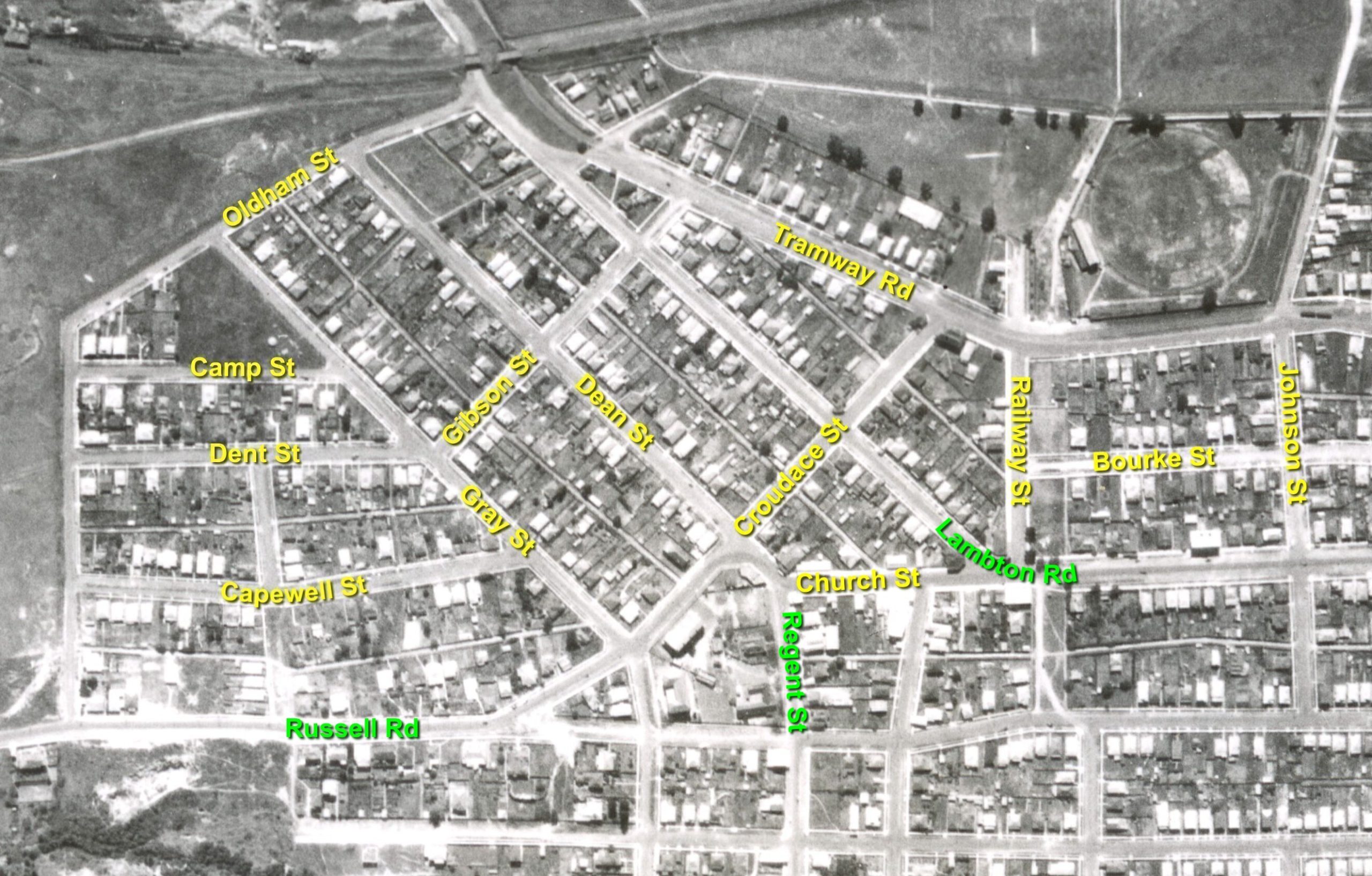
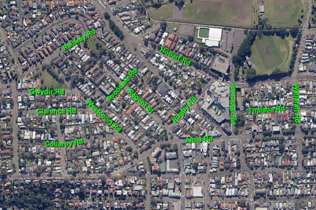
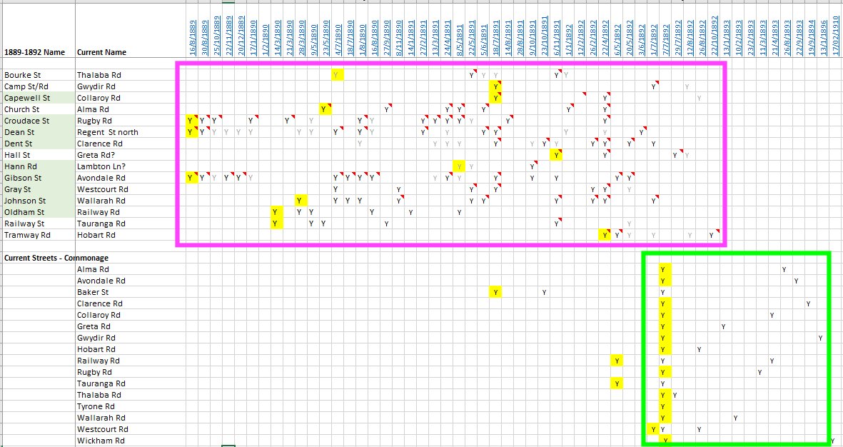
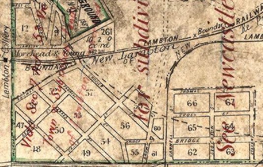
| 4 Nov 1955 | First Street in Lambton is renamed to Noble Street. |