“In the depths of the bush, about half a mile to the south of the rising and flourishing township of Lambton, there was celebrated, on Thursday last, an event of no ordinary interest and importance.”
Thus began a Newcastle Chronicle report on the ‘turning of the first sod’ of the New Lambton colliery on 25 June 1868.
James and Alexander Brown were mining coal from the ‘Old Dog and Rat’ pit in East Lambton when they had a lucky break in 1868. On learning that the owners of Lambton colliery had failed to make payments on a mining lease, the Browns quickly stepped in and bought the mineral rights for 265 acres in the area we now know as New Lambton.
They immediately investigated the potential of their acquisition by commencing a trial shaft in April 1868. In June, at a depth of 100 feet, a good payable seam of coal was found and the Browns committed to developing a colliery at a cost of £10,000.
To inaugurate their new venture the Browns invited their employees and local dignitaries to a ceremony at the site on 25 June 1868. Two barrels of ale which had previously been conveyed to the ground, were at once tapped, speeches made, and the assembled company called upon to drink “Success to the New Lambton Colliery”.
Success came quickly, a new working shaft 16 feet in diameter was sunk, an engine house erected and a railway constructed to convey coal to the port. The colliery attracted miners and their families, and a town began to grow. Just a year later New Lambton was described as “going ahead, and buildings of all descriptions are multiplying fast.”
By 1884 the payable coal was exhausted, and the Brown’s moved on to establish other mines. The pit closed, but the town endured. The Chronicle was correct in asserting that the event celebrated 150 years ago was of no ordinary importance, for it marked the birth of New Lambton.
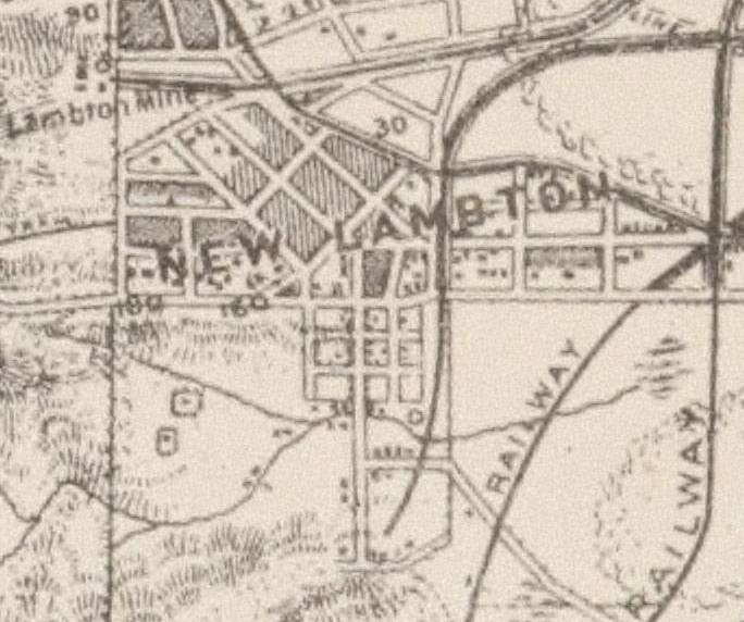
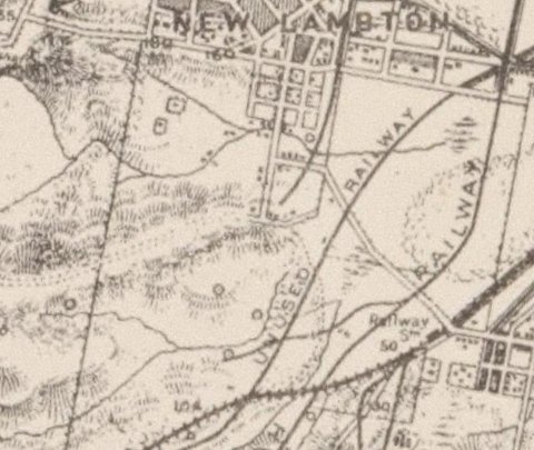
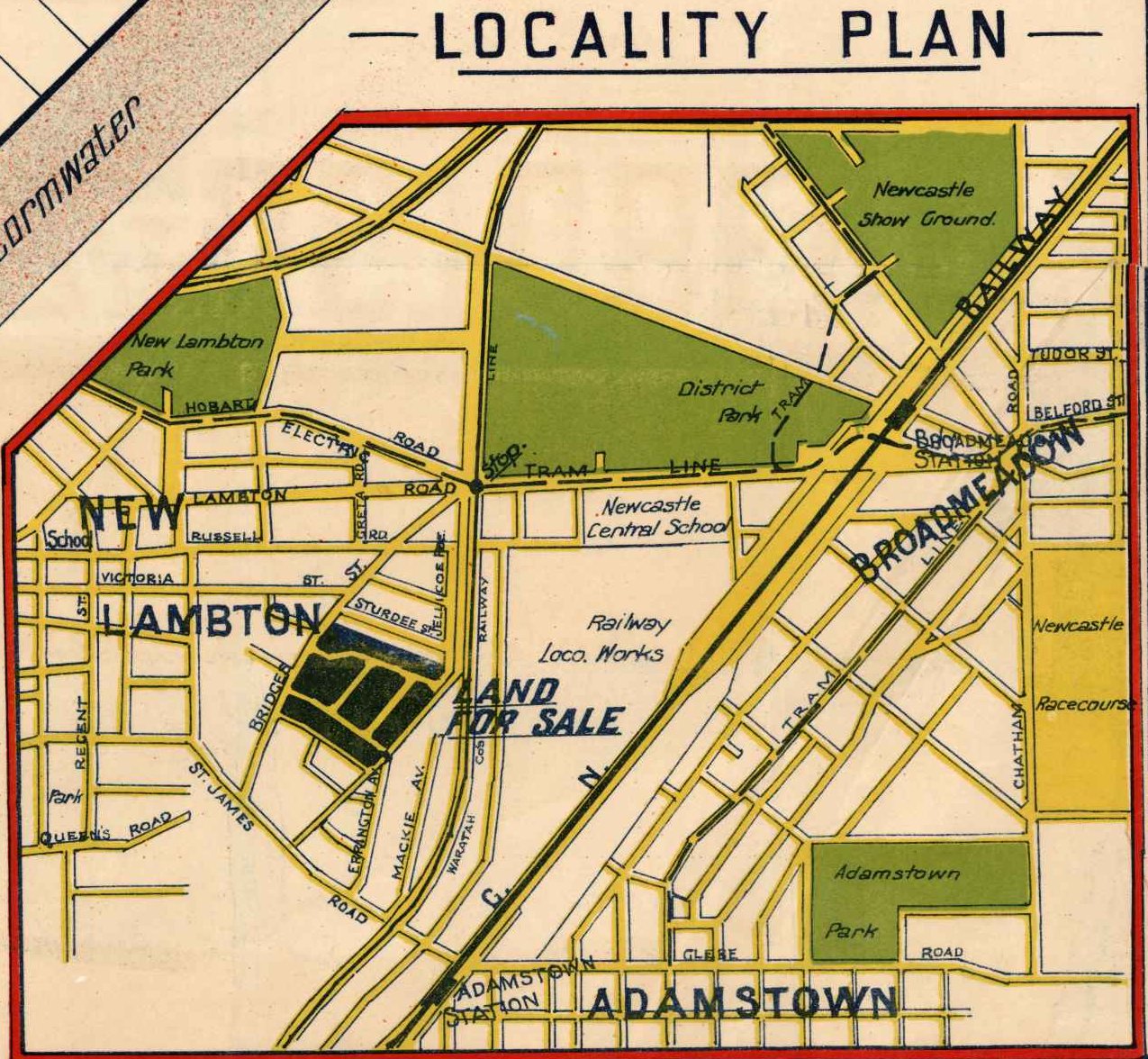
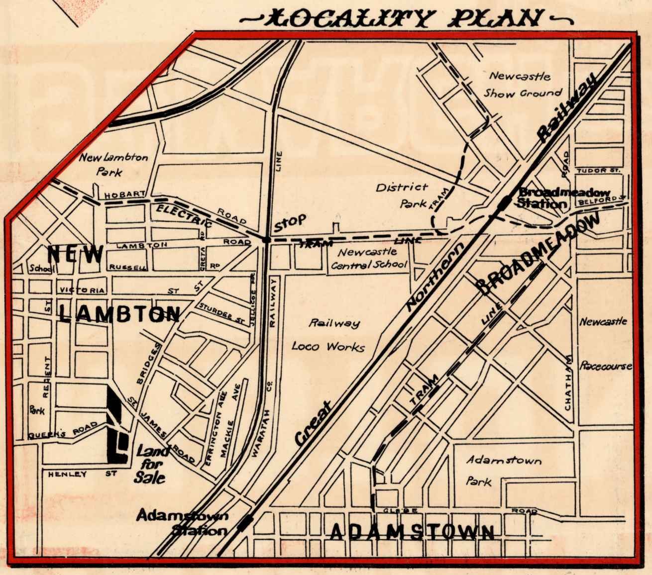
Major T S Parrott’s 1893 map of Newcastle showing the railway and a shaft of the New Lambton colliery. National Library of Australia.
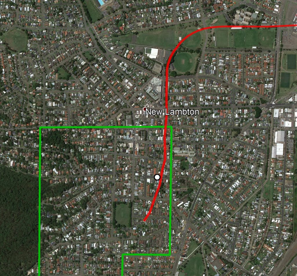
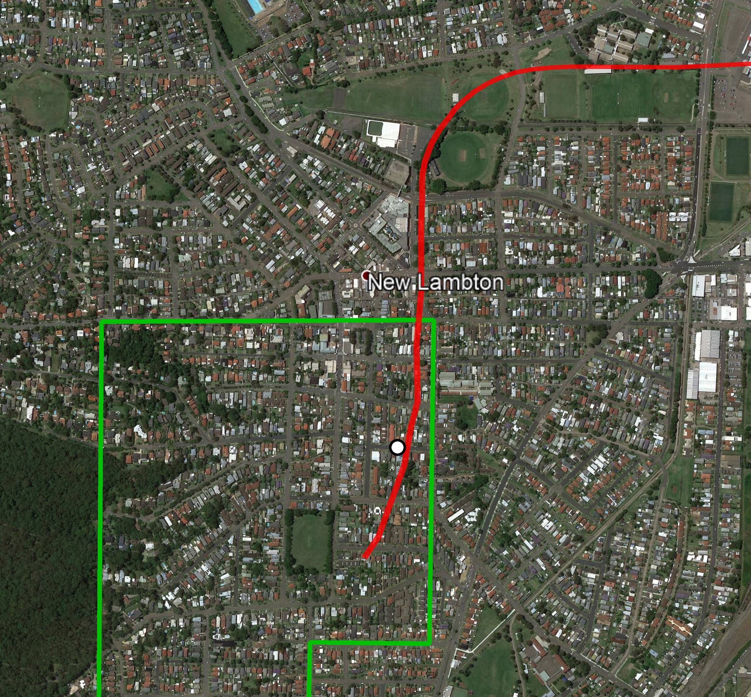
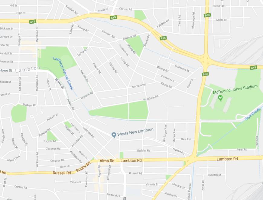
Google Earth, showing the New Lambton Colliery mining lease, railway line, and a shaft located near present day Oxford St.
The article above was first published in the June 2018 edition of the Lambton & New Lambton Local.
Additional Information
In working out the history of the New Lambton colliery I have used the following sources:
- Contemporary newspaper articles retrieved from Trove.
- “The Coal Mines of Newcastle NSW”, George H Kingswell, 1890.
- Map of Waratah Coal Company blocks, 1873. National Library of Australia.
- T S Parrott’s Map of the country around Newcastle, 1893. National Library of Australia.
- Plan of the Hartley Vale Railway, 1867. State Library of NSW.
- The Hartley Vale Railway Colliery act of 23 Dec 1867
- “Coal, Railways and Mines, Vol 1”, Brian Robert Andrews, 2004. (Although much of Andrew’s information is taken from the above sources.)
Trying to work out the history of the New Lambton Colliery, and the mines of J and A Brown in Newcastle is a tricky matter for a variety of reasons.
- The newspaper articles are sparse and often very cursory, and can sometimes contain errors.
- The term “pit” is ambiguous – it could mean
- a specific shaft
- a collection of mine buildings at a particular location
- a mining lease
- a mining company
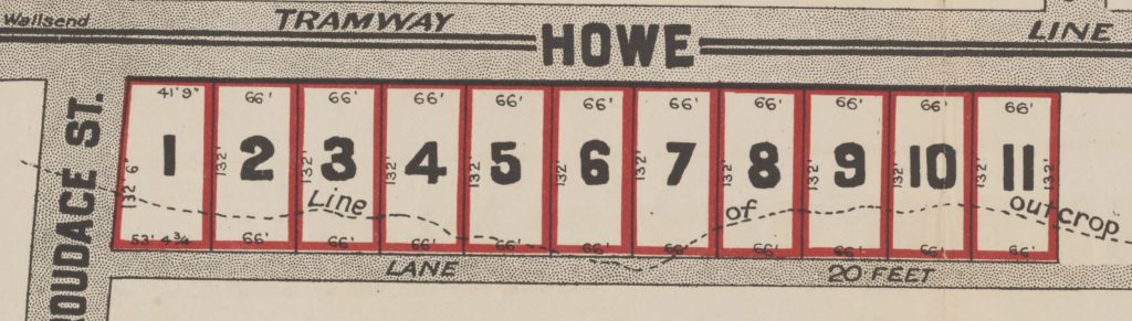
- Suburb names in a mine name can be misleading and bear no relation to geography. The classic example of this is the “East Lambton Colliery“, which was located in New Lambton, and operated by the Waratah Coal Company!
Bearing in mind these difficulties, here’s my summary of the Brown’s mining leases and the history of New Lambton colliery.
| Colour |
Notes |
| White |
Development of this 310 acre lease commenced in 1863 as the Hartley Vale Colliery. The colliery was ready for production at the end of 1864, but was a commercial failure. In a c. 1873 Waratah Coal Company map this area is marked as “Brown’s Colliery” and “Brown’s shaft”.[ Brian Andrews on page 36 of his book “Coal, Railway and Mines, Vol. 1” indicates that this coal lease began development in 1861, but I cannot find any corroborating evidence for this. A report on Alexander Brown’s death in 1877 suggests that the Browns only acquired the land at Hartley Vale after they had sold off their Minmi colliery, which occurred in early 1863.] |
Pink
|
This 54 acre block was considered part of the Hartley Vale Colliery. The land was sold to Thomas Adam in 1869 and became the township of Adamstown. |
| Blue |
This 280 acre lease was obtained by J&A Brown in 1862. Two pits (marked as A and B pit on the 1867 Hartley Vale railway map) were commenced to the north of the Lambton colliery railway in 1866. The B Pit later became known as the “Dog and Rat Pit.” These workings were connected to the New Lambton/Hartley Vale railway via a tunnel underneath the Lambton railway. The reason for the tunnel is described in the Empire newspaper of 2 September 1867.
The Messrs. Brown have coal bearing land between Lambton and Waratah, which they cannot work without passing from the Lambton railway, or going under it to their own Hartley Vale railway. Having waited two years to get an Act passed to amend the Amended Railway Act without success, they have apparently taken the law coach into their own hands, and will drive it, not through the Act, but under it : so they have commenced operations by driving a dip tunnel from their own land, intersecting the Lambton railway at an angle of forty-five degrees, but so much below it as to leave it perfectly secure, even to the most fastidious.
In 1867 the “New Lambton Coal Pit” was opened on the 280 acre lease, to the south of the Lambton colliery railway, with a short curved branch line off the New Lambton railway. This pit later became known as New Lambton A Pit when the new ‘B’ workings were opened up in the 265 acre lease in 1868. (See below.) Some time around 1883 the New Lambton A Pit was renamed New Duckenfield Colliery. |
| Green |
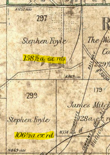
This 265 acre lease obtained by Stephen Foyle (on behalf of the Browns) in late 1867 when Morehead and Young failed to pay rent on lease. A trial pit was finished in June 1868 and a celebration held to inaugurate the “New Lambton Second Coal Working”, the first New Lambton coal working being the 280 acre lease in East Lambton. A working pit was commenced soon after. Somewhat confusingly, this New Lambton second coal working also became known as “the B or New Lambton Pit” (Kingswell)
Kingswell gives two contradictory dates as to when this pit ceased. On page 46 he states that the “B or New Lambton Pit” was “worked until the beginning of 1888”, and in the very next paragraph state that in 1884 “the old B Pit (was) finally abandoned.” (Although possibly this second reference is to the Old Dog and Rat pit in East Lambton?) |
| Orange/Red |
This 640 acre area consisting of two 320 acre leases was obtained by J&A Brown and Stephen Foyle in March 1867. The December 1867 Hartley Vale Railway act shows that the Brown’s intended to build a railway to this lease, but it was not completed at this time. After the New Lambton second workings began to wind down in 1884, the New Lambton ‘C’ Pit was commenced in this area in 1884, and the railway finally completed in March 1884. |

The mining leases of J and A Brown.
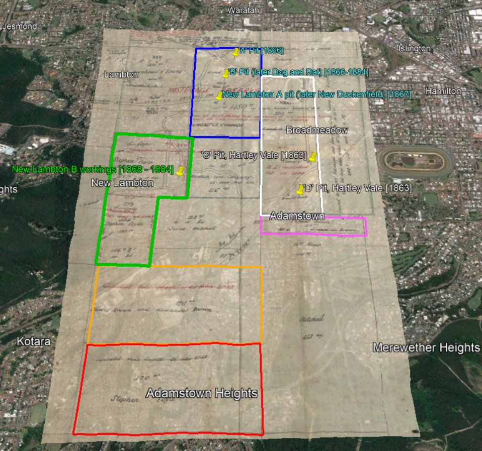
The mining leases of J and A Brown in Newcastle, overlaid onto 1873 map.
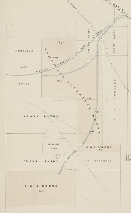
1867 Hartley Vale Railway map showing location of New Lambton Colliery pits.
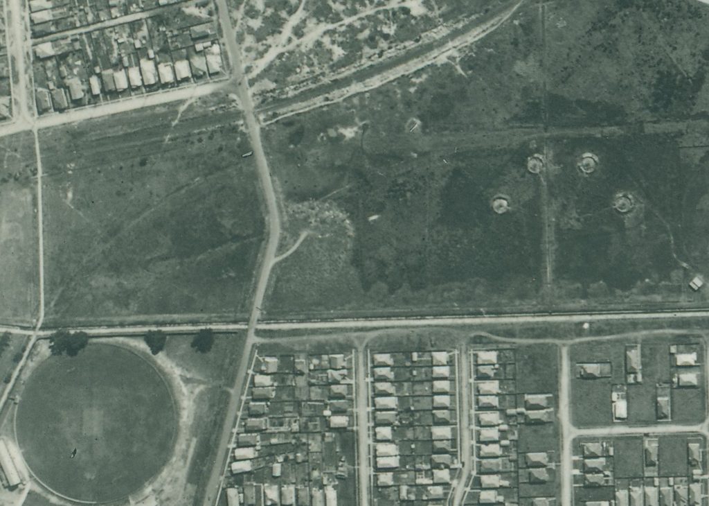
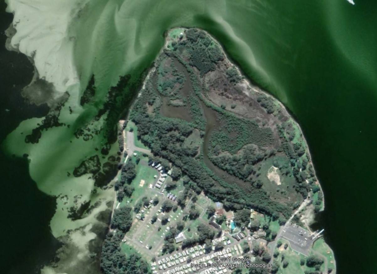
1944 aerial photograph that shows the remnants of the New Lambton railway traversing the park.
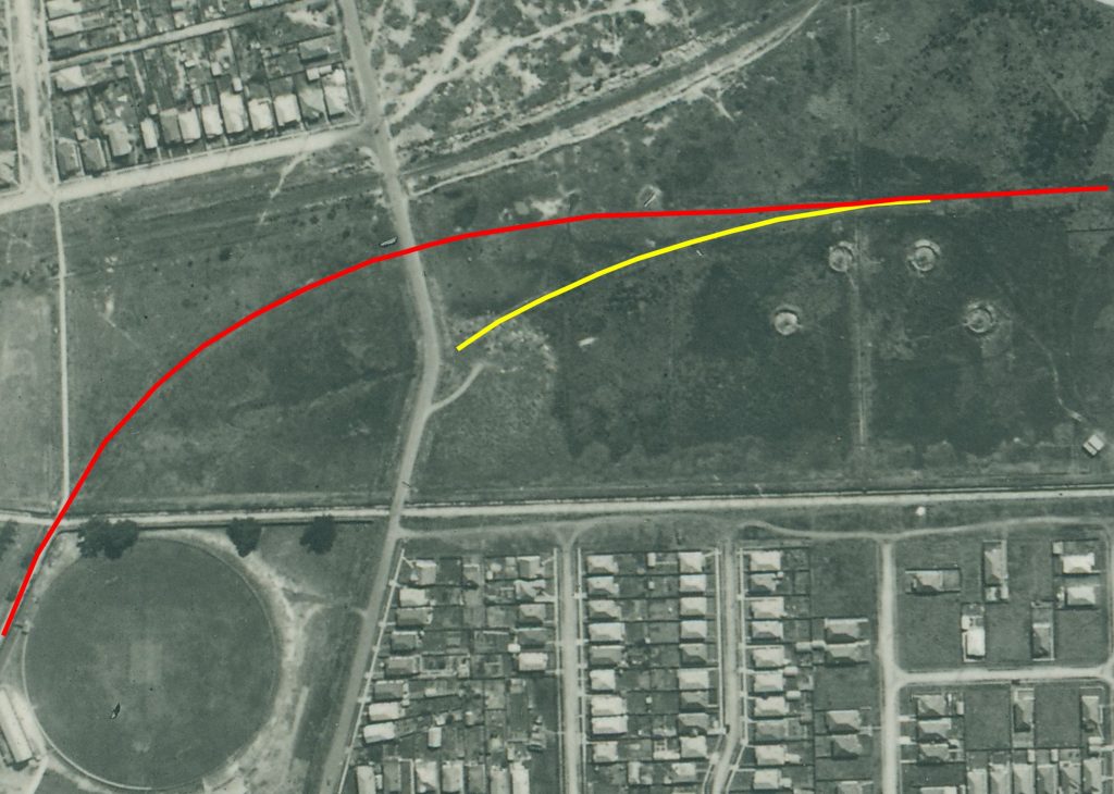
Path of rail line to New Lambton B pit marked in red, and the short branch line to the New Lambton A pit marked in yellow.
Kingswell’s 1225 acres
On page 45 of “The Coal Mines of Newcastle NSW”, Kingswell states that the New Lambton Estate consists of 1225 acres.
In the year 1867 Messrs. J. and A. Brown commenced to work coal from the New Lambton Estate, which at present is the freehold property of Messrs. George R. Dibbbs, and Alexander Brown, M’s. P. It consists of 1225 acres, and is bounded on the north and east by the Commonage, on the south by the Waratah Coal Company’s land, while the estate of the Scottish Australian Mining Company forms the western boundary. Prior to opening a mine the firm obtained a mineral lease of some 280 acres from the Government, and on this block, which lies to the north of the present estate, the now celebrated Dog and Rat, or A Pit, was sunk.
Where was this 1225 acres? It is difficult to be certain, but given that in the next sentence he refers to the 280 lease as being “prior” and to the north of the “present estate”, then it is reasonably clear that the 280 acre lease (blue) is not included in the 1225 acres.
Thus adding the 310 acres (white), 265 acres (green) and the 640 acres (orange/red), comes to a total 1215 acres, which is very close to the figure of 1225 acres that Kingswell state. The discrepancy of 10 acres could be accounted for in two ways. It is possibly simply an adding up error, or possibly because the 265 acre lease on the maps is marked as “ex rds”, and that these excluded roads account for the missing 10 acres.
Newspaper articles
| Article Date Event Date | Notes |
|---|
| 3 Dec 1867 | First mention of New Lambton colliery in the newspapers. The article is reporting on the opening of a section of the Hartley Vale Railway, that leads to a new pit a pit "about half a mile ... from the Lambton Colliery, and which has been denominated by the Messrs. Brown 'The New Lambton Coal Pit.' "
If the distance of half mile is correct then this is almost certainly referring to a pit in the 280 acre lease in East Lambton. The article goes on to state that "The line further leads to a pit on the other side of the South
[sic] Australian Company's Railway, underneath which a tunnel has been made." This is possibly referring to a connection to the Dog and Rat Pit which was to the north of the Lambton colliery railway. |
| 4 Jan 1868 | James and Alexander Brown obtain the mineral lease for what would become the New Lambton mine, after Messrs. Morehead and Young of the Scottish Australian Mining Company indavertently fail to keep up payments on the mineral lease. |
27 Jun 1868
25 Jun 1868 | 'Turning the first sod' of the New Lambton Colliery. |
| 30 Jun 1868 | "The tunnel now in operation [the 280 acre east Lambton lease] will I believe give remunerative employment to about sixty miners, and I have no doubt, a profitable return to the proprietors for capital
invested therein, until the new pit [265 acre lease in New Lambton] is in full working order." |
| 4 Jul 1868 | "The new railway works at the New Lambton Colliery are being pushed forward as fast as practicably, and are I believe progressing satisfactorily." |
| 4 Jul 1868 | Advertising for tenders for the sinking of the new working pit, and for earthworks in the extension of the New Lambton railway. |
| 18 Jul 1868 | "The new line of railway at the new Lambton colliery is making considerable headway but the sinking of the new working pit has been considerably delayed in consequence, I believe, of the difficulties experienced in getting a boiler across a swamp separating the new pit from the end of the present railway." |
| 5 Sep 1868 | "The extension of the New Lambton railway, is, I believe, progressing satisfactorily, and will, it is expected, in a short time, be so far advanced towards completion as to enable the proprietors to convey direct, any materials that may be required at their new pit, which is now down about seventy feet. It is expected that the coal in this shaft will be found at a depth of about 120 feet." |
| 31 Oct 1868 | The Brown's New Lambton colliery "line of railway will be shortly completed." |
| 29 Jul 1869 | "New Lambton is still going a-head, and buildings of all descriptions are multiplying fast. I am glad to see that those enterprising and really spirited men, the Messrs. J. and A. Brown, have commenced making a new line of railway to another new pit." |
| 3 Mar 1877 | "Plans and specifications have been prepared for a bridge to cross the New Lambton Railway, and
tenders will be called for the erection at once."
This was for a bridge on Lambton Rd (where Royal Place is now) to go over the New Lambton railway. |
| 25 Aug 1883 | "The proprietors of the New Lambton Colliery are sinking a new shaft on their estate some mile and a-half from the present pit." This was the New Lambton C pit, which was located in the present day suburb of Adamstown. |
| 22 Mar 1884 | "The railway to the new pit [C Pit] on the New Lambton Company's estate has been completed throughout in a very workmanlike manner by the contractor, Mr. Chas. Turner, and a large staff of workmen. The line is about two and a-quarter miles in length from its junction with New Lambton railway to the pit mouth." |
| 1 Aug 1890 | New Lambton council prepares "specifications for the work of pulling down the New Lambton Railway Bridge, on the main road, and filling up the road." |
| 6 Aug 1890 | Tenders called for "filling in roadway over New Lambton railway at main road bridge." |
| 19 Jun 1925 | "The old shaft in Cromwell-street, New Lambton, the covering of which collapsed last week, has not yet been filled. The Mayor informed the council meeting that he had arranged to tip into it eight or 10 truck loads of rubble from the quarry, and New Lambton Coal Co, had agreed to complete the filling." |