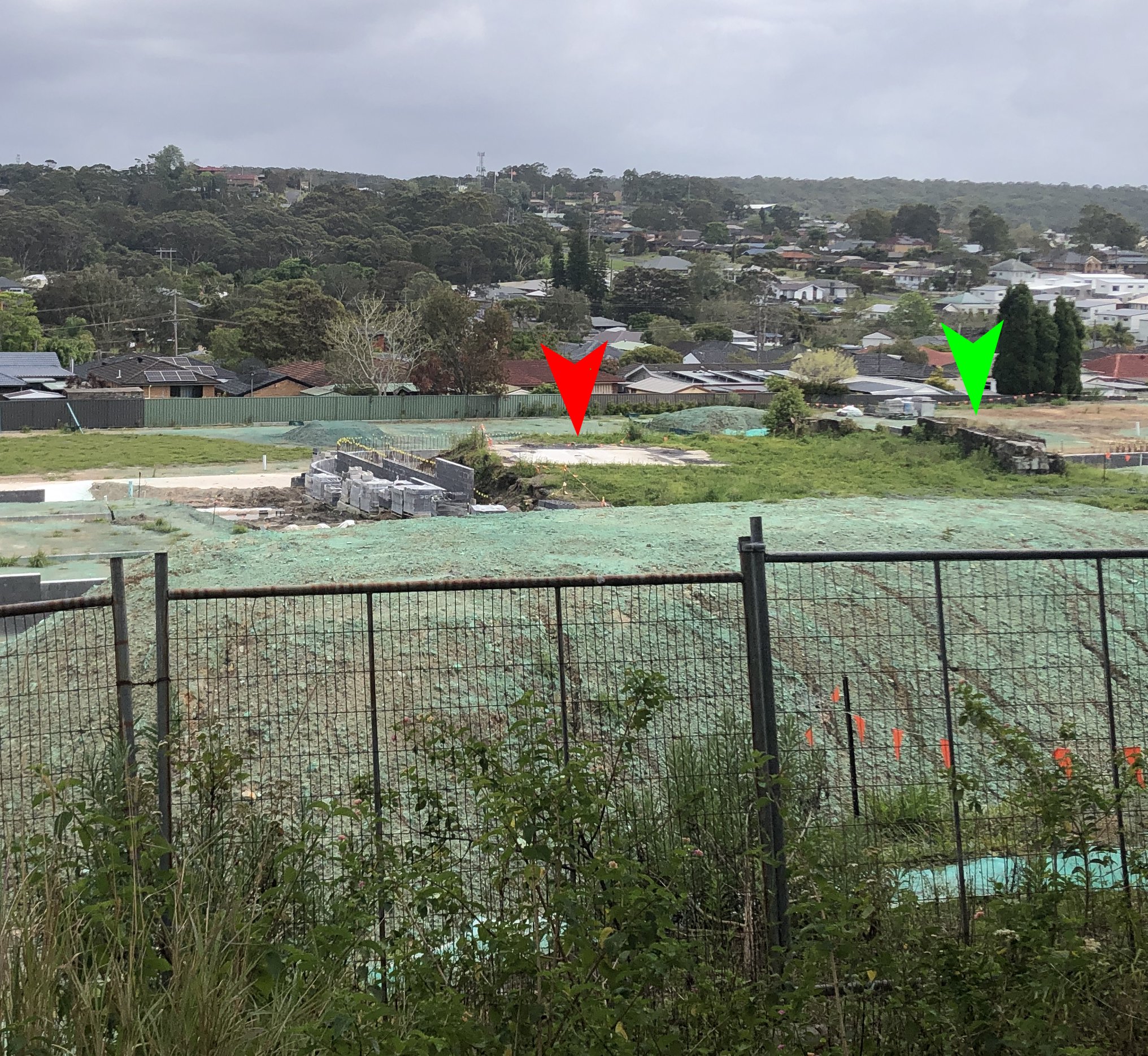
Navigating the real estate market today can be a battle, but it’s unlikely to be as dangerous as the New Lambton land sale of 1886. The colliery in this area was established in 1868, with land leased to miners rather than sold outright. After the mine closed, the owners planned a 474-lot subdivision, to be auctioned on-site on 27 February 1886. To entice bidders, a free special train from Newcastle was laid on, and lunch was to be provided. Things did not go well. The Newcastle Morning Herald and Miners’ Advocate reported:
One of the most disorderly scenes ever witnessed in the county occurred at New Lambton on Saturday, when Mr. J. C. Bonarius, the well-known and popular auctioneer, endeavoured to sell the property known as the New Lambton Estate. This land has been occupied for the past 16 or 17 years by tenants who have erected houses, and having lived so long on the land, resent any attempt to dispossess them. Accordingly, as soon as the train arrived, it was met by a hooting, roaring crowd, composed of the old leaseholders shouting, “They’re going to sell the roof over our heads!” On the sale being commenced, by their howling and groaning and making ridiculously small bids, they endeavoured to block the proceedings. The crowd then broke into the luncheon tent, seized the provisions and liquors, and threw the furniture outside. Five different messengers were despatched for the police, but none could be found, they all being away at the Wallsend races. The meeting had become a complete riotous display, and a number of intending buyers were intimidated and threatened. Mr. Bonarius had nothing left but to withdraw the sale.
Newcastle Morning Herald and Miners’ Advocate, 1 March 1886.
In the aftermath of the riot another on-site auction was not attempted. Instead, a month later Mr Bonarius held an auction in the Victoria Theatre in Newcastle – this time without food, without alcohol, and without incident.


The article above was first published in the March 2023 edition of The Local.
Additional Information
The original land sale was heavily promoted by J C Bonarius in the lead up to the on-site auction, with multiple large advertisements in the newspaper. The proprietor of the newspaper also got on board, with more than one editorial ‘puff piece’ praising the impending land sale in glowing terms such as “fine subdivision”, “best land”, “beautiful building sites”, “a more lovely spot is not to be found”, “the beauties of New Lambton Heights are far beyond description”, and “this little paradise”.

On the Monday after the attempted land sale, the Newcastle Morning Herald and Miners’ Advocate had a lengthy report on the disturbance. Because of its sensational nature, the story was reproduced in dozens of other newspapers across the country.
For reasons of space, the newspaper report I quoted in the article published in The Local was a much condensed version of the original, which appears in full below.
RIOT AT LAMBTON.
The Mob Block a Land Sale.
Disgraceful Proceedings.ONE of the most disorderly scenes ever witnessed in the county of Northumberland occurred at New Lambton on Saturday last, when, pursuant to advertisement, Mr. J. C. Bonarius, the well-known and popular auctioneer, endeavoured to sell the property known as the New Lambton Estate. The special train, which left here at noon, conveyed a large number of intending purchasers from Newcastle, and there were numerous visitors from Sydney, Maitland, and elsewhere.
It appears that this property has been occupied for the past 16 or 17 years by a number of tenants who have erected houses thereon, and who originally held leases of 14 years, which have expired, two or three years since, through effluxion of time. Hence, having lived so long on the land, the occupiers came to regard it as their own, and were prepared to resent any attempt to dispossess them of what they, from force of habit, had led themselves to believe to be their birth-right, forgetting that since the expiration of their leases they had been permitted to remain on the land on sufferance rent free.
Accordingly, as soon as the train arrived, it was met by a hooting, roaring crowd, composed of the old leaseholders and their patizans, and a number of those who are always in their glory when there is a prospect of a row, shouting “They’re going to sell the roof over our heads !” Taking no notice, the party proceeded to partake of luncheon in a tent prepared for the occasion. During this time the larrikin element began to manifest itself in various way, and Mr. Bonarius, the auctioneer, addressed the crowd, which number in all about 700 persons, asking them in the most persuasive terms to keep quiet; but without avail. On the sale being commenced, it was evident that a concerted plan had been adopted by the old leaseholders to block it. Drafts of them were distributed here and there among the mob, and by their howling and groaning and making ridiculously small bids, they endeavoured to achieve this object. The crowd then broke into the [lunch] tent and took whatever they could lay their hands on, seized the provisions and liquors and threw the articles of furniture outside. The Hon. G. R. Dibbs, Colonial Secretary, who was present, remonstrated with them, asking them to conduct themselves like men, but they took no heed, and Mr. Dibbs and a number of gentlemen had to withdraw to save themselves from violence. Mr. Bonarius and his son were also threatened, and the attendants in charge of the luncheon paraphernalia beaten and ill-used. Five different messengers were despatched for the police, but none could be found, they all being away at the Wallsend races – which fact the mobs well knew. The meeting had now become a complete riotous display; the auctioneer’s voice was inaudible amidst the babel of tongues, and a number of intending buyers who were present were intimidated from bidding, as the rioters threatened them with ill-treatment if they did so. Mr. Bonarius had nothing left but to withdraw the sale, on which announcement being made, the mob set up cheer after cheer that could be heard a mile off. Lots 1 and 2, section B, on the crown of the hill, were sold at £2 per foot, while a few blocks lower down realised from 15s to £1 per foot.
It may be mentioned that last week Mr. Bonarius valued the allotments, informing their occupants that he would not sell the lots on which houses were built if the tenants were willing to pay the same for them as the adjoining allotment fetched. All except three were satisfied with his valuation, from which the proprietors were willing to knock off 50 per cent., and also to give two large allotments to each of the churches for the erection of their respective places of worship, and two allotments for a Mechanics’ Institute.
We understand that Police Court action is to be taken against the ringleaders.
Newcastle Morning Herald and Miners’ Advocate, 1 March 1886.
A fortnight later, one of the leaseholders on the New Lambton estate wrote a letter to the editor, giving quite a different explanation of the disturbance.
Sir, – Seeing an account in your paper of Monday, March 1st, wherein one of the most disorderly scenes ever witnessed in the county of Northumberland occurred at New Lambton, there being so many misstatement I deem it my duty to correct. First, the train arrived at New Lambton with 25 passengers, including vendors, auctioneers, and others. True, Sir, we have lived on the estate for 16 or 17 years, and have held leases for 14 years, but after that term expired we went on the same as before, paying our 30s a year for each allotment. As our original leases stated we had the right of renewal, and the proprietors have held out promises to renew it, so you will see, Sir, we have not, been living there rent free.
Newcastle Morning Herald and Miners’ Advocate, 13 March 1886
Next, the train arrived and was “met by a hooting, roaring crowd, composed ofleaseholders, &c.” We give our most emphatic denial to this. The people got out of the train and were never molested. After arriving on the top of the hill and partaking of luncheon provided by the auctioneer, some of the liquid portion was not long before it commenced to operate on the larrikin element, which had come from all parts of the district; and I have no doubt that they did misbehave themselves, and for this we blame other people, and not the tenants of the New Lambton Estate. As for 700 people being there, I think if the writer had said 70 it would have been nearer the mark.
Now, Sir, I say we had no concerted plan adopted to block the sale, but it was the auctioneer who ran the land up to such an exorbitant price that the leaseholders knew they had no chance to buy the small piece of land their houses stood on, which was believed not to be a bona fide bid after all.
The Hon. G. R. Dibbs was also present, and remonstrated with children and larrikins for their bad behaviour.
Now, Sir, if I were the father of one of those children who got intoxicated I would most undoubtedly have seen further into it. As for Mr. Dibbs and other gentlemen having to withdraw to save themselves from violence, they did not leave until after the sale was closed. Also as to Mr. Bonarius and his son being threatened and the attendants in charge of the luncheon paraphernalia beaten and ill used, we know of no one being ill used; but this we know, a young man stood on the counter, with a bottle of porter in his hand, threatening to knock down the first man that touched anything, but he was besieged by the larrikins and the bottle taken from him. And as for the police, I think it was the man’s fault who brought so much liquor. He should have seen that it was properly protected.
Next comes: “Mr. Bonarius’s voice being inaudible with the babel of tongues.” This noise proceeded from the larrikin element, who were by this time intoxicated and quarrelling among themselves. The “intending buyers being intimidated by the leaseholders” we deny in toto. As for cheering taking place after the sale was closed, we heard none, and if there had been we would have heard it.
True, Sir, lots Nos. 1 and 2 on the top of the hill were knocked down at £2 per foot, that being the only legitimate sale that took place that day, the others being a farce. It is true Mr. Bonarius was up last week and valued the houses on the allotments, not the allotments, Sir, and for which we had agreed to pay 50 per cent. of the said valuation, provided we became purchasers of the land, for which we had to pay the same as the next allotment to us brought.
Hoping you will pardon me for trespassing,-I am, &c., ONE OF THE NEW LAMBTON TENANTS.
Some of this letter stretches credulity to breaking point, as the writer successively blames the riot on …
- “the larrikin element, which had come from all parts of the district”
- “other people”
- “the auctioneer who ran the land up to such an exorbitant price”
- “children and larrikins”
- “children who got intoxicated”
- “the man’s fault who brought so much liquor”
… while all the time denying that the leaseholders, who clearly had the most to gain from blocking the sale, bore any responsibility at all.
The truth probably lies somewhere between the Herald’s sensationalistic report of 1 March 1886 and the leaseholder’s exculpatory letter of 13 March 1886. However it is clear that whatever occurred on Saturday 27 February 1886, it was sufficiently disruptive to cause the abandonment of the sale after only 2 lots had been auctioned.
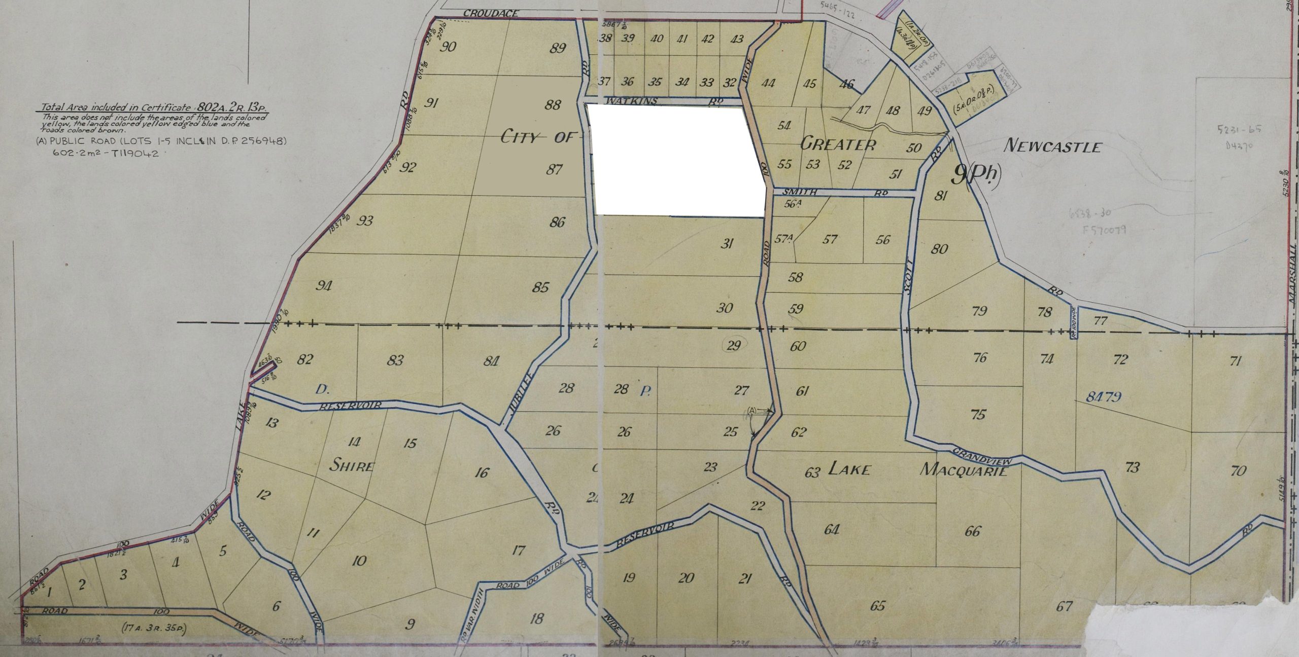
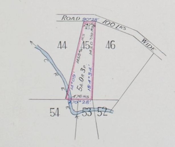
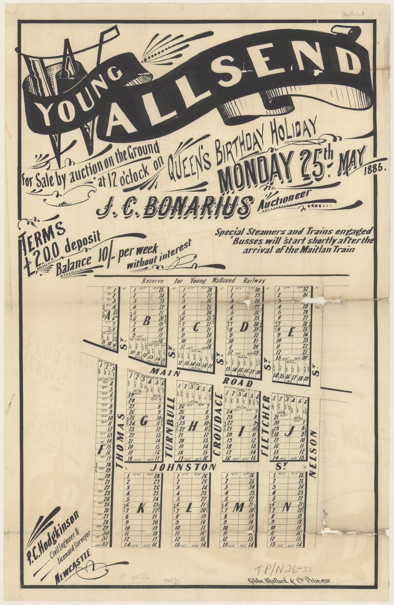
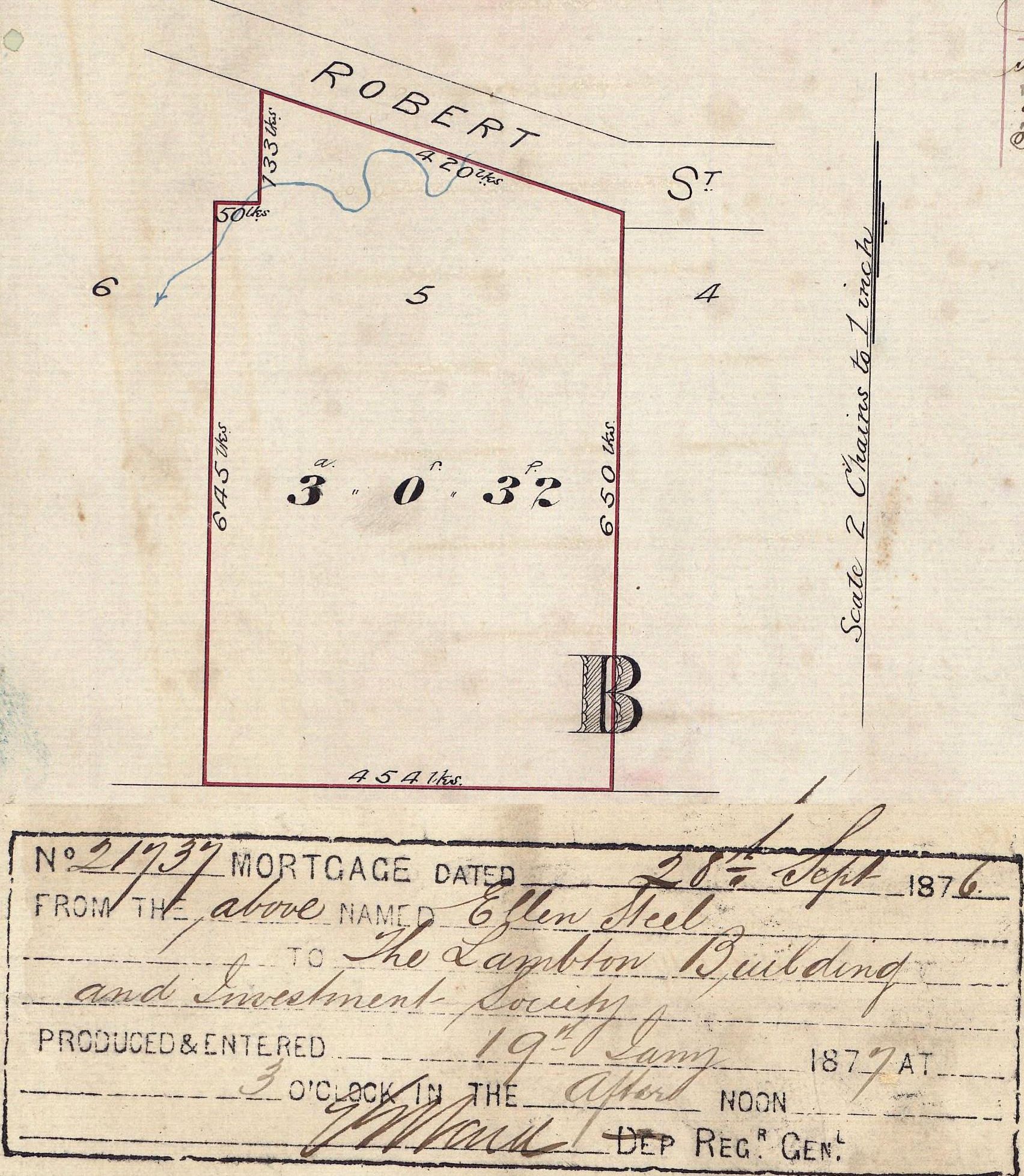
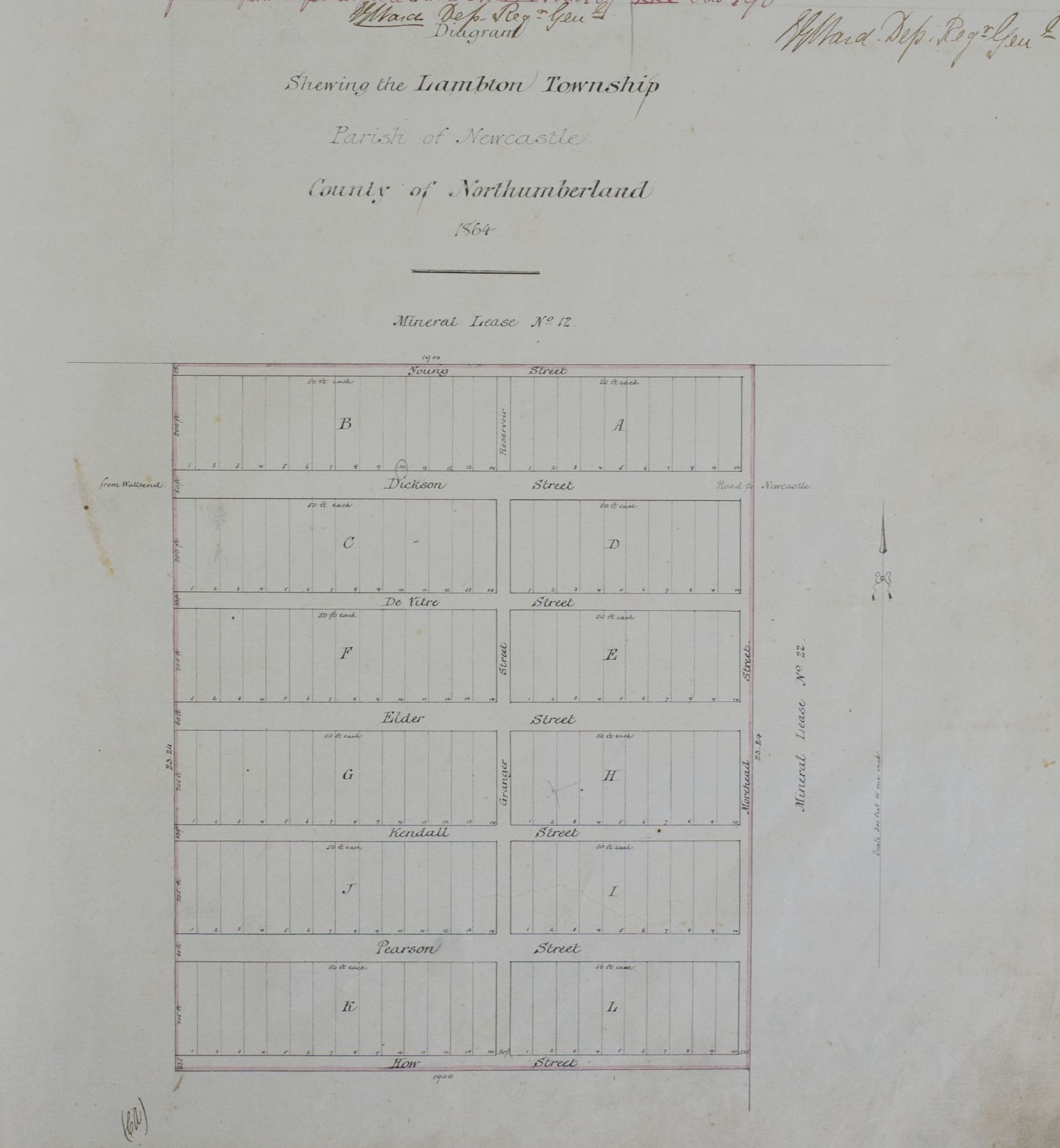
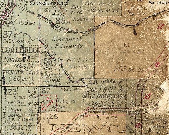
The 1886 subdivision map
One of the important aspects of the 1886 subdivision map is that it shows which lots were leased and to whom they were leased. For example, in Sections D and G we see leases to Lunn (James Lunn of the Hand of Friendship Hotel), Sneddan, Horsfield, and Butterworth (Abraham Butterworth of the Duke of Wellington Hotel.)

The whole map shows leases to: Allanby, Banks, Bart, Beveridge, Boberly, Buckley, Bunn, Butterworth, Chinchin, Cummin, Davis, Dover, Gould, Hincks, Hitchcock, Horsfield, Hyde, Jeffries, Johnston formerly Strange, Jones, Kelly, Lewis, Limn, Lucas, Lunn, M. John, Marchant, Mogg, Morgan, Musgrove, Pellew, Peterson, Police, Price, Pritchard, Ray, Reece, S. Williams, Sager, Saunders, Sneddan, Solway, Thomas, Wesleyan Church, Williams, Wilson, Winspear.
Lots 1 to 4 of Section G are shown as leased by “Sneddan”, a rather mercurial name with various other documents and newspaper articles spelling the name “Snedden”, “Sneddon”, and even “Snedding”. Mr Thomas Sneddon was a long-time resident and well known gardener and florist in New Lambton. A number of editorial puff pieces leading up to the February 1886 land sale made reference to his garden.
- 20 January 1886 – “A correspondent writes that having had occasion to transact business at Wallsend the other day, he started from Newcastle in a bus, and when near New Lambton a gentleman induced him to get out and visit Snedding Garden at New Lambton. To his utter astonishment he saw one of the prettiest gardens outside of Sydney. The whole place was a living mass of flowers of all kinds and colours, and the fernery was beautiful, some of the choicest kinds being New South Wales ferns.”
- 30 January 1886 – “The paragraph which appeared in your paper last week, referring to Snedding Garden, or this estate, and to the site equalling for scenery anything in this part of New South Wales, led me to take a journey to this northern paradise, and to my astonishment I was well paid for my labour. The ‘bus dropped me at the railway bridge, and I made my way to the gardens, which are really beautiful. Flowers and ferns are herein abundance, and to give you the names of them would take me too long, but the wonder to me was how they grow here in the open air in such splendour. I was informed the soil was very rich, and with a little trouble anything thing will grow at New Lambton Heights.”
- 20 February 1886 – “I visited some of the houses, and fortunately happened to drop into Mr. Sneddon’s garden. I was very glad of this, as I had read an account of this garden, and really was paid for my trouble. I was here surrounded by all the colours of the rainbow, and was not long in procuring a lovely bunch of flowers that really would have done credit to Covent Garden in the old country. The camelia bushes are just breaking out with their lovely new leaves, and when the season arrives New Lambton Heights will be able to show camelias with any part of New South Wales.”
Thomas Sneddon resided in New Lambton until his death in 1927, aged 83. His obituary described the fame of his garden.
Mr Thomas Sneddon who died last week at his home, cnr Cromwell and Victoria streets, was one of the oldest residents of New Lambton. He was known throughout the Newcastle and Maitland districts as a keen horticulturist, and his gardens proved a strong attraction. In past years, during the days of the old wind jammers, they were the rendezvous of ship captains and other visitors. Mr. Sneddon was born at Cockpen, county of Edinburgh in 1844. He came to New Lambton in 1879, when the township was but a scrub, and lived there till his death at the age of 83. As a flower exhibitor he won many prizes at various shows, and in certain classes he invariably swept the board. He had also acted as judge on many occasions. In his early years at New Lambton he conducted a grocery business on the corner of Regent and Victoria streets, eventually selling out, and taking up the florist business, which he conducted (with the aid of his family) to the present.
Newcastle Morning Herald and Miners’ Advocate, 13 April 1927.
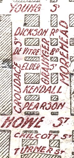
1886 street names
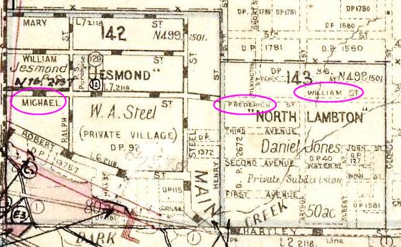
| 1886 Street Name | Probably named after | Present Street Name |
| Bonarius St | John Charles Bonarius, auctioneer | Carrington Pde |
| Brown St | Alexander Brown, proprietor of New Lambton Coal Company | Cromwell St |
| Brummy St | Russell Rd | |
| Coal St | Fleet St | |
| Dibbs St | G.R. Dibbs, colonial secretary and part owner of the New Lambton Estate land. | Evescourt Rd |
| Griffin St | Victoria St | |
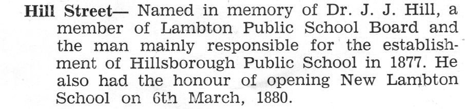
| Hill St | Queens Rd | |
| Mitchell St | James Mitchell, former owner of a 128 acre parcel of land whose northern border is on the line of Mitchell St. | Henley St |
| Pitt St | Portland Pl | |
| Horsfield St | Thomas Horsfield, former manager of the New Lambton colliery. | Regent St |
| Short St | Baker St/Curzon Rd | |
| Soudan St | Addison Rd | |
| Thomas St | James Thomas, manager of New Lambton colliery. | Oxford St |
| William St | High St | |
| Young St | St James Rd |
There are scant references to the original street names in the newspaper …
- Griffin St is mentioned in 1875 and in an 1879 reference to the Duckenfield Hotel.
- Horsfield St is mentioned in reference to the Duke of Wellington Hotel – Abraham Butterworth licensee in 1878, and Thomas Pringle licensee in 1879.
I have found no information as to why the original street names was abandoned, and a new set of names adopted. The modern street names first started appearing in newspaper reports in 1889, the year that New Lambton municipal council was formed.
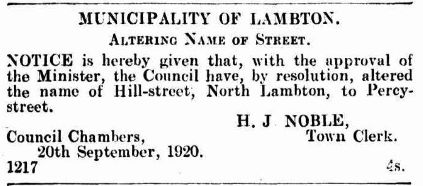
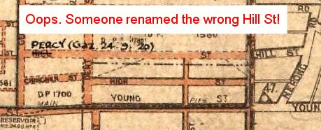
Curiously, the part of New Lambton north of Russell Rd also originally had a set of street names different from the current names, although in this case we know this was due to an administrative bungle.
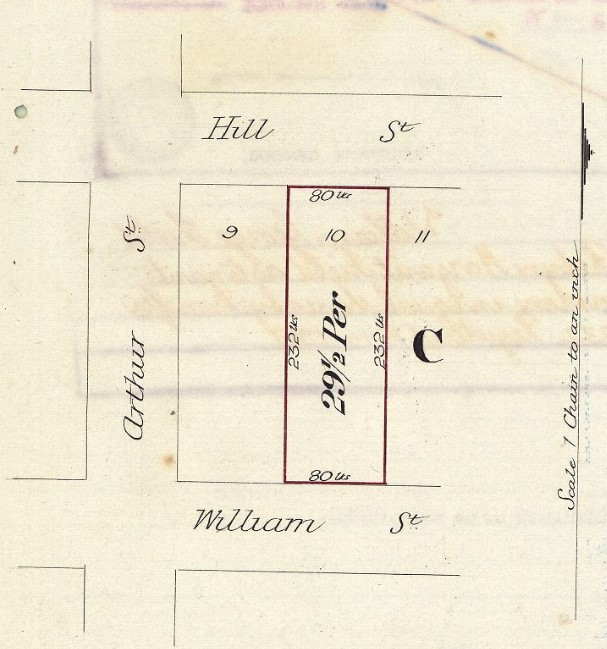
The ‘missing’ lot
The map promotes the subdivision as “containing 474 blocks of land”.

The subdivision contains 25 sections, labelled ‘A’ to ‘Z’ (omitting section ‘I’), with each block of land labelled with a number. On tabulating the numbered lots in each section, I initially came up with a total of only 473 lots. I eventually found what I think is the answer to this discrepancy, where in Section S lot 22 is divided in half and leased to two different persons.

Later land titles show the southern half of this block labelled as Lot 22A.

The 1901 Sale
Fifteen years after the aborted on-site auction of 1886, the proprietors felt brave enough to attempt another on-site auction of the remaining lots, on Saturday 20 April 1901. I have no explanation of why the advertisement says there are 325 allotments available while the poster map shows only 312 lots for sale.


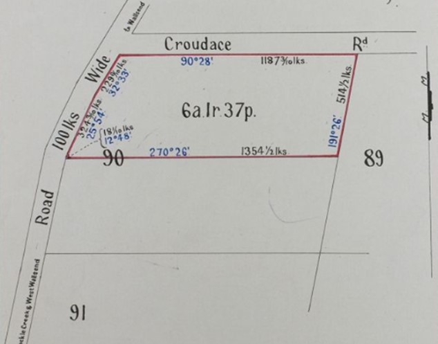
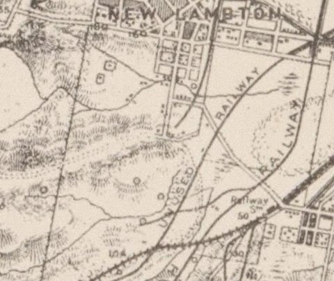
1913 Subdivision Map
The University of Newcastle Living Histories site has another subdivision map of New Lambton, which has no date information on the map.

The map only has 213 lots that are not marked as sold, so is clearly after 1901 when there were more than 300 lots for sale. Inspecting the land sales on Vol-Fol 1865-121, pages 6 and 7 shows that Lot 9 Section F sold on 15 April 1913 and is marked as sold on the above map. The next entry on Vol-Fol 1865-121, Lot 15 Section J sold on 19 June 1913 and is NOT marked as sold on the map. All subsequent entries on Vol-Fol 1865-121 are likewise not shown as sold on the map, thus dating it to mid 1913.
There does not appear to have been a big advertised sale of land in New Lambton in 1913 associated with this map, however a 9 September 1913 article refers to progress in constructing the “Eves Court” bridge and notes that …
The bridge will have the effect of opening up a considerable portion of land on what is generally termed “The Second Hill,” to the right of Orchardtown, and this land will probably be the second subdivision of the New Lambton Coal Company.
Newcastle Morning Herald and Miners’ Advocate, 9 September 1913.
The bridge was of sufficient importance to the New Lambton Company in their real estate ambitions, that they contributed £115 of the eventual £234 construction cost. It is probable that the 1913 subdivision map was produced to facilitate and promote land sales expected to arise from the construction of the Evescourt Rd bridge. A social function to celebrate the opening of the bridge was held at Butterworth’s hotel on 13 December 1913.
Newspaper articles
| Article Date Event Date | Notes |
|---|---|
| 20 Jan 1886 | Editorial 'puff piece' promoting the upcoming New Lambton Estate land sale. |
| 23 Jan 1886 | Lengthy advertisement for New Lambton Estate land sale. |
| 30 Jan 1886 | Editorial 'puff piece' promoting the upcoming New Lambton Estate land sale. |
| 13 Feb 1886 | "Mr. W. H. Bonney has just completed a plan for Messrs. Hodgkinson and Wilkinson, of Newcastle and Maitland, which does him great credit. The plan is 11 feet, long, by 5 feet wide and shows all the blocks of land - 474 building sites, at New Lambton - which are to be sold on the 27th instant by Mr. J. C. Bonarius, auctioneer. The colouring is very good, and the plan altogether is one of the neatest we have seen. It is to be on view at the Borough Markets." |
| 20 Feb 1886 | Editorial 'puff piece' promoting the upcoming New Lambton Estate land sale. |
| 1 Mar 1886 27 Feb 1886 | Report on the riot at the New Lambton Estate land sale. |
| 2 Mar 1886 | Letter to the editor countering the misapprehension that it was the striking miners at Lambton colliery who had rioted. |
| 13 Mar 1886 | Letter from one of the leaseholders, refuting a number of claims made in the newspaper report of 1 March 1886. |
| 20 Mar 1886 27 Mar 1886 | Advertisement for sale of land to be held in Victoria Theatre. |
| 26 Mar 1886 27 Mar 1886 | "Attention is drawn to the great land sale of "The heights of New 'Lambton," which is to be held in the Victoria Theatre to-morrow at 12 o'clock. Mr. J. C. Bonarius is the auctioneer. The property consists of over 158 acres of freehold land, subdivided into lots to suit all classes. As it is within a quarter of an hour's drive of the city, and adjoins the proposed tramway, it is most conveniently situated. Healthy and elevated, this most valuable subdivision should meet with keen competition." |
| 25 Aug 1886 | "Purchasers of allotments of land on the New Lambton Estate are reminded that promissory notes for the second payment, due on 1st September next, are payable at the Commercial Bank, Newcastle." |
| 20 Apr 1901 | Advertisement for sale of 325 lots of the New Lambton subdivision, to "take place on the ground adjoining Doritty's Sportsmen's Arms Hotel." |