A few weeks ago I attended a Zoom seminar run by Newcastle Family History Society, at which Jeff Madsen explained how to navigate and search the Historical Land Records Viewer to find old land title certificates, which can contain valuable historical information, as well as the occasional map.
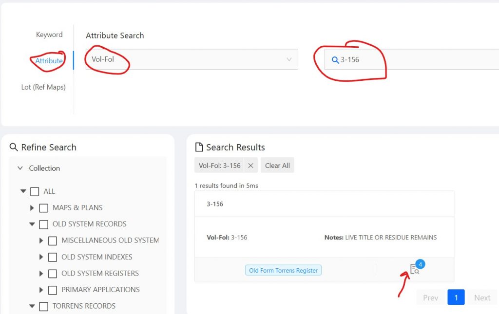
I had used this service before to find some old maps, but was never able to find anything when searching the Torrens (land titles) records. I learnt that the reason why I never found anything is because none of the contents are indexed. The only way you can find a land title certificate is if you know the Volume and Folio number. This is often referred to as the Vol-Fol, and is searched for by entering the numbers separated by a hyphen as shown below.

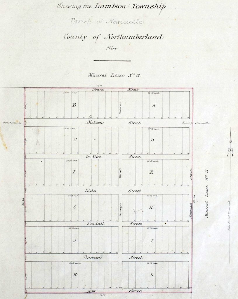
Without a Vol-Fol number, your chance of finding what you want is literally millions to one. However, having found a title certificate (that’s a story for another post), it will often contain a reference to the previous certificate, and possibly one or more references to following certificates. These links then form a ‘Chain of Title’ that shows the progressive changes of ownership and subdivision of land. Using this concept of ‘chain of title’, starting with my own property in Lambton I was able to trace the chain back to the original mineral lease granted to Morehead and Young in 1863 (Vol-Fol 2-4), and then trace the chain forward to Vol-Fol 3-156 from 1864 wherein the plan of the township of Lambton appears on page 3.
Finding this map was very exciting. It is the oldest map I had found of Lambton, more than 30 years older than what I had seen before. The map revealed a few interesting details:
- It confirmed my previous suspicion that the original name for Howe St was How St, almost certainly named after Robert How, an investor in the Scottish and Australian Mining Company.
- The main road from Wallsend to Newcastle was originally going to be Dickson St.
- The section of Grainger St between Dickson St and Young St (Newcastle Rd now) was originally called Reservoir St.
- Grainger St appears on this map as “Granger” without the ‘i’. Unlike the ‘How/Howe’ discrepancy, this is almost certainly a mis-spelling on the 1864 map. Newspaper reports and Government Gazettes overwhelmingly and from an early date spell it as “Grainger”. The street is named after “Charles Garston Grainger” which returns 454 results in Trove, whereas searching for “Charles Garston Granger” returns no results.


I should add that I also find your Google Maps index to the Sales Plans an invaluable resource.
Hi Lachlan
The Torrens titles are indexed. They are indexed by year ranges and purchaser initial. But I’m assuming from your comment that you didn’t know the purchaser.
There are several ways to find the Vol-Fol numbers of a property if you don’t know any of the purchasers.
SIXMaps will give you the current title, then use that in the LRS portal’s “Find Records” page and do a “Prior Title” search.
If the result is an old form Torrens, ie vol-fol, above 8497-215 then you’re finished here, unless you want to pay a broker.
If the result is in the form, lot/planNumber, eg 1/456789, then click the “All Records” button and do another “Prior Title” search the new fields, and keep going until you either get a vol-fol, or a CA.
If its a CA then this is a Conversion Action, which is an automatic conversion from Old System to Torrens. Click the “View” button next to “Document Inquiry” and enter the CA number as returned in the search. This will give you the Book and Number of the OS deed. If it’s above Bk 3887 No 941, then, again, you’re out of luck. Otherwise, use the Book and Number as bbbb-nnnn in HLRV to see the OS deed.
If the result is a PA number, a Primary Application, the you can search for that in HLRV.
If you hit a dead end with this, you can try neighbouring properties, and, assuming its Torrens, backtrack until you get to the subdivision, look for the transfer of the lot you after.
Another, source for the title is the valuation books. The Newcastle books are held at the Newcastle Library Local Studies. Pick a year prior to 1961 (when they moved to New Form Torrens).
Sometimes, if you’re lucky, the parish or town map will show a PA or RPA number on the portion. You can use HLRV to view the PA search, or use the collection search on State Records web site (use eg PA 1234), which may return the vol-fol.
Oops. Just re-read your article and you obviously know the purchaser. However, I hope it helps for future research.
Thanks John for your helpful tips. I’m just a newbie in the world of navigating the HLRV site, so your insight is most welcome.
While there is a purchaser’s index to the Torrens titles, coming from a Computer Science background I find that to be a very generous use of the term ‘index’, given that you can only search the index by the first character of the purchaser’s surname, and a date range. Much patience is required, a point well made by Jeff Madsen in the Zoom presentation I attended.