Lambton Central Collieries

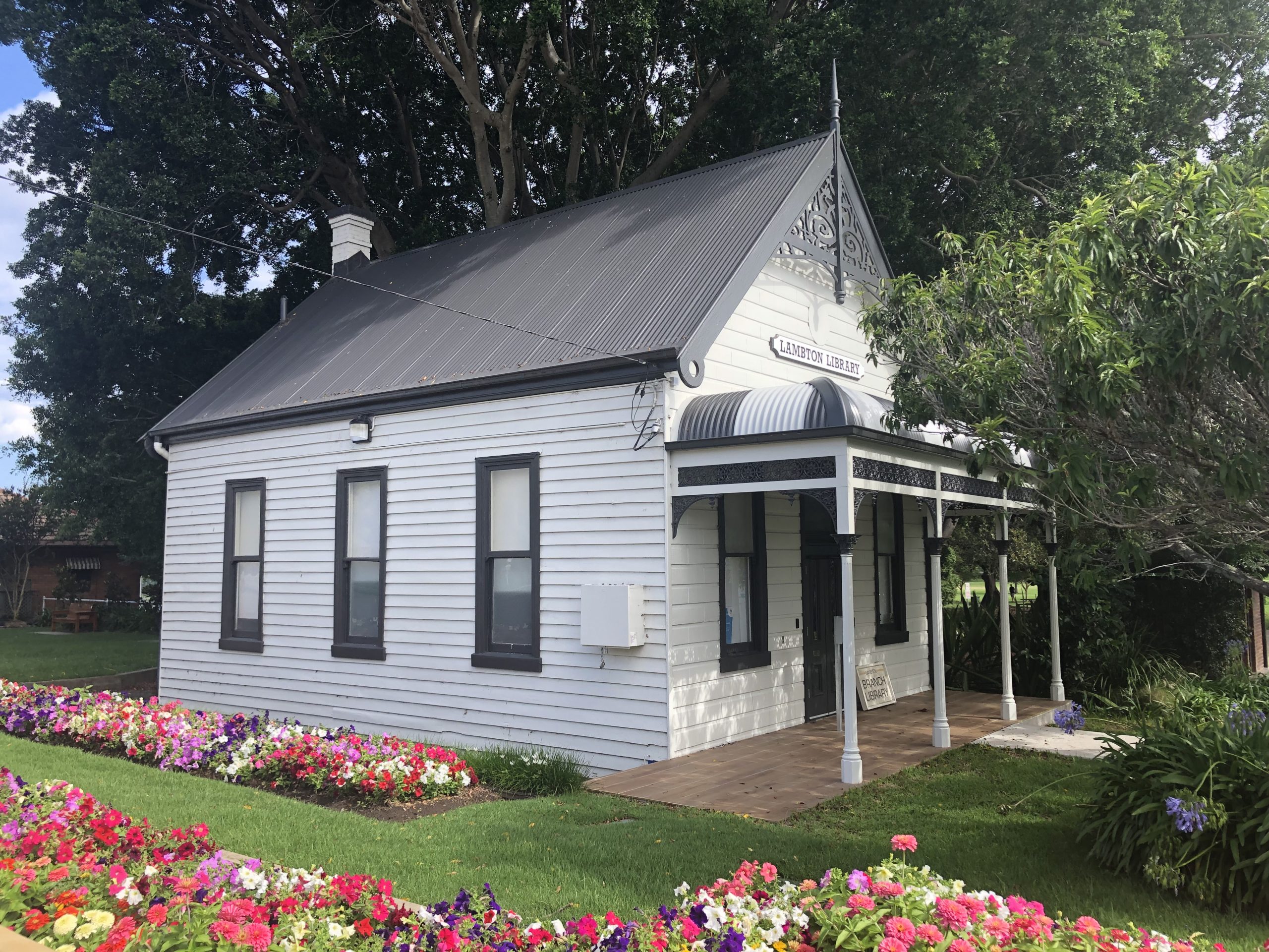
Seven years ago, in my first article for The Local, I remarked on how little evidence of coal mining remains in our town. The gulf between the prevalence of mining and the scarcity of surviving artefacts continues to surprise me.

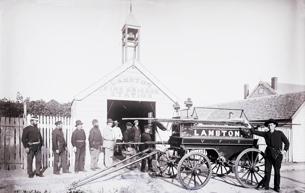
The pre-eminence of mining is starkly seen in historical land title records. For example, looking at the first purchaser of blocks of land in the township of Lambton we find a staggering 67% are listed as miners. There is a cavernous gap to the second most common occupations, carpenters and storekeepers at just 3% each. Mines were everywhere in Newcastle. Even into the 1950s road maps orientated motorists by showing the location of suburban collieries.

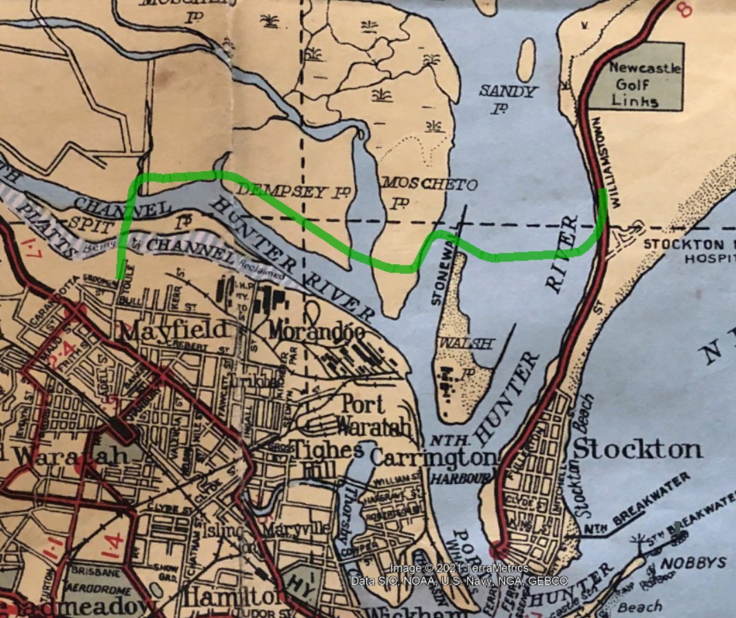
In spite of the utter dominance of coal mining, suburban development has progressively removed almost every trace of old collieries.  But some artefacts survived if they were sufficiently hidden away. I recently discovered in the heart of Blackbutt Reserve a rusting iron chimney. This was a furnace air shaft of the Lambton Central colliery, who mined a seam of coal in the middle of Blackbutt from 1936 to 1942. Around 1945 they commenced mining a different seam in the same area, naming the workings Lambton Central No. 2. Coal extracted from this seam was hauled in trucks to the old Lambton colliery railway (near present day Lewis Oval) to be loaded into rail wagons. In 1947 coal from Lambton Central was being sent to Zara St power station in Newcastle East.

Lambton Central No. 3 (Rankin Park) and Lambton Central No. 4 (Cardiff) commenced around 1951, and somewhat paradoxically Lambton Central No. 1 was the last of the company’s workings to be opened, in 1953 at Kotara. This site is now the Carnley Ave picnic area of Blackbutt Reserve. While much used and loved facilities in Blackbutt have replaced the mines, hidden parts of the Reserve still preserve a few relics of our coal mining history.

An iron chimney of a furnace air shaft of Lambton Central Colliery (1936-42), hidden in the bush of Blackbutt Reserve.
A 1950s road map showing suburban collieries, including Lambton Central No. 2 in Blackbutt Reserve, and the coal rail line in Lambton.

The article above was first published in the February 2022 edition of The Local.


Additional Information

The history of the various “Lambton Central” collieries is somewhat difficult to pin down exactly. The original “Lambton Central Colliery” operated from 1936 to 1942, and then subsequent pits opened up by the company had a numerical suffix. Thus the second, third and fourth pits opened up, quite sensibly had the suffixes of “No. 2”, “No. 3”, and “No. 4”. But somewhat confusingly when the company opened their fifth pit in 1952 (near March St, Kotara), rather than naming it “Lambton Central Colliery No. 5”, they chose to name it “Lambton Central Colliery No. 1”, presumably to have a neat sequence of numbers from 1 to 4. (Remember that the original pit from 1936 had no numbered suffix.)

To make matters more confusing, some newspaper articles mention “Lambton Central Colliery” without any numerical suffix, and you have to work out from the context and date of the article whether that refers to

  • The original 1936-1942 mine
  • The company that operated the 5 different mines
  • One or more of the numbered mines that operated from 1945 onwards

There are two main sources of information I have used to get a timeline of the Lambton Central Collierys:

  1. Newspaper articles from Trove
  2. The Annual Reports of the Department of Mines, available at the NSW Government DIGS website.

As most newspapers in Trove only go up to 1955, and the DIGS site only has annual reports up to 1953, it is difficult to ascertain the history of the mines after this time. There is a frustratingly brief and vague report from 10 November 1956 that states

Two northern collieries, Killingworth and Lambton Central, closed today, putting 152 mine workers out of work. The Joint Coal Board could find no markets for the collieries’ coal.

The Argus, 10 Nov 1956

It is not clear whether this refers to all the Lambton Central collieries (1-4), or just one of the pits.

The table below summarises the timeline of the five collieries, with references to newspaper articles and Department of Mines annual reports.

DateLambton CentralNo. 2No. 3No. 4No. 1
LocationBlackbutt – ridge north of Richley ReserveNear Richley reserveNorth side of McCaffrey DriveFern Valley, CardiffMarch St Kotara
Years1936-421946-?1951-?19521952-57
AR 1936Commenced    
AR 1938Discontinued. Recommenced    
25/2/1942Mine to close    
6/3/1942Mine closed on 5/3/1942 – two miners called up for military service.    
13/5/1945 Theft of parts of a haulage engine   
5/10/1946 Wanted. Permit manager for a small colliery to be opened up in the Lambton District.   
20/11/1946 Wanted. Working foreman for colliery pit top.   
6/12/1946 Wanted. Experienced contract miners.   
AR1946 New Lambton   
12/7/1947 Wanted. Undermanager for “New colliery being developed”   
27/10/1947 Pit idle after fatal accident.   
10/12/1947 Pit idle due to heavy rains.   
AR 1948 New Lambton   
AR 1949 New Lambton   
11/10/1950 Off Aldyth-street, New Lambton   
AR 1950 New Lambton   
10/12/1951   Fern Valley, Cardiff. First mention in Trove. In planning. 
AR 1951 Electric Safety Lights in use. 19/12/51 – fire in battery boring unitElectric Safety Lights  
26/3/1952   Query about whether permission has been granted yet 
14/5/1952    permission to erect bath house in March Street
28/7/1952   Idle due to transport bottleneck 
AR 1952 Electric Safety LightsElectric Safety LightsInspected. Discontinued. 
28/3/1953Wanted. Surface hand. March St Kotara.
AR 1957, p.58Discontinued
BHP Coal Geology map overlaid into Google Earth, showing the general location of Lambton Central Collieries Nos. 1 to 3. University of Newcastle, Special Collections.

Lambton Central Colliery (1936-1942)

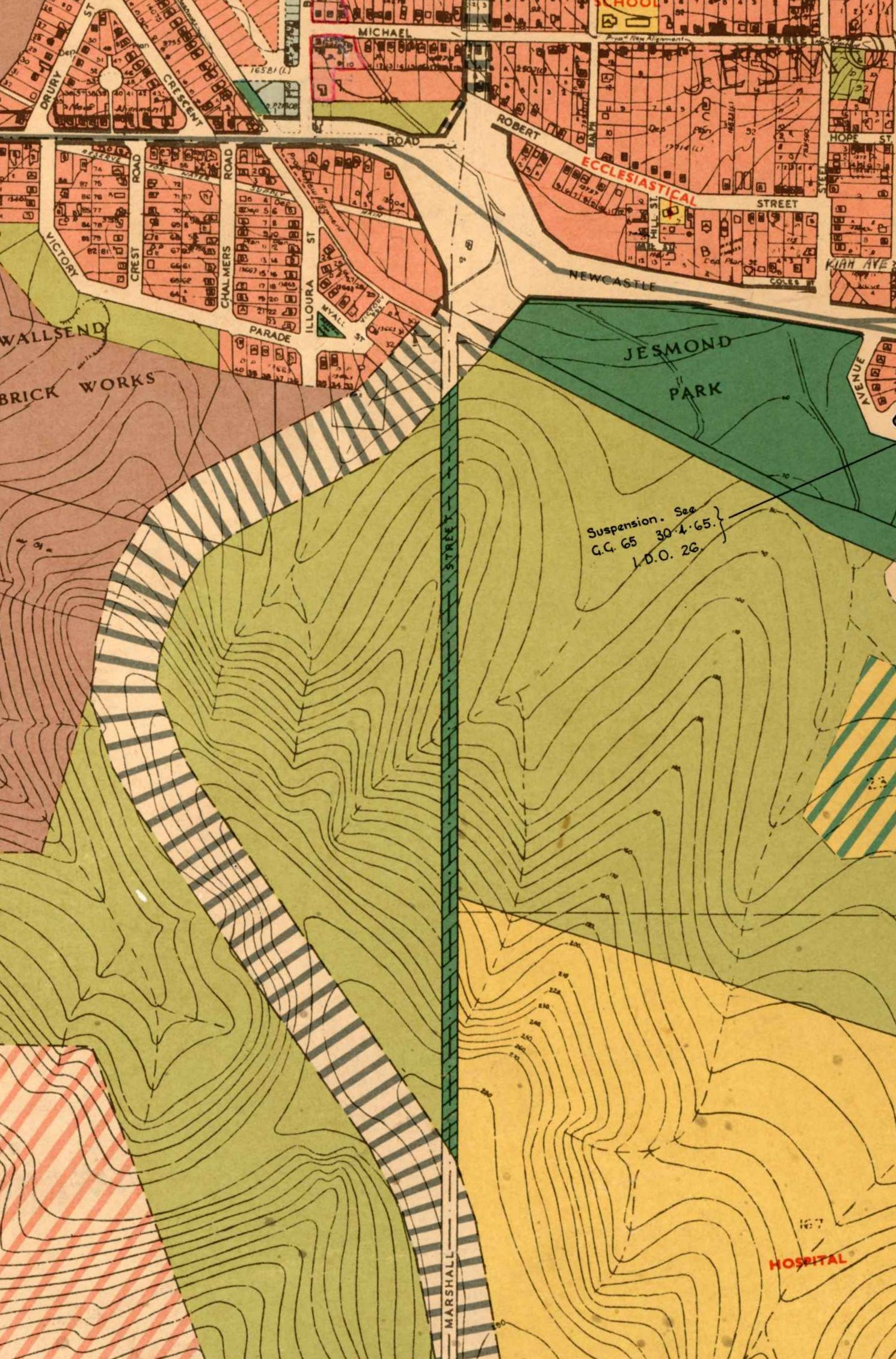
I have identified the furnace shaft that I discovered in Blackbutt Reserve as belonging to the original 1936-42 Lambton Central Colliery, on the basis of a map held in the Local Studies section of Newcastle Library.

Plan of Lambton Central Colliery Workings, New Lambton. LHM A 622.33/20, Local Studies, Newcastle Library.

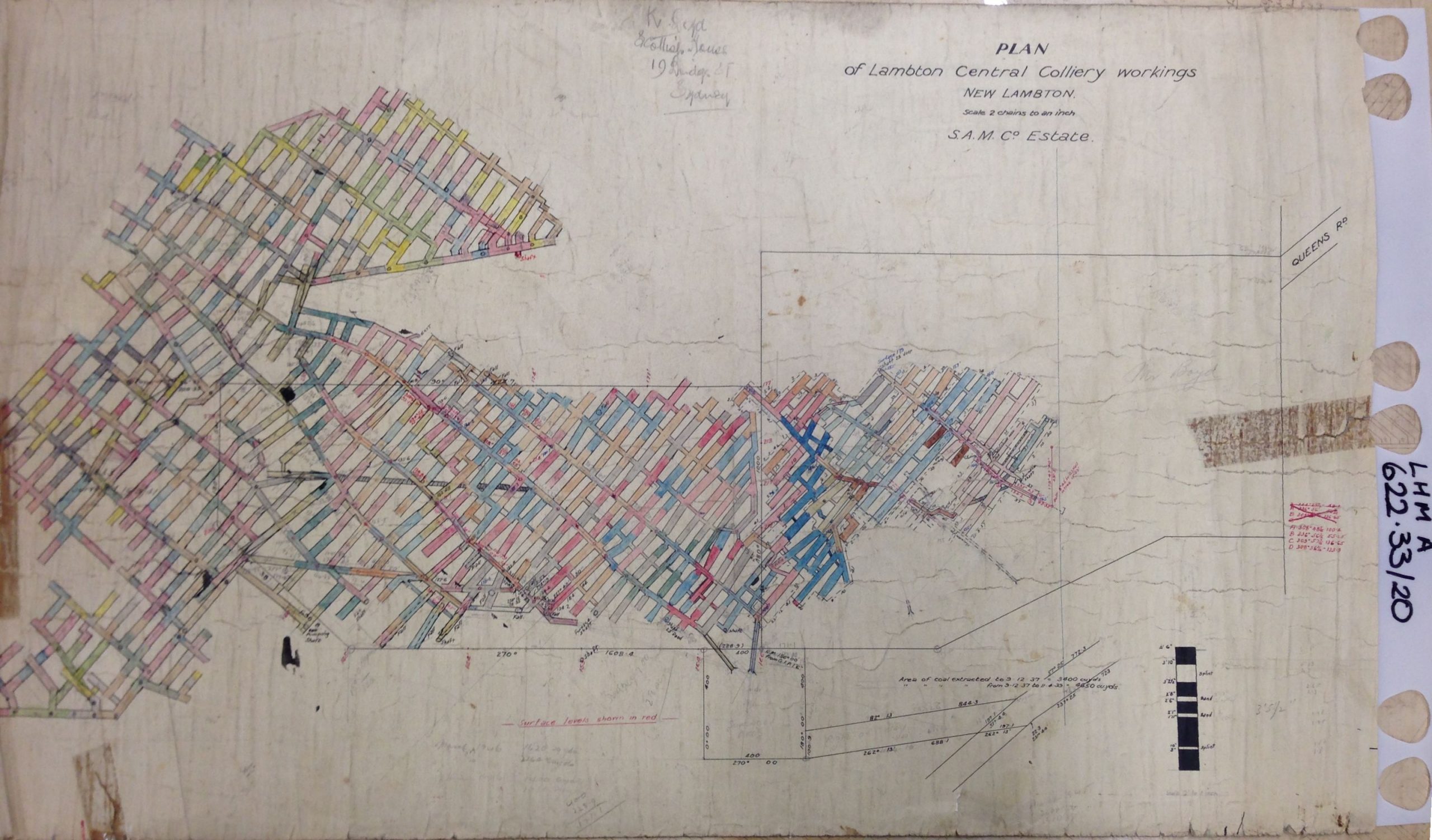
I had photographed this map several years ago but was unsure exactly how it fitted into the geography, as the only reference point on the map was Queens Rd (what part??) and I was uncertain as the units of distance (yards? feet?) used on the map.

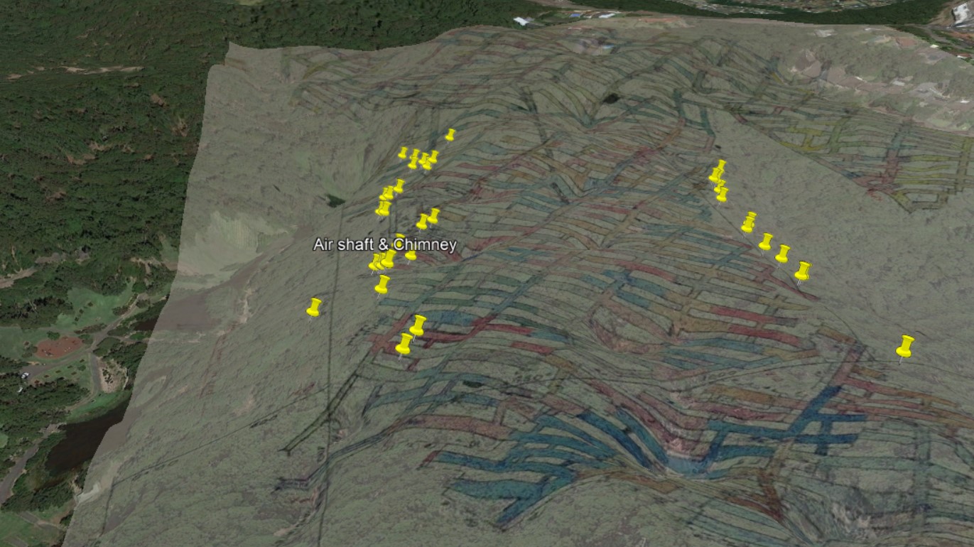
After finding the steel chimney in Blackbutt, I remembered that the map had a furnace shaft marked on it, and suspecting it was the one I had found I overlaid the map into Google Earth, using the two points of reference I now had – the shaft and Queens Rd.

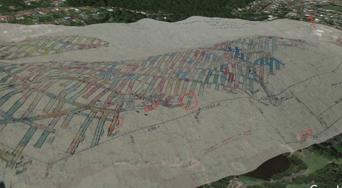
This quickly confirmed my guess about the shaft, as the overlaid map showed the mine workings correlating with the ridge running east from the top of Queens Rd, westwards to Lookout Rd. I was also able to confirm that the distances marked on the map were in units of links – where 1 link is approximately 0.2 metres.

While walking around both the southern and northern sides of the ridge I had observed quite a number of large sunken depressions that appeared to be the result of mine workings falling in. The depressions on the north side of the ridge were usually dry, but on the southern side where it is more shaded, most were filled with water from recent heavy rainfalls.

A mine workings pitfall on the southern side of the ridge, filled with water after recent rains.

I took photographs of each depression I came to, and then extracted the GPS co-ordinates to plot them in Google Earth. When I overlaid the mine workings map the depressions I had observed lined up with the extremity of the workings, where the map has many annotations of “fall”.

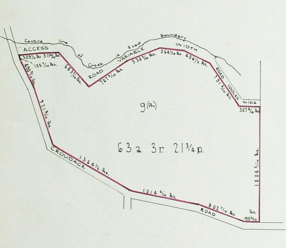
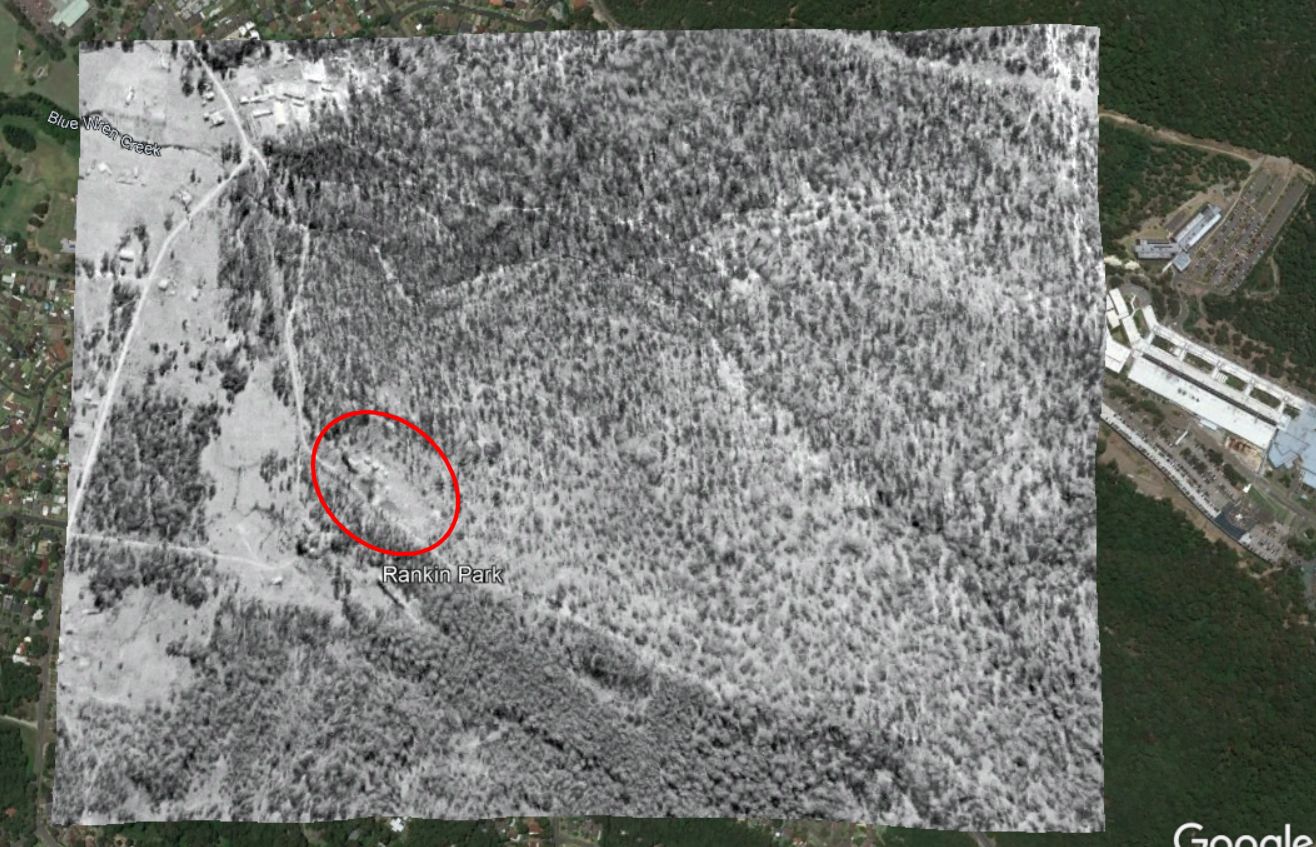
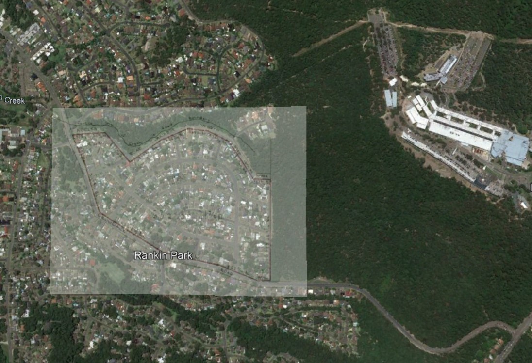
Lambton Central No. 3 (1951-?)

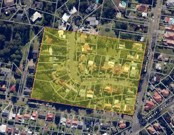
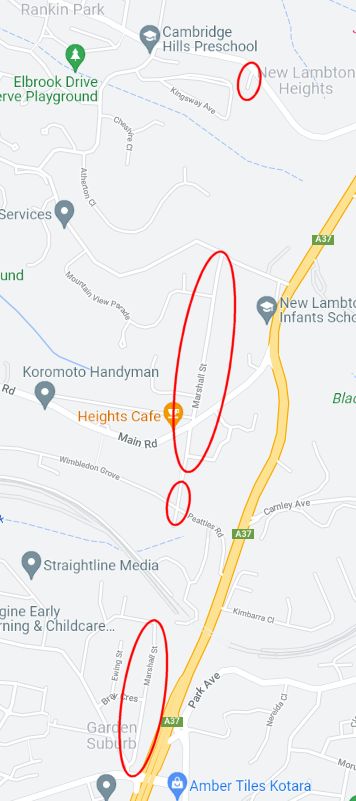
Lambton Central No. 3 colliery was an underground mine situated in the Rankin Park area, north of McCaffrey Drive. In 1951 the company purchased 63 acres of land for their surface infrastructure.

Surface land purchased for Lambton Central Colliery No. 3 in 1951. Vol-Fol 6538-30
An aerial photograph from 1954 shows a small number of surface buildings and infrastructure at the site of Lambton Central Colliery No. 3. NSW Historical Imagery.
The surface land of Lambton Central Colliery No. 3 is now a housing subdivision in Rankin Park.

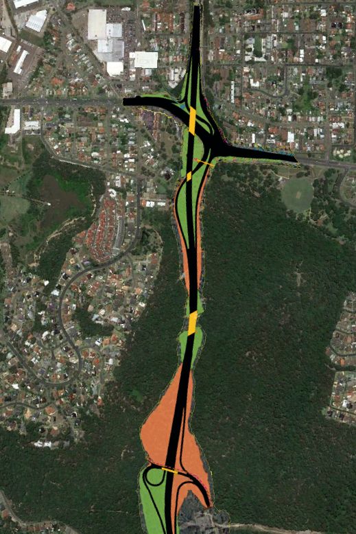
Lambton Central No. 1 (1952-1957)

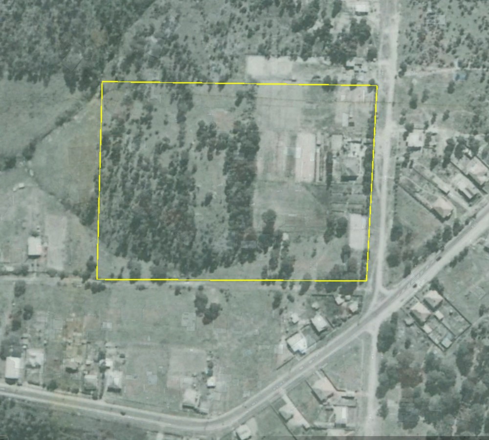
The last of the Lambton Central Collieries to be opened, was somewhat paradoxically named Lambton Central No. 1. Presumably this was to fill in the gap in the numbering as the first colliery opened in 1936 had no numerical suffix. No. 1 colliery was located north of March Street in Kotara.

Workings of Lambton Central Colliery No. 1. Newcastle Library, Local Studies.

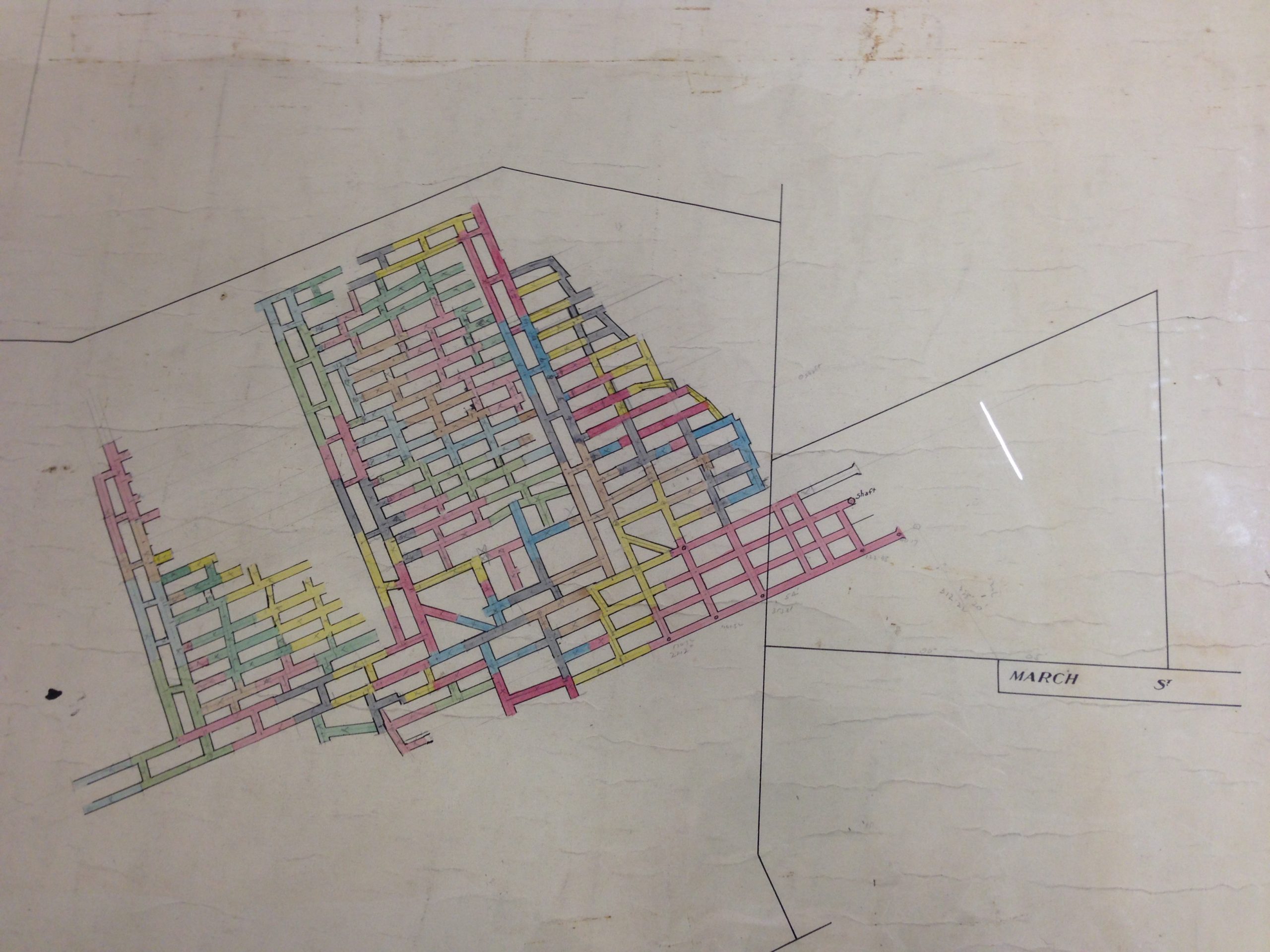
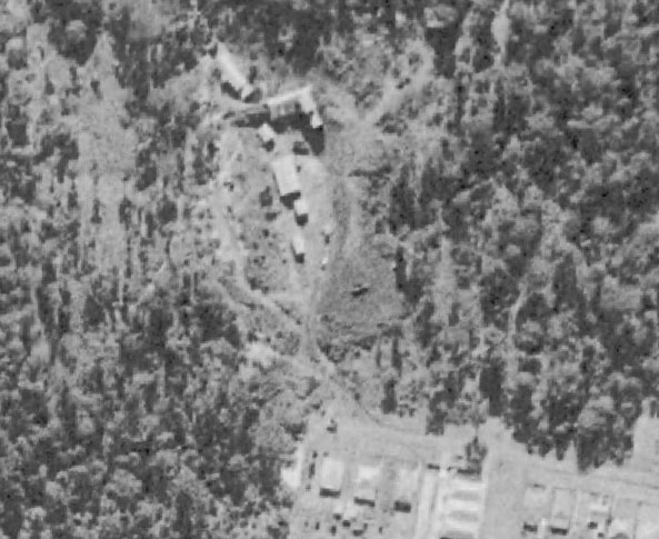
Overlaying this workings map into Google Earth shows that the colliery was working a seam of coal in Blackbutt Reserve to the west of the current Carnley Avenue picnic area.

Workings of Lambton Central No. 1, overlaid into Google Earth,
Tunnel entrance and shaft locations. (Approximate only.)

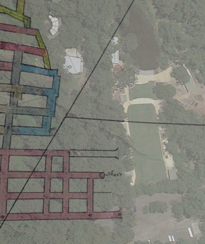
The overlay above indicates that a tunnel entrance and shaft were located somewhere near where the timber boardwalk entrance to the animal exhibits exist today. (Bear in mind that the overlay above is an approximation only, based on my best effort to align a photograph of a drawing into Google Earth, using a combination of visual alignment and dimensions marked on the drawing.)

The Department of Mines Annual Report for the year 1957 indicates on page 58 that Lambton Central No. 1 discontinued operations in that year.

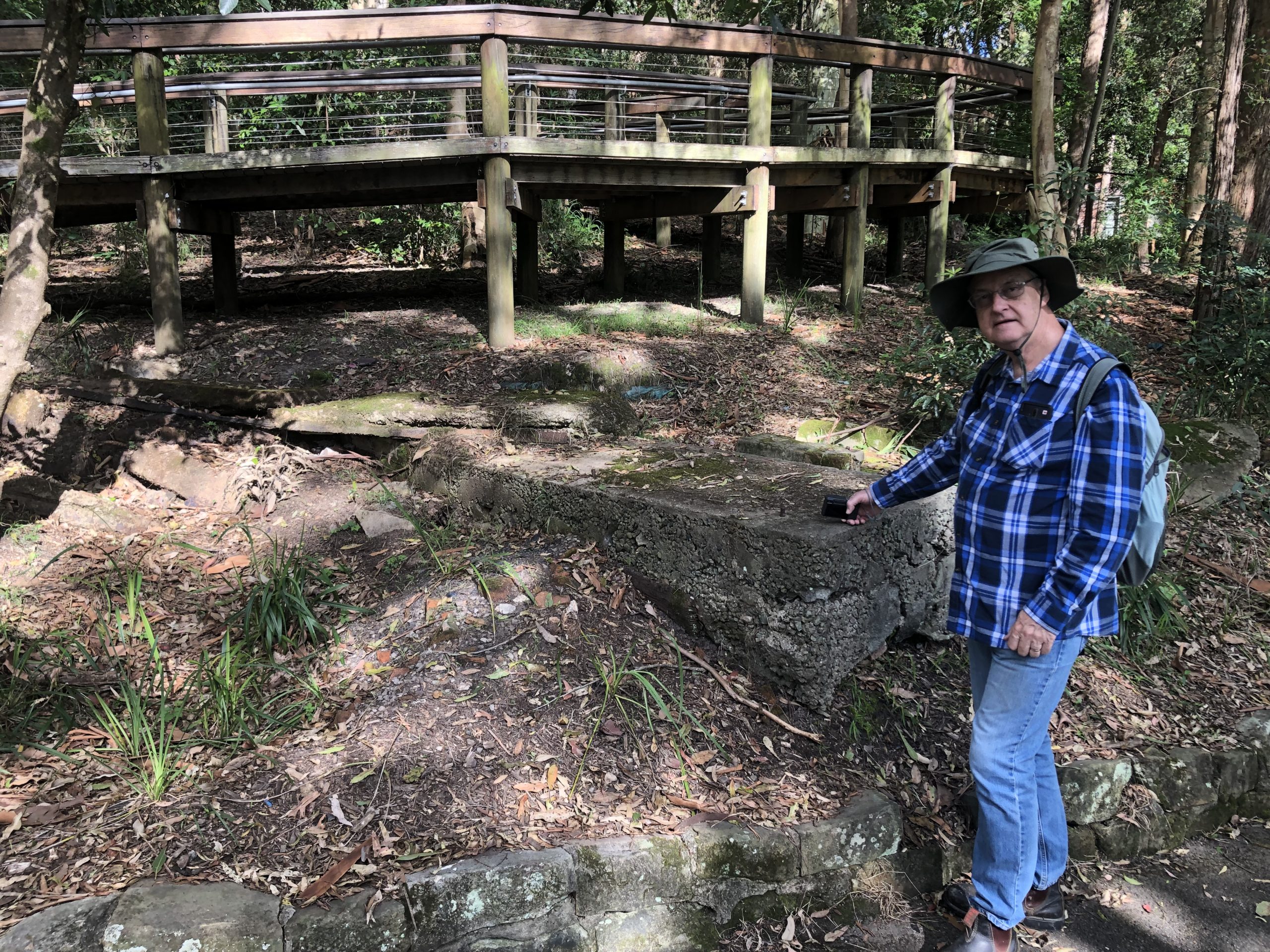
Below the boardwalk today, there still exists some old concrete footings belonging to some part of the coal mine’s infrastructure.

Concrete foundations of relics of Lambton Central Colliery No. 1 infrastructure, Blackbutt Reserve.
Lambton Central Colliery No.1. Aerial photograph from 1954. March St can be seen at the bottom. NSW Historical Imagery.

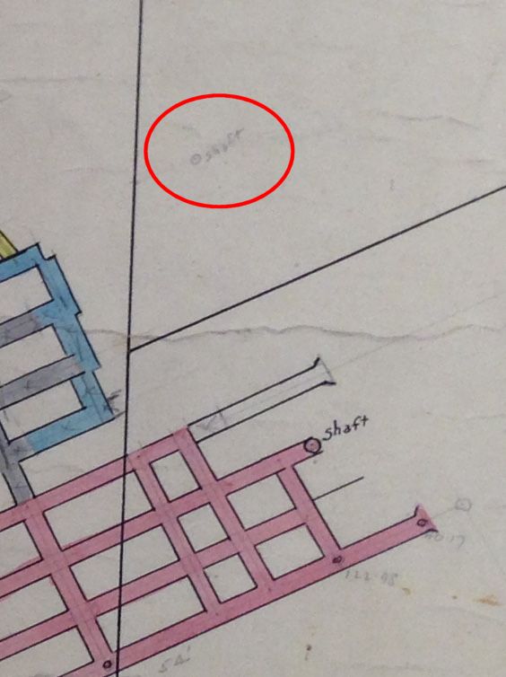
One final point of interest on the workings map of the Lambton Central Colliery No. 4, is that some 70 metres to the north of the shaft and tunnel, someone has pencilled in an annotation of another shaft. The position of this annotation aligns exactly with the old Mosquito Pit shaft (of the original Lambton colliery) that was discovered by Newcastle Council in 2014 during renovations of the picnic area.

Mosquito Pit shaft marked in pencil on Lambton Central Colliery No. 1 workings map.

Newspaper articles

Article Date Event DateNotes
25 Feb 1953"Borehill and Lambton Central are two small collieries with main tunnels, about 70 yards apart. Both enter the one hill and work on the one seam. But the production cost of one is 16/ a ton more than the other."
10 Nov 1956
9 Oct 1956
"Two northern collieries, Killingworth and Lambton Central, closed today, putting 152 mine workers out of work."

Lambton Council Chambers

Thanks to the land titles available in the Historical Land Records Viewer, I have been able to identify all the locations that Lambton Council meetings were held during its existence from 1871 to 1938. I have updated my Lambton Council page with this information, including a map.

Of the six buildings they met in, only the last of them still survives – the Lambton Library building in the corner of the park.

Lambton Library, January 2022.

A Timely Trophy

Fire Brigade Demonstration Days 1888

Fire-fighting services in our cities today are provided by the state government, but they did not begin that way. The first brigades were started in Sydney in 1836 by insurance companies who supplied rudimentary equipment for use by volunteers. In 1854 purely voluntary brigades began to be formed, with local communities supplying not only the manpower, but also the equipment and funds.

Newcastle formed a volunteer brigade in 1856, followed by outlying townships. Having no overarching governing body, the separate brigades fostered connections by holding “demonstration days”, to gather together and hold competitions. They provided an opportunity for training, camaraderie and fund raising.

From 8 to 10 November 1888 Newcastle hosted a grand demonstration event, with 19 brigades attending, from as far away as Goulburn. On Thursday night, 15000 people lined the streets to witness a torchlight parade of the brigades. On Friday and Saturday, competitions were held on Newcastle Cricket Ground.

The premier event was the “Engine Practice for Eight Men”. From a standing start, the men deployed hoses, nozzles and pumps from their engine, to throw a stream of water at a disc 20 feet above ground. The Lambton Brigade, with a time of 40.75 seconds, won the substantial prize of a 50kg marble clock modelled on the London Royal Exchange. The trophy, donated by local businessman George Galton and valued at 25 guineas (equivalent of $4000 today), was an indication of the high value placed on fire-fighting services. One observer in 1888 wryly noted that “the arrival of so many fine-looking firemen, showily-dressed, has created an unusual flutter in the hearts of the gentler sex in this city.” Firefighting then was an exclusively male occupation, and it took nearly a hundred years before women were first employed as fire-fighters in 1985. While the hands of Lambton’s trophy clock have stood still for many years, the recruiting practices of NSW Fire and Rescue have moved forward, and today women comprise 9% of the full-time fire-fighters in the state.

Lambton Volunteer Fire Brigade, 1890s. Hunter Photobank, Newcastle Library.
The 50kg marble clock trophy, won by Lambton Volunteer Fire Brigade at the 1888 demonstration day, on display at the Fire and Rescue station in Young Road. Photo by Robert Watson.
The fire brigades’ trophy was modelled on the Royal Exchange in London. Photo by Yair Haklai, Wikimedia Commons.

The article above was first published in the January 2022 edition of The Local.


Additional Information

Advertisement for the Fire Brigades’ Demonstration Days. Newcastle Morning Herald and Miners’ Advocate. 8 November 1888.

The marble clock trophy on display at Lambton fire station has a brass plaque that reads …

Presented by
Mr George Galton
As a Trophy
At the Newcastle Fire Brigades Demonstration
Nov. 9th 1888

Brass plaque on the clock trophy.

In 1888 the value of the clock was stated as 25 guineas. At the time a guinea was equivalent to 1 pound and 1 shilling, so 25 guineas was 26 pounds and 5 shillings. The Reserve Bank of Australia Pre-Decimal Inflation Calculator shows that £26 5s in 1901 (the earliest year the calculator supports) is equivalent to over $4000 today.

George Galton

George Galton was born in London on 8 January 1850. In 1866 at the age of 16 he emigrated to Australia. After working in several large retail stores in Sydney he moved to Newcastle in 1876 and opened a store in Hunter Street West, opposite the Honeysuckle railway station. Galton opened two more stores in Newcastle, and in 1888 Galton opened a store in West Maitland.

George Galton. circa 1900. Maitland Library, and University of Newcastle Special Collections.

In 1896 Galton sold his stores in Newcastle in order to concentrate on his West Maitland business. One of the buildings he had erected still stands in High Street. (This building is very familiar to me – as a school student in the 1970’s living in the Maitland area, I passed this location every school day.)

The site of one of George Galton’s stores, in High Street, West Maitland. Google StreetView.

George Galton died at his residence “Yarrawonga”, in Regent St West Maitland on 25 July 1930, aged 80. The Galton’s business continued after George’s death, with his wife becoming chairwoman of the company, and then on her death in 1936, her two sons, George and Walter became joint directors of the business.

Newspaper articles

Article Date Event DateNotes
21 Jun 1856"Up to the present time there has existed no organized body in Newcastle whose duty would have been to undertake the direction and control of the fire engine, in the event of its services being required; however, the subject has been taken in hand, and has progressed so far as to have secured the co-operation of a sufficient number of volunteers to work the engine in case of need ; together with a number who undertake to support the cause by their annual subscriptions and donations ; so that there is now every prospect of there being a brigade trained to render efficient service whenever their services may be required."
30 Jun 1856
24 Jun 1856
"A meeting was held on Tuesday evening last at the Court-house, Charles Bolton, Esq., J.P., in the chair; to take into consideration the means to be adopted to establish a fire brigade in Newcastle."
24 Feb 1887George Galton offers a donation of £10 to Honeysuckle Fire Brigade.
16 Jun 1888
14 Jun 1888
"A meeting of the City Fire Brigade was held on Thursday evening, at the station, Scott street. A letter was received from the Honeysuckle Point Brigade, asking the members to consider the advisability of holding a Fire Brigade Demonstration in Newcastle. The project was approved of, and delegates were appointed."
17 Aug 1888"THE delegates of the proposed fire brigades' demonstration held a meeting last night, when numerous correspondence from leading citizens was read promising to assist in the movement. Some valuable trophies have already been promised by different gentlemen - the Mayor (Mr. H. Buchanan), Mr. Fletcher, M.L.A., Mr. G. Galton, Hudson Bros., the Mayor of Parramatta (Mr. Hugh Taylor), and several others."
24 Aug 1888"The secretaries of the proposed Fire Brigades Demonstration acknowledge with thanks handsome donations from the following gentlemen, through Mr. Frank Gardner:-A cheque of £10 10s from the Australian Mutual Fire Insurance Society; cheque of £2 2s from the Victoria Theatre Company; case of biscuits, Mr. W. Arnott; also a clock, valued at 25 guineas, from Mr. George Galton."
27 Oct 1888"The splendid prizes which are to be competed for [at the Newcastle Fire Brigades Demonstration] are on view at the establishment of Mr. Walter Neve, Hunter street, and they should cause great competition."
8 Nov 1888Advertisement for the Fire Brigades' Demonstration Days/
9 Nov 1888
8 Nov 1888
"A grand torchlight procession of firemen, with their appliances and gorgeous decorations, marched through the principal thoroughfares. The event was in connection with the United Fire Brigades' Demonstration."
9 Nov 1888
8 Nov 1888
"A large crowd turned out yesterday evening to witness the departure of the members of the [Lambton] Fire Brigade forNewcastle, where they are to take part in the demonstration. The scene was of an imposing nature, delighting all the onlookers. The engine was beautifully decorated with choice flowers and bunting, and drawn by four horses."
10 Nov 1888
9 Nov 1888
"On the Newcastle Cricket Ground, yesterday, the first day's sports in connection with the United Fire Brigades' Demonstration of 1888, were contested. With regard to attendance, there were at least 1500 persons on the ground in the morning, and this number kept steadily increasing until the afternoon, when there must have been over 4000 persons present."
10 Nov 1888"The arrival of so many fine-looking firemen, showily-dressed, to assist at the above display has created an unusual flutter in the hearts of the gentler sex in this city."
12 Nov 1888
10 Nov 1888
Report on the second day of competitions of the Fire Brigades' demonstration on the Newcastle Cricket Ground.
26 Jul 1930
25 Jul 1930
Death of George Galton, aged 80, at his residence "Yarrawonga" in West Maitland.
3 May 1939The story of George Galton and his business.

A long road

My article for the December 2021 issue of The Local is out now, this month on Marshall St and the inner city bypass. The article is titled “A very long road story” for three reasons.

  1. Marshall St (on early maps at least) is a very long straight road, stretching 5 km from Jesmond to Kotara.
  2. This story took a long time to come to fruition. I’ve had plans to write various versions of this story for over five years, before I completed it this year.
  3. With the construction of the final section of the inner city bypass to commence in 2022, as I researched the history of this project I was quite surprised to find how long ago the bypass was first announced – in 1945! When construction is completed in 2025 it will have been 80 years in progress, making it a very long road story indeed.
A 1936 map showing Boundary Rd (Marshall St) stretching from Jesmond to Garden Suburb.

A very long road story

Marshall Street and the Inner City Bypass

Some roads in our city snake across the landscape following ridges or valleys, while others cut expansive straight lines across suburbia. In the former category are roads such as Grandview Rd in New Lambton Heights. In the latter category are roads such as Chatham Rd/St in the Hamilton area, and the curious Marshall St which has four disconnected sections running through five different suburbs, from Rankin Park to Garden Suburb.

These long straight roads have more to do with geometry than geography. They originated from the patchwork quilt of rectangular land grants in the mid-19th century, where it was common for roads to be planned along property borders.  Such is the case with Marshall St, where an 1884 map shows a three-mile un-named road separating the Scottish Australian Mining Company from Joseph Weller’s 2500 acre land grant.

It remained a road in plan only until the 1920s, when the Scottish Australian Mining Company built the first section as part of “The Lookout Subdivision” in New Lambton Heights. In 1925 it was named “Boundary Rd”, an eminently suitable title as over the years various portions of it divided mining leases, parishes, suburbs, municipalities, and state and federal electorates. In 1933 New Lambton Council changed the name to Marshall St, in recognition of one of the road’s earliest residents, James Gordon Marshall. In 1945 the NSW government unveiled big plans for the road network in Newcastle, including a highway from Rankin Park to Jesmond traversing the bush where the northern section of Marshall St existed only as a line on the map. Plans for this highway then changed many times over many years. In September 2021, Transport for NSW called for tenders for the construction of the $450 million final section of the Newcastle Inner City Bypass, with work to commence in  2022.  The expected opening in 2025 will be a final chapter in a 140-year story of a road, from nameless marks on a map to major motorway.

Long range road plans from 1945. Newcastle Morning Herald and Miners’ Advocate, 18 September 1945. Construction of the Rankin Park to Jesmond section (highlighted in green) is expected to commence in 2022.
On a 1960s map the never built Marshall St is shown as straight line, with the proposed bypass curving through the Jesmond bushland. University of Newcastle, Living Histories..
The final route of the inner city bypass through the Jesmond bushland closely follows the path of the original planned Marshall St.

The article above was first published in the December 2021 edition of The Local.


Boundary Road

An historical parish map whose origins date back to 1884, shows that the road that was given the name Boundary Road in 1925, was aptly named. It incorporated the following boundaries:

  • Parish of
    • Hexham
    • Kahibah
    • Newcastle
  • Municipality of
    • Plattsburg
    • Wallsend
    • Lambton
    • New Lambton
  • Coal lease of
    • Morehead and Young
    • Joseph Weller
    • Waratah coal
  • Town Police boundary
Parish of Newcastle, 1884.

Marshall Street

James Gordon Marshall of Cardiff, engine driver, purchased 8 acres of land in November 1918. The land title certificate shows an un-named road on the eastern boundary of his property. This road was the boundary between New Lambton and Lake Macquarie council areas.

Purchase of 8 acres by James Gordon Marshall in 1918. Vol-Fol 2893-203.

The location of Marshall’s land is shown below.

On the eastern side of the road, opposite Marshall’s property, the Scottish and Australian Mining Company subdivided a portion of their land to sell in October 1920.

The Lookout Subdivision, 1920. University of Newcastle, Living Histories.

In October 1925 Lake Macquarie Shire Council informed the Cardiff Heights Progress Association (James Marshall presiding) that the road at the east boundary of their council area was to be named Boundary Road.

In January 1927 James Marshall applied to Hunter District Water Board to have water mains extended to his property on Boundary Road.

In October 1933, at the suggestion of Lake Macquarie Shire Council, New Lambton Council agreed that the name of the road should be changed from Boundary Road to Marshall St. Despite the decision being made in 1933, it took another four years before the name change was made official in June 1937.

James Gordon Marshall’s property in 1944. NSW Historical Imagery.
James Gordon Marshall.
A 1936 map shows Boundary Road as a continuous straight road stretching from Jesmond to Garden Suburb. National Library of Australia.
In 2021, Marshall St consists of four disconnected segments.
Marshall St in 2021 runs through five different suburbs – Rankin Park, New Lambton Heights, Cardiff Heights, Garden

Newspaper articles

Article Date Event DateNotes
29 Oct 1925"At a meeting of the Cardiff Heights Progress Association, Mr. Marshall presiding a letter was received from the shire council stating that the road on the boundary would be called Boundary-road."
17 Jan 1927J G Marshall applies to Hunter District Water Board to have water mains extended to his property on Boundary Road.
14 Sep 1933"Lake Macquarie Shire Council asked if [New Lambton] Council would bear half of the cost of constructing a boundary road between main road number 223 and Mr. Marshall's premises, Cardiff, a distance of about six and a half chains. The road was on the boundary of New Lambton municipality and Lake Macquarie shire. The total cost would be £29. It was decided to pay half the cost."
26 Oct 1933At a New Lambton Council meeting, a letter was received from Lake Macquarie Shire Council in which they "appreciated the Council's decision to pay half the cost of repairs to Boundary-road, near Cardiff. The letter also suggested that the name of Boundary-road be altered to Marshall-street. The Council decided to approve the name selected."
24 Sep 1936New Lambton Council meeting : "The Cardiff Heights Progress Association expressed dissatisfaction at the state of Boundary-road, and inquired if there was an agreement between the council and the Lake Macquarie Shire Council to form the road."
18 Jun 1937Government Gazette with official name change from Boundary Rd to Marshall St.
18 Sep 1945Long range road plans for Newcastle.

Stockton Bridge

It was 50 years ago today, on 1 November 1971, that Stockton Bridge was officially opened. To mark the occasion, on the weekend I walked over the bridge and took a time lapse video as I traversed it from west to east.

The idea of a bridge from Newcastle to Stockton had been discussed for a long time prior to its construction. In a newspaper article from 10 May 1921, the writer compares Stockton with Manly in Sydney, pointing out the many similarities, and how with a bit of investment in infrastructure Stockton could become a popular tourist destination.

Stockton is almost cheek by jowl with Newcastle, and could be brought closer. Who knows but that some day, in the not too distant future, Newcastle will have its North Shore bridge, to connect the city with its premier pleasure resort at Stockton.

The Newcastle Sun, 10 May 1921.

At that time, access between Stockton and Newcastle was via a vehicular ferry, as shown in the circa 1930s map below.

Stockton vehicular ferry route on a circa 1930s map. National Library of Australia.

In April 1931, Stockton municipal council in debating the cost of running the vehicular and passenger ferries, suggested that a bridge might possibly be built across Newcastle Harbour from near Fort Scratchley, with the cost of construction to be recouped by tolls over a 20 to 30 year period.

The feasibility, advisability, type of bridge, projected cost, and the preferred route of a Stockton bridge generated many varied and strong opinions.

Surely it would be obvious, even to a child, that the bridge suggested would be of the lifting or swinging type, thus doing away with the unnecessary height. The assertion that the bridge would cost £200,000 is ridiculous, and I still contend that a suitable bridge could be constructed for the trifling sum of £750.

Letter to the editor, Newcastle Sun, 27 July 1932.

Serious consideration of a bridge to Stockton revived in the 1950s when the state government began reclamation of the Hunter River delta islands, to be used for industrial purposes. This reclamation opened up the possibility of a bridge that crossed the river north of Stockton via the reclaimed islands, rather than the more problematic alternative of building a bridge across a busy Newcastle Harbour.

A bridge should be built from Walsh Island to North Stockton in conjunction with the Newcastle harbor reclamation scheme, Mr. L. B. Saddington declared in the Legislative Council yesterday. The bridge would span the north arm of the harbor and connect by road with another planned for the south arm near the B.H.P. Consideration had been given over some years to connecting Stockton with Newcastle proper by bridge or tunnel. Owing to the topography this would be most costly … But one from Walsh Island to North Stockton could be done much more speedily and for less cost.

The Newcastle Sun, 17 September 1953.
A circa 1960s map, prior to the construction of Stockton bridge. I have overlaid in green the eventual route of the road and bridge.

Construction of the bridge commenced in 1968, with the erection of the pillars for the approach spans. The Department of Main Roads in 1971 made a very interesting 17 minute documentary on the construction of the bridge, which is available on YouTube.

https://www.youtube.com/watch?v=OZ430DXMmOk
At the top of Stockton Bridge, 29 October 2021.
The plaque from the official opening of the bridge on 1 November 1971 is located at the peak of the pedestrian walkway in the centre of the bridge.

Worlds apart

My October 2021 article for The Local is out, this month on William Thomas Dent.

Often my research for these articles leads me in unexpected directions, and this month was no exception taking me to the short lived Hartley Vale colliery of James and Alexander Brown in the Broadmeadow area, and all the way to the other side of the world to the coalfields of Durham where William’s father Mark Dent was a key figure in the great miners’ strikes of 1844 .

One of the things that struck me about the story of the Dent family is how much things can change in the space of one generation. Because of his involvement in the miners strikes, Mark Dent found it hard to get work, was subject to poverty and was “driven from his native land” to seek a living in Australia. William arrived in Australia after his father, lived and worked in a coal mining community, grew wealthy as the head of major financial institution, was an alderman for 17 years, many of them working co-operatively alongside Thomas Croudace the Lambton colliery manager.

The unexpected find from this month’s research is that Dent St North Lambton is probably named in honour of Mark Dent the famed mining unionist who died in Lambton in 1882, rather than William Thomas Dent who was only a relatively junior alderman at the time Dent St was named.