Seven years ago, in my first article for The Local, I remarked on how little evidence of coal mining remains in our town. The gulf between the prevalence of mining and the scarcity of surviving artefacts continues to surprise me.
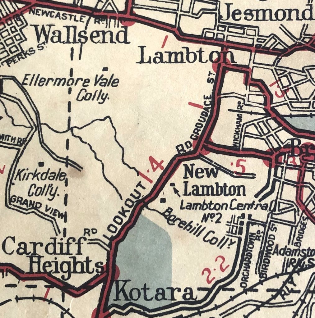
The pre-eminence of mining is starkly seen in historical land title records. For example, looking at the first purchaser of blocks of land in the township of Lambton we find a staggering 67% are listed as miners. There is a cavernous gap to the second most common occupations, carpenters and storekeepers at just 3% each. Mines were everywhere in Newcastle. Even into the 1950s road maps orientated motorists by showing the location of suburban collieries.
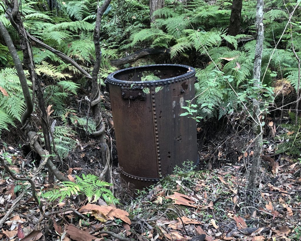
In spite of the utter dominance of coal mining, suburban development has progressively removed almost every trace of old collieries. But some artefacts survived if they were sufficiently hidden away. I recently discovered in the heart of Blackbutt Reserve a rusting iron chimney. This was a furnace air shaft of the Lambton Central colliery, who mined a seam of coal in the middle of Blackbutt from 1936 to 1942. Around 1945 they commenced mining a different seam in the same area, naming the workings Lambton Central No. 2. Coal extracted from this seam was hauled in trucks to the old Lambton colliery railway (near present day Lewis Oval) to be loaded into rail wagons. In 1947 coal from Lambton Central was being sent to Zara St power station in Newcastle East.
Lambton Central No. 3 (Rankin Park) and Lambton Central No. 4 (Cardiff) commenced around 1951, and somewhat paradoxically Lambton Central No. 1 was the last of the company’s workings to be opened, in 1953 at Kotara. This site is now the Carnley Ave picnic area of Blackbutt Reserve. While much used and loved facilities in Blackbutt have replaced the mines, hidden parts of the Reserve still preserve a few relics of our coal mining history.
The article above was first published in the February 2022 edition of The Local.
Additional Information
The history of the various “Lambton Central” collieries is somewhat difficult to pin down exactly. The original “Lambton Central Colliery” operated from 1936 to 1942, and then subsequent pits opened up by the company had a numerical suffix. Thus the second, third and fourth pits opened up, quite sensibly had the suffixes of “No. 2”, “No. 3”, and “No. 4”. But somewhat confusingly when the company opened their fifth pit in 1952 (near March St, Kotara), rather than naming it “Lambton Central Colliery No. 5”, they chose to name it “Lambton Central Colliery No. 1”, presumably to have a neat sequence of numbers from 1 to 4. (Remember that the original pit from 1936 had no numbered suffix.)
To make matters more confusing, some newspaper articles mention “Lambton Central Colliery” without any numerical suffix, and you have to work out from the context and date of the article whether that refers to
- The original 1936-1942 mine
- The company that operated the 5 different mines
- One or more of the numbered mines that operated from 1945 onwards
There are two main sources of information I have used to get a timeline of the Lambton Central Collierys:
- Newspaper articles from Trove
- The Annual Reports of the Department of Mines, available at the NSW Government DIGS website.
As most newspapers in Trove only go up to 1955, and the DIGS site only has annual reports up to 1953, it is difficult to ascertain the history of the mines after this time. There is a frustratingly brief and vague report from 10 November 1956 that states
Two northern collieries, Killingworth and Lambton Central, closed today, putting 152 mine workers out of work. The Joint Coal Board could find no markets for the collieries’ coal.
The Argus, 10 Nov 1956
It is not clear whether this refers to all the Lambton Central collieries (1-4), or just one of the pits.
The table below summarises the timeline of the five collieries, with references to newspaper articles and Department of Mines annual reports.
| Date | Lambton Central | No. 2 | No. 3 | No. 4 | No. 1 |
| Location | Blackbutt – ridge north of Richley Reserve | Near Richley reserve | North side of McCaffrey Drive | Fern Valley, Cardiff | March St Kotara |
| Years | 1936-42 | 1946-? | 1951-? | 1952 | 1952-57 |
| AR 1936 | Commenced | ||||
| AR 1938 | Discontinued. Recommenced | ||||
| 25/2/1942 | Mine to close | ||||
| 6/3/1942 | Mine closed on 5/3/1942 – two miners called up for military service. | ||||
| 13/5/1945 | Theft of parts of a haulage engine | ||||
| 5/10/1946 | Wanted. Permit manager for a small colliery to be opened up in the Lambton District. | ||||
| 20/11/1946 | Wanted. Working foreman for colliery pit top. | ||||
| 6/12/1946 | Wanted. Experienced contract miners. | ||||
| AR1946 | New Lambton | ||||
| 12/7/1947 | Wanted. Undermanager for “New colliery being developed” | ||||
| 27/10/1947 | Pit idle after fatal accident. | ||||
| 10/12/1947 | Pit idle due to heavy rains. | ||||
| AR 1948 | New Lambton | ||||
| AR 1949 | New Lambton | ||||
| 11/10/1950 | Off Aldyth-street, New Lambton | ||||
| AR 1950 | New Lambton | ||||
| 10/12/1951 | Fern Valley, Cardiff. First mention in Trove. In planning. | ||||
| AR 1951 | Electric Safety Lights in use. 19/12/51 – fire in battery boring unit | Electric Safety Lights | |||
| 26/3/1952 | Query about whether permission has been granted yet | ||||
| 14/5/1952 | permission to erect bath house in March Street | ||||
| 28/7/1952 | Idle due to transport bottleneck | ||||
| AR 1952 | Electric Safety Lights | Electric Safety Lights | Inspected. Discontinued. | ||
| 28/3/1953 | Wanted. Surface hand. March St Kotara. | ||||
| AR 1957, p.58 | Discontinued |

Lambton Central Colliery (1936-1942)
I have identified the furnace shaft that I discovered in Blackbutt Reserve as belonging to the original 1936-42 Lambton Central Colliery, on the basis of a map held in the Local Studies section of Newcastle Library.
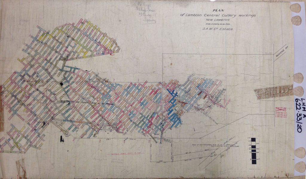
I had photographed this map several years ago but was unsure exactly how it fitted into the geography, as the only reference point on the map was Queens Rd (what part??) and I was uncertain as the units of distance (yards? feet?) used on the map.
After finding the steel chimney in Blackbutt, I remembered that the map had a furnace shaft marked on it, and suspecting it was the one I had found I overlaid the map into Google Earth, using the two points of reference I now had – the shaft and Queens Rd.
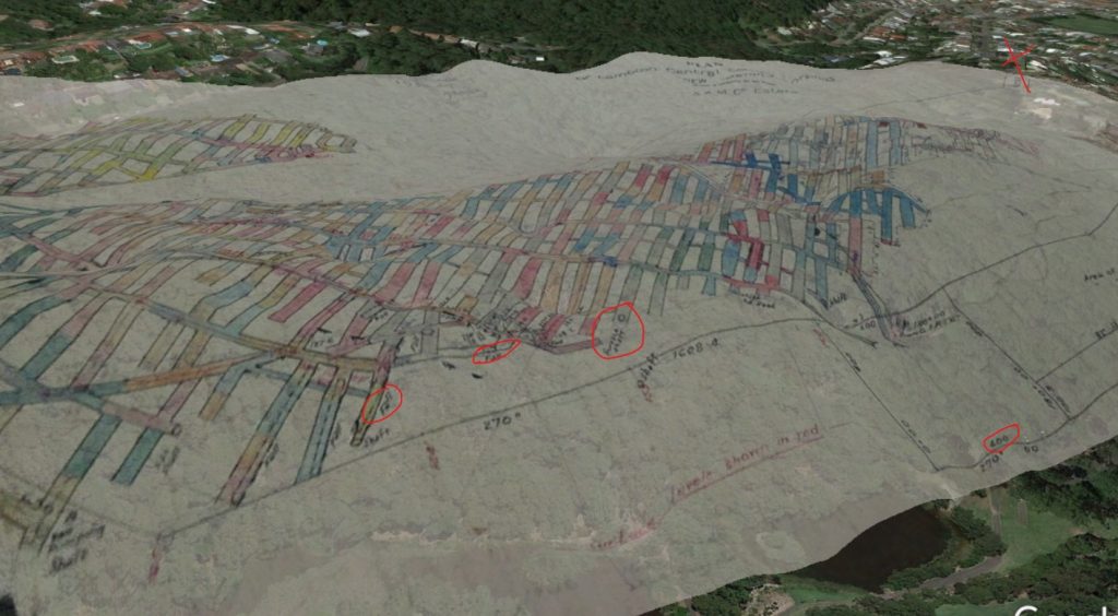
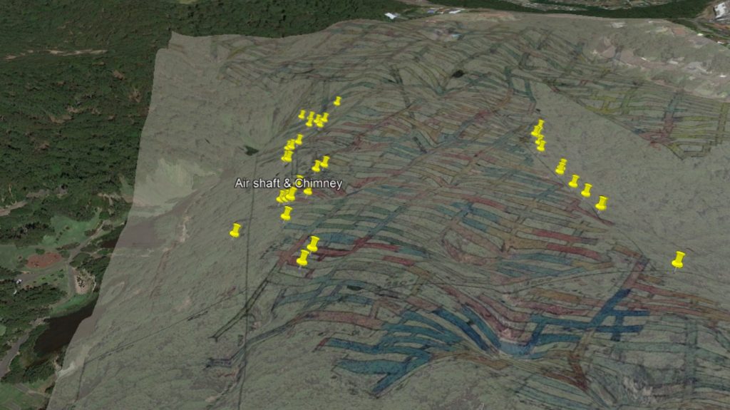
This quickly confirmed my guess about the shaft, as the overlaid map showed the mine workings correlating with the ridge running east from the top of Queens Rd, westwards to Lookout Rd. I was also able to confirm that the distances marked on the map were in units of links – where 1 link is approximately 0.2 metres.
While walking around both the southern and northern sides of the ridge I had observed quite a number of large sunken depressions that appeared to be the result of mine workings falling in. The depressions on the north side of the ridge were usually dry, but on the southern side where it is more shaded, most were filled with water from recent heavy rainfalls.
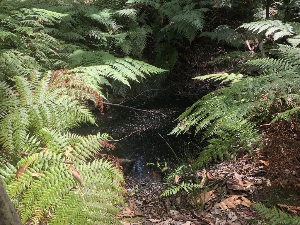
I took photographs of each depression I came to, and then extracted the GPS co-ordinates to plot them in Google Earth. When I overlaid the mine workings map the depressions I had observed lined up with the extremity of the workings, where the map has many annotations of “fall”.
Lambton Central No. 3 (1951-?)
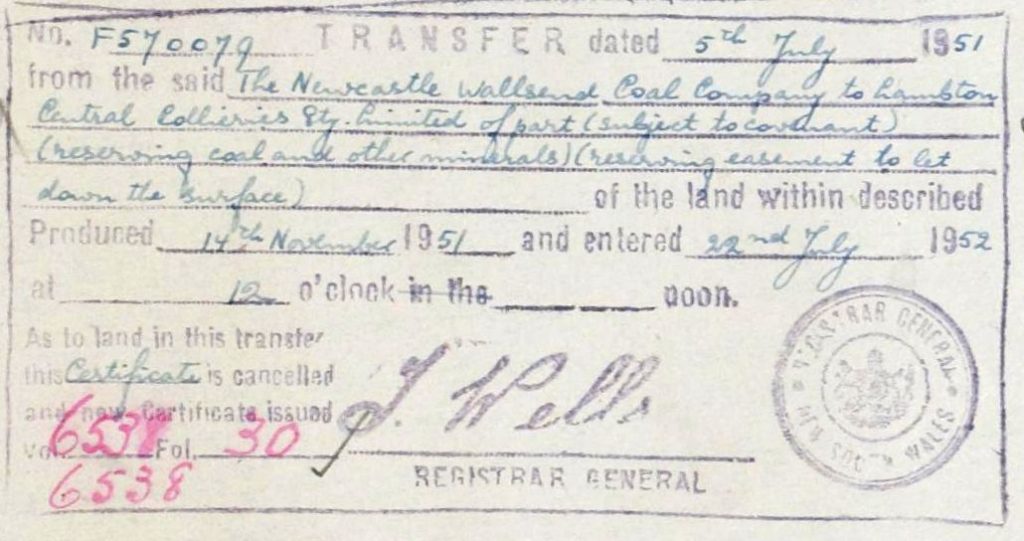
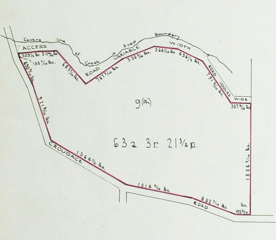
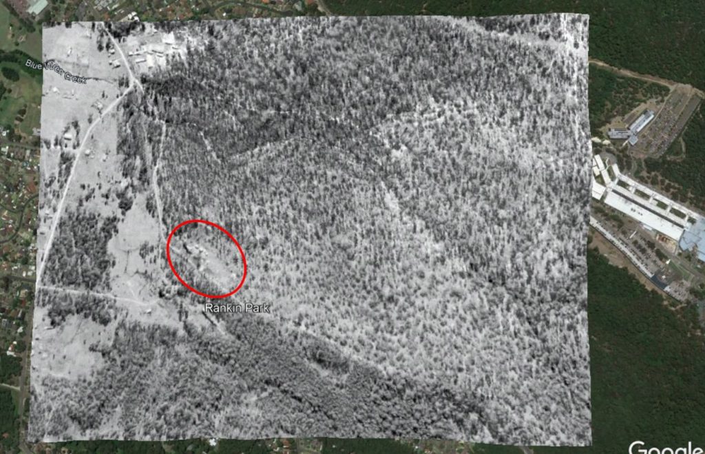
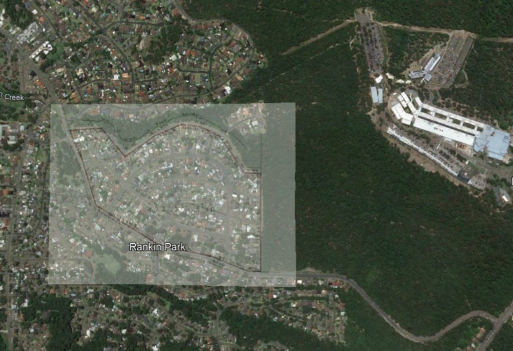
Lambton Central No. 3 colliery was an underground mine situated in the Rankin Park area, north of McCaffrey Drive. In 1951 the company purchased 63 acres of land for their surface infrastructure.
Lambton Central No. 1 (1952-1957)
The last of the Lambton Central Collieries to be opened, was somewhat paradoxically named Lambton Central No. 1. Presumably this was to fill in the gap in the numbering as the first colliery opened in 1936 had no numerical suffix. No. 1 colliery was located north of March Street in Kotara.
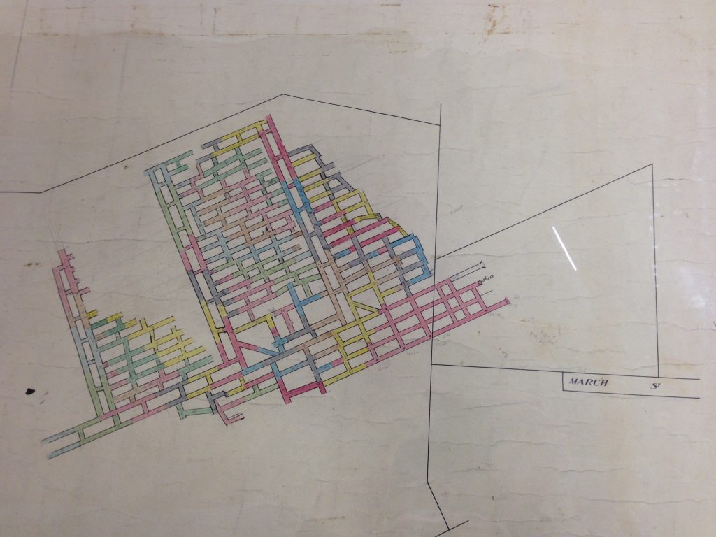
Overlaying this workings map into Google Earth shows that the colliery was working a seam of coal in Blackbutt Reserve to the west of the current Carnley Avenue picnic area.
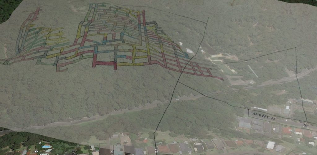
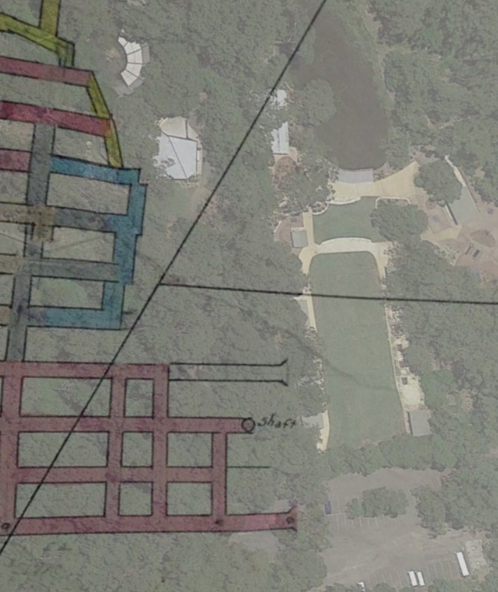
The overlay above indicates that a tunnel entrance and shaft were located somewhere near where the timber boardwalk entrance to the animal exhibits exist today. (Bear in mind that the overlay above is an approximation only, based on my best effort to align a photograph of a drawing into Google Earth, using a combination of visual alignment and dimensions marked on the drawing.)
The Department of Mines Annual Report for the year 1957 indicates on page 58 that Lambton Central No. 1 discontinued operations in that year.
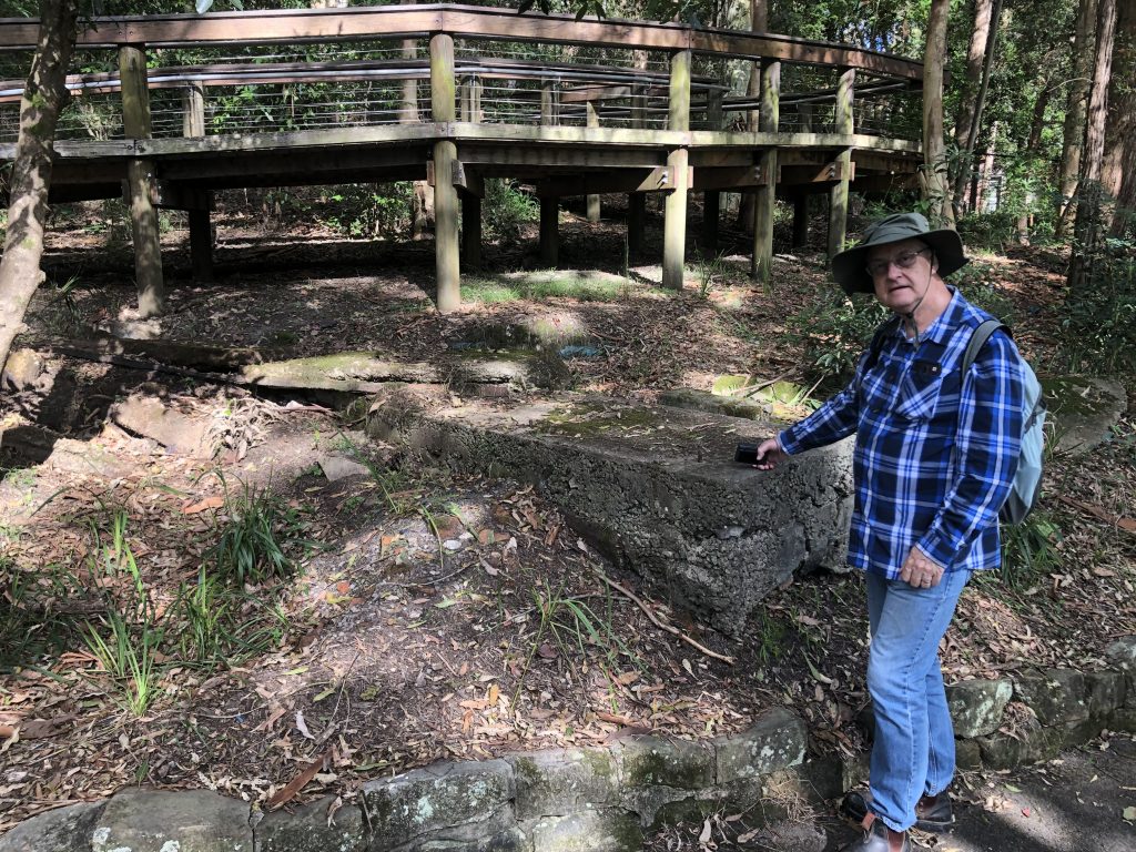
Below the boardwalk today, there still exists some old concrete footings belonging to some part of the coal mine’s infrastructure.
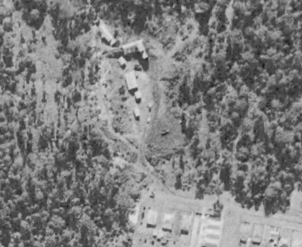
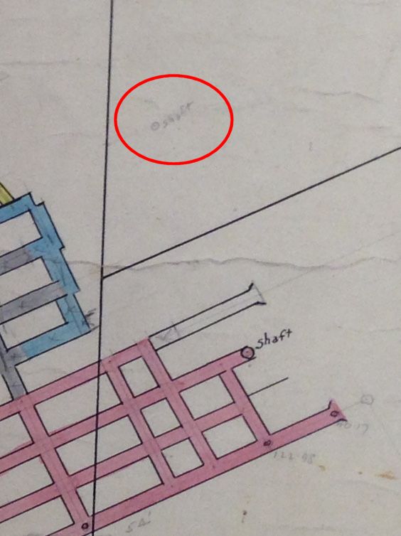
One final point of interest on the workings map of the Lambton Central Colliery No. 4, is that some 70 metres to the north of the shaft and tunnel, someone has pencilled in an annotation of another shaft. The position of this annotation aligns exactly with the old Mosquito Pit shaft (of the original Lambton colliery) that was discovered by Newcastle Council in 2014 during renovations of the picnic area.
Newspaper articles
| Article Date Event Date | Notes |
|---|---|
| 25 Feb 1953 | "Borehill and Lambton Central are two small collieries with main tunnels, about 70 yards apart. Both enter the one hill and work on the one seam. But the production cost of one is 16/ a ton more than the other." |
| 10 Nov 1956 9 Oct 1956 | "Two northern collieries, Killingworth and Lambton Central, closed today, putting 152 mine workers out of work." |


Hello,
Very interesting articles and research, thanks!
Do you happen to know at what depth beneath the surface these various Lambton central collieries are?
I don’t have any information on the working depth of the Lambton Central Collieries, except for the original 1936-1942 mine, where it was working a shallow seam along the ridgeline, probably no more than a few tens of metres below the surface.
Article on Lambton Central Mines
For years I’ve been trying to figure out what a mine off the end of Ridgeway Road New Lambton Heights is. The tunnel runs parallel with the track at the end of Ridgeway road (on left side going down the track) and approx 10-20 metres in. The entrance is about 100-200m down the track where there is a cut into the hill. It appears they hauled coal down onto another track that came out on addison road New Lambton. (near the entrance a section of roof has collapsed and you can peer in along the tunnel) . Could this mine be South Lambton Colliery or Lambton Central no 2 Colliery ?
The plan diagram at https://search.geoscience.nsw.gov.au/report/R13219270 suggest that the workings at that location belonged to the “South Lambton” colliery. I have tried in the past to find out more information about this colliery, but without success.