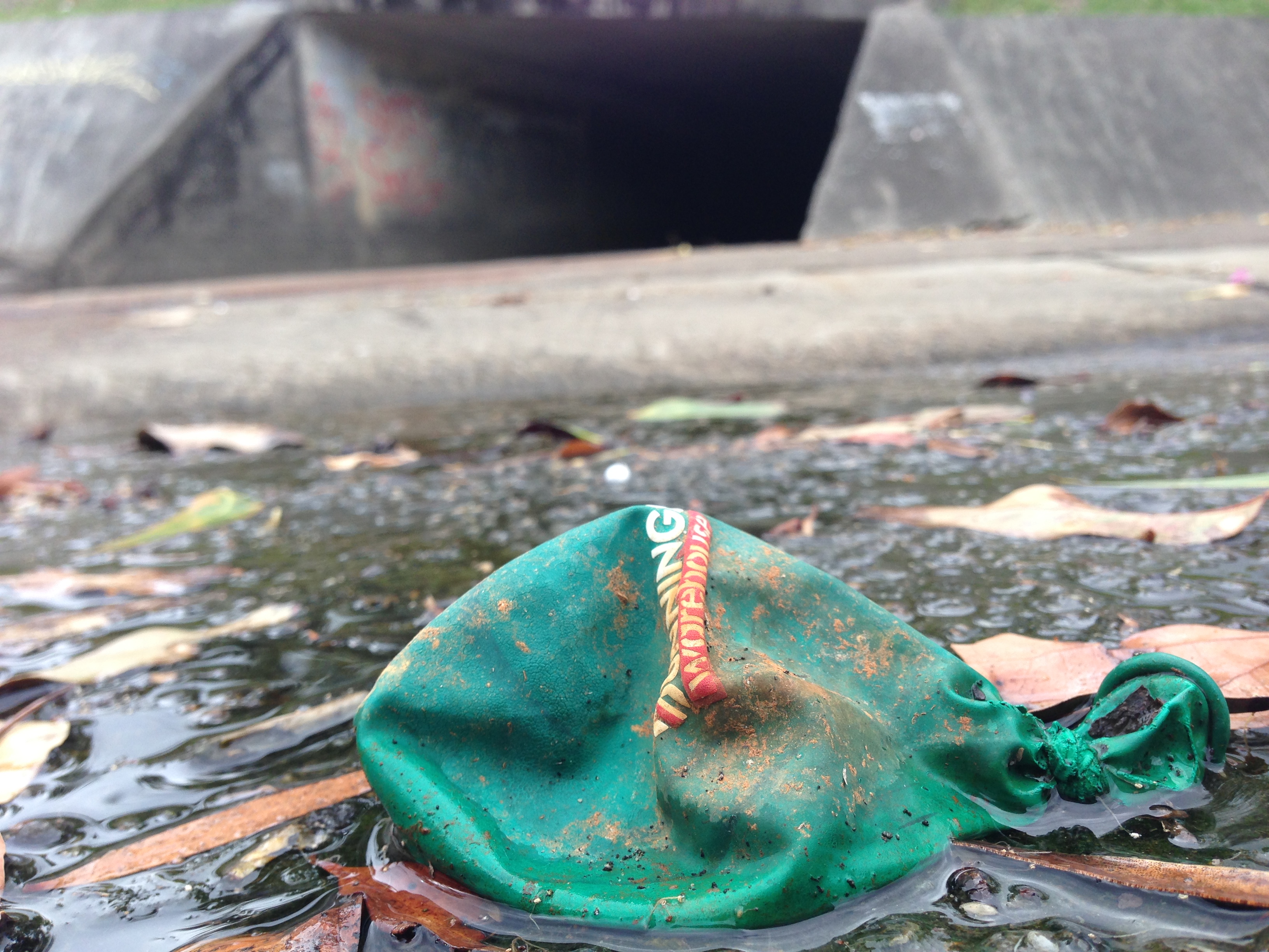
No Christmas baubles. But I did find something with red and green.
Deflated hopes.
I’m sure there’s a metaphor lurking in there somewhere – something about the deflated hopes of an over-commercialised society limp and prostrate before a yawning abyss of darkness.
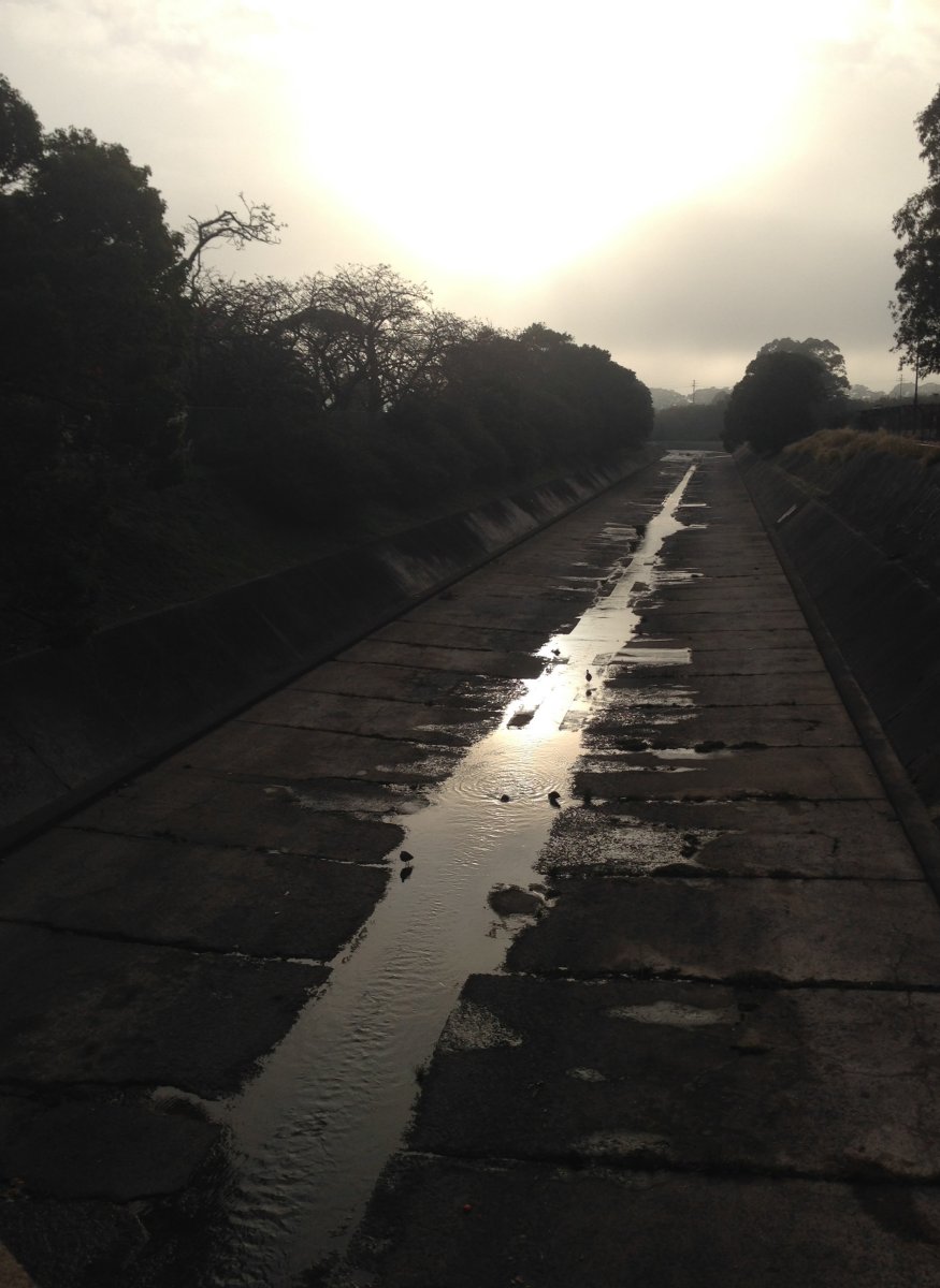
unvaporia – noun. The delicious tingling sensation on a cool foggy winter’s morning when the mist clears sufficiently for the warmth of the sun to be felt on the face for the first time.
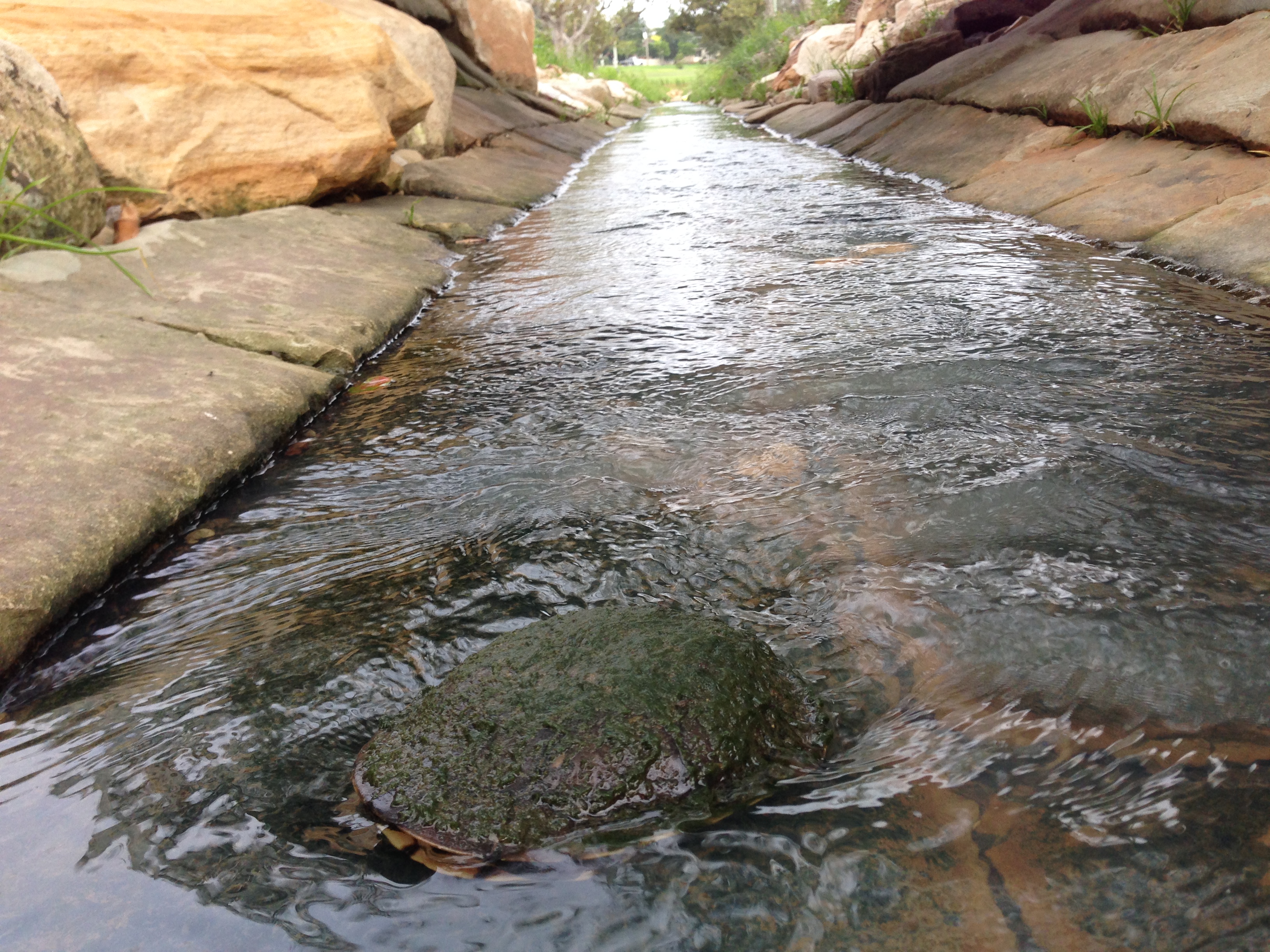
After the recent east coast low, Styx Creek in Hamilton North is looking comparatively beautiful – enough rain to wash the crap out, but not enough rain to wash more crap in.
It happened again this morning on my way to work. An elderly man (not the same man as before) doing his ‘civic duty’ by throwing rubbish into the drain beside Hunter Stadium. This time however, I foolishly decided to challenge him about this, and in return copped a gobful of abuse telling me to mind my own f****** business.
As I rode away afterwards I reflected … I’m a human being living on this planet … it IS my business to care about how humanity is trashing the planet.
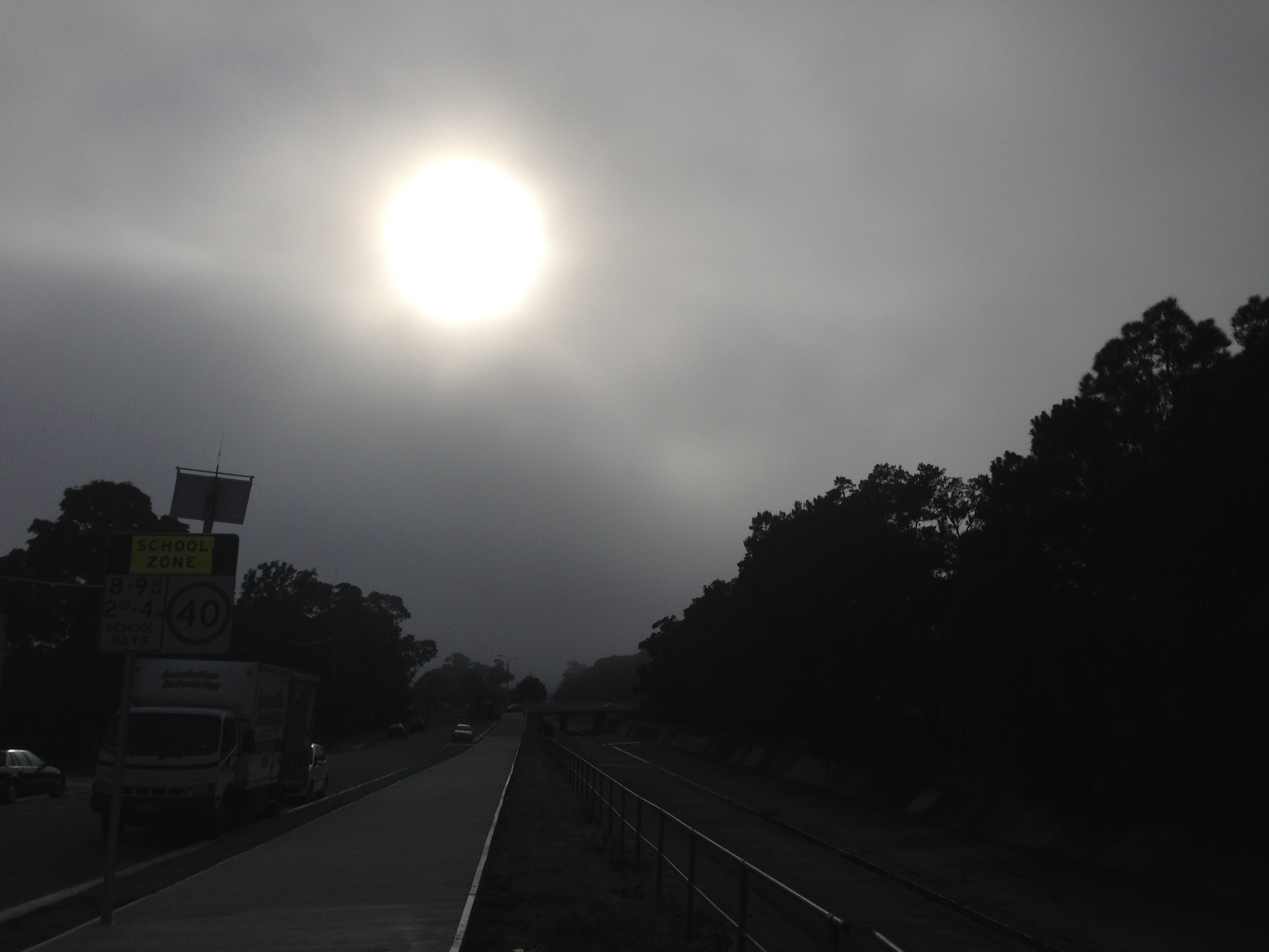
As rich as the English language is, sometimes there are moments where there is no English word available to adequately describe that experience. I had two such moments on my cycle to work this morning.
Firstly, that moment, when you’re out on a foggy morning, when the mist disperses sufficiently for you to feel the warmth of the sun on your face for the first time. A subtle, but truly delicious moment that deserves its own word in the English lexicon.
Secondly, only moments before I took the photograph above, an elderly gentleman walking along saw some litter on the path (an empty beer can), and in a ‘civic minded’ gesture dealt with it by picking it up and … throwing it in the Styx Creek drain, the satisfied look on his face betraying his obvious belief that in throwing the can there he had somehow magically made it disappear! Surely the English language has space for one more word to describe this particular kind of insanity?
Although I didn’t intend it when I set out, a bike ride with my son around town today ended up visiting various sites in Newcastle matching the old photos in my previous drain blog post. Here’s the “Then and Now” comparisons.
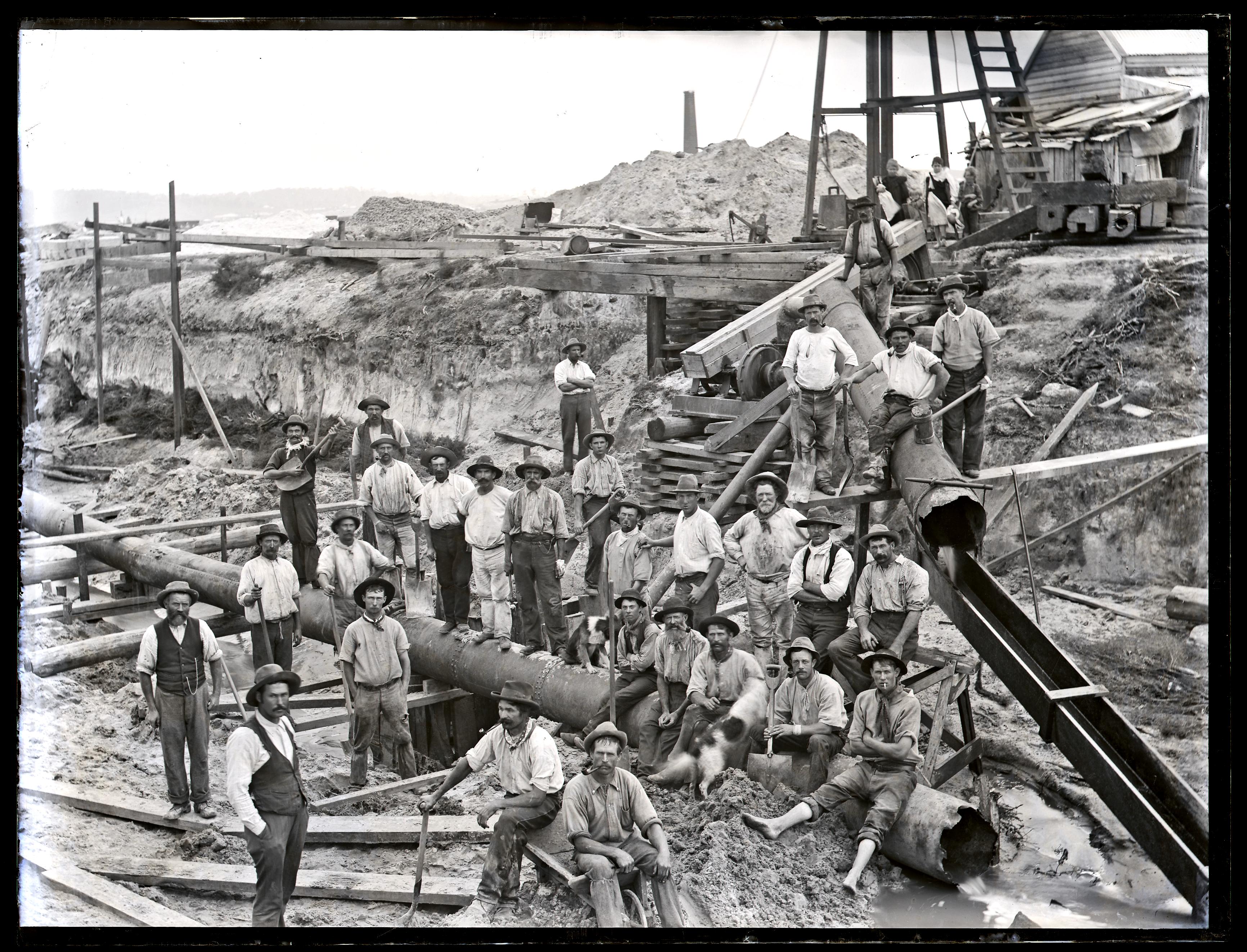
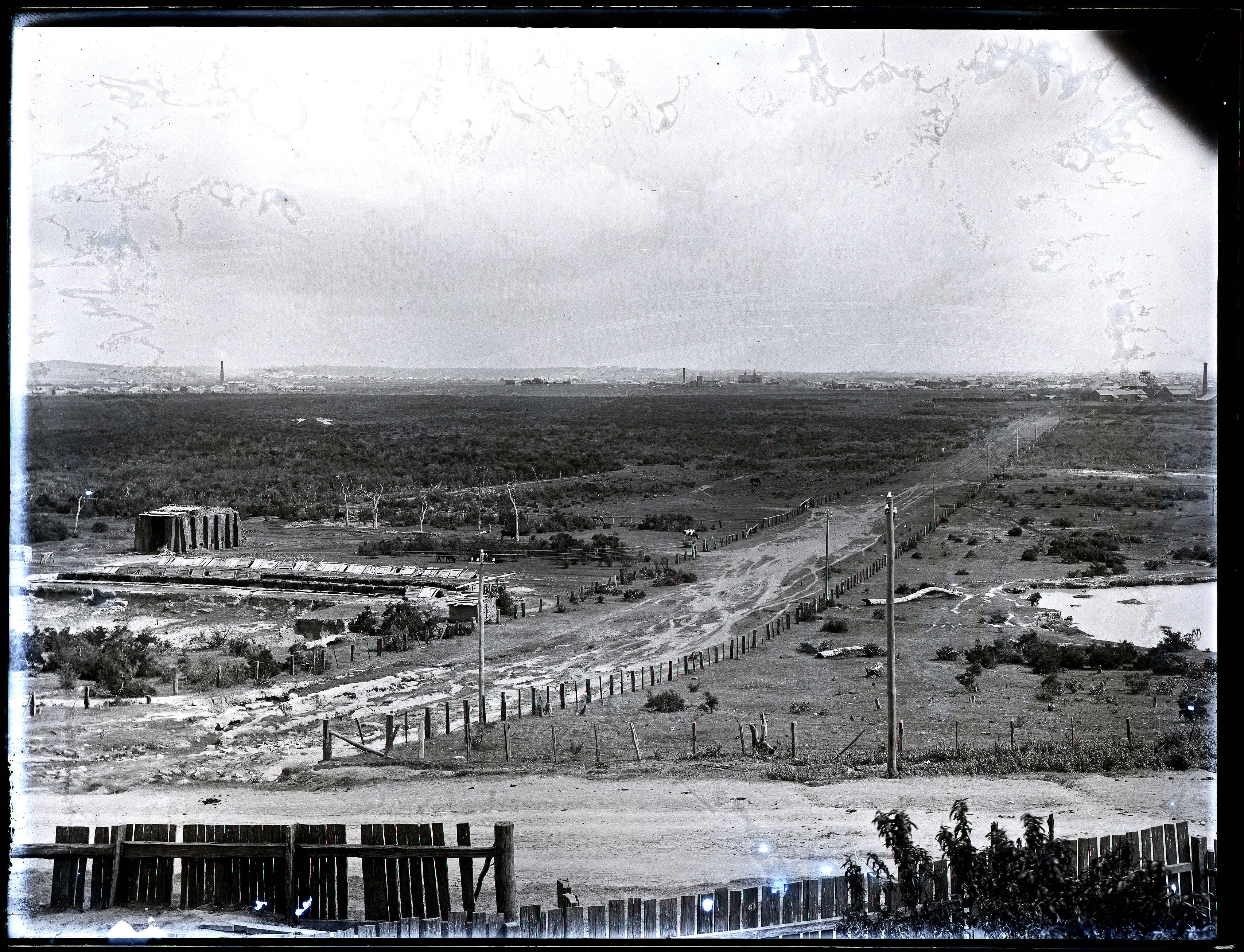
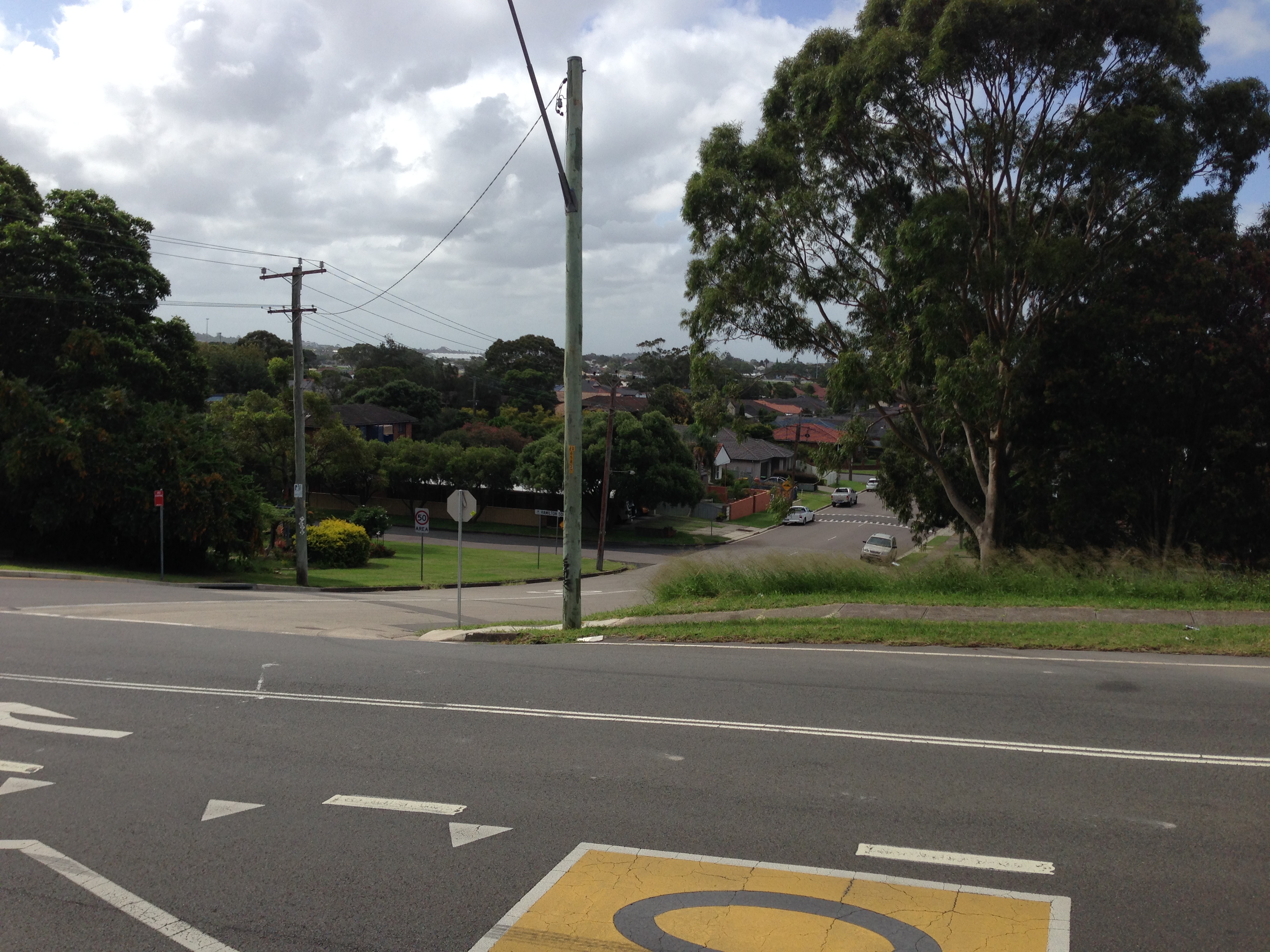
Broadmeadow drain
Drain construction workers at Broadmeadow, NSW, 6 April 1900
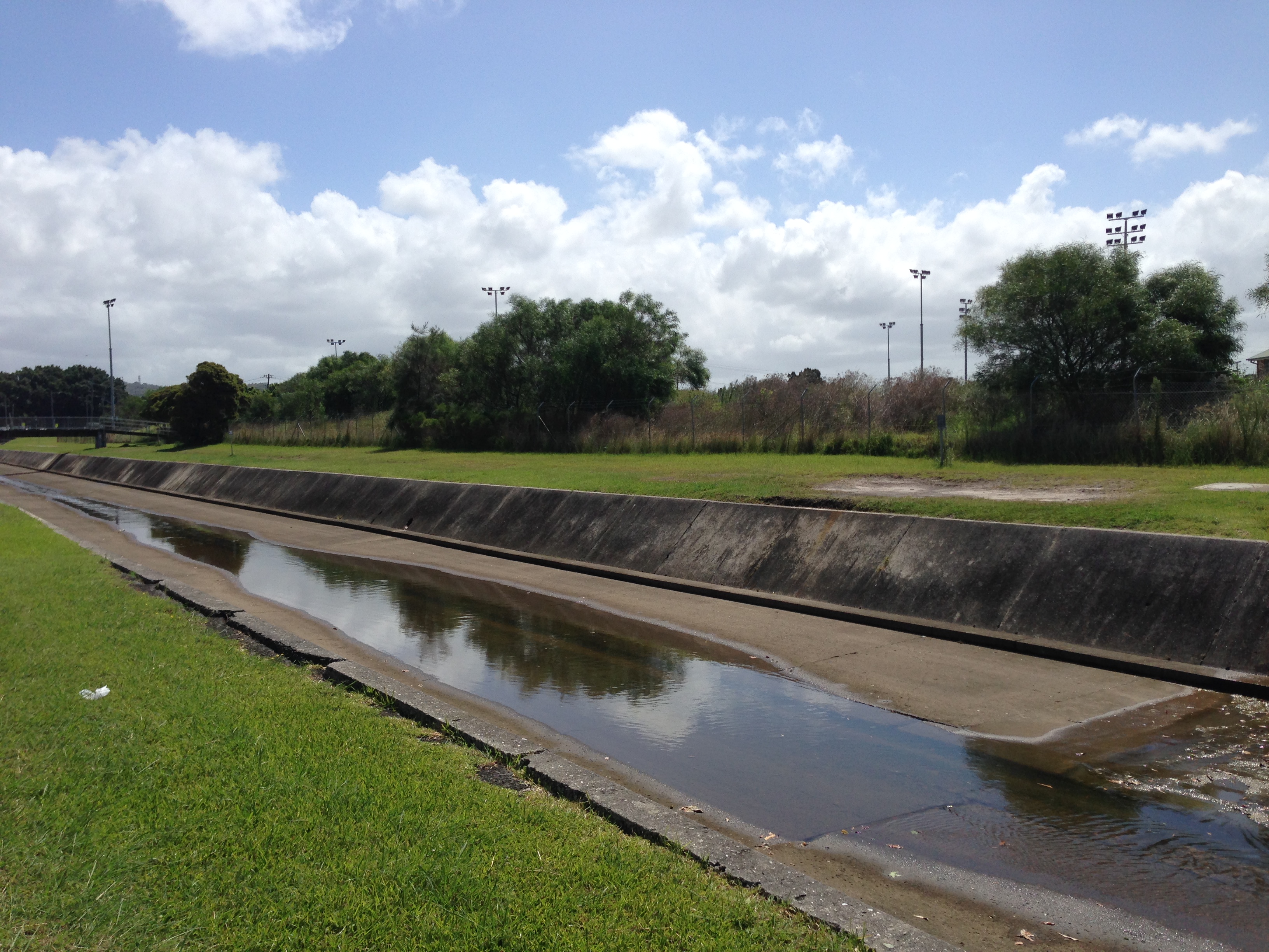
Broadmeadow drain, 6th February 2016.
The stormwater drain at Hamilton North, March 2017.
Update, March 2017: With subsequent research I have found that the location of the 1900 Snowball photo was Hamilton North, not Broadmeadow.
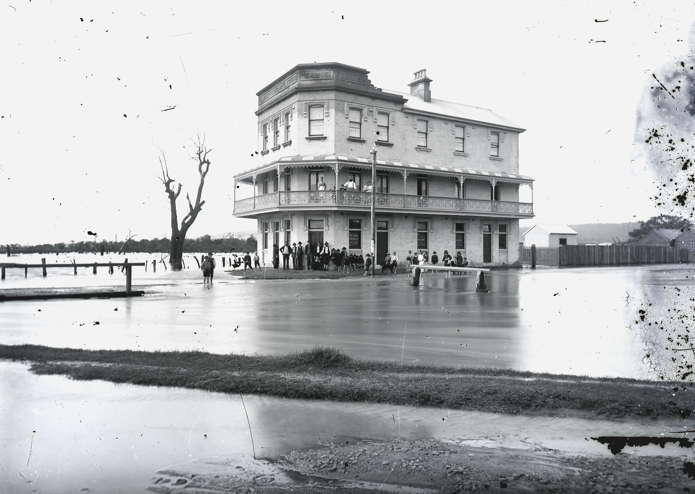
The Premier Hotel
Premier Hotel, Broadmeadow, 1892. Photo by Ralph Snowball. University of Newcastle Cultural Collections.
Premier Hotel, 6th February 2016.
View of the lowlands from Glebe Road
The Newcastle lowlands. 1897. Photo taken from intersection of Beaumont St and Glebe Rd looking north towards Hamilton. University of Newcastle Cultural Collections.
Looking north from Glebe Rd towards Hamilton. 6th February 2016.
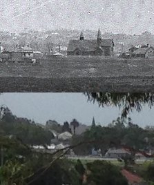
This modern view bears almost no resemblance to the 1897 photo, with the previously deserted lowlands now covered with trees, suburbia and industry. The only visible match (apart from Beaumont St sloping down the hill) is a spire of St Peter’s Anglican church in Denison St Hamilton.
St Peters Anglican Church Hamilton
St Peter’s Anglican Church Hamilton.
It seems that at some time the church has lost one of its spires.
Back in 2014 a change of residence meant that my bicycle commute to work changed to a route that took me alongside long stretches of the concrete drains that spider across the low lying Newcastle suburbs. For 85% of my commute to work I am within 200 metres of one of the concrete drains, or Throsby Creek.
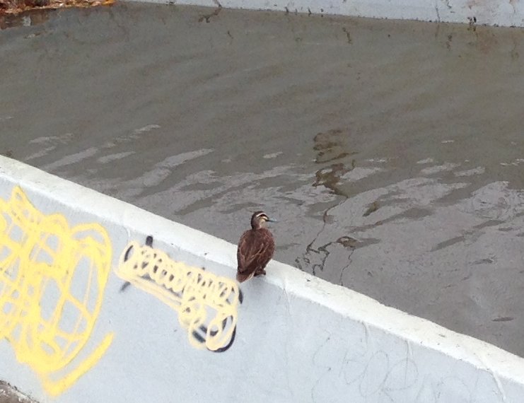
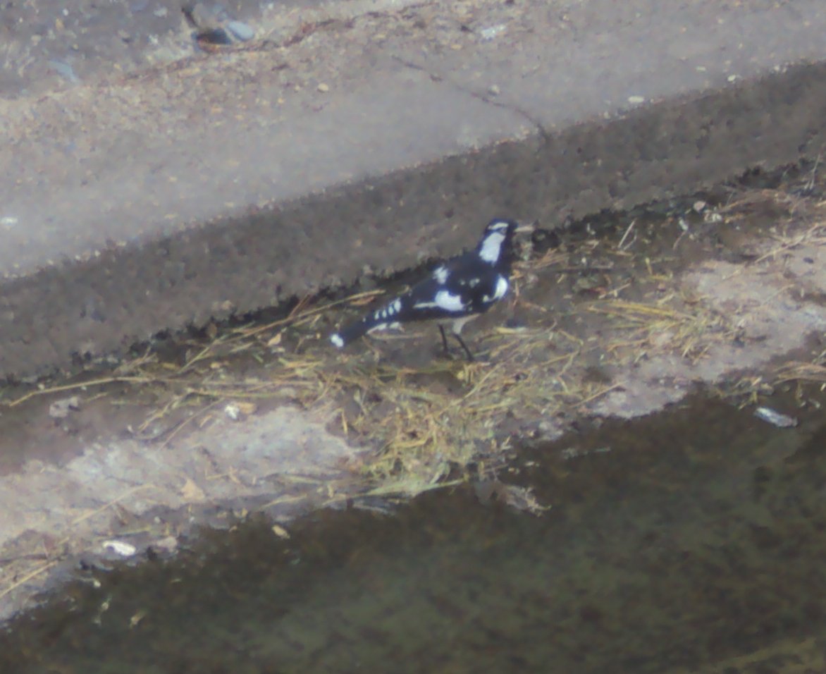
In a recent conversation with a friend when I mentioned this, they responded with some expression of sympathy and sadness that I had to endure such an ugly travelling companion. As I reflected on this reaction I realised that although the drains are not exactly the most aesthetic feature of our city, there are a number of positives.Firstly, cycling alongside the drains offers relative serenity, in comparison to busy roads. Secondly, the drains often attract a variety of bird life – ducks, ibises, some other kinds of birds, the black and white ones, the fast darting ones, as well as those little fluttery ones. (As much as I like birds, you might correctly guess I’m no ornithologist!)
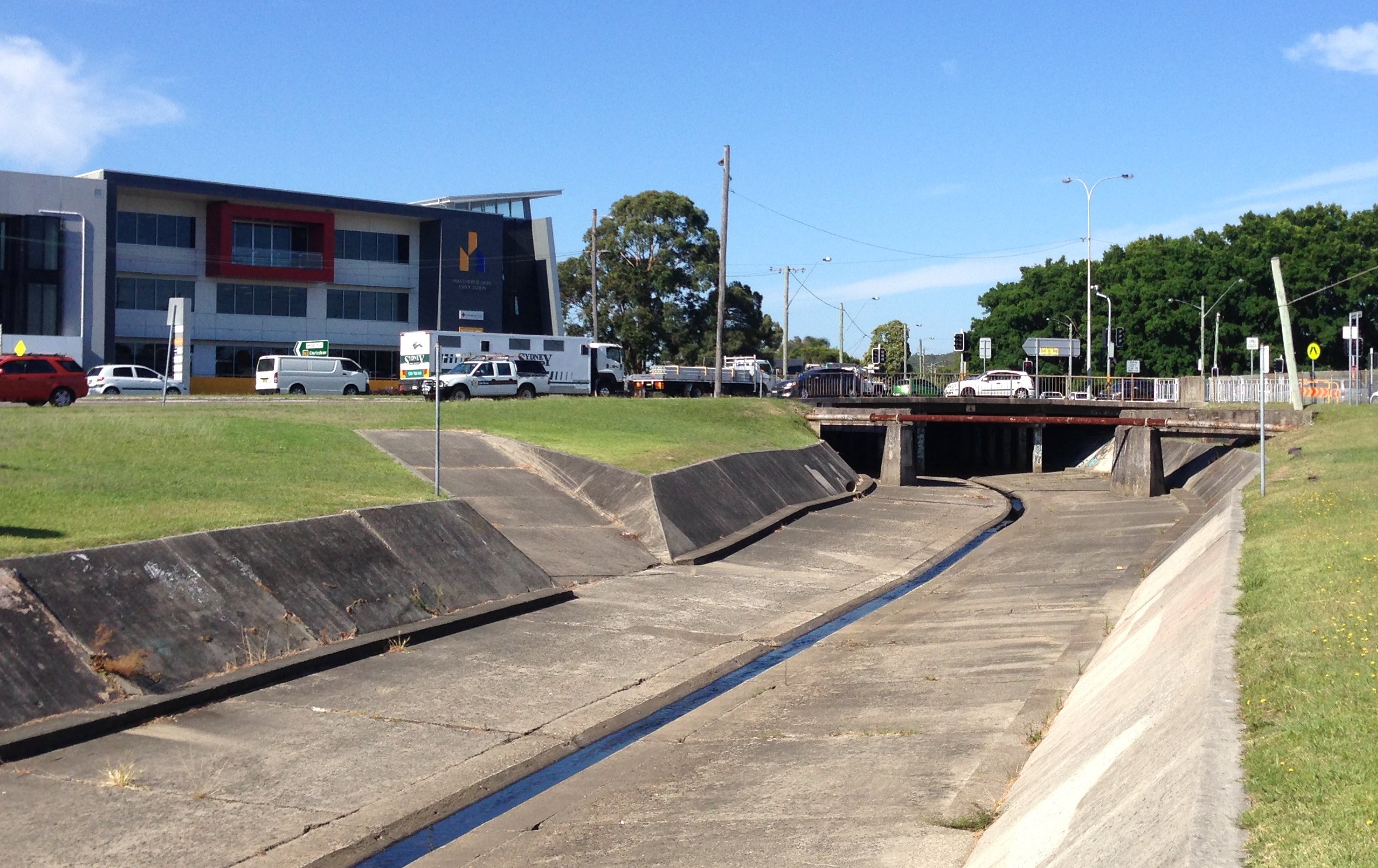
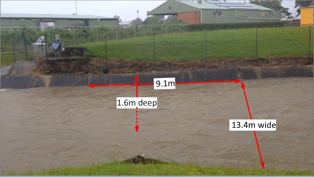
In thinking about the concrete drains I’ve also been pondering their principal purpose – to drain away water. In the downpours of January 2016 I saw this fully in action, and recorded this video of the drain in Broadmeadow near the rescue helicopter base.
It got me thinking. How much water was being carried away each second? Stepping through the frames on the video I was able to see that it took 2.94 seconds for the flow to pass from one concrete seam in the drain to the next. A visit to the drain a few weeks later (when it was dry) to take some measurements revealed the following.
[ Note that all these measurements and calculations are ‘back of the envelope’, ‘ballpark figures’ for the purpose of gaining a broad sense of the capabilities of the drain, and not a precise hydrological survey. ]
I’ve also been pondering the economic benefit of these drains. Prior to their construction from 1895 onwards, the lowlands of Newcastle were regularly turned into a useless boggy swampland. A 1892 description of Broadmeadow states that:
“When there are heavy rains the water comes down in such a way as to flood the streets and property, the water being sometimes 12 and 18 inches deep on the streets.”
Premier Hotel in Broadmeadow surrounded by flood waters in 1892. Photo by Ralph Snowball. University of Newcastle Cultural Collections.
The 1897 Ralph Snowball photograph below looking from Glebe Rd Merewether across to Hamilton graphically illustrates the large plain of unused and unusable land, and with the roads suffering significant water erosion.
The Newcastle lowlands, 1897. Photo taken from intersection of Beaumont St and Glebe Rd looking north towards Hamilton. University of Newcastle Cultural Collections.
Even as construction was progressing the economic benefit of drainage was clear to see, with an 1897 newspaper report on the extension of the system into Adamstown noting that:
“Its construction will prove a great boon to those residing on the lowlands, and should increase the value of property materially.”
Drain construction workers at Broadmeadow, NSW, 6 April 1900. University of Newcastle Cultural Collections.
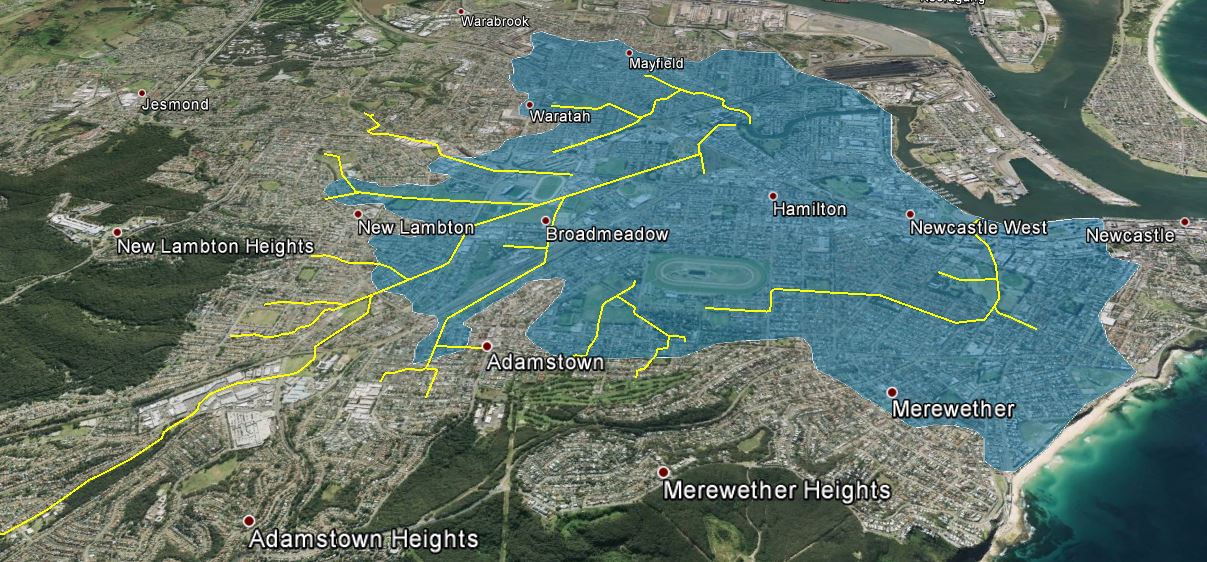
The question then is what is the area of the “lowlands” that are emptied by the drainage system? Browsing the altitude data in Google Earth, and observing the landscape around town, 15 metres above sea level seems to be the inflection point where a gradual rise in elevation across the plains changes to a steeper inclinaton of the surrounding hills and ridges. Using Google Earth I marked with yellow lines the concrete drains, and mapped out in blue the area of the drainage basin that is 15m or less above sea level. This area totalled approximately 1850 hectares. [ KML file viewable in Google Earth ]
[ Note, as before, this mapping is a rough approximation for the purpose of gaining a broad sense of the capabilities of the drainage system, and not a precise hydrological survey. ]
Newcastle concrete drain system. Area shaded blue is 15m or less above sea level.
As an aside, when I first viewed the map of the drains against the shaded lowlands, it immediately struck me that there is a large area centred on Hamilton that has no open concrete drains, and my recollection is that in the June 2007 Pasha Bulker storm, Hamilton was one of the main areas of flooding. Coincidence or not? I don’t know, as I keep reminding you, I’m not a hydrologist.
Nor am I an economist. With that final disclaimer out of the way I can now ask, how much is all that land worth? What is the monetary value of the land made productive by the open concrete drain system? As an example of land values, the NSW Valuer General shows that in 2015 a 424 m2 area of land in Hamilton North had a value of $327,000. This equates to $771 per square meter, or $7.7 million per hectare. If we assume that only 75% of the 1850 hectares is usable (allowing for roads, creeks, etc) then the total land value of the lowlands shaded in the map above is … 10.7 billion dollars!
So the next time you pass one of those ‘ugly’ concrete drains … give a bit of respect.
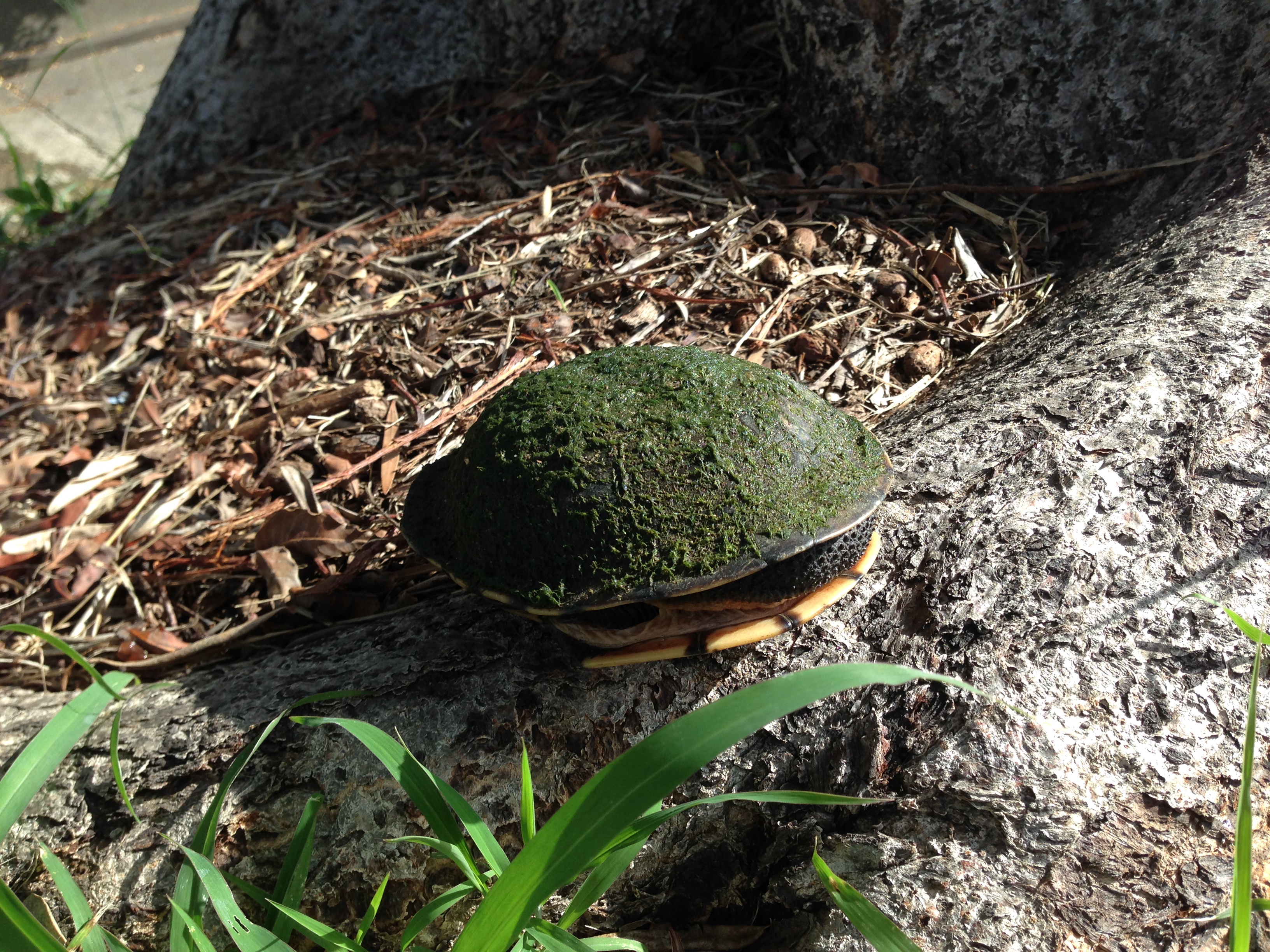
Cycling home from work this afternoon I found this tortoise, on Bates Street Hamilton North, rapidly dehydrating in the heat of today, and in a prime position for being run over by a car. I placed her1 beside the road under a tree and verified that I was looking at a live’n and not a dead’n, and then pondered for a while.
I’m guessing that with the recent heavy rains she’s been washed down the drain and eventually managed to crawl out in Hamilton North. I wondered what to do for a while – putting her back in the bare concrete drain nearby didn’t seem suitable, so I carried her upstream in my lunchbox, and released her in Kerai Creek in Lambton Park, which is looking pretty nice after the recent restoration work by Hunter Water.
I went back later in the evening with my daughter to see how she was going, and found her lying submerged in the middle of the flow, and my immediate thought was “oh no, she’s slipped in and drowned”, but on picking her up she poked her head out slightly and gave me a healthy but exasperated “not you again” look.
My daughter has named her “Flo”.
1. Actual gender unknown. Assumed gender for narrative purposes.