Hollywood revisited

A few weeks ago I met up with Mike Scanlon from the Newcastle Herald, and we had a pleasant chat about a number of local history subjects, including the depression era shanty town “Hollywood” near Jesmond Park, which I wrote about last March. Mike has made use of some of my material in his article in the Herald today and made it available to a wider audience.

You can check out my page on Hollywood for further background information and photos, and also leave comments there. You can also read my monthly column for the Lambton and New Lambton Local, “That was then, this is now”, which focuses on the history of these suburbs, as well as other blog articles on the local history of Newcastle.

Fragmentary remains of human habitation, in “Hollywood”.

Why?

Newcastle Council are at it again, upgrading cycle paths where it’s not really needed. This time it’s the cycleway from Hunter Stadium through to Broadmeadow, alongside the stormwater drain.

I’ve cycled this route twice every weekday for eight years, and apart from the grass encroaching in a couple of places, and a few minor lumps from tree roots, the path seemed fine to me. It never once entered my mind that this section of path needed an upgrade.

There are lots of other places however where I have thought that. One example is just on the other side of Turton Road, where the path travels alongside the New Lambton sporting fields. The path here is perfectly adequate, but the drainage certainly isn’t. Every time there’s heavy rain, water trickles off the sporting fields and across the path, turning it into a slimy slippery mess for days afterwards. Why couldn’t the money be spent there where it would actually make a difference?
As before I suspect the problem is that the cycling infrastructure budget is too small to do anything worthwhile, so council are left to spend the money on projects that aren’t worthwhile.

Update 27th June 2017

The path reconstruction is completed and now open.

Feeling Flat

It’s not just the weather bringing me down today. Two minutes into my ride home from work my bicycle got into a somewhat unfair battle with a stray nail on the road.

I’ve never experienced a tyre go flat so quickly before. It went from intact to fully deflated in under a second. Fortunately it happened at one of the few times today when it wasn’t raining, so I was able to change the tube and get under way again without too much bother.

Birdwood Park

In this weekend’s article in the Newcastle Herald, Mike Scanlon writes about the restoration of the Birdwood Flag, made in 1917 for General Sir William Birdwood. In the article Mike mentions that

“The now truncated Birdwood Park in the West End is probably named after this popular WWI general.”

Searching Trove I found that the park was constructed by Newcastle Council in 1892, was originally called “West End Park” and covered three acres.

Newcastle Morning Herald, 14 Apr 1892, p4.

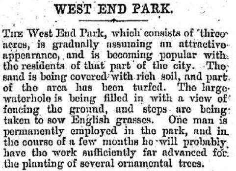
Newcastle Morning Herald, 17 Nov 1892, p8.

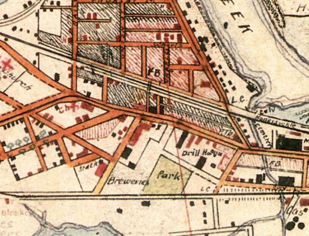
Corporal Barrett’s 1910 map of Newcastle shows the trapezoid shaped park adjacent to the brewery, with the modern King and Parry streets yet to be built.

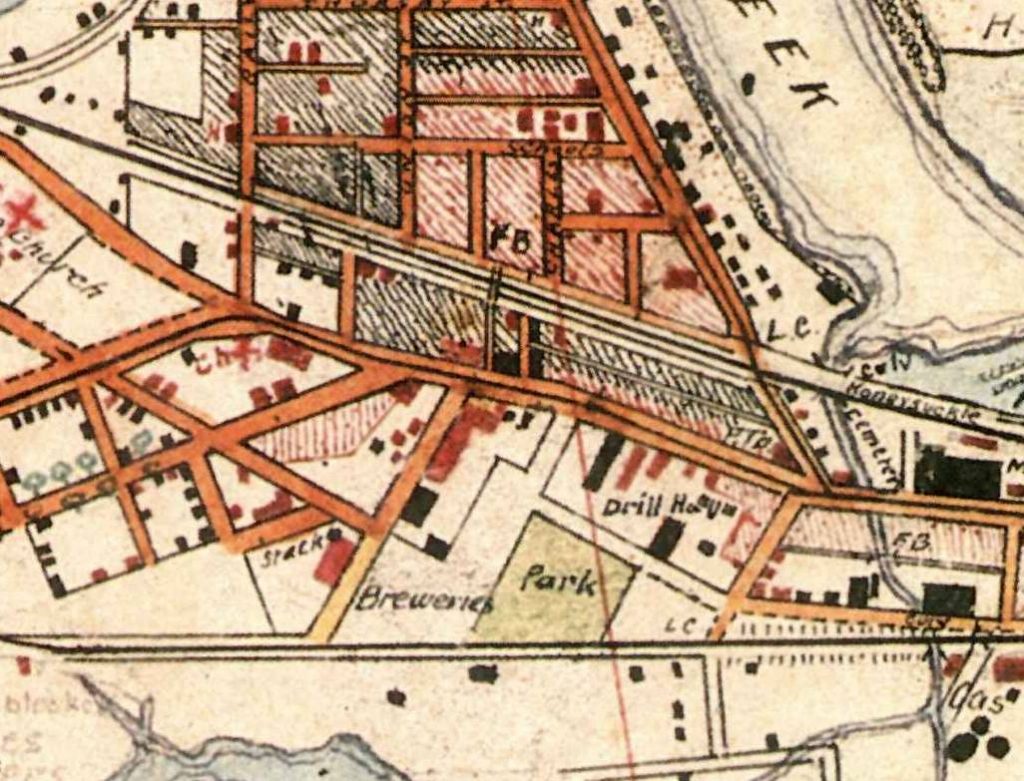
Overlaying the 1910 map into Google Earth we can see that the park originally extended further to the south of present day King and Parry streets.

1910 map overlaid into Google Earth, showing location of West End Park.

Using Google Earth Pro’s area measurement tool, the area of the park in the 1910 map shows as 3.2 acres, which corresponds well with the three acres mentioned in the 1892 newspaper article.

Area of West End Park in 1910.

In August 1920, Newcastle Council renamed the park to “Birdwood Park”.

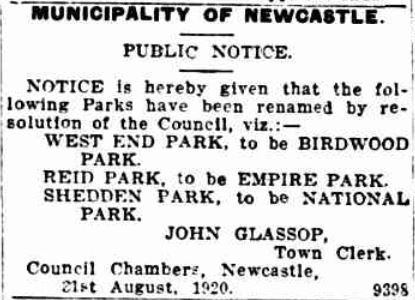
Newcastle Morning Herald, 1 Sep 1920, p6.

Although it is not explicitly stated that this renaming is in honour of General Birdwood, that is almost certainly the reason for the name change. In just the year before, New Lambton Council had renamed one of their streets in honour of the WW1 general.

A real estate poster from 1924 shows that the construction of Parry St (and a narrow diagonal section of King St) has truncated the park, reducing its size to about 2.6 acres.

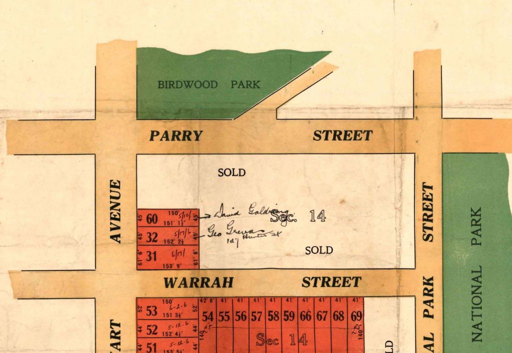
Real Estate Poster from 1924, showing Birdwood Park.

An aerial photograph from 1944 nicely shows the shape of the park at that time.

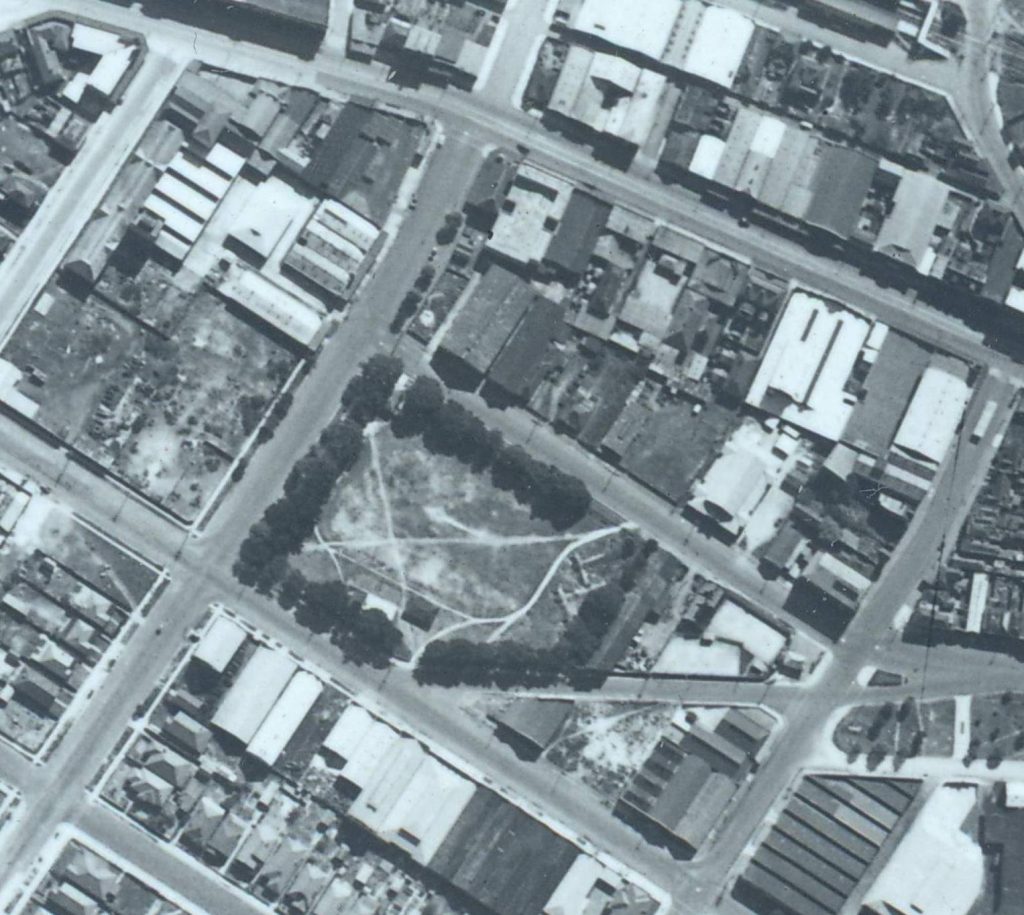
Birdwood Park, 1944. Newcastle Region Library, Local Studies.

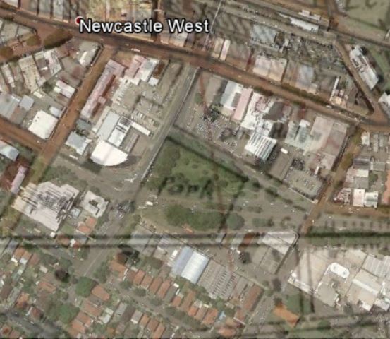
A later re-alignment and widening of King St resulted in a further truncation of the park, down to its present size of about 1.8 acres.

Birdwood Park in 1944, with the outline of the present day streets.

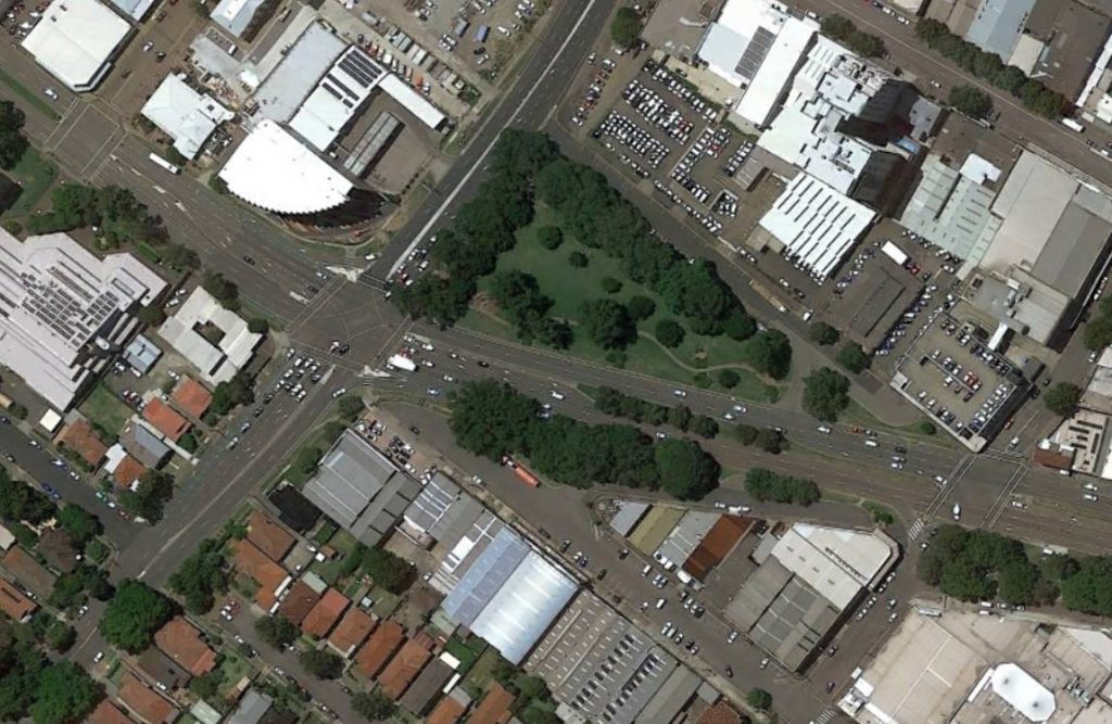
Birdwood Park 2016. Google Earth.

Resources