 Merry Christmas from the Wetherall’s (and the cat). Also don’t miss appreciating the Escheresque reflection in the Christmas bauble.
Merry Christmas
Reply

Merry Christmas from the Wetherall’s (and the cat). Also don’t miss appreciating the Escheresque reflection in the Christmas bauble.
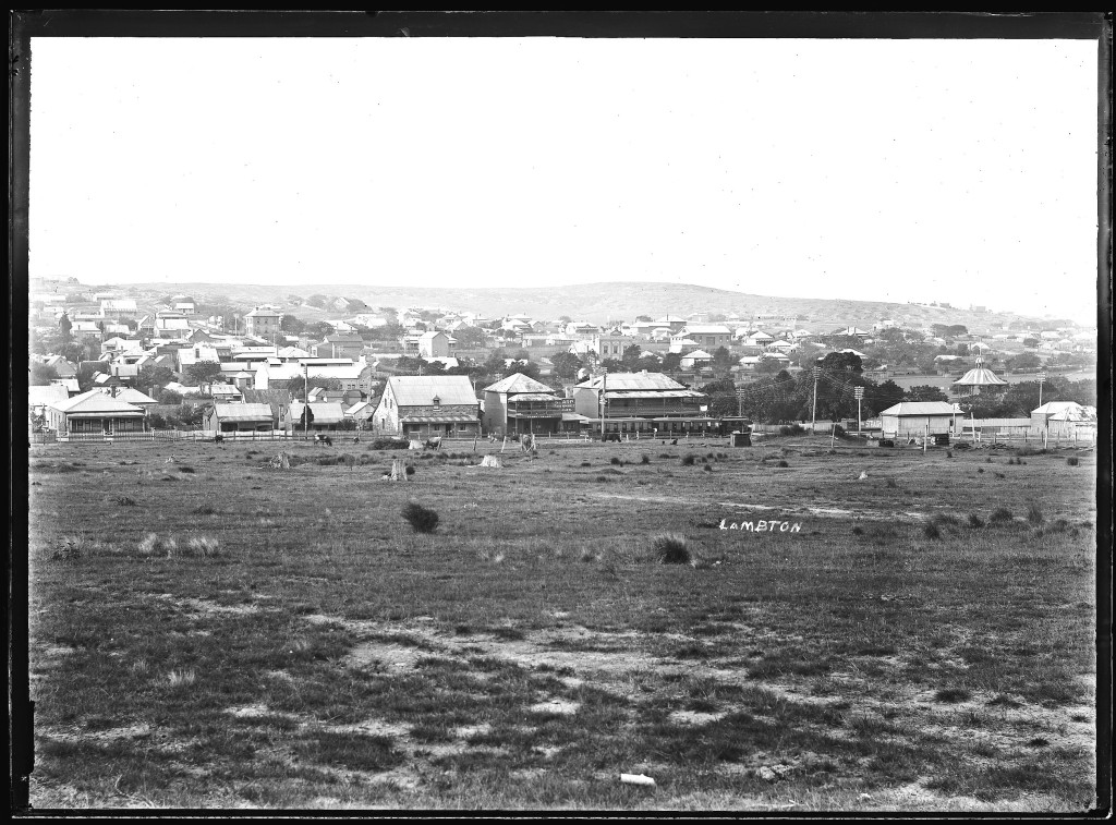
Photo by Ralph Snowball. University of Newcastle Cultural Collections.
 The site where the original photo was taken is now houses. This photo is as close as I can get to the original location. Still visible 102 years on, are the old Post Office in Morehead St, the old stone house in Howe St, and if you look carefully the roof of the old Red Lion Inn on the corner of Morehead St and Newcastle Rd.
I was able to make a reasonable guess at the location the 1912 photo was taken from by triangulating from known points (Post Office + stone house, Mechanics Institue + Lambton Park Hotel, Rotunda + Morehead/Howe intersection) and drawing those lines onto a Google Maps image.

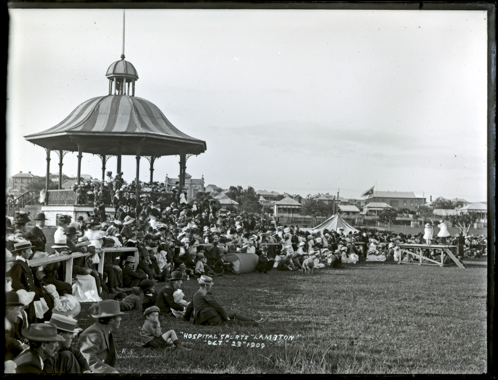
Rotunda, Lambton Park. Photo by Ralph Snowball, University of Newcastle Cultural Collections.
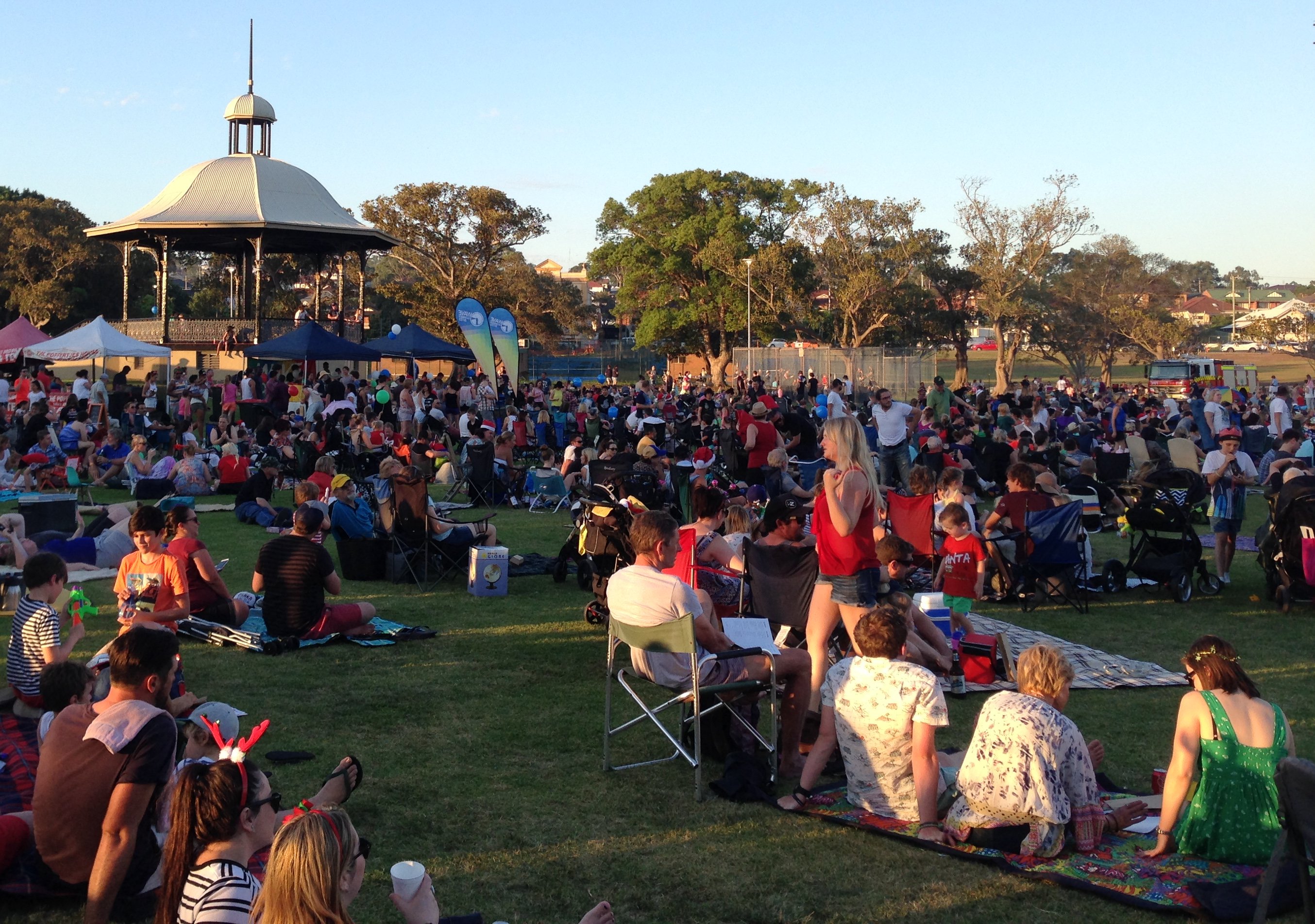
Hunter Bible Church Carols in the Park, 20th December 2015.

Photo from the same spot in 2014. The Old post office is still visible to the left of the rotunda. The Mechanics Institute building is hidden behind the trees.
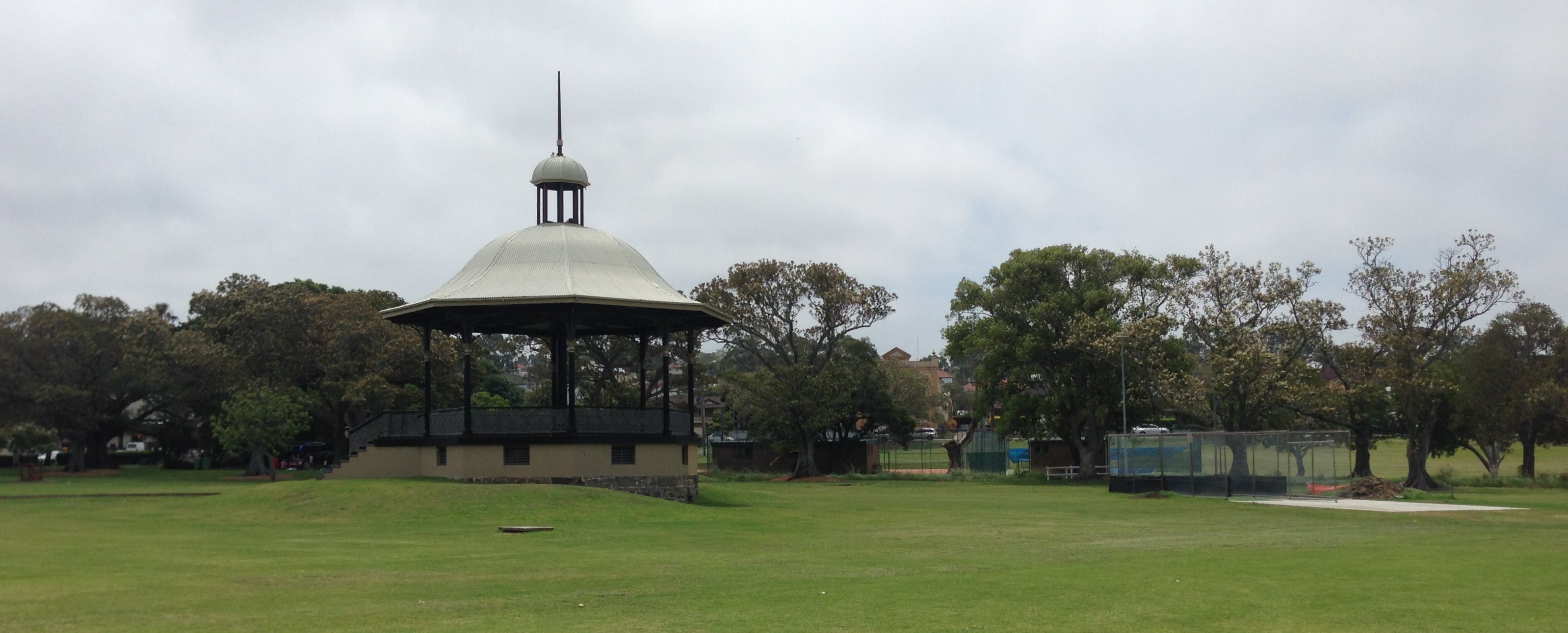
From a position slightly to the right of the original photo, the Mechanics Institute is now visible in the background.
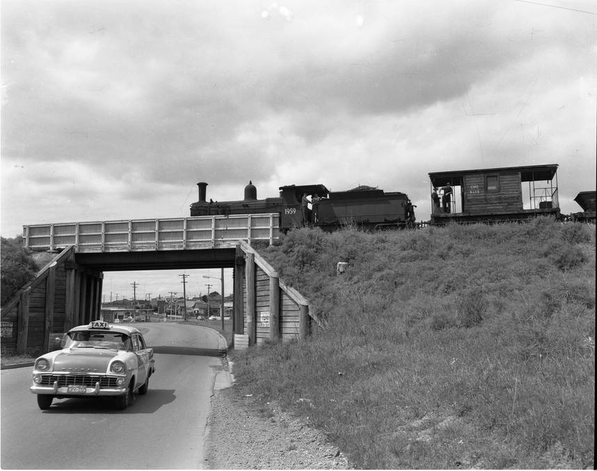
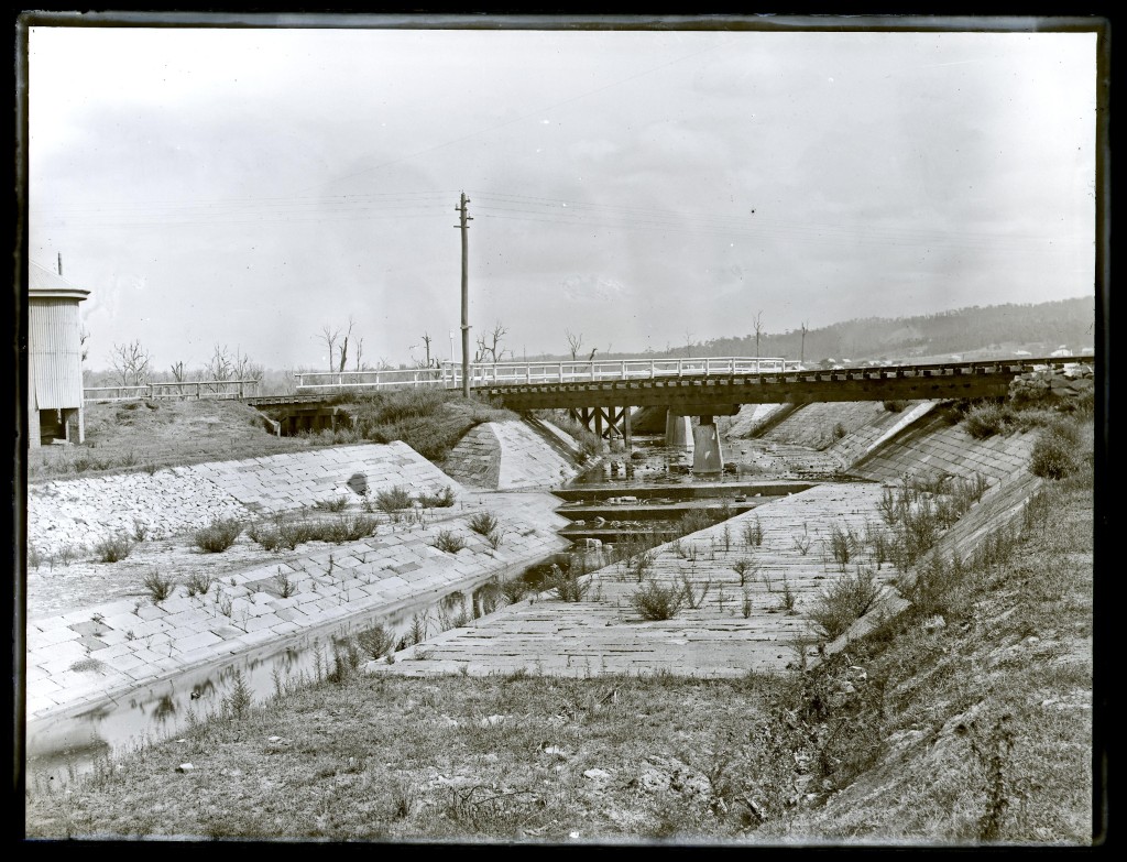
Railway bridge over Hobart Rd New Lambton. The railway led to the Lambton Colliery site a few hundred metres to the west of this location. Hunter Photo Bank. Newcastle Region Library.
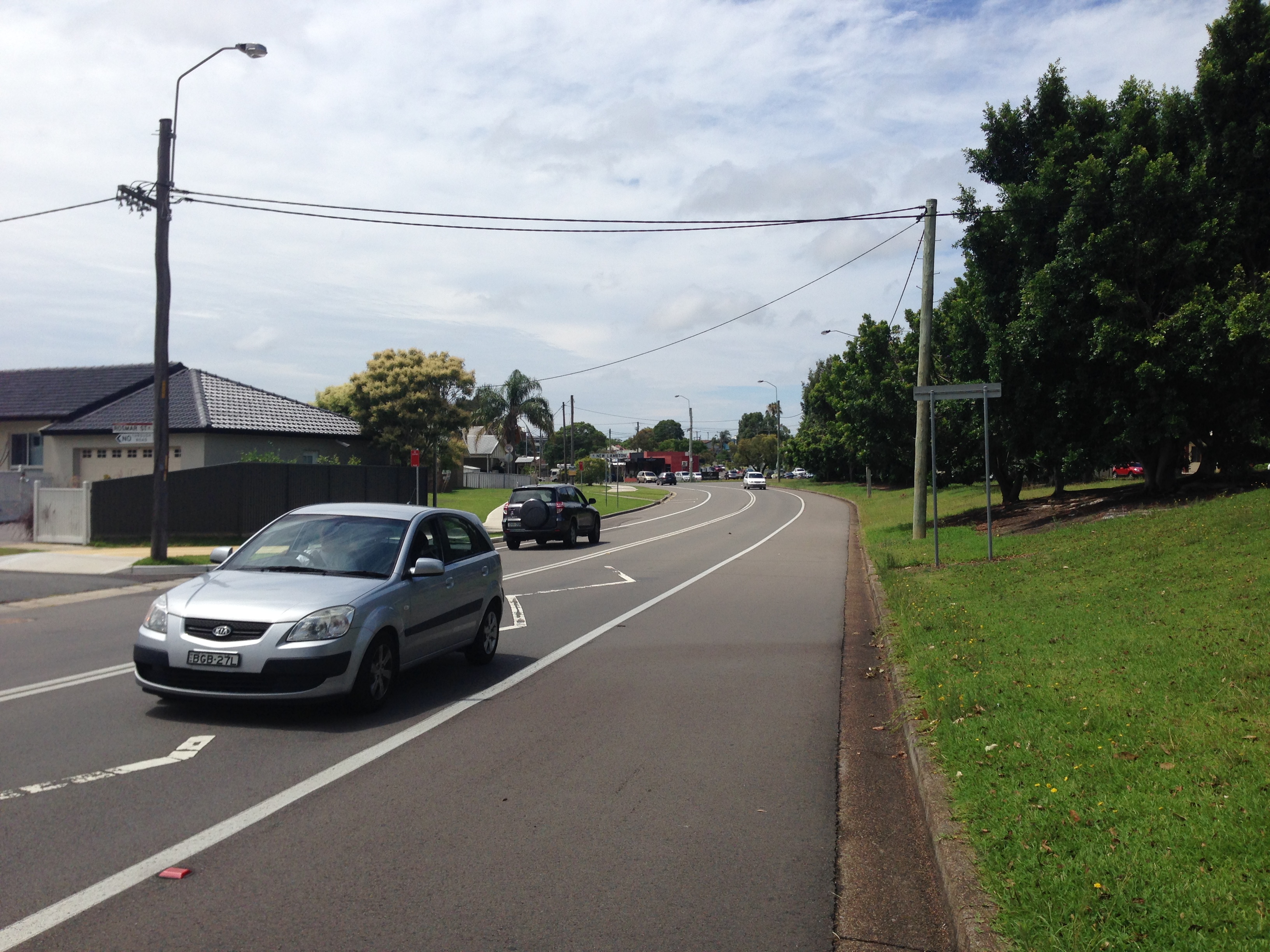
The railway bridges over Hobart Rd and Howe St were removed in 1966. The only subtle reminders that remain, are the slight dip in Hobart Road where it passed under the bridge, and a funny little jink in Howe St where the road needed to pass perpendicular under the narrow bridge.
Acknowlegement. This little adventure was inspired by the book by Peter Armstrong, “Looking Up The Gully Line – A History Of The Waratah Colliery”. Much of the information in this post is sourced from this book.
On the 22nd December 1961, the final whistle blew on the final shift at the Waratah Colliery and all but 3 of the 55 strong labour force were now out of work.
Fifty three years later to the day, on 22nd December 2014, I went for a bike ride with my son along the route of the Gully Line railway that connected the colliery to Port Waratah. We started our journey from Hunter Stadium and travelled south, on a gentle upwards slope, eventually reaching Raspberry Gully, the site of former colliery.
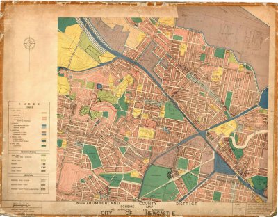
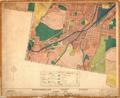
The following old maps in the University of Newcastle Cultural Collections shows the route of the Gully Line. (Note that rail corridors are coloured blue in these maps – don’t get fooled into thinking they are rivers!)
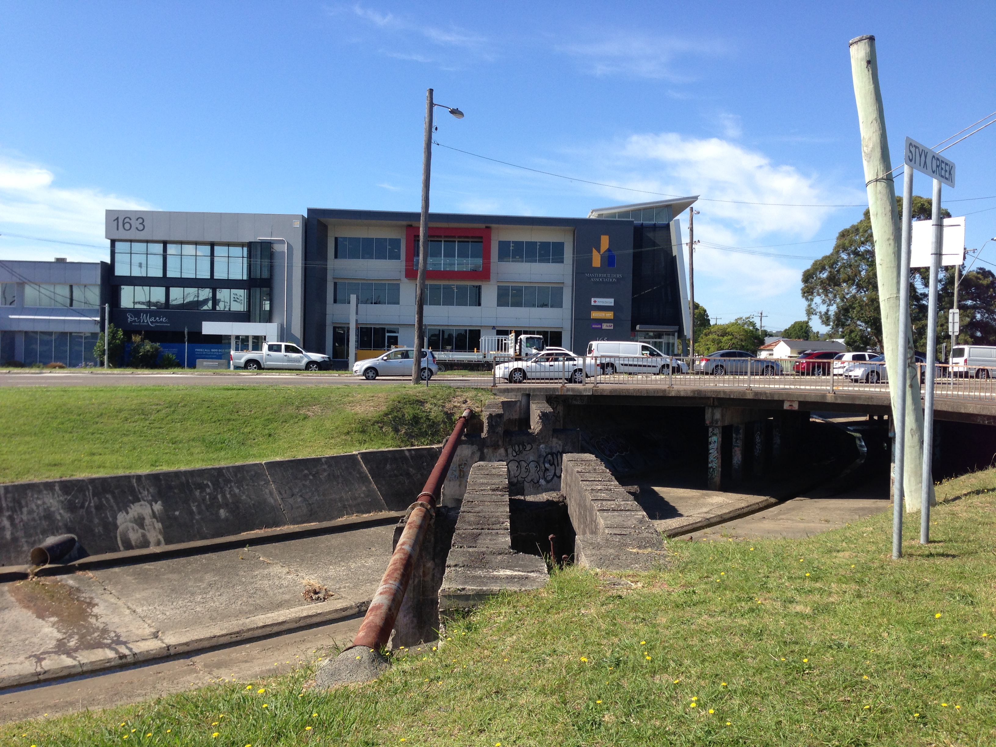
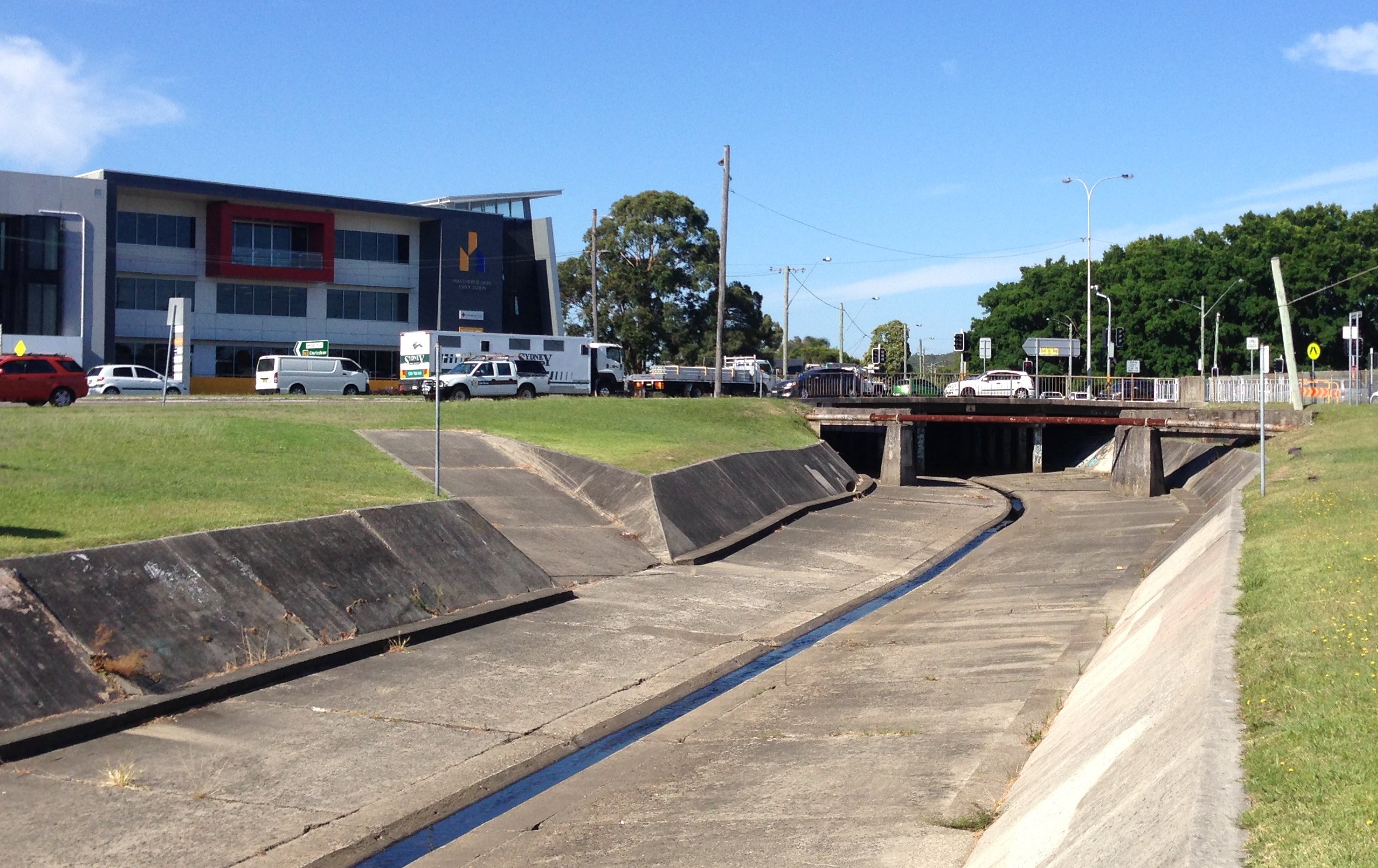
The remains of the bridge that carried the gully line rail across the stormwater drain in Broadmeadow.
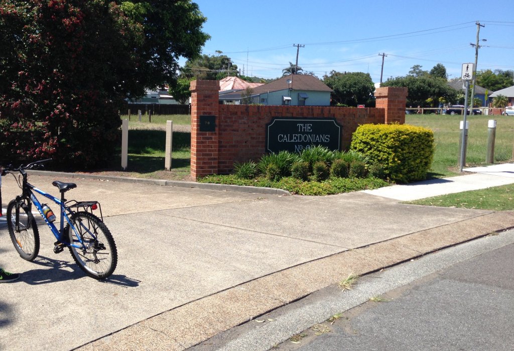
The South Waratah Colliery fell on hard financial times in 1895, and was taken over by the Caledonian Coal Company Limited, who then dropped the ‘South’ from the colliery name. This housing development on land previously occupied by the gully line is named after the new owners.

A slight crest in the road is the only remaining visible clue of where the gully line crossed St James Rd New Lambton

Looking north, through the underpass where the gully line passed under the main northern railway near St Pius X High School.

Similar to the St James Rd crossing, a slight crest in the road marks where the railway crossed Park Ave Kotara, just adjacent to the Dan Murphy’s store.

Looking north from Vista Pde Kotara, the present day cycle track veers away to the left of the path of the original rail line, which can be seen in the subtle dip of the landscape passing through the gap in the trees.
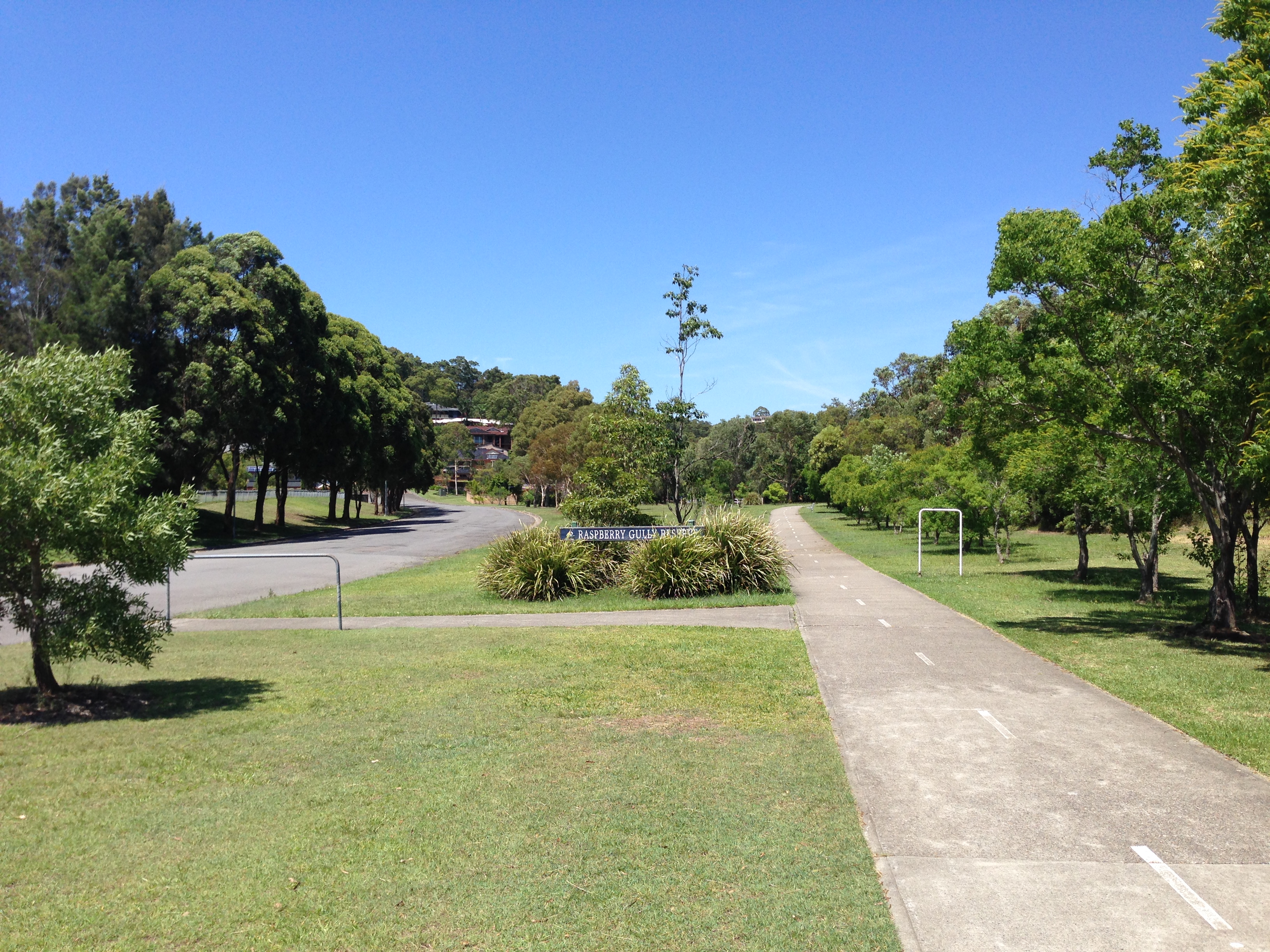
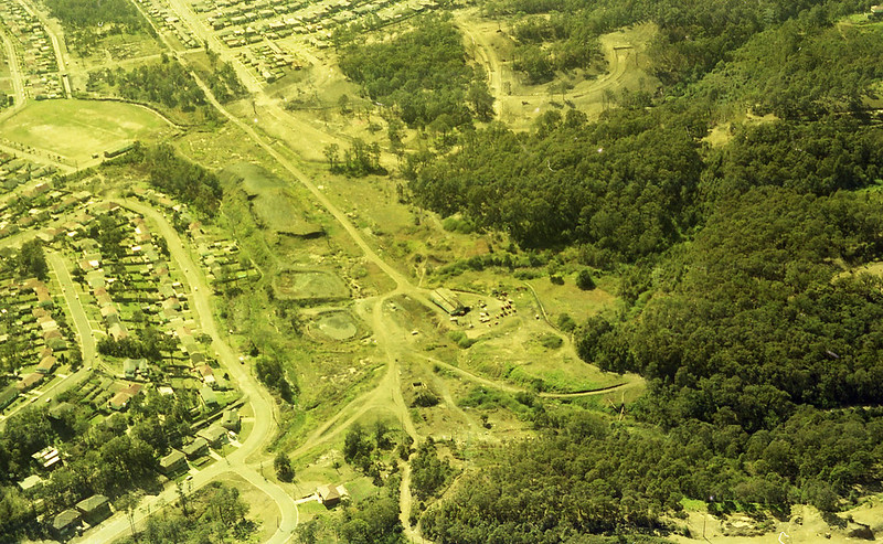
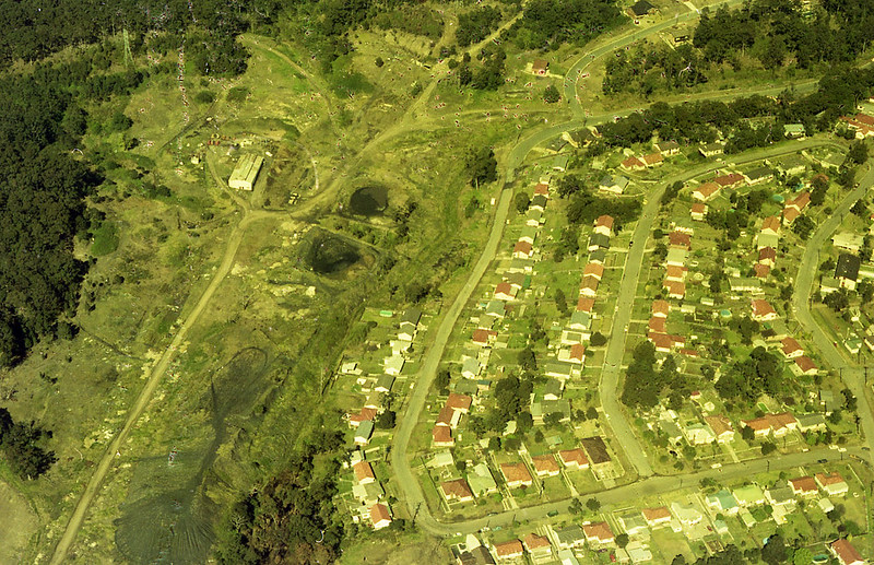
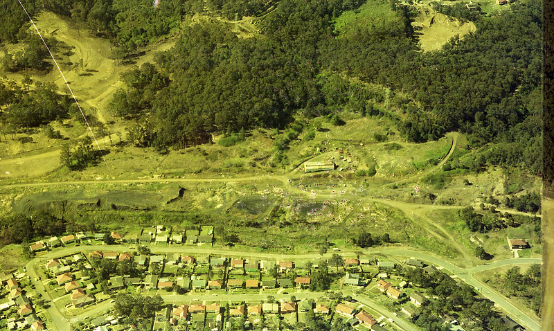
The South Waratah Colliery was situated in Raspberry Gully, just to the north of Charlestown, below the ridge that Charlestown Rd runs along. The Raspberry Gully name is preserved in the name of the reserve.

Somewhere here in this landscape the Waratah Colliery finished up production 53 years ago, in 1961. Nothing of the original colliery remains visible.

From Elton Close adjacent to Raspberry Gully, there is a set of stairs going up to Powell St Charlestown.

On Charlestown Rd, just near the turnoff into the shopping centre there are still standing four miners cottages built by the colliery to house strikebreakers in 1888.
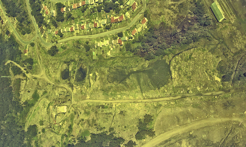
Update, May 2021. The University of Newcastle Living Histories website has a number of aerial photographs of the Raspberry Gully/South Waratah colliery site, in the Brian R Andrews collection. Click on the images below to view the original photo on the Living Histories site.
The Gully Line railway crossing the stormwater drain in Broadmeadow. Photo by Ralph Snowball. University of Newcastle Cultural Collections.
 The Gully Line railway ran from Hamilton North to Raspberry Gully (at the bottom of the ridge, just north of Charlestown) to serve the South Waratah colliery. The railway line was completed in 1876. The colliery ceased production on 22nd December 1961. The photos above and below were taken on 22nd December 2014, 53 years to the day after the mine closed.
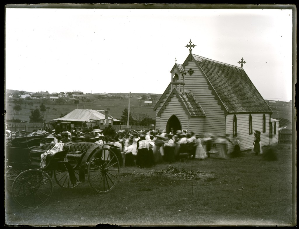
St John the Baptist Church, Lambton. Photo by Ralph Snowball. University of Newcastle Cultural Collections.
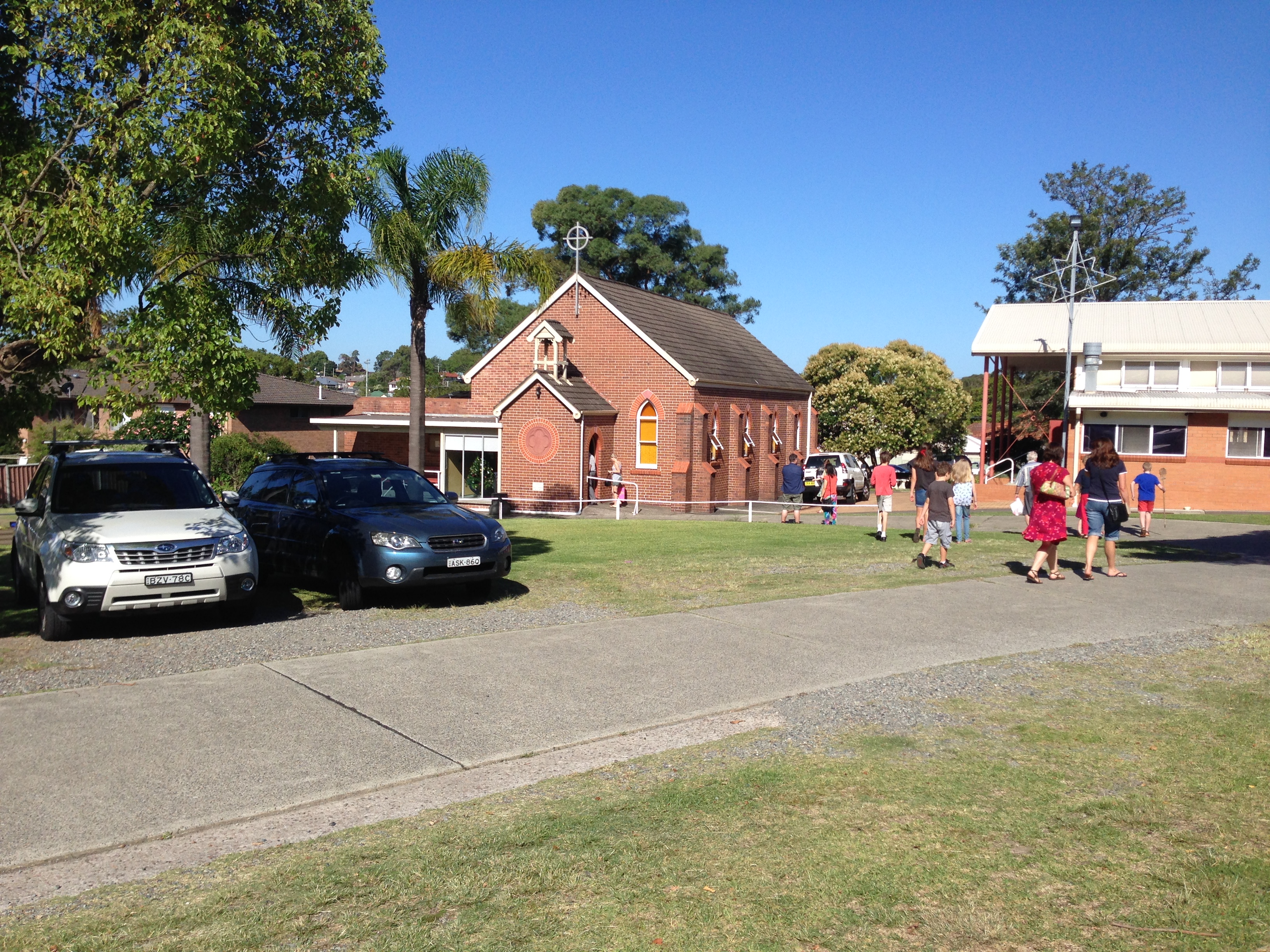
Not the same building (this brick building was built in 1907) but approximately the same site.
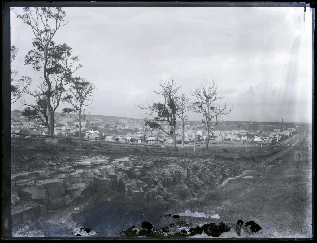
Tramway cutting, leading on to Howe St Lambton. Photo by Ralph Snowball. University of Newcastle Cultural Collections
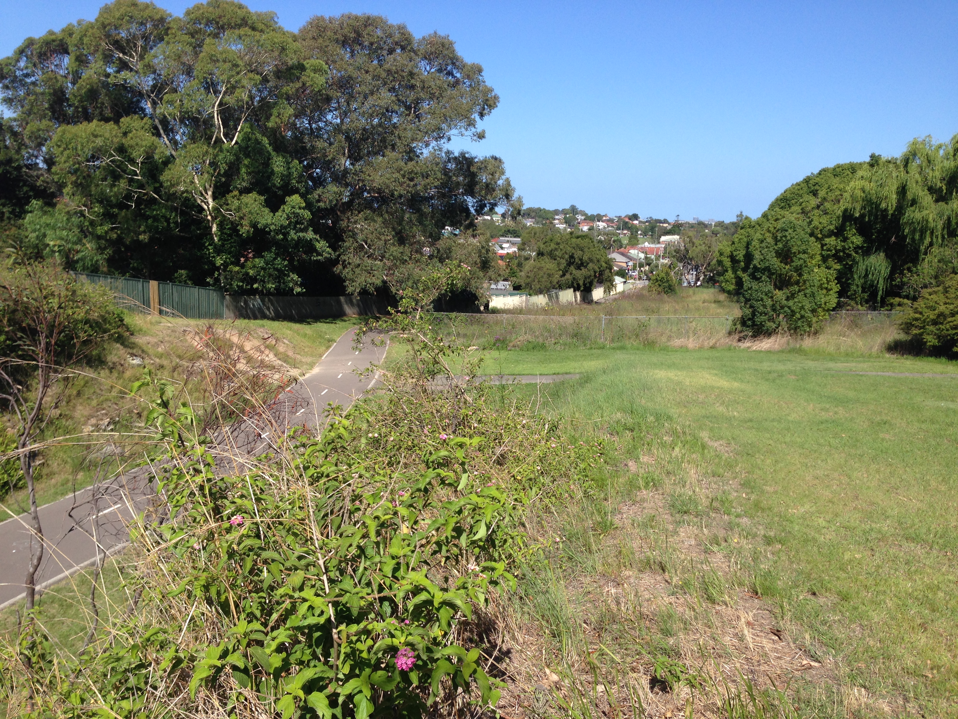
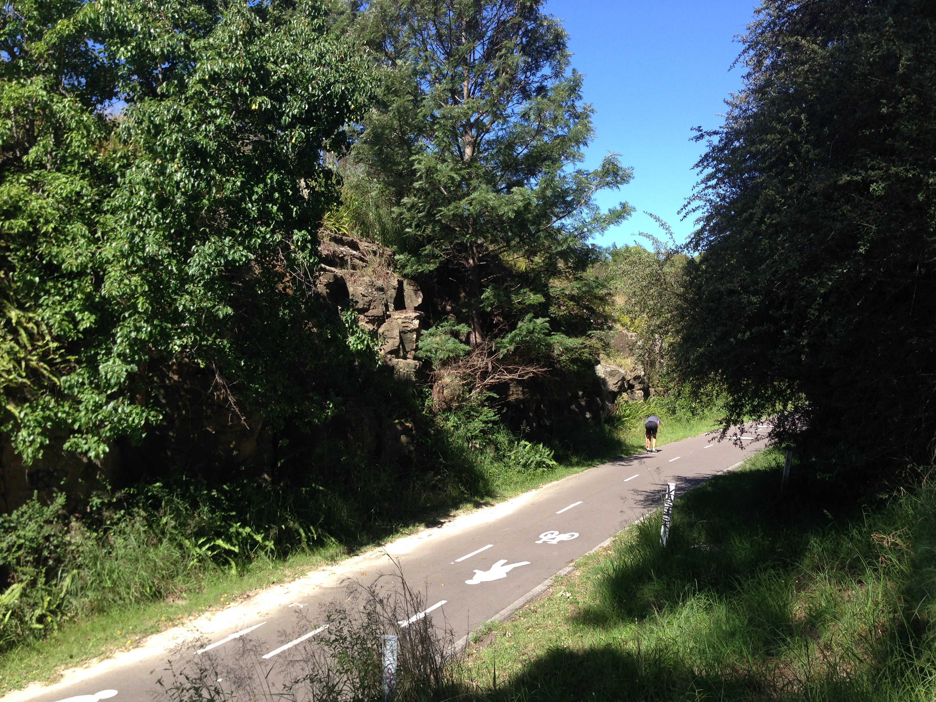
The sides of the cutting are considerably overgrown, and it is almost impossible to get to the spot where the original photo was taken.