I’ve just updated my visual index to historical real estate maps by adding maps from Creer and Berkeley, catalogued by the National Library of Australia. There were 130 items that were not in the University of Newcastle Flickr archive.
The two most interesting discoveries I made while adding the maps were
- A map of Howe St Lambton from 1914 showing the line of outcrop of the coal seam.
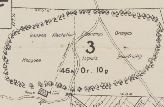
- A map of Dudley from 1916 showing a substantial banana plantation and orchard.


