Spring has swooped in

468px-Cracticus_tibicen_hypoleuca_male_domain

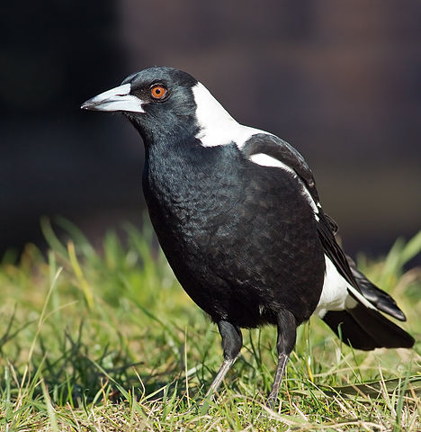
“Cracticus tibicen hypoleuca male domain” by JJ Harrison (jjharrison89@facebook.com) – Own work. Licensed under CC BY-SA 3.0 via Commons.

Many people have various markers as to when spring has sprung. I have three, all of which have happened in the last couple of weeks:

  1. Taking my gloves off while riding to work.
  2. The smell of blood and bone fertiliser in the air.
  3. Being swooped by a magpie, which happened to me yesterday in Chatham Road, Hamilton North, just in time for the official start of spring today.
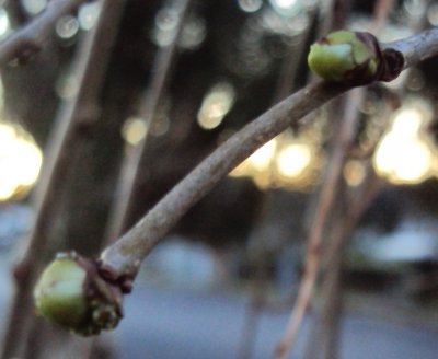
Update

I’ve been checking every day, and right on cue, on the first day of spring my mulberry tree sprouted its first green leaf buds.

MulberryBud

Then and now – trees

Here’s a “Then and Now” whose results I wasn’t too pleased with, documenting the handiwork of the Ausgrid tree contractors who have been through Lambton recently.

I’m no arborist, so I’ll have to charitably assume they knew what they were doing, but the result sure is an ugly mess.

The only consolation is, as Mark MacLean points out, in the long run vegetation eventually wins.

Walking in Mt Royal National Park

After years of driving on the New England Highway through Singleton, and passing the sign at the turnoff to Lake St Clair and Mt Royal National park, and wondering what’s up there, yesterday I finally got to drive up there and explore a bit. We drove all the way up to the Youngsville picnic area, which was very neat and very quiet.
youngsville

The information board at the picnic area shows a “Creek Walking Track” and says that it is “long” and “strenuous” and “requires a good level of fitness”. Unfortunately it didn’t give any indication of how long, either in distance or walking time.

creekwalkmap

So we set off anyway on the southern leg of the loop, with the intention of seeing how far we could get, with the fallback plan of just returning back the same track if we didn’t have enough time to do the whole loop. We didn’t make it all the way down in our allotted time, but from my GPS recording, later loaded into Google Earth, I can see that we made it about two thirds of the way down to the creek. This downhill walk was 2.25km and took 37 minutes, at quite a brisk walk. From this I would guess that the full loop walk would be about 7km and would take about 3 hours to do? One day I shall go back and see how good my estimates are.

googleearth