I’ve seen it written before (but I can’t recall where) and seen it again recently, an assertion that Thomas Croudace was a megalomaniacal mine manager who built his house (Lambton Lodge) at the top of the hill so that he could watch his workers go to and from the mine, monitoring their movements.
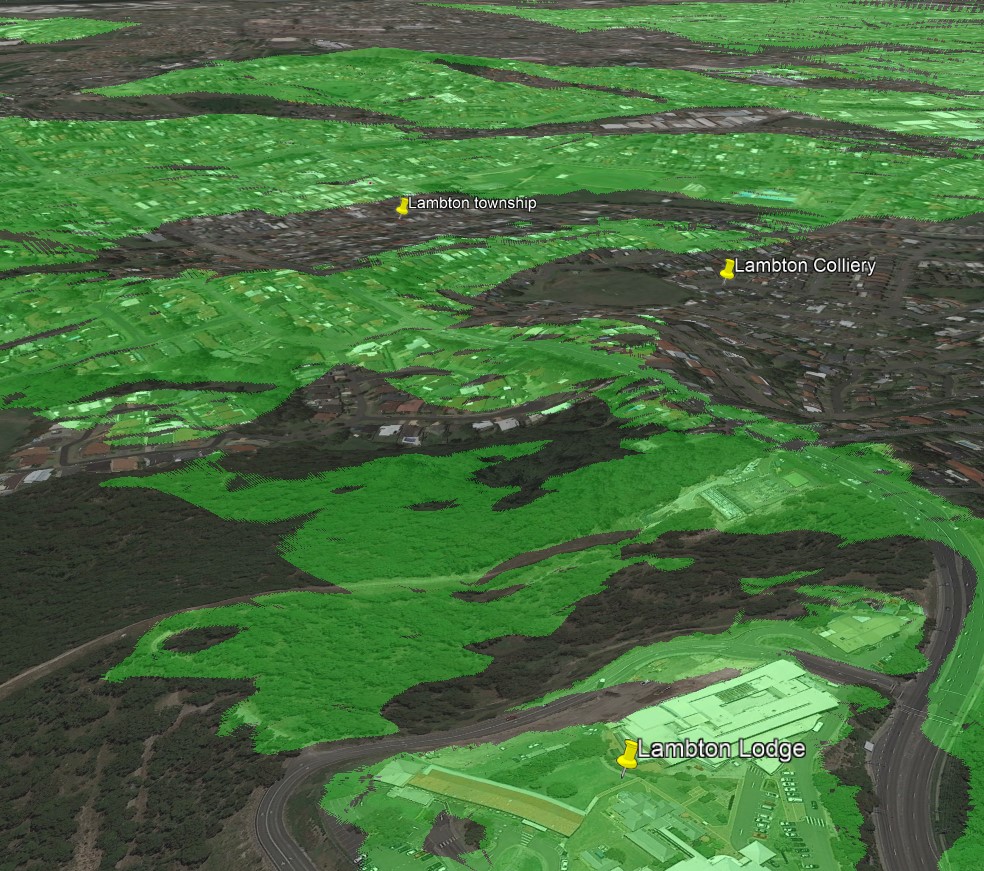
Apart from this being an unfair and very one-sided representation of Croudace’s character, it’s also a topographical absurdity. The Lambton colliery was in a valley (where Lewis Oval is today) that is not visible from the site of Lambton Lodge. Similarly Lambton township is in a valley, and a large proportion of the town is not visible from the Lambton Lodge hill 1.6km away.
Google Earth Pro has a neat feature called viewshed analysis, that shades in green areas that are visible from a specified point. Even from a height 10 metres above the ground at Lambton Lodge, both the township and colliery are hidden from view.

