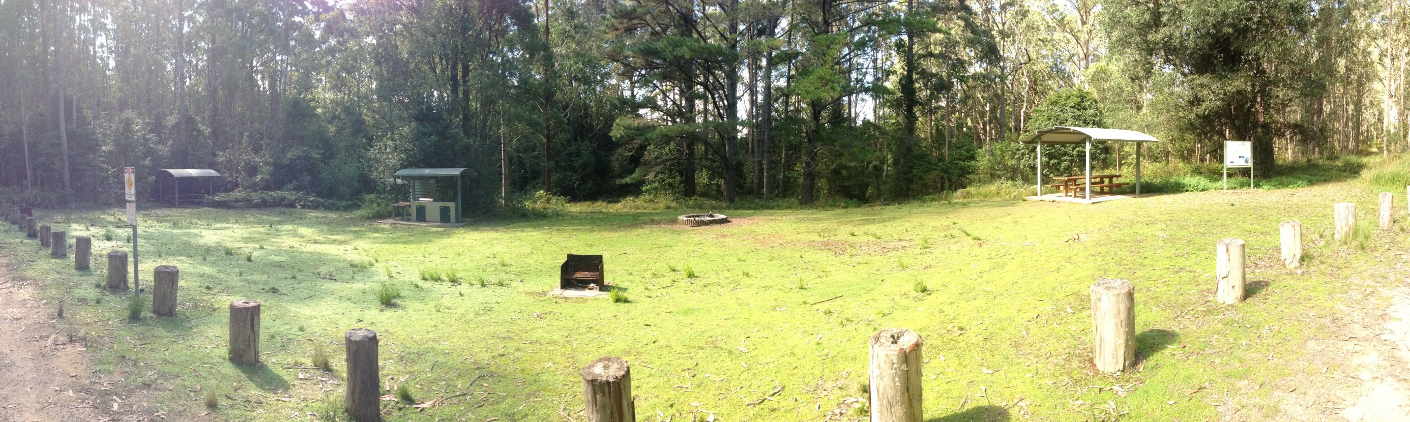
After years of driving on the New England Highway through Singleton, and passing the sign at the turnoff to Lake St Clair and Mt Royal National park, and wondering what’s up there, yesterday I finally got to drive up there and explore a bit. We drove all the way up to the Youngsville picnic area, which was very neat and very quiet.
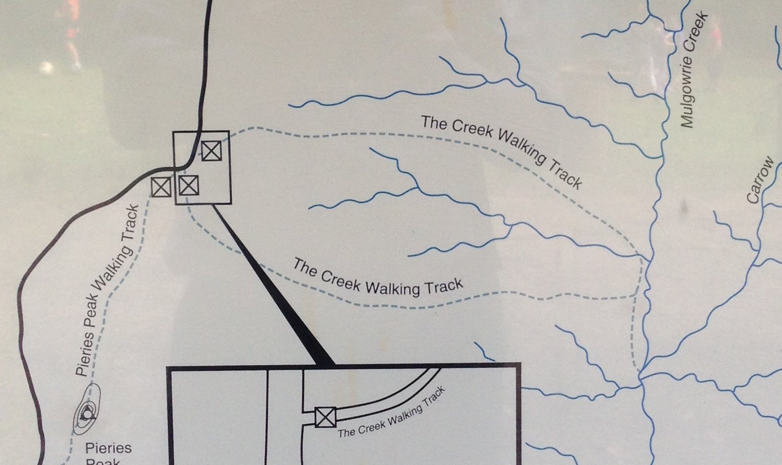
The information board at the picnic area shows a “Creek Walking Track” and says that it is “long” and “strenuous” and “requires a good level of fitness”. Unfortunately it didn’t give any indication of how long, either in distance or walking time.
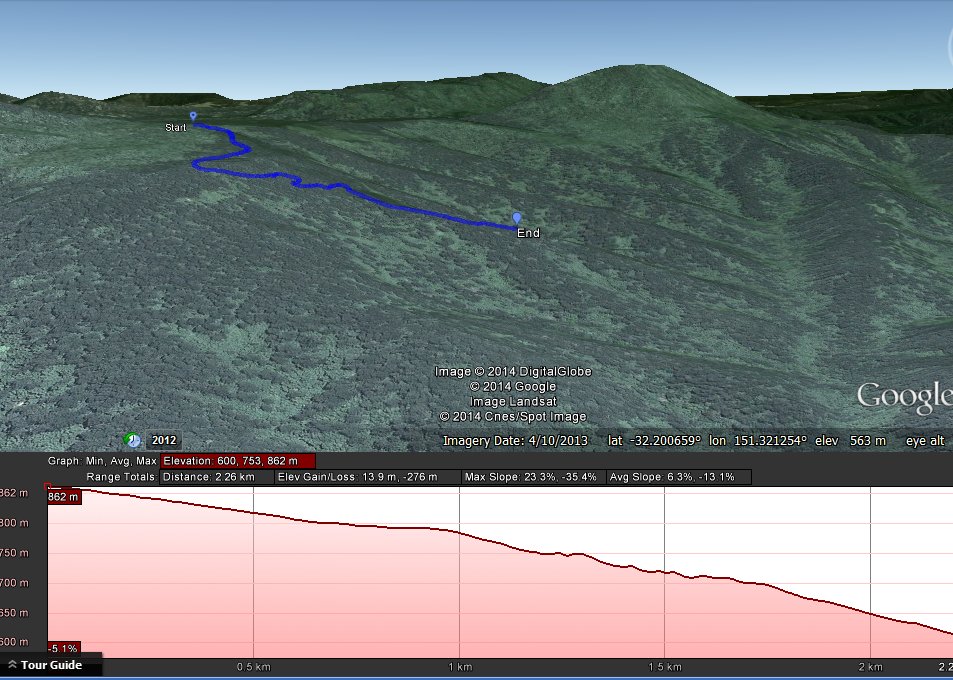
So we set off anyway on the southern leg of the loop, with the intention of seeing how far we could get, with the fallback plan of just returning back the same track if we didn’t have enough time to do the whole loop. We didn’t make it all the way down in our allotted time, but from my GPS recording, later loaded into Google Earth, I can see that we made it about two thirds of the way down to the creek. This downhill walk was 2.25km and took 37 minutes, at quite a brisk walk. From this I would guess that the full loop walk would be about 7km and would take about 3 hours to do? One day I shall go back and see how good my estimates are.
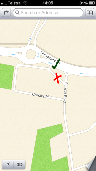 I noticed today that some of the problems with Apple Maps that I reported to Apple have been corrected. Unfortunately, in some cases they’ve just replaced one error with a different error. e.g. In Canara Place, they’ve correctly added in the connection to University Drive that was missing, but added an extra connection to Sunset Boulevarde that doesn’t exist in the real world.