Army Encampment, 1897

Prior to Federation in 1901, each Australian state was responsible for its own military defence. In NSW, volunteer forces were formed and trained in various localities, and they held annual encampments where multiple units gathered for extended training and drills.

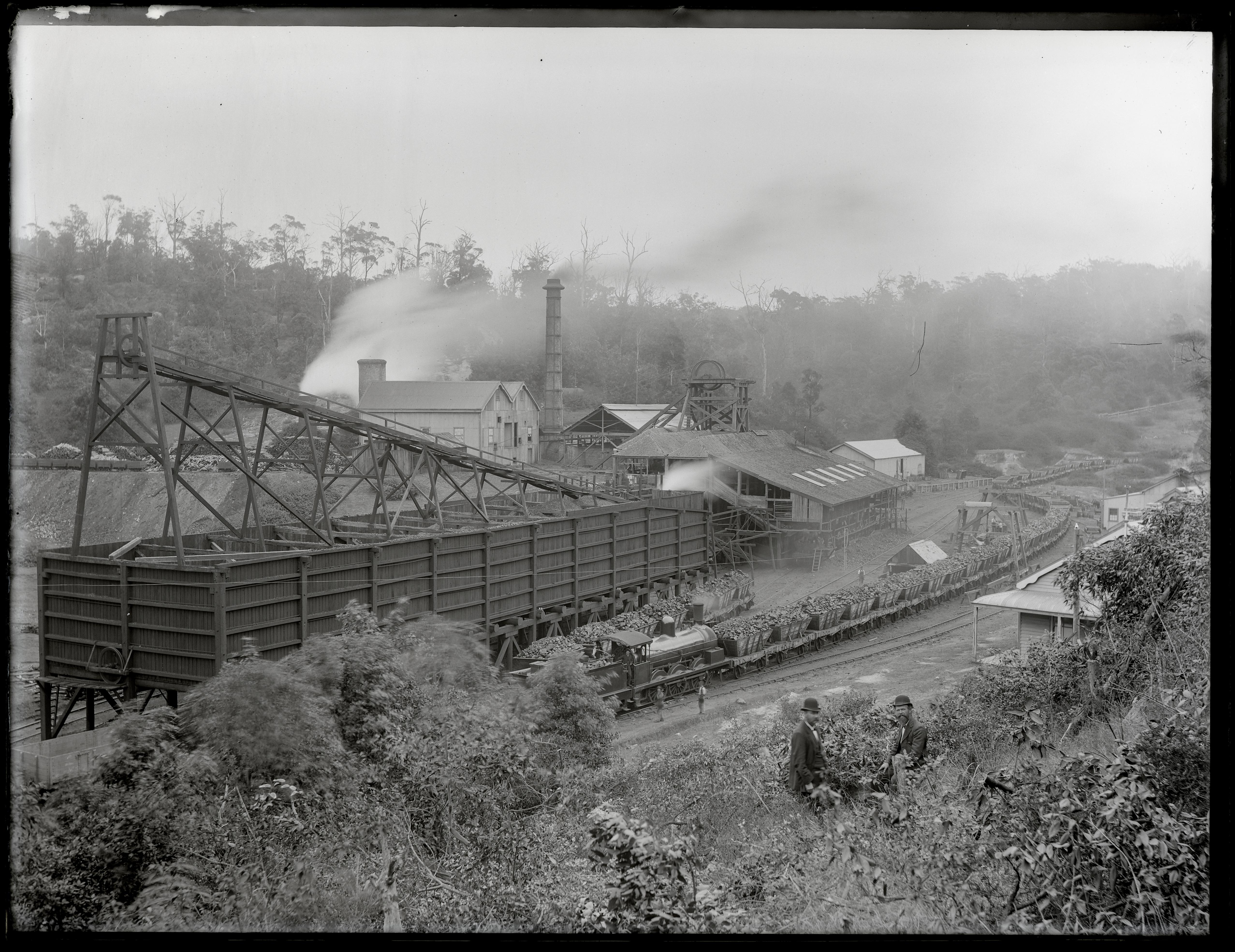
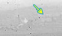
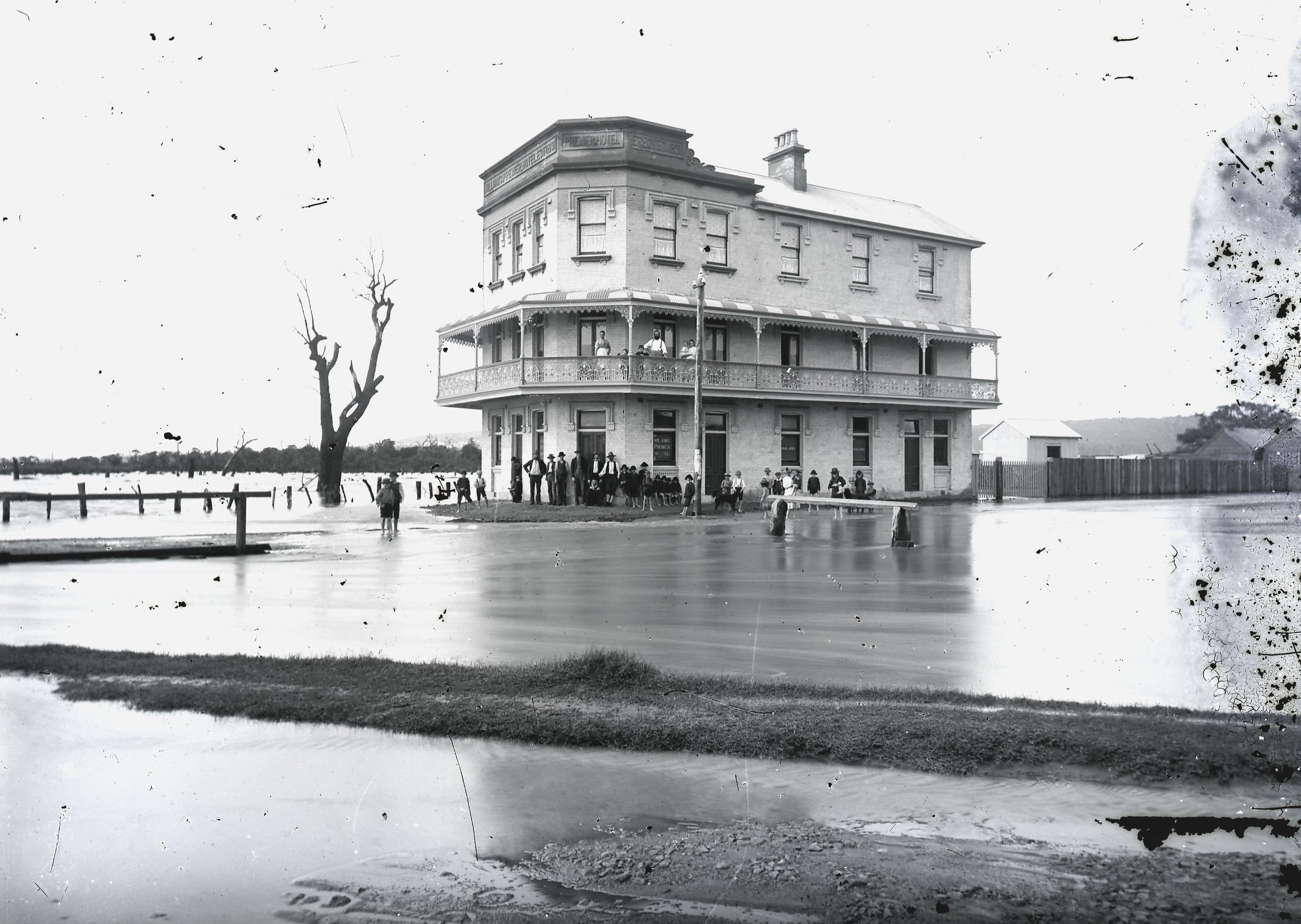
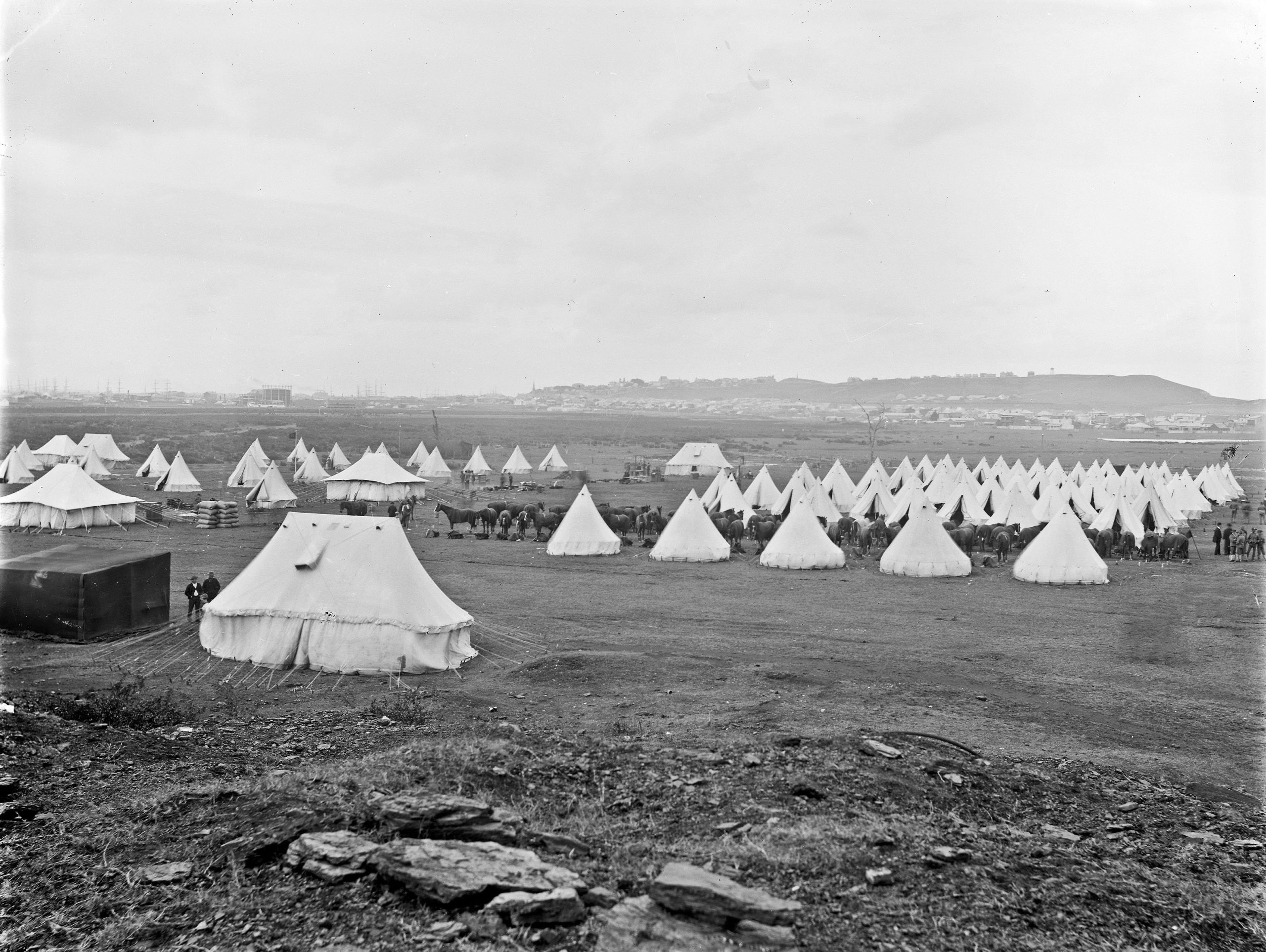
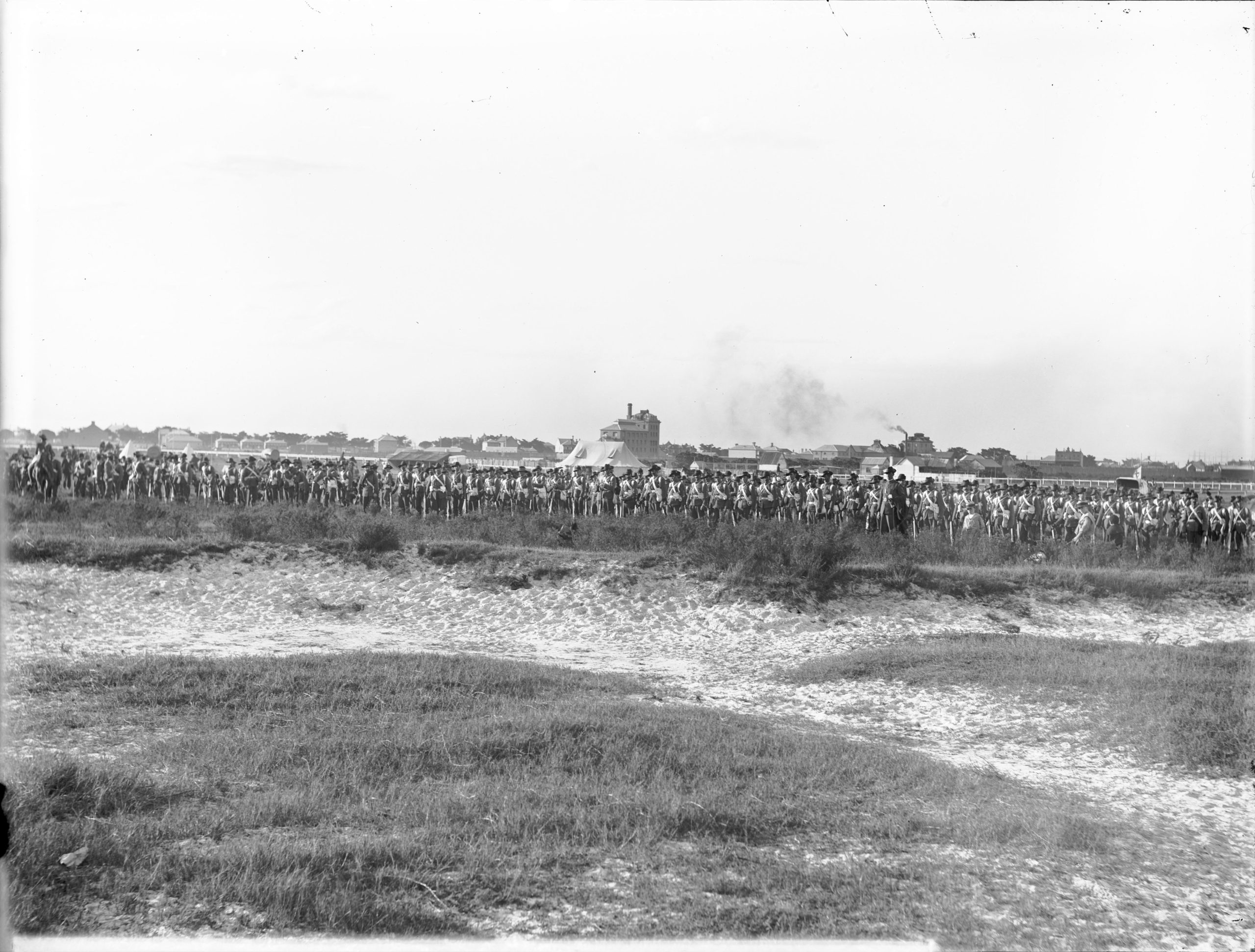
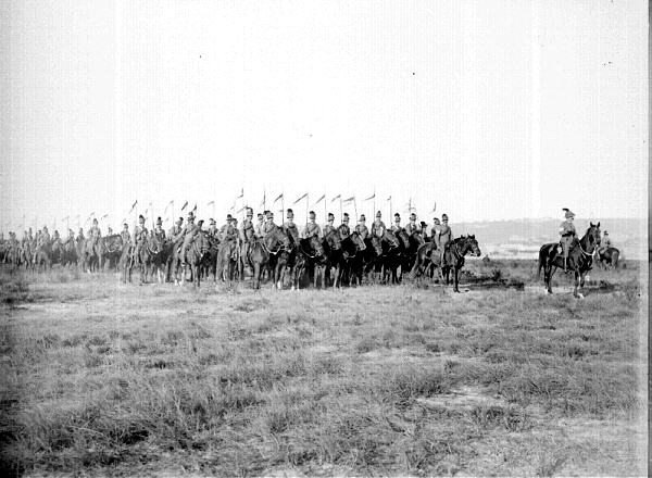
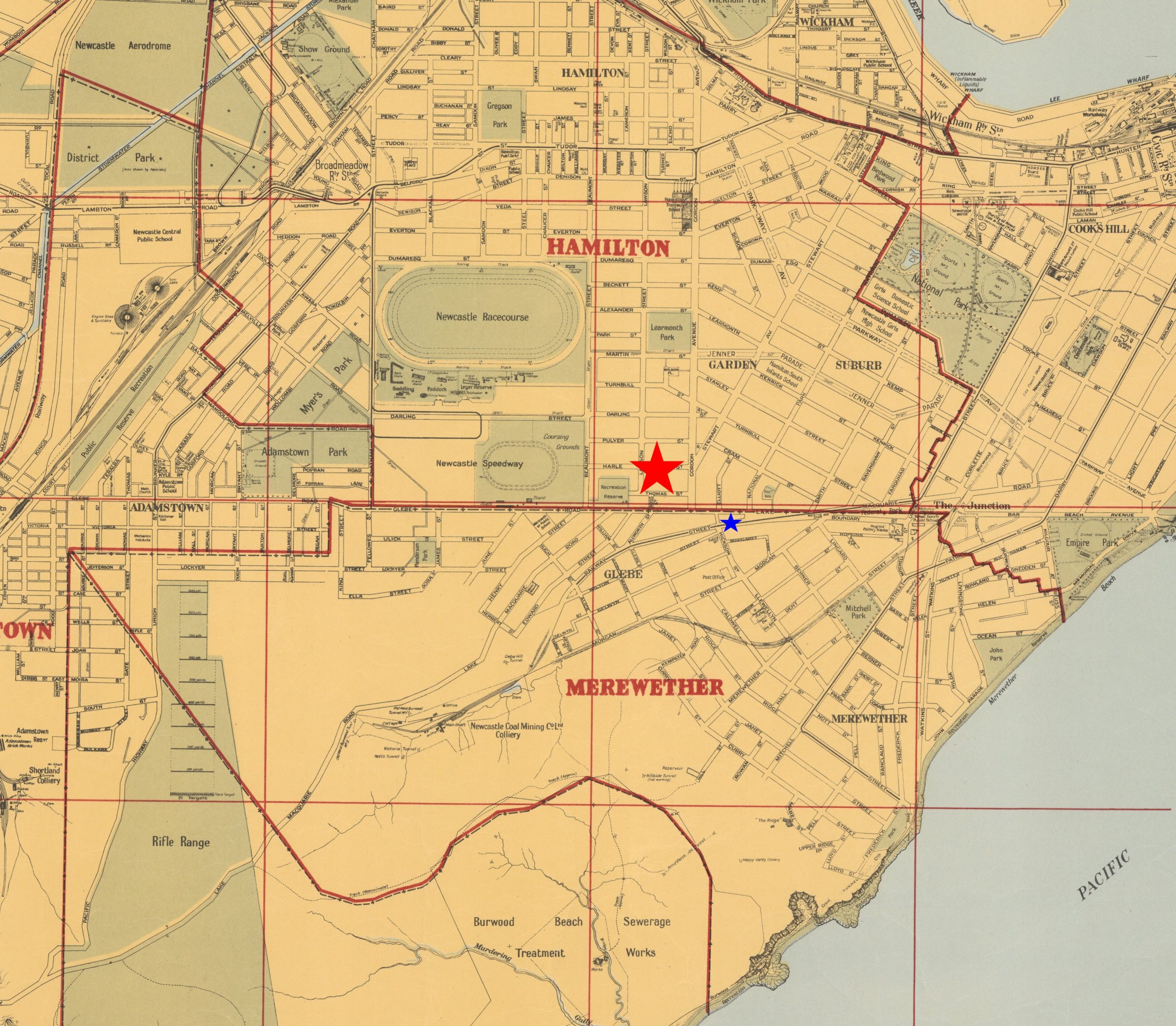
In 1897 a camp was held in the flat area of Hamilton South known as Blackburn’s Oval. This was located near the Merewether Hotel (now the Mary Ellen) operated by Edward Blackburn. Over 60 tents were erected to accommodate 550 men, comprising the 4th Infantry Regiment from Newcastle, a field artillery unit from Sydney, and the mounted No. 3 Lancers Squadron from Singleton and Maitland. The Newcastle Morning Herald and Miners’ Advocate reported that “the four days’ military encampment commenced on Friday night under most unfavourable weather auspices, a strong southerly gale, with pouring rain, rendering the condition of the men under canvas far from pleasant.”

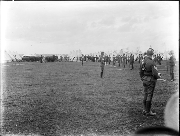
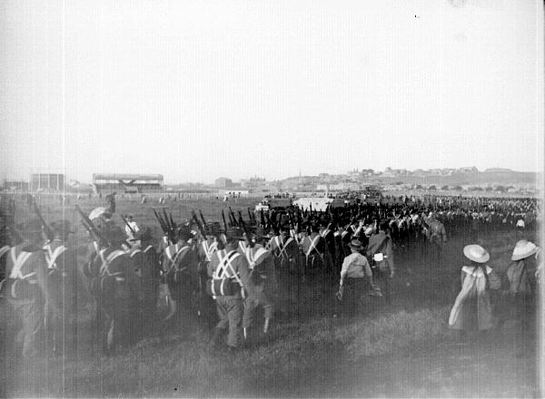
Each day was filled with drills and parades, with the main exercise held on Monday. Woken at 3:30am, the troops formed up on the parade ground and were told of an ‘enemy’ force having landed at Belmont and heading to Newcastle. The infantry, cavalry and artillery proceeded to Charlestown and engaged in a 90-minute mock battle that repulsed the ‘invaders’ in time for breakfast at 8.30am.

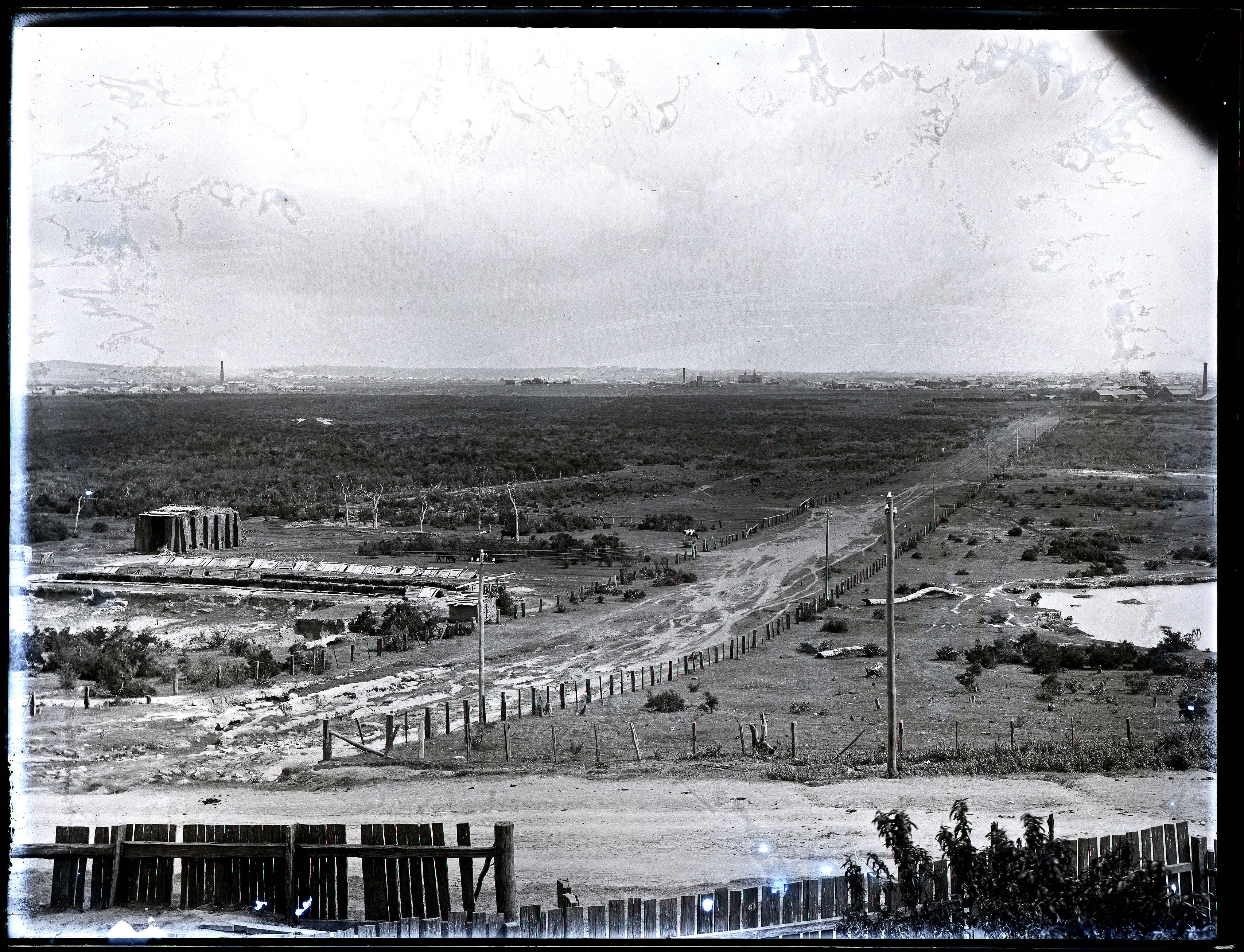
Returning to camp and a few hours rest, the soldiers held another exercise in the afternoon. Upwards of 7000 spectators crowded onto the Glebe Hill and the spoil heap of the old Hamilton colliery to watch “the troops rushing to and fro, the cavalry galloping around, with the air thick with smoke as the big guns reverberated.”

The camp ended on Tuesday with general satisfaction at its success, apart from the departing troops’ complaints of “insufficient and commonplace” food rations. Newcastle continued to host annual military encampments in the vicinity, with the last held in September 1914. Blackburn’s Oval was used for sport up until 1923, after which the area was developed for housing.

Army Camp Blackburn Oval, Hamilton South, NSW, 23 May 1897. Photo by Ralph Snowball. University of Newcastle, Living Histories.
Pacific Highway, Hamilton South. Motorists now drive where the military once drilled.

The article above was first published in the May 2024 edition of The Local.
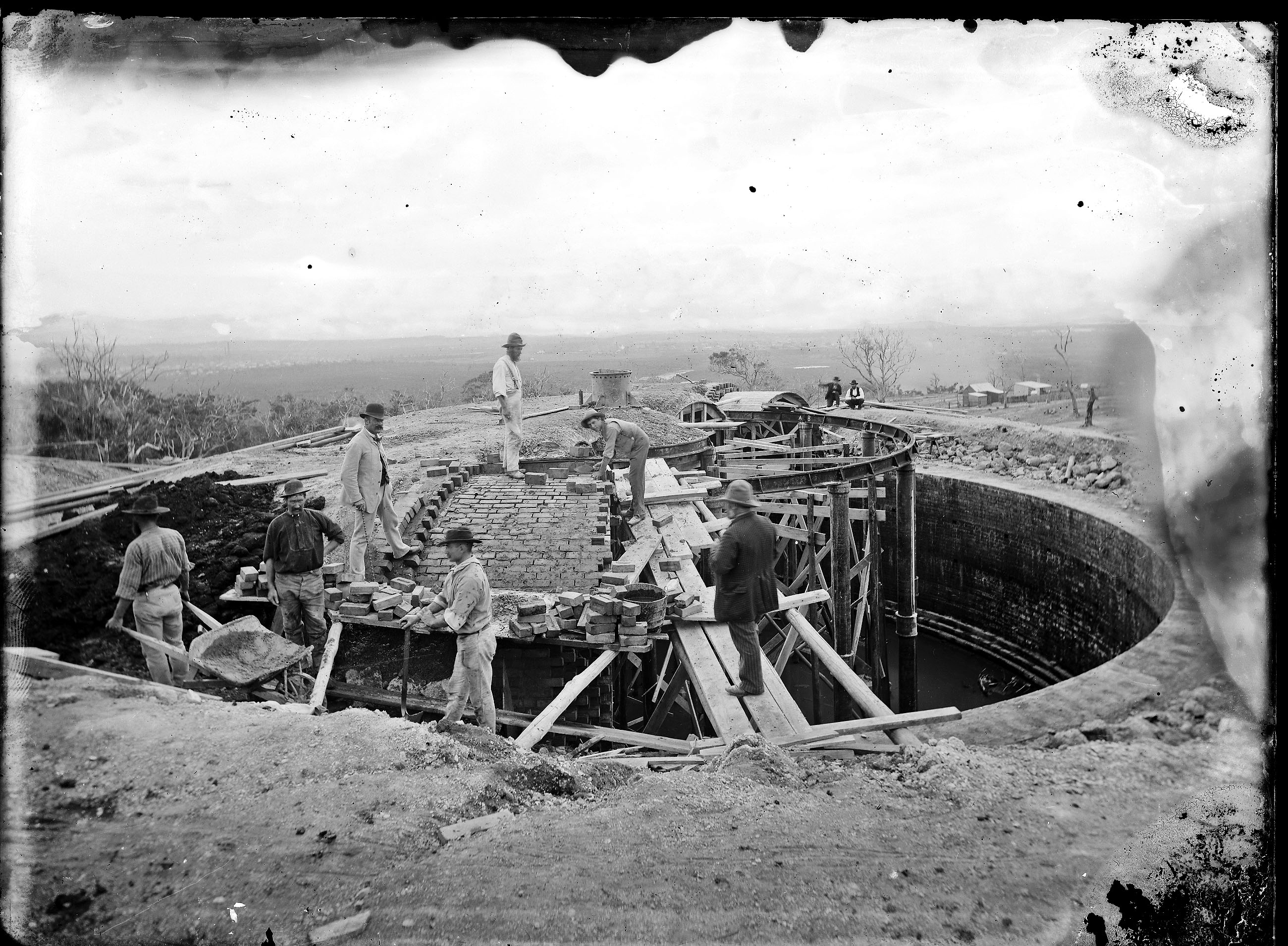

Additional Photos

Newcastle Libraries Hunter Photobank has a number of photos of army encampments held in the inner city area. The photograph below is undated in their collection, but it is almost certainly the encampment of 1897.

Army camp (Blackburns Oval), May 1897. Photo by Ralph Snowball. Hunter Photobank, accession number 001 000171

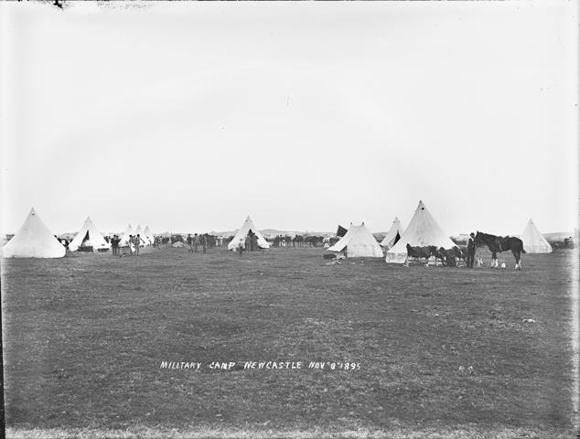
The collection has one photograph of an earlier encampment held in 1895 …

Military camp at Newcastle, 8 November 1895. Photo by Ralph Snowball. Hunter Photobank, accession number 001 001463

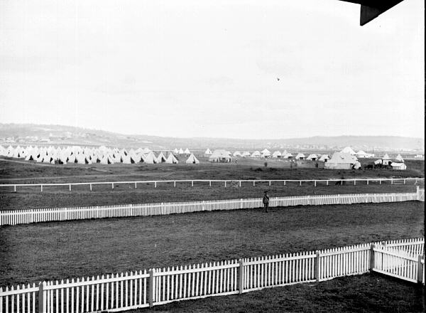
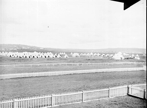
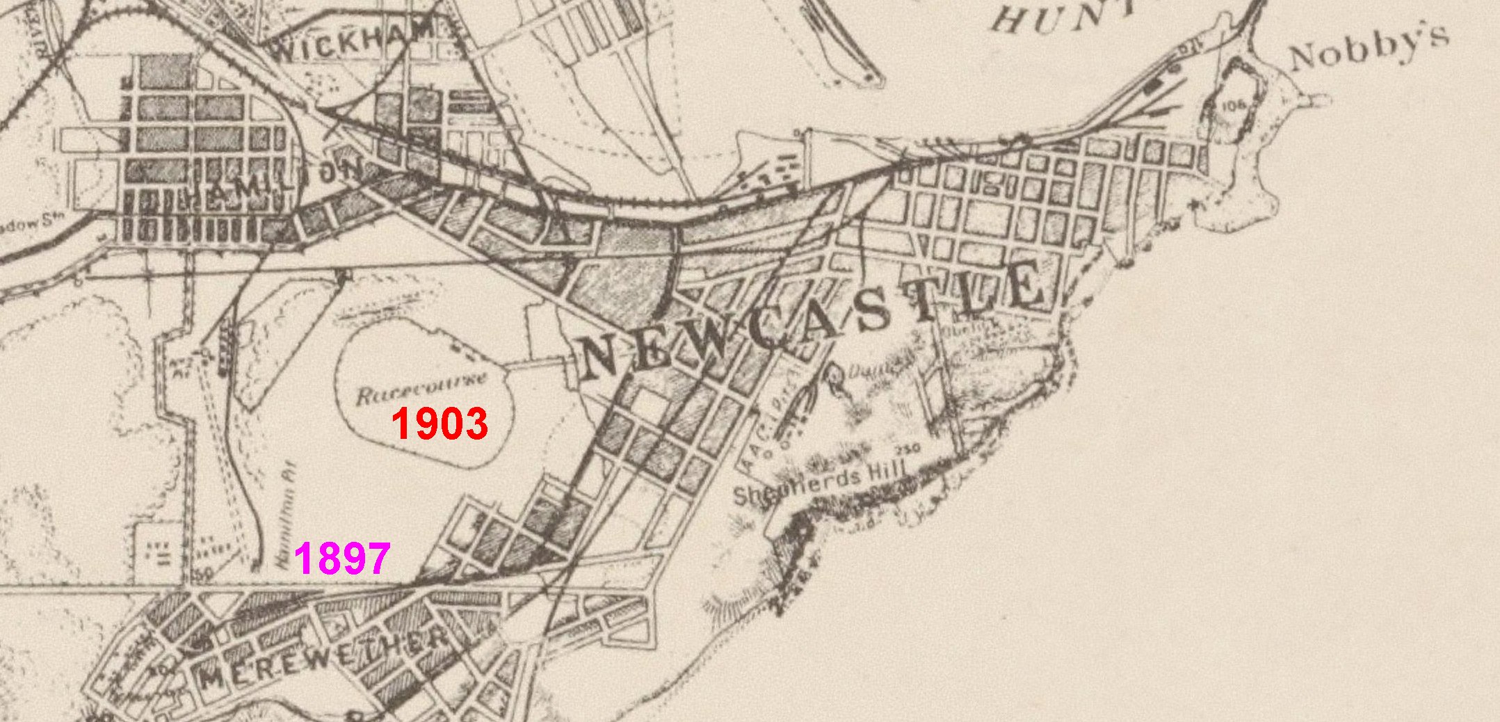
… and multiple photographs of the encampment held on the old racecourse in April 1903.

Army encampment at Old Racecourse, Newcastle, 13 April 1903. Photo by Ralph Snowball. Hunter Photobank, accession number 001 001618
Army encampment at Old Racecourse, Newcastle, 13 April 1903. Photo by Ralph Snowball. Hunter Photobank, accession number 001 001620
Troops at Old Racecourse, Newcastle, 14 April 1903. Photo by Ralph Snowball. Hunter Photobank, accession number 001 001619
Troops at Old Racecourse, Newcastle, 14 April 1903. Photo by Ralph Snowball. Hunter Photobank, accession number 0001 001621.
Lancers at Old Racecourse, Newcastle, 14 April 1903. Photo by Ralph Snowball. Hunter Photobank, accession number 001 001616
Portion of Parrott’s 1893 map of Newcastle, annotated with the position of the 1897 encampment on Blackburns Oval adjacent to the Hamilton Pit, and the 1903 encampment on the old racecourse. National Library of Australia.

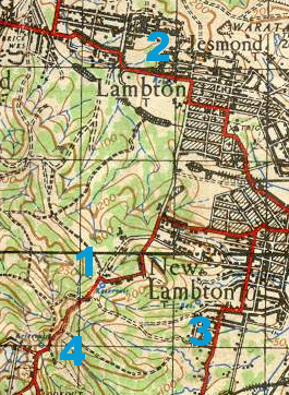
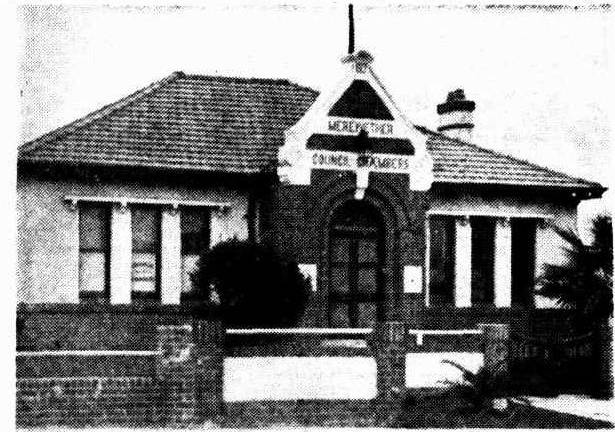
Blackburns Oval/Ground

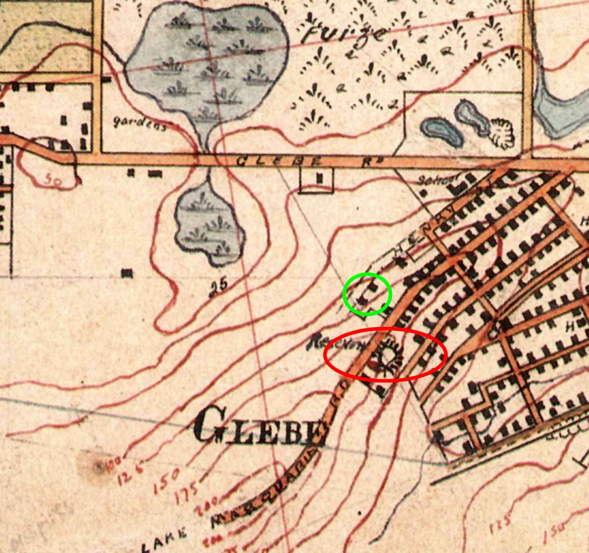
The Lost Football Ground Newcastle website has a good summary of Blackburn’s Oval/Ground. Edward Blackburn became the licensee of the Merewether Hotel in August 1893, and continued until September 1907 when his licence was cancelled after receiving three convictions in three years. The first mention I can find in Trove to Blackburn’s Oval/Ground is 4 Apr 1900, and the last mention on 10 September 1923.

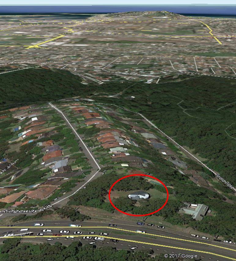
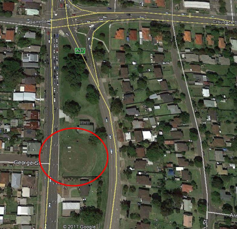
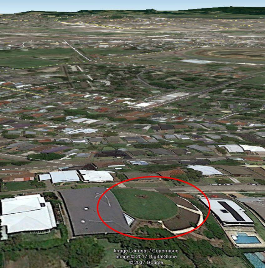
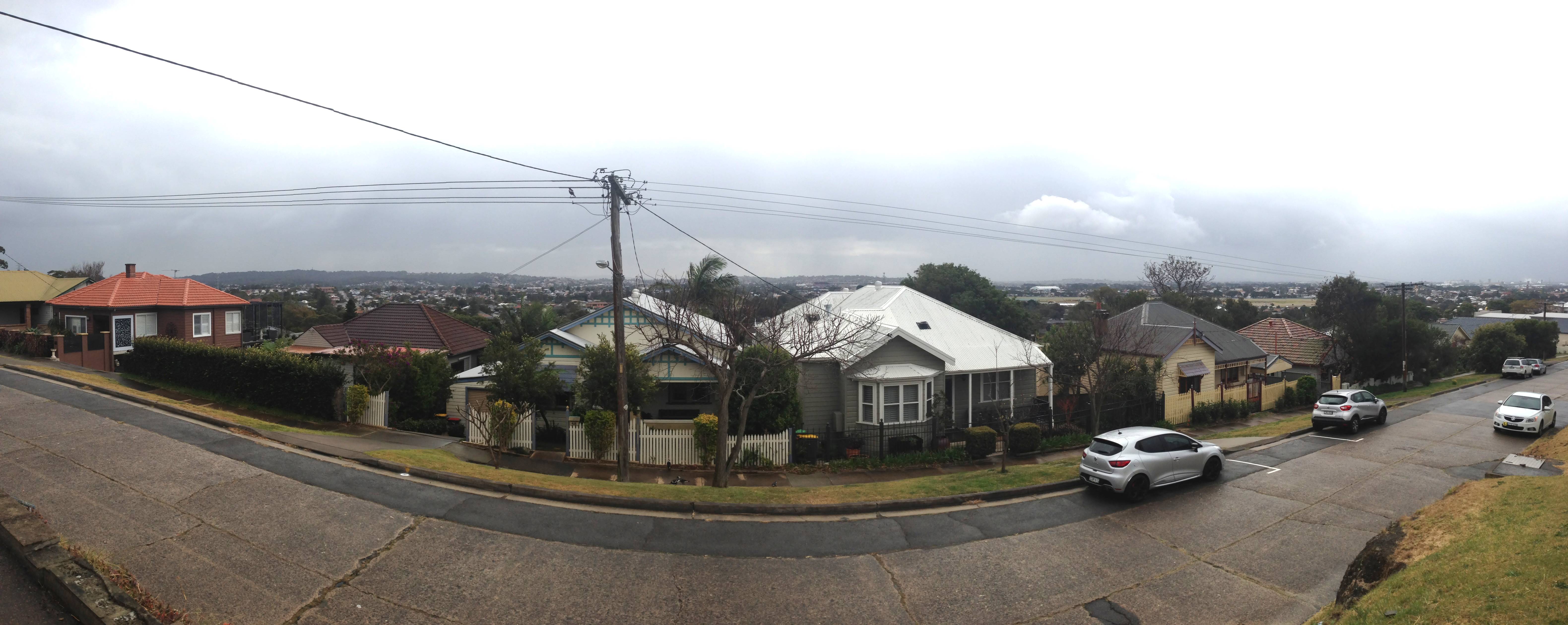
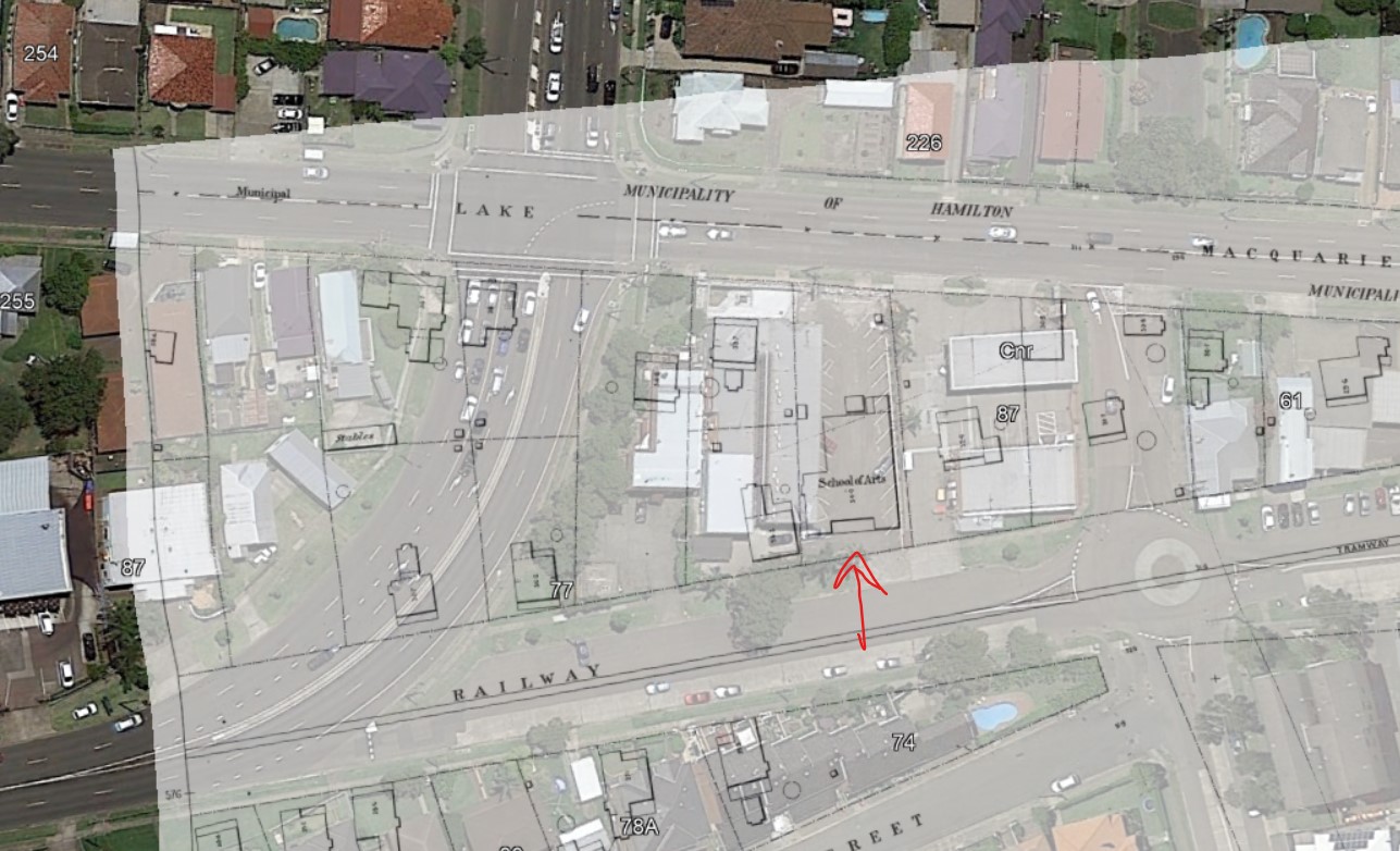
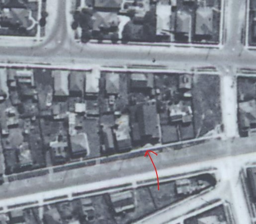
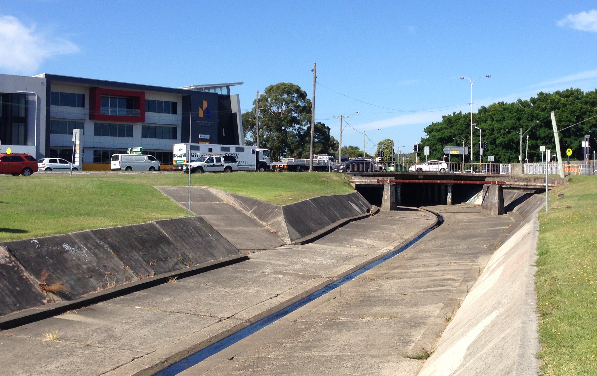
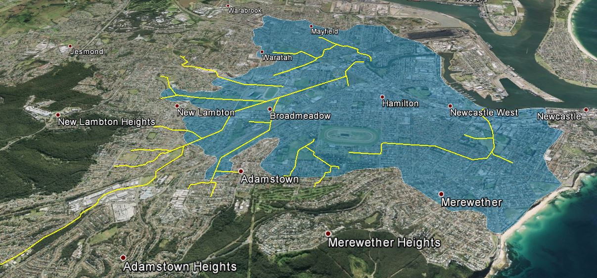
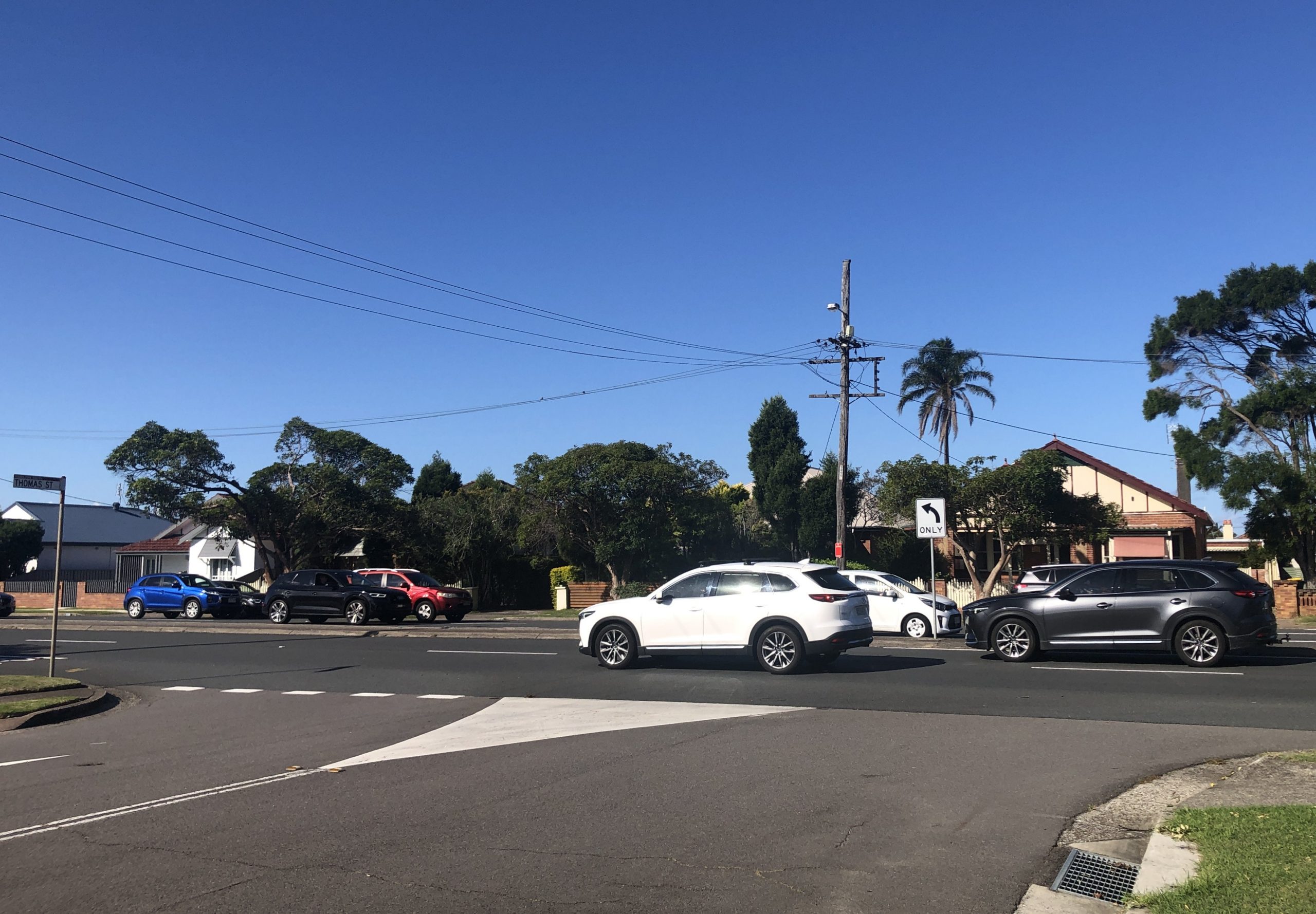
Overlaying old Water Board maps into Google Earth, we can see that the Hamilton Pit slack (spoils) heap from which Snowball’s photo was taken, was located in the vicinity of where Thomas St is today. Thus the army encampment was in the area where the Pacific Highway passes through today.

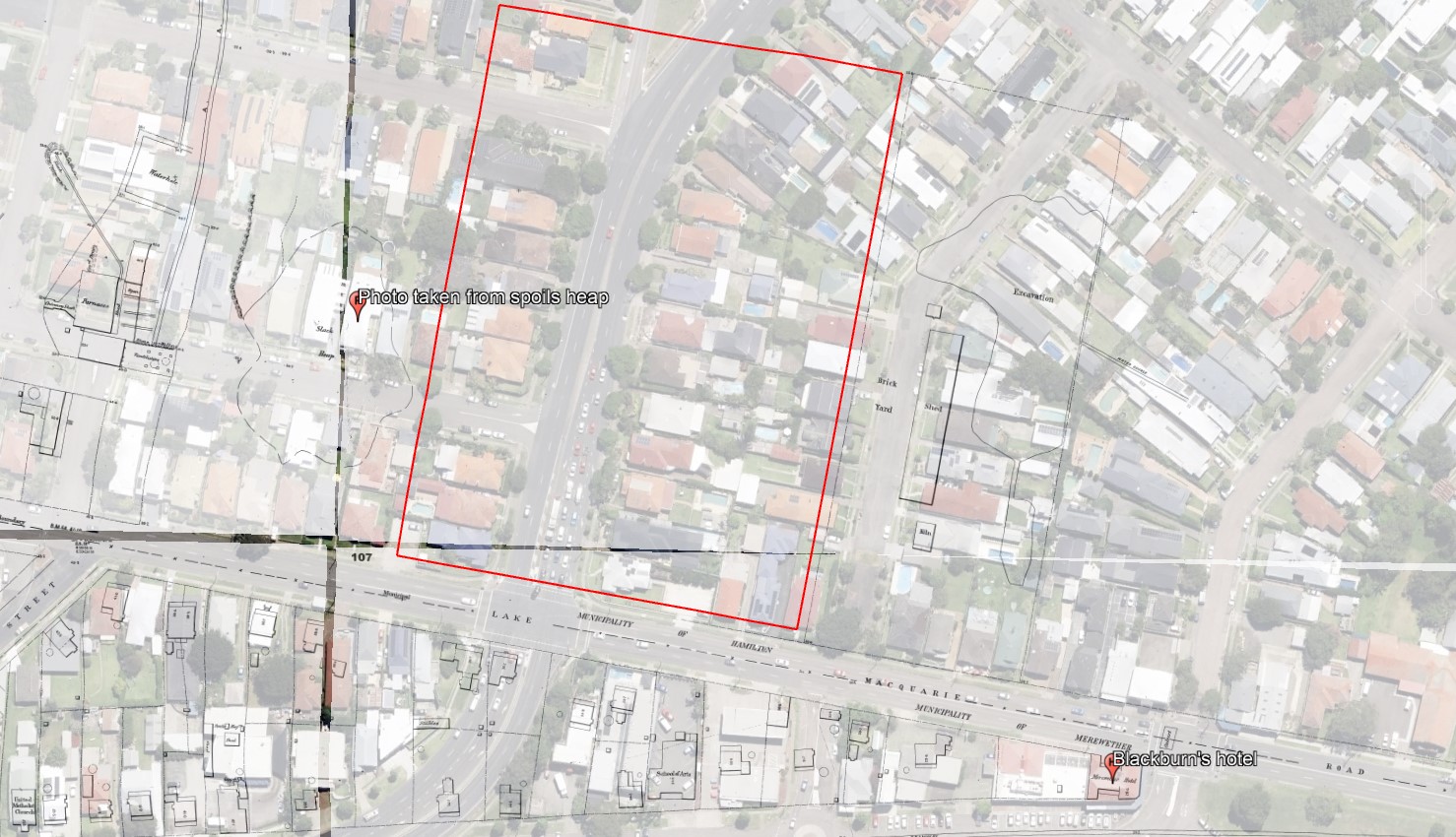
Note that reports of the army encampment of 1897 variously describe it as being in Hamilton or Merewether. Edward Blackburn’s hotel was located on Glebe Rd on the northern edge of the Merewether municipality. Thus across the road, the sporting ground known as Blackburn’s Oval was located in the Hamilton municipality.

Craigies map with the municipal districts of Newcastle (red borders) that shows Blackburn’s hotel (blue star) was in Merewether, while Blackburn’s Oval across the road (red star) was in Hamilton. National Library of Australia.

Appendix – Date of the Snowball photograph

The Ralph Snowball photograph of the army encampment from the Living Histories site used in this article, originally had a date of 23 May 1899. After researching for this the article I am certain that the correct date is 23 May 1897, for the following reasons.

  1. Searching Trove for information about army encampments in May 1899 reveals no results.
  2. Searching Trove for information about army encampments in May 1897 reveals lots of articles, with details that align with the photograph – its location next to the spoil heap of the Hamilton Pit, the number of tents, the presence of infantry and cavalry.
  3. The listing for Box 137 of Snowball’s glass plates that commences on 22 May 1897, shows four photographs taken of “Encampment, Merewether”.
Ralph Snowball Box 137 listing. Newcastle University, Living Histories.

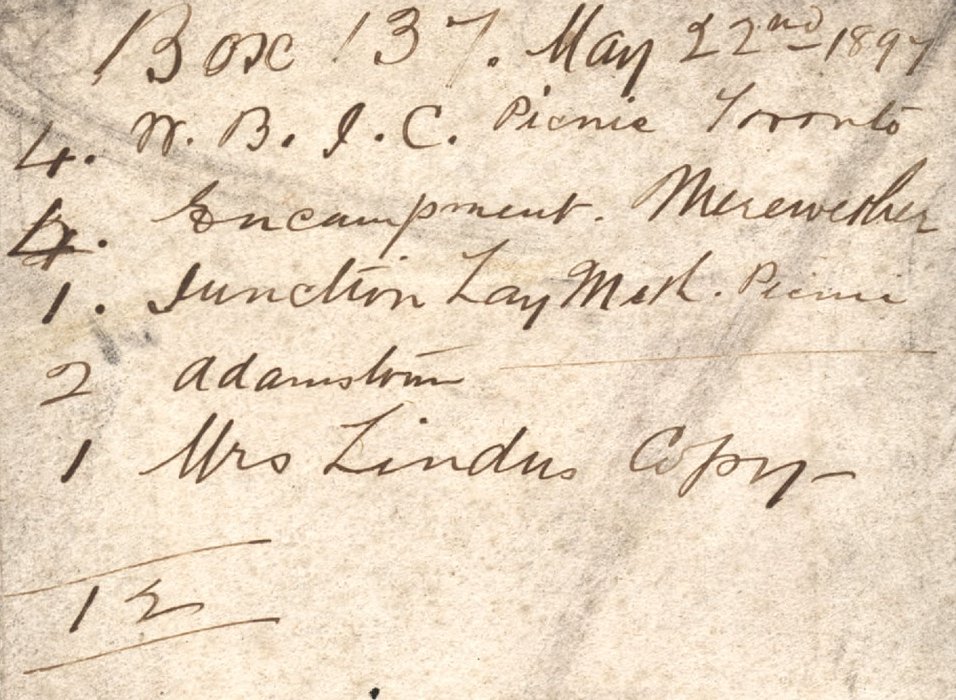
I have subsequently corrected the date in the Living Histories site.

Newspaper articles

Article Date Event DateNotes
28 Apr 1894
26 Apr 1894
"On Thursday 38 men were inspected by Warrant-officer Thompson and passed into the ranks of the Singleton Half-Squadron of Lancers, which is now, therefore, duly formed."
4 May 1897"A communication was read from the officer commanding the 4th Infantry Regiment, asking in the event of an encampment for between 500 and 600 men being held at Merewether, on the 22nd to the 25th instant, if arrangements could be made for supplying water at a spot indicated on a plan which accompanied the letter. Under the circumstances it was decided to grant a free supply of water, and also lend a meter to check the consumption; but all the required pipes and connections would have to be supplied by the military authorities, and the work carried out at their expense by a licensed plumber."
11 May 1897"The military encampment to be held in Newcastle this month is being looked forward to with considerable interest."
18 May 1897"Captain Hilliard, the military staff officer for Newcastle, having completed the surveying in connection with the encampment for the No. 3 Squadron New South Wales Lancers and the 4th Infantry Regiment, to be held at Merewether on 22nd, 24th, and 26th inst., Captain Luscombe yesterday had a fatigue party at work putting up the tents. It is expected that the whole of the arrangements will be completed by to-morrow evening."
19 May 1897"In view of the contemplated encampment of the volunteer forces of the northern district, to be held during this and part of next week, the scene of operations, adjoining the A.A. Co.'s Hamilton pit, has undergone a complete transformation. Upwards of 60 tents have been erected, giving the place a very picturesque appearance."
22 May 1897
21 May 1897
"The officers and troops from Morpeth West Maitland, and East Maitland who are to take part in the military encampment arrived at Honeysuckle Point station by special train at 8.37 last evening, and marched off at once to Merewether to camp under canvas for the night, with the elements anything but favourable to camping out."
22 May 1897
21 May 1897
"The military encampment at Merewether commenced last night, and despite the unpropitious state of the weather it was expected that 550 men of all ranks would be under canvas. These consist of the A B D E and H Companies, who will be reinforced by two guns from A Battery Field Artillery, who will arrive here by special train today from Sydney. The Maitland and Singleton Lancers will arrive by train to-day to take part in the proceedings."
24 May 1897"The four days' military encampment at Merewether commenced on Friday night under most unfavourable weather auspices, a strong southerly gale, with pouring rain, rendering the condition of the men under canvas far from pleasant."
24 May 1897"The military encampment at Merewether attracted a large number of visitors yesterday. The particularly fine specimens of horseflesh to be seen in the Lancers' lines excited considerable admiration among the visitors.” At Fort Scratchley and Shepherd's Hill "there will be shot practice by the No. 6 Company at a target to be moored at sea. Residents in the neighbourhood are reminded to open their windows, to avoid them being broken by the force of the concussion."
25 May 1897
24 May 1897
Detailed description of the sham fight and mock battles undertaken by the encamped soldiers.
25 May 1897
24 May 1897
"Those who considered that a military encampment would have no attraction for the general public must, after yesterday's experience, admit that they are very bad judges of the public taste. From an early hour in the morning, crowds began to gather at the Merewether camp, comprising men, women, and children of all ages and sizes, and, as the day wore on the numbers increased rapidly. After 2 o'clock, when the grand attack was commenced in the direction, of Hamilton, the Glebe Hill and the slack heap of the old Hamilton pit were literally black with people. There could not have been less than 7000 spectators, and though few, if any, really knew what was going on to cause the troops to be rushing to and fro and the cavalry to be galloping around the outskirts of the attack formations."
"The air at one time was thick with smoke, and still the reports of the big guns reverberated."
26 May 1897
25 May 1897
"The encampment at Merewether was broken up yesterday afternoon, the whole of the troops, headed by the 4th Regiment Band, marching out shortly after half-past 4 o'clock, fairly tired out after their few days' continuous training."< /br> "There would, however, need to be better commissariat arrangements. The rations allowed to the men during this camp have been insufficient … The meals, though wholesome, were of a common-place description, and those who required drinks - other than tea and water - had to pay for them. On the whole the camp was run with more than a due regard to economy, and it would not be out of place if an effort were made before next year to stretch the Government purse strings in this matter."
26 May 1897"The troops who have just come out of the encampment hope that arrangements will be made by which they shall get more liberal rations when they next go under canvas."
27 May 1897
26 May 1897
"All the paraphernalia used in connection with the late encampment was brought into the city yesterday and stored in the drill hall of the military buildings in Hunter street."
4 Sep 1914Last reported army encampment in the inner Newcastle suburbs.
4 Nov 1915"An immediate, and strong protest should be made against the determination of the military authorities to abolish the Newcastle encampment, and to centre the large number of recruits from Newcastle and the northern district in Sydney."

Railway Street, Merewether

A relative of mine lives in Railway Street, Merewether, and that got me digging in to the origin of the name.

Presumably it was so named  because of a colliery railway running along or near the street. A 1920s map shows the tram line running along Railway Street, and a colliery railway running along a different route further to the south.

1920s map showing both the Glebe tramway and Glebe Hill Colliery railway. University of Newcastle, Cultural Collections.

So why is it called Railway St when it was a tramway running along the street? Some further digging revealed that the tramway to Glebe was opened on 19th April 1894. Originally called the Merewether line, it was later renamed to the Glebe line to avoid confusion when the Merewether Beach tram line was opened in October 1903. The name “Railway street” pre-dates the tram line, with the name being used as early as 1886. So what is the railway that it refers to?

A. P. Pulver in 1976 compiled a plan showing early coal company railways, which shows that in this area there were two rail lines going to the Glebe Pit – the solid line following the path of Railway Street, and the dashed line further to the south.

Both these rail routes are still visible in a 1954 aerial photograph.These rail lines went to a number of collieries, including the Glebe Pit pictured below.

A Pit Colliery, Newcastle, NSW, 24 February 1899. University of Newcastle, Cultural Collections.

So why were there two rail lines going to the same location? Two newspaper reports from 1881 throw some light on the matter. From 3 Aug 1881

“The railway from Newcastle to the Glebe pit is now nearly completed with the big rails which the company are having laid down in order that the Government engine can haul from the pit, instead of the company’s engine taking the coal from the pit to the siding in town.”

And a month later on 10 Sep 1881

“We have had the pleasure of witnessing the Government locomotive coming direct from Newcastle to the Glebe pit to take away our coals. In connection with the past history of the coal trade in this locality much might be written, for in primitive times we remember when the black diamonds were conveyed to Newcastle by bullock teams. Then we so far advanced as to get a line of wooden rails laid down, along which the coal was taken in waggons drawn by horses. Then came the iron rails and “the puffer,” who for many years screamed and tugged in the performance of her duty as if the coal trade of the port was alone depending upon her efforts. Next came the splendid locomotive, the property of the N.C.M. Co.; and now fine steel rails, a good track, Government engine, break van, &c.”

The best sense I can make of this is that the original railway route with wooden rails and horse drawn wagons (and later upgraded to iron rails) was along the path of Railway Street. Then in 1881 a new railway with “fine steel rails” was constructed on a different route further to the south. With the original railway no longer needed its path became Railway Street, and was subsequently used also used for the tramway in 1894.

Glebe Hill Reservoir

The University of Newcastle Cultural Collections site has a Ralph Snowball photo with the caption “Construction of the water reservoir, New Lambton, NSW 1917”. In tracking down the location of this photo, thanks to Robert Watson I somewhat surprisingly ended up in a different suburb and a different year.

Construction of Glebe Hill Reservoir, 1886. Located at 65 Macquarie St, Merewether. Photo by Ralph Snowball, University of Newcastle, Cultural Collections.

Part 1: Ridgeway Road?

Given that the photo is taken from an elevated position overlooking a flat plain I had always assumed that the location was where the reservoir now is at the top of Ridgeway Road, New Lambton Heights.

Water Reservoir site, corner of Ridgeway Rd and Lookout Rd, New Lambton Heights.

A search of Trove appeared to confirm my assumption, with a 9th January 1917 newspaper article reporting that

“The construction of the New Lambton reservoir was completed on the 3rd instant, and after satisfactory tests were made the reservoir was brought into use.”
Further investigation however cast serious doubt on this being the site of the Snowball photo, for none of the other details matched up.
  • the topography of the land wasn’t right – there is a deep gully below Ridgeway Rd, but in the photo the land slopes down more gently.
  • the reservoir in the photo was of brick construction, but the New Lambton reservoir was of reinforced concrete.
  • the reservoir in the photo was large (from estimates of the dimensions in the photo I calculated the capacity to be 350,000 imperial gallons) whereas the New Lambton reservoir was only 50,000 gallons.

Visiting the site of the Ridgeway Rd reservoir revealed that the 50,000 gallon 1917 reservoir is still there, covered in ivy, beside the new 1954 steel reservoir. It is clearly not the reservoir in the Snowball photo.

The 1917 ivy covered concrete reservoir, Ridgeway Rd, New Lambton Heights.

On the horizon of the Snowball photo there is a very faint outline that appeared to me to be the outline of Shepherd’s Hill on the coast. What other reservoirs on the hills around the Newcastle would provide a view eastwards over the flatlands towards the coast?

A 1940 map of Newcastle shows reservoir locations as small blue circles. Having ruled out the Ridgeway Rd site [1], I then considered Lambton Reservoir [2], St James Rd Reservoir [3], and Lookout Reservoir [4].

1940 map of Newcastle, showing reservoir locations.

Part 2: Lambton?

Lambton Reservoir was built in 1885 and sits in the middle of Newcastle Road at the top of the hill.

Lambton Reservoir, Newcastle Road.

Interestingly, a drawing of the Lambton Reservoir shows that it is the same design as the reservoir in the Snowball photo, with a central dome and two concentric rings of arches to form the roof.

Design of Lambton Reservoir, 1885.

But despite the similarity of design, the topography of the land in the photo doesn’t match. If the photo was of Lambton Reservoir we would expect to see the township of Lambton (including the very prominent Post and Telegraph Office building) before us.

Part 3: St James Road?

The reservoir (marked 3 in the map above) in New Lambton, between St James Rd and Queens Rd was built soon after August 1926. It didn’t seem to match up too well with the shape of the land in the Snowball photo – the St James Rd reservoir appears to have a slight ridge to its right, which is absent in the old photo. Also in 1926 we would expect to see the growing suburb of New Lambton below the reservoir, instead of the large expanse of scrub land that we do see.

Reservoir, between St James Rd and Queens Rd, New Lambton.

Part 4: Lookout?

The reservoir marked 4 on the map above was known as the Lookout Reservoir. It also was constructed on 1926, and its location can still be seen in the empty circular space between the two newer above ground steel reservoirs.

Location of the “Lookout Reservoir”, corner of Grandview Rd and Lookout Rd, New Lambton Heights.

The “Lookout Reservoir” seemed to be a better candidate for the Snowball photo in terms of the shape of the land and size of the reservoir, but it led me to an impossible conclusion … the “Lookout Reservoir” was constructed in 1926, but Ralph Snowball had died in August 1925, before construction had begun!

Part 5: Merewether?

At this point, Robert Watson came to my aid, and with some inspired thinking rescued me from my impossible conclusion. He deduced that the reservoir in the Snowball photo is actually situated in Macquarie St, Merewether.

Location of Glebe Hill reservoir on the 1940 map.

I had led myself astray in too quickly assuming that the Snowball photo was looking east towards the coast. It is in fact looking north-west, across the Broadmeadow flatlands towards Waratah.

Glebe Hill Reservoir, Merewether.

Panorama from the site of the Glebe Hill reservoir.

Glebe Hill Reservoir in Macquarie St Merewether is now part of a private residence. Google Street View.

A newspaper article from May 1886 states that the construction of the reservoir began in November 1885, only three months after the Lambton reservoir was completed in August 1885. The article contains a detailed description of the design that matches the photo very closely.

The roof is formed of two concentric arched rings and a dome carried by cast-iron girders, supported by iron columns resting on stone foundations some two feet square.
A March 1887 article describing the Hunter River District Water Supply shows that the Glebe Hill reservoir was almost identical to the size to the Lambton reservoir.
The reservoir at Lambton is built on the hill above the Public school, a distance of twelve and a half miles from. Buttai. It will hold 402,600 gallons. At fifteen and a third miles from Buttai a 15-inch branch pipe, a mile and a quarter in length, is connected with a reservoir having a capacity of 403,000 gallons, to supply Hamilton, Adamstown, the Glebe, and other towns along the line.
Note that although the reservoir is located within the modern day suburb boundaries of Merewether, it is sometimes called the “Hamilton Reservoir”, as that was the principal township it served.
Some other hints that confirm that the Snowball photo is of the Glebe Hill reservoir are the faint outline of smoke stacks in the distance. At the right are two stacks of different size, close together.

Broadmeadow copper smelter stacks.

These are the stacks of the English and Australia Copper Company smelter at Broadmeadow.

To the right is a single stack of one of the A.A. Company pits in Hamilton, and the very faint outline of the roof of St Peters Church in Denison St, Hamilton.

The Glebe Hill reservoir photo is taken from a spot only about 400 metres away from another Ralph Snowball photo taken in 1897, which shows the same landmarks in the distance.

The Newcastle lowlands. 1897. Photo taken from intersection of Beaumont St and Glebe Rd looking north towards Hamilton. University of Newcastle Cultural Collections.

1886 Glebe Hill Reservoir photo (top) and 1897 Glebe Rd photo (bottom)

The Glebe Hill reservoir is marked on Corporal Barrett’s 1910 map of Newcastle, situated on Lake Macquarie Rd. Quite possibly the two buildings marked at the end of Henry St are the two buildings we see in the Snowball photograph.

Glebe Hill reservoir, on 1910 map. University of Newcastle Cultural Collections.


Acknowledgements

My thanks to Robert Watson who had a substantial input into the content of this article. Thanks also to Brendan Berghout of Hunter Water, who pointed me towards some useful information on early water supply infrastructure, and who helpfully reminded me that imperial gallons (220 gallons/m3) are not the same as U.S. gallons (264 gallons/m3). It was a casual conversation with Brendan on a bicycle commute to work one morning that was the genesis of this journey of discovery.

Merewether Council

Merewether Council was incorporated on 20th August 1885, and published in the Government Gazette on that same day. The first election of 9 aldermen from a field of 18 candidates was held on 26 October 1885 at the Merewether Mechanics’ Institute  (School of Arts) building, Glebe. Immediately following the official declaration of the poll sometime after 6pm that night, the first meeting of the newly-elected alderman was held, for the purpose of choosing a Mayor. Thomas Kempster was elected unopposed as Mayor.

Railway St Council Chambers

The second meeting of the council was held on November 3, 1885, also in the Mechanics Institute building. It was decided that the council should continue to hold its regular meetings in that building. A report on 28 December 1935, at the time of the council’s jubilee, gives a brief history of the Mechanics’ Institute …

The building has an interesting history, for it was originally opened as a Protestant hall, and later became the Merewether Council Chambers, until new quarters for the council were erected. The Protestant hall, which is now the main hall of the building, was opened in January, 1879, having been built by Mr. H. Caddy, of Newcastle. Within two years of this date, residents decided to do something about the erection of a mechanics’ institute, and in February, 1882, the building was reopened as the Glebe and Burwood Mechanics’ Institute. When the municipality was incorporated in 1885, the first meetings of the new council were held in the institute hall, and later a separate room, now used as a reading room, was built for the council, which continued to meet there until September, 1894, when a new building in Llewellyn street was opened. The name of the Mechanics’ Institute was subsequently changed to the Merewether School of Arts, and in 1914 the site of the building was purchased from the Merewether estate.

The Merewether Mechanics’ Institute (School of Arts) was located in Railway St on the land that is now the car park of the Merewether Motel at 231 Glebe Rd. The Australian and Decorative and Fine Arts Societies has a publication detailing the history of the building. The School of Arts building is shown on an 1897 Water Board map.

Location of Merewether School of Arts building on an 1897 Water Board Map. Hunter Living Histories.

The building can be seen in this 1944 aerial photograph.

Merewether School of Arts building in Railway Street in 1944.

A rather dilapidated Merewether School of Arts building. c. 1960. Newcastle Region Library.

Llewellyn St Council Chambers

A new dedicated Council Chambers building was constructed with weatherboard in 1894 in Llewellyn St and officially opened on Friday 7th September 1894.

Merewether Council Chambers. Erected 1894. Photo by Ralph Snowball. University of Newcastle, Cultural Collections.

Merewether Council Chambers. Erected 1894. Photo by Ralph Snowball. University of Newcastle, Cultural Collections.

A real estate map shows that in 1918 the council chambers were located at 41 Llewellyn Rd, between St Augustine’s church and the fire station. I’m guessing that in the photo above, the ladder structure in the background was associated with a fire station next door.

MerewetherCouncil1918In September 1922 a tender was advertised for the erection of new council chambers. The chambers were built by the end of that year and were officially opened on 20th January 1923. The old wooden council chambers building was then dismantled, and re-erected on Merewether Beach for the use of the Merewether Surf and Life Saving Club.

Merewether Council Chambers. Newcastle Morning Herald, 21 May 1938.

In 1950 the the former council chambers brick building in Llewellyn St was sold to the Merewether R.S.L. sub-branch for £1200.
The site of the former council chambers, April 2016. The fire station is still next door.

The site of the former council chambers, April 2016. The fire station is still next door.

New council chambers were opened in 1923.

Questions yet to be answered

  • When was the 1922 brick council chambers demolished?

Differences of grandeur

My latest article for the Lambton Local is out, this month on Council mergers, and in particular how 11 city and suburban councils merged together in 1938 to form the City of Greater Newcastle Council.

Researching the article got me thinking about the various town halls and council chambers left behind after the 1938 merger, where were they, what happened to them, are they still around today? I’m currently putting together some web pages to document the various municipal council buildings in the Newcastle area.

One thing that has struck me is the stark differences in style and expense in the buildings erected by the various councils. The extremes are best exemplified by the castellated fortress erected by Stockton Council in 1891 , and the simple weatherboard box that Merewether Council erected just three years later in 1894. What were the differences in budgetary restrictions and/or delusional aspirations of grandeur that led to such disparate buildings?  I don’t know the answer yet, but it will be interesting to find out.

Stockton Council Chambers. Newcastle City Council, Hunter Photobank.

Stockton Council Chambers. Erected 1891. Newcastle City Council, Hunter Photobank.

Merewether Council Chambers. Erected 1894. Photo by Ralph Snowball. University of Newcastle, Cultural Collections.

Merewether Council Chambers. Erected 1894. Photo by Ralph Snowball. University of Newcastle, Cultural Collections.


The drain explain

DryBack in 2014 a change of residence meant that my bicycle commute to work changed to a route that took me alongside long stretches of the concrete drains that spider across the low lying Newcastle suburbs. For 85% of my commute to work I am within 200 metres of one of the concrete drains, or Throsby Creek.

In a recent conversation with a friend when I mentioned this, they responded with some expression of sympathy and sadness that I had to endure such an ugly travelling companion. As I reflected on this Dsc04477areaction I realised that although the drains are not exactly the most aesthetic feature of our city, there are a number of positives.Firstly, cycling alongside the drains offers relative serenity, in comparison to busy roads. Secondly, the drains often attract a variety of bird life – ducks, ibises, some other kinds of birds, the black and white ones, the fast darting ones, as well as those little fluttery ones. (As much as I like birds, you might correctly guess I’m no ornithologist!)

In thinking about the concrete drains I’ve also been pondering their principal purpose – to drain away water. In the downpours of January 2016 I saw this fully in action, and recorded this video of the drain in Broadmeadow near the rescue helicopter base.

Untitled
It got me thinking. How much water was being carried away each second? Stepping through the frames on the video I was able to see that it took 2.94 seconds for the flow to pass from one concrete seam in the drain to the next. A visit to the drain a few weeks later (when it was dry) to take some measurements revealed the following.

Distance between cracks: 9.1m
Average width of drain: 13.4m
Average depth of drain: 1.6m
Cross sectional area: 21.44m2
Water velocity: 3.1 m/s
Flow volume (cubic metres per sec): 66.4 m3/s

That’s 66 thousand litres per second. Impressive. Or to put it another way, since a standard size Olympic swimming pool contains 2.5 million litres, the waterway at this point is capable of draining an Olympic sized swimming pool every 38 seconds.

Drain dimensions

Broadmeadow drain measurements.

[ Note that all these measurements and calculations are ‘back of the envelope’, ‘ballpark figures’ for the purpose of gaining a broad sense of the capabilities of the drain, and not a precise hydrological survey. ]

I’ve also been pondering the economic benefit of these drains. Prior to their construction from 1895 onwards, the lowlands of Newcastle were regularly turned into a useless boggy swampland. A 1892 description of Broadmeadow states that:

“When there are heavy rains the water comes down in such a way as to flood the streets and property, the water being sometimes 12 and 18 inches deep on the streets.”

Premier Hotel, Broadmeadow, 1892. Photo by Ralph Snowball. University of Newcastle Cultural Collections.

Premier Hotel in Broadmeadow surrounded by flood waters in 1892. Photo by Ralph Snowball. University of Newcastle Cultural Collections.

The 1897 Ralph Snowball photograph below looking from Glebe Rd Merewether across to Hamilton graphically illustrates the large plain of unused and unusable land, and with the roads suffering significant water erosion.

The Newcastle lowlands. 1897. Photo taken from intersection of Beaumont St and Glebe Rd looking north towards Hamilton. University of Newcastle Cultural Collections.

The Newcastle lowlands, 1897. Photo taken from intersection of Beaumont St and Glebe Rd looking north towards Hamilton. University of Newcastle Cultural Collections.

Even as construction was progressing the economic benefit of drainage was clear to see, with an 1897 newspaper report on the extension of the system into Adamstown noting that:

“Its construction will prove a great boon to those residing on the lowlands, and should increase the value of property materially.”

Drain construction workers at Broadmeadow, NSW, 6 April 1900

Drain construction workers at Broadmeadow, NSW, 6 April 1900. University of Newcastle Cultural Collections.

The question then is what is the area of the “lowlands” that are emptied by the drainage system? Browsing the altitude data in Google Earth, and observing the landscape around town, 15 metres above sea level seems to be the inflection point where a gradual rise in elevation across the plains changes to a steeper inclinaton of the surrounding hills and ridges. Using Google Earth I marked with yellow lines the concrete drains, and mapped out in blue the area of the drainage basin that is 15m or less above sea level. This area totalled approximately 1850 hectares. [ KML file viewable in Google Earth ]

[ Note, as before, this mapping is a rough approximation for the purpose of gaining a broad sense of the capabilities of the drainage system, and not a precise hydrological survey. ]

Newcastle concrete drain system. Area shaded blue is 15m or less above sea level.

Newcastle concrete drain system. Area shaded blue is 15m or less above sea level.

As an aside, when I first viewed the map of the drains against the shaded lowlands, it immediately struck me that there is a large area centred on Hamilton that has no open concrete drains, and my recollection is that in the June 2007 Pasha Bulker storm, Hamilton was one of the main areas of flooding. Coincidence or not? I don’t know, as I keep reminding you, I’m not a hydrologist.

Nor am I an economist. With that final disclaimer out of the way I can now ask, how much is all that land worth? What is the monetary value of the land made productive by the open concrete drain system? As an example of land values, the NSW Valuer General shows that in 2015 a 424 m2 area of land in Hamilton North had a value of $327,000. This equates to $771 per square meter, or $7.7 million per hectare.  If we assume that only 75% of the 1850 hectares is usable (allowing for roads, creeks, etc) then the total land value of the lowlands shaded in the map above is … 10.7 billion dollars!

So the next time you pass one of those ‘ugly’ concrete drains … give a bit of respect.


For more drain related musings, check out Mark Maclean’s Hamilton North blog.