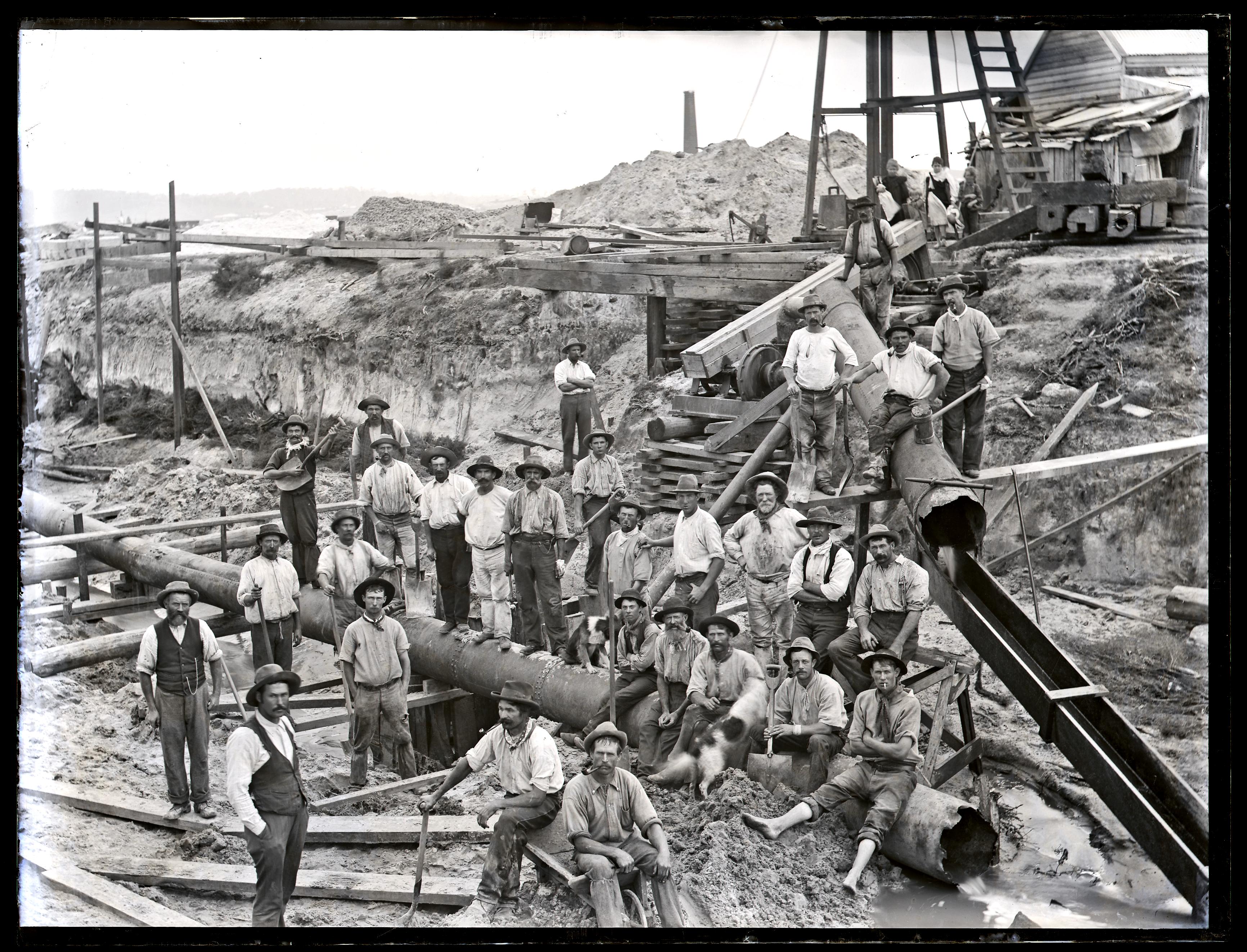
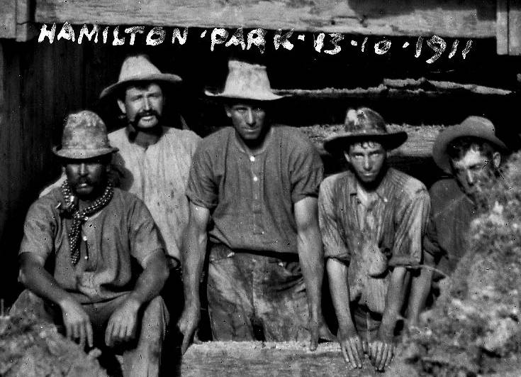
While browsing the University of Newcastle’s collection of Ralph Snowball photos, I came across a picture of construction work, with the inscription of “Hamilton Park – 13.10.1911”. It wasn’t immediately clear from the photo what work was being done, but after some searching of Trove I established that it was the construction of sewer mains in the streets of Hamilton. A newspaper article from 3rd August 1911 reports
“Out at Hamilton West the main sewer is being put down at a depth of 16ft. The ground there is a sort of bluish clay, and although it has to be cut out like so much putty, it does not present anything like the same trouble that the sand at the eastern end of the municipality does. Here, as in Denison street, centrifugal pumps, electrically driven, deal with the water, and the current is supplied from the city council’s power-house.
There are 130 men at work in Hamilton East and 61 in Hamilton West. About half of these were coal-miners, and they are doing very well at the new class of work.”
Construction of sewer main, Tudor St Hamilton, 13th October 1911. Photo by Ralph Snowball. University of Newcastle, Cultural Collections.
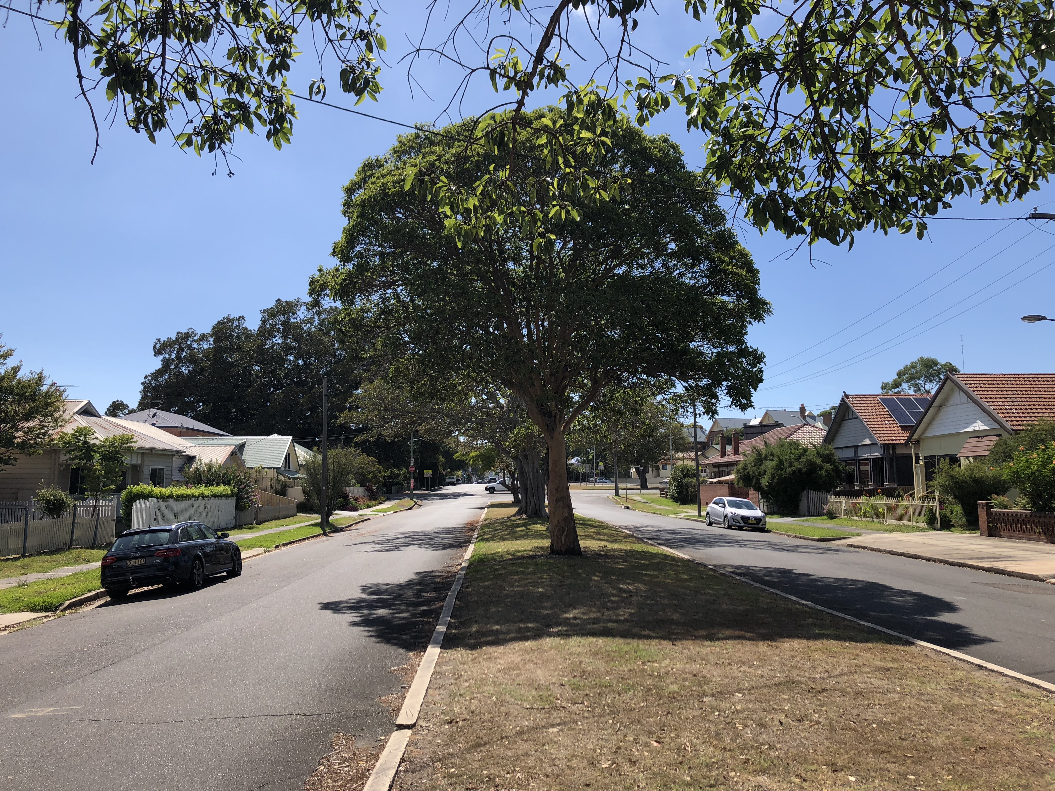
Tudor St Hamilton. January 2018.
The approximate location of the 1911 photo can be established by taking note of the distinctive façade of the building at 5 Belford St Hamilton. From this it would appear that the photo is taken in Tudor St, somewhere between Blackall St and Samdon St, looking towards the east.
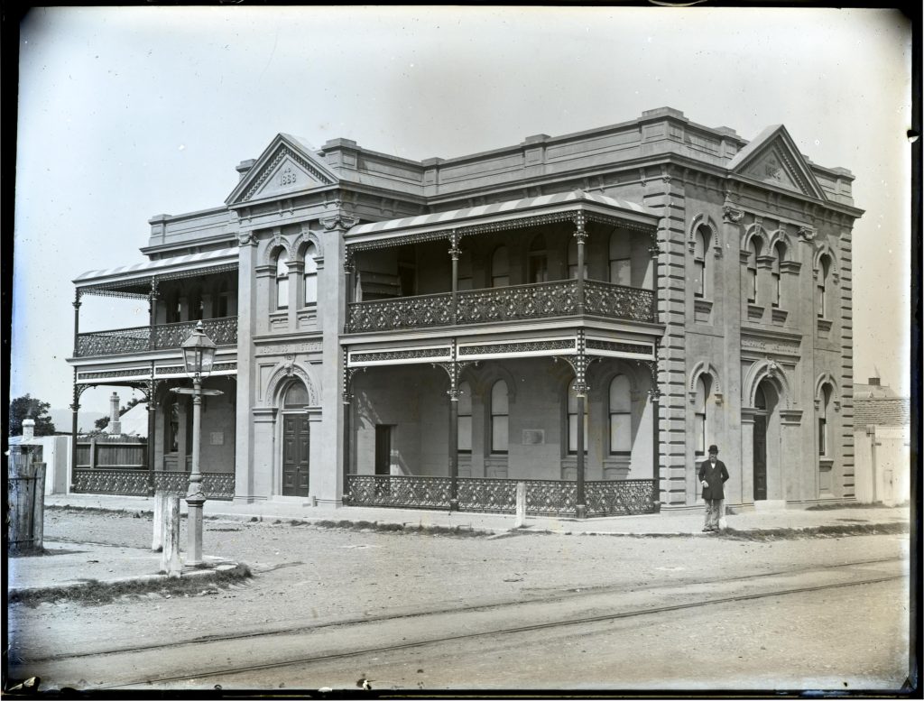
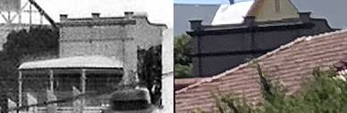
A few months ago when I was doing research for my article on the Lambton Mechanics’ Institute, I came across this old photo of the Hamilton Mechanics’ Institute.
Hamilton Mechanics’ Institute, Tudor and Milton Streets, 1892. Photo by Ralph Snowball. University of Newcastle Cultural Collections.
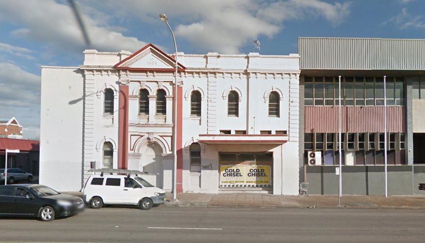
On driving down Tudor St I was somewhat saddened to find that this marvellous building was almost unrecognisable in its current drab utilitarian state, with the beautiful verandahs gone, and the symmetry of the building mutilated by uninspired additions. I wished that someone would restore it to its former glory.
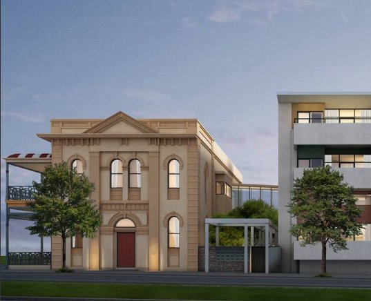
Then last week as I was driving down Tudor St I noticed some scaffolding up around the building, and wondered what was happening. My question was answered in the Newcastle Herald yesterday where I was very excited to learn that local firm DJB Developments are renovating the buildings there into a 33 apartment complex. This looks fantastic, with the Mechanics Institute building restored to its former symmetry and beauty, and with a clear separation of old and new. I sincerely hope that the restoration turns out to be as good as it looks in the plans.
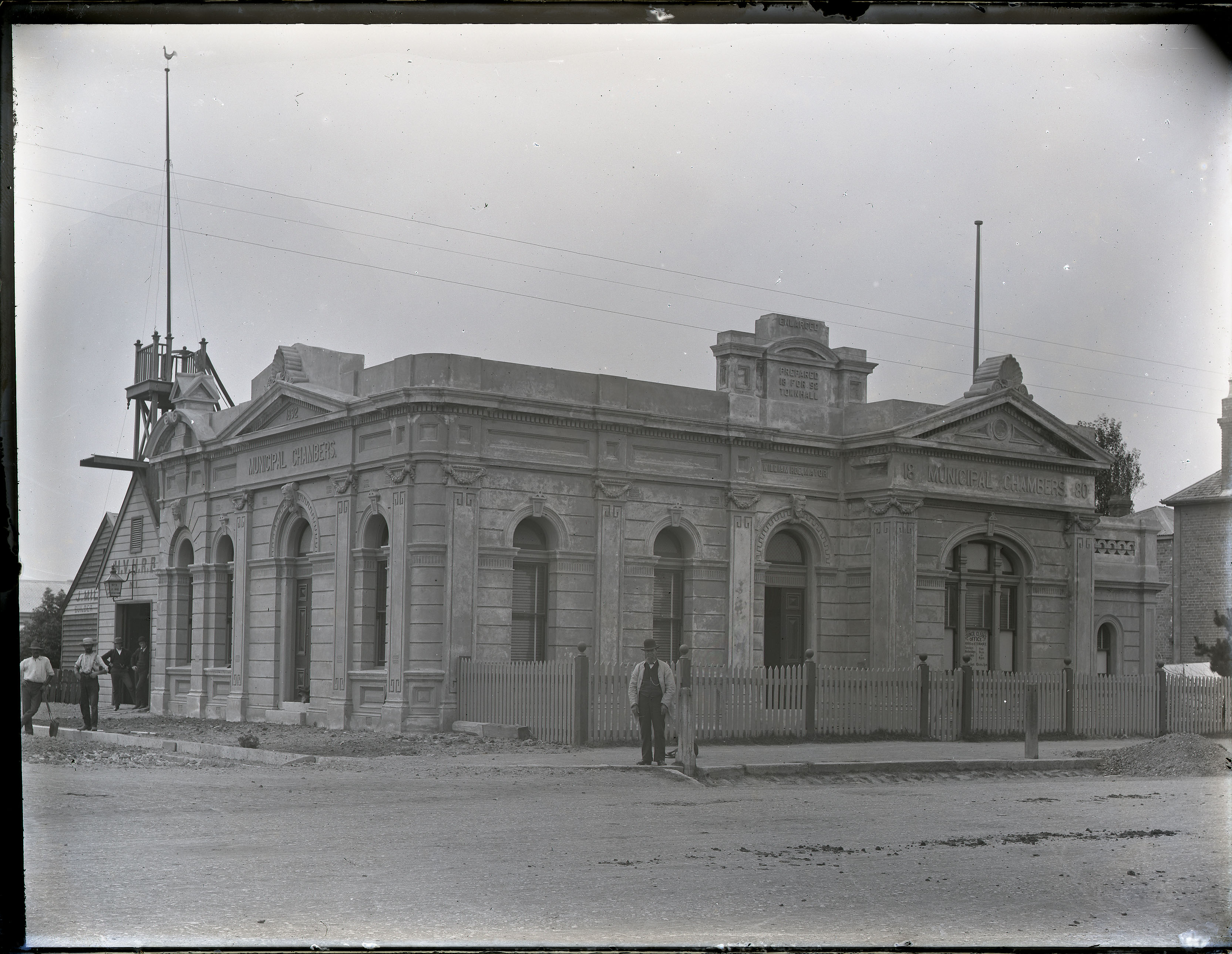
Hamilton Council was incorporated on 11th December 1871. The first meeting of the council was held on 13th February 1871, in the building known as the Mechanics’ Institute. Over the years Hamilton had a number of municipal council buildings.
Hamilton Council Chambers 1880. University of Newcastle, Cultural Collections.
In the photo below from the University of Newcastle Cultural Collections, the building has two different dates
“Municipal Chambers – 1880”
“Enlarged – Prepared For Town Hall – 1892”
Hamilton Council Chambers. University of Newcastle, Cultural Collections.
Hamilton Council Chambers. Newcastle Morning Herald, 21 May 1938.
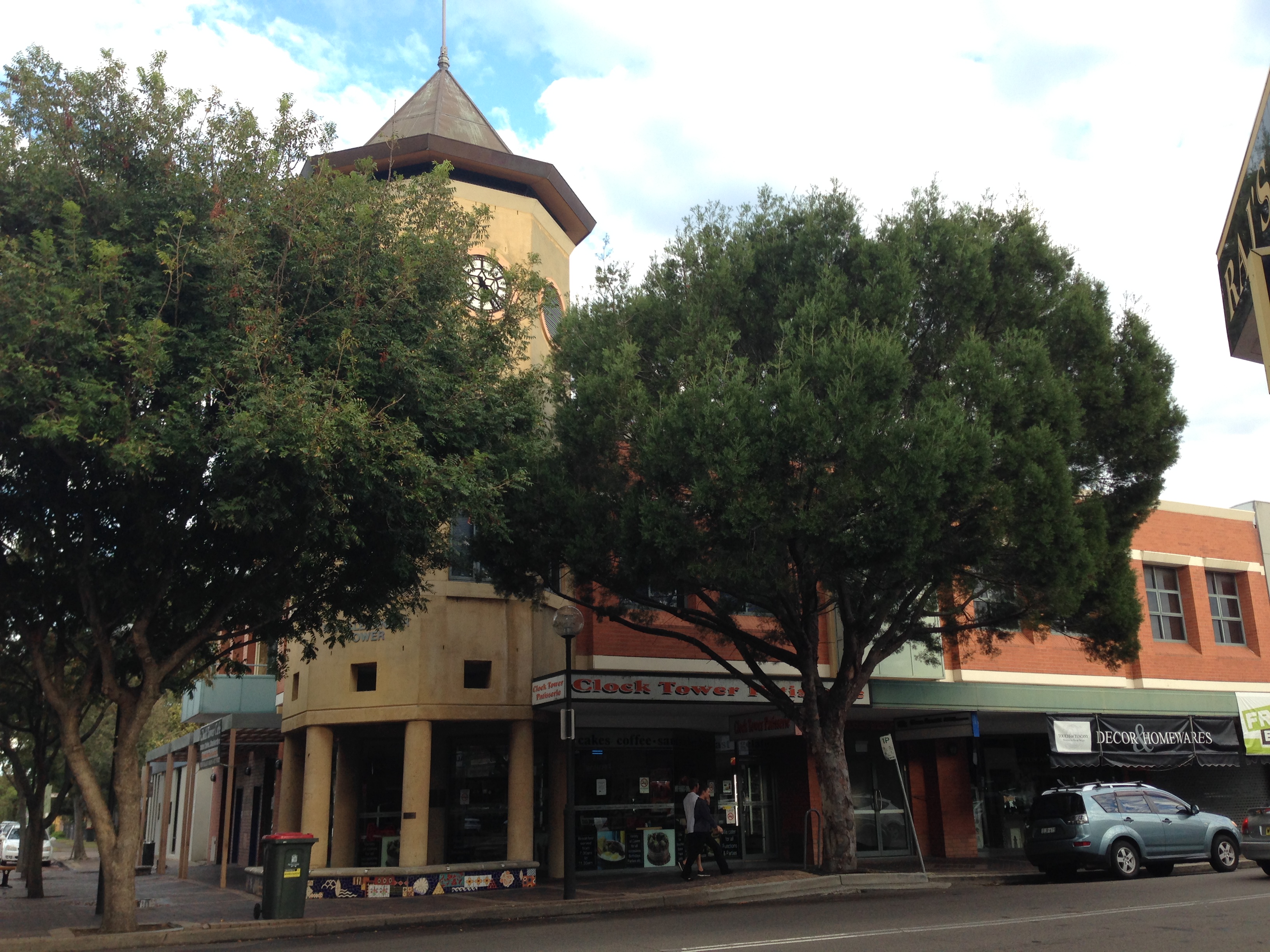
The new building at the former location of the Hamilton Municipal Council building. A replica of the clock tower was incorporated into the new building. March 2016.
Questions yet to be answered
Where was the the Mechanic’s Institute building where the 17 Feb 1872 newspaper article says the first council meeting was held?
The photo of 70 James Street Hamilton (in the Hunter Photobank) is where early council meetings were held. Is this the same site as the current 70 James St? (Bearing in mind that renumbering of streets is not an uncommon event.)
Where exactly was the 1880 council chambers located?
Is the 1892 council chambers in the same spot? If so, why does it look so different from the 1880 chambers?
Although I didn’t intend it when I set out, a bike ride with my son around town today ended up visiting various sites in Newcastle matching the old photos in my previous drain blog post. Here’s the “Then and Now” comparisons.
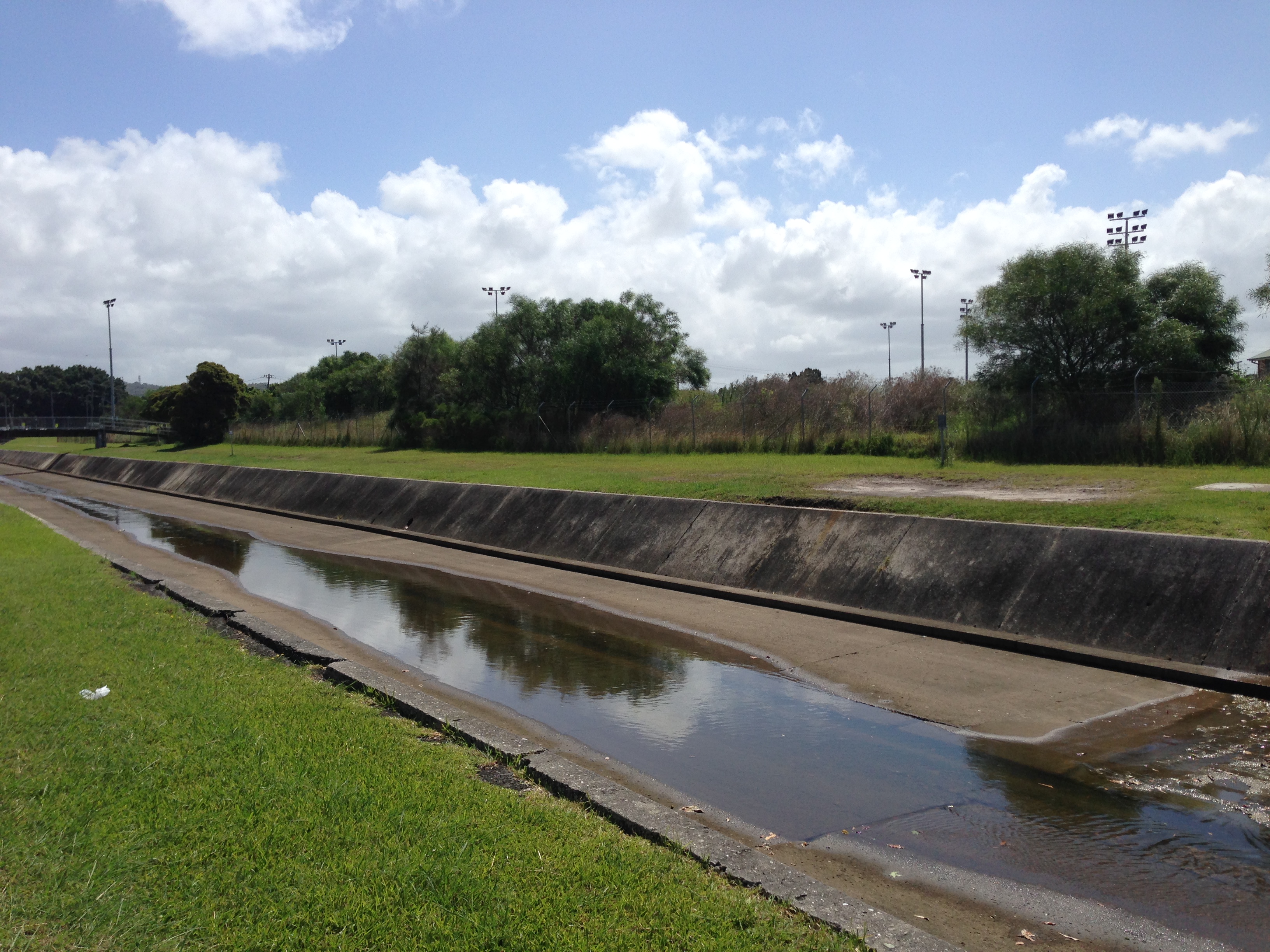
Broadmeadow drain
Drain construction workers at Broadmeadow, NSW, 6 April 1900
Broadmeadow drain, 6th February 2016.
The stormwater drain at Hamilton North, March 2017.
Update, March 2017: With subsequent research I have found that the location of the 1900 Snowball photo was Hamilton North, not Broadmeadow.
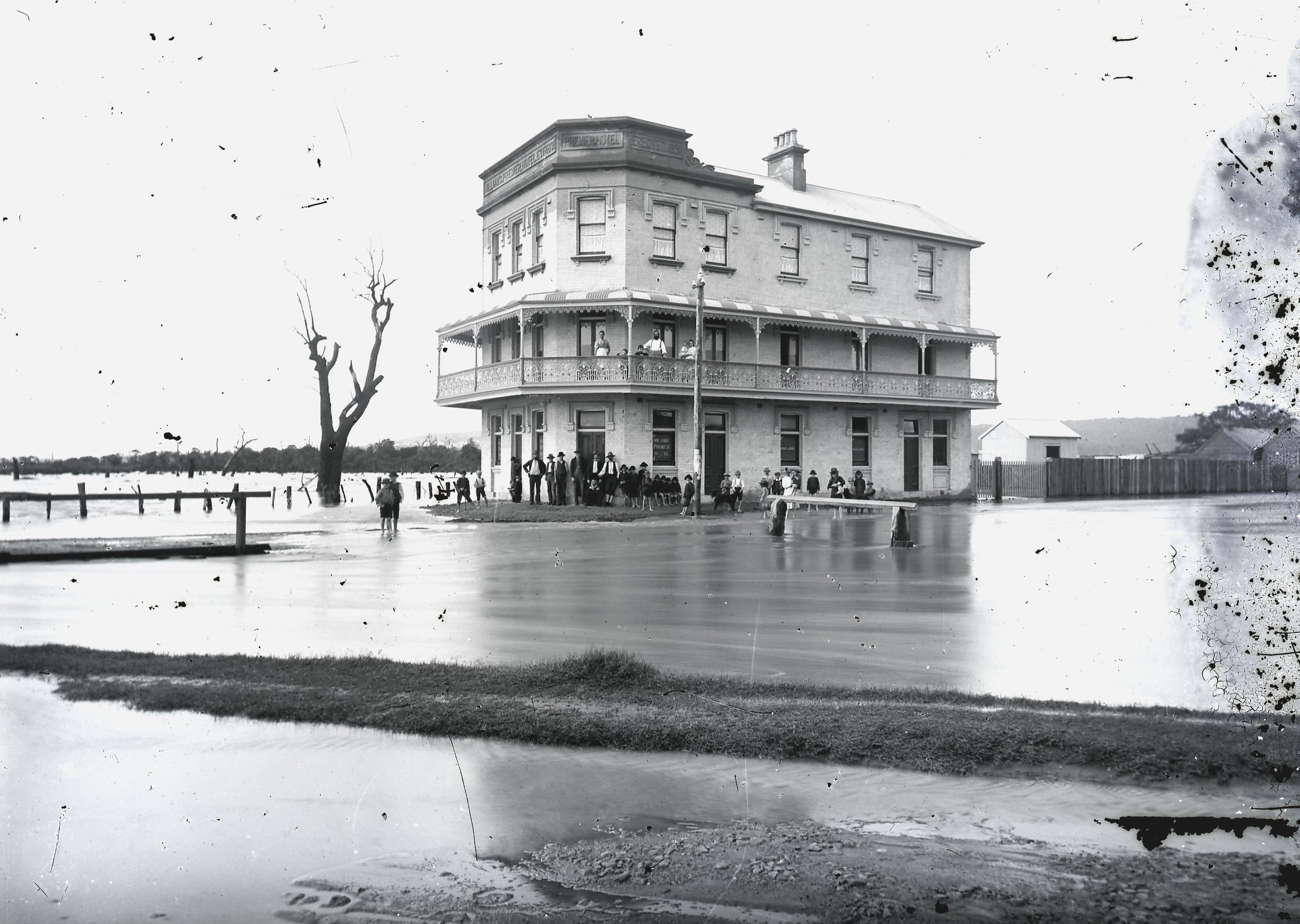
The Premier Hotel
Premier Hotel, Broadmeadow, 1892. Photo by Ralph Snowball. University of Newcastle Cultural Collections.
Premier Hotel, 6th February 2016.
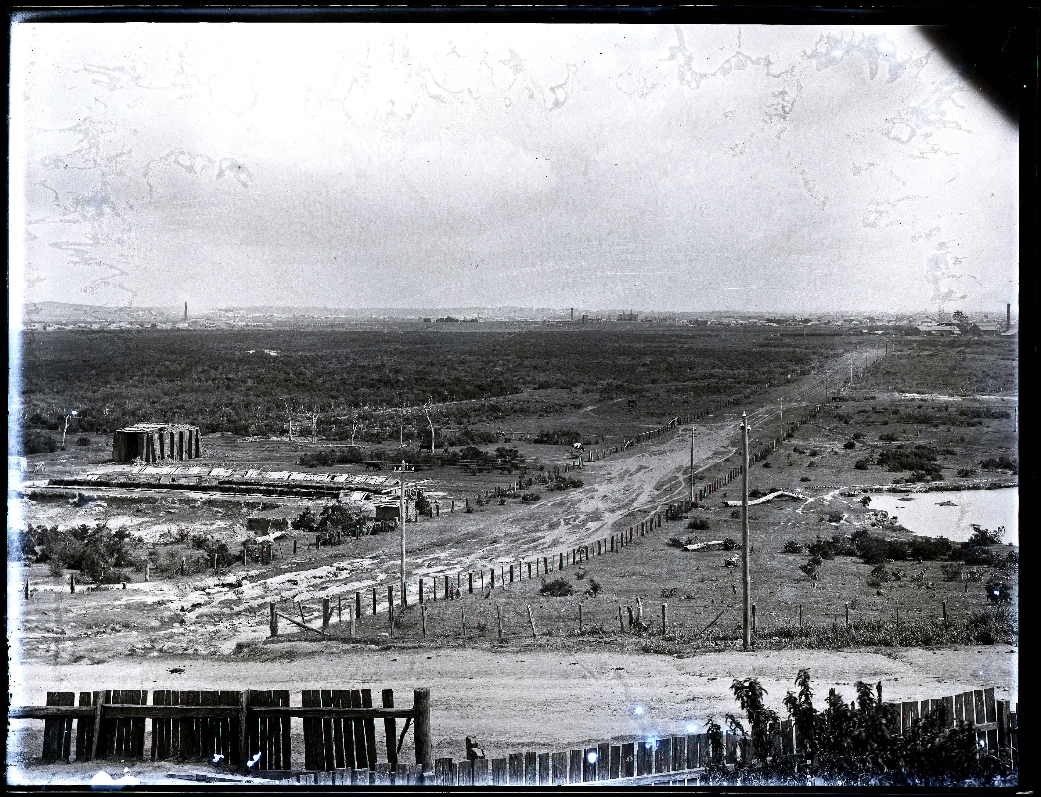
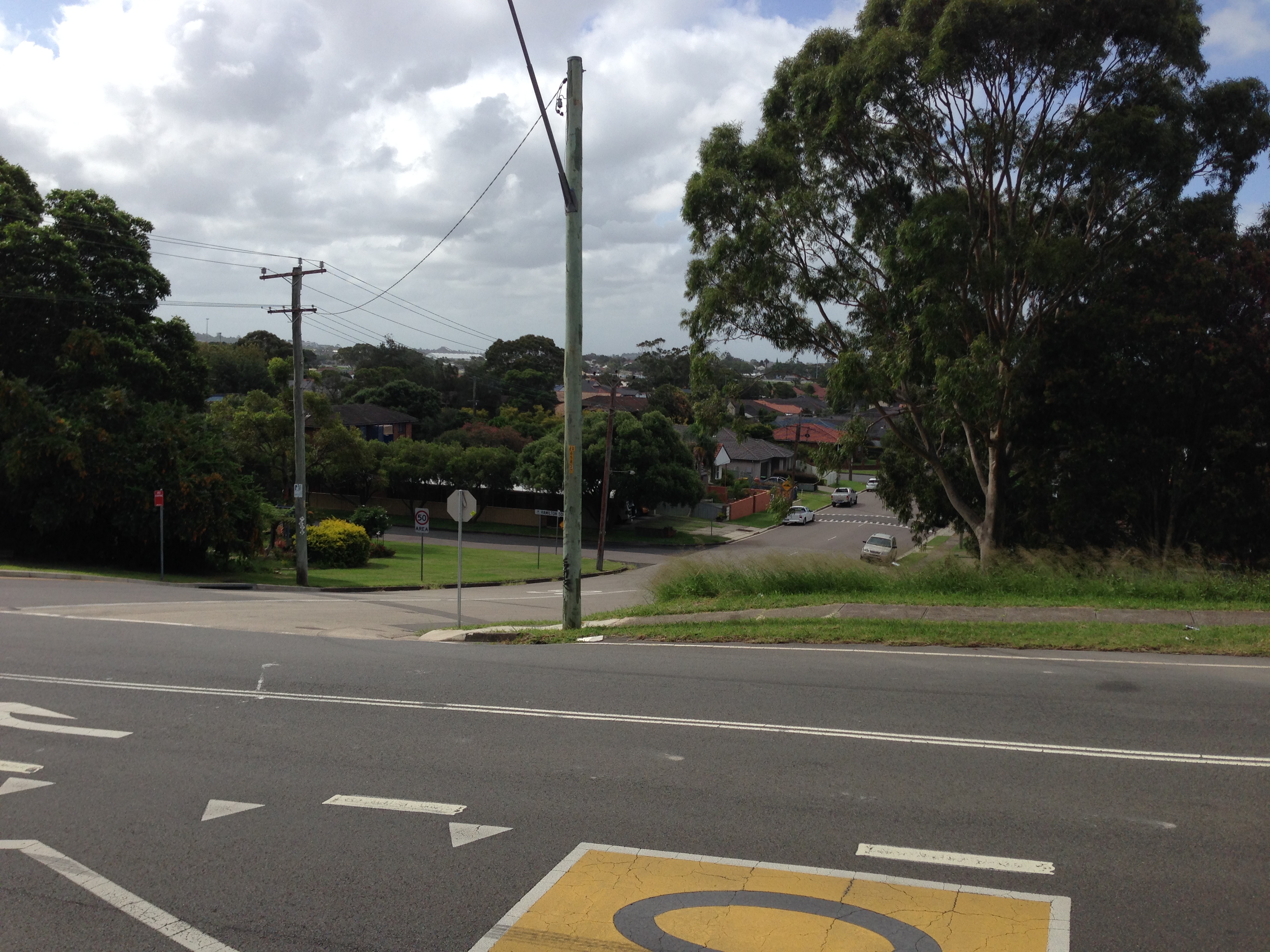
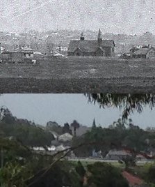
View of the lowlands from Glebe Road
The Newcastle lowlands. 1897. Photo taken from intersection of Beaumont St and Glebe Rd looking north towards Hamilton. University of Newcastle Cultural Collections.
Looking north from Glebe Rd towards Hamilton. 6th February 2016.
This modern view bears almost no resemblance to the 1897 photo, with the previously deserted lowlands now covered with trees, suburbia and industry. The only visible match (apart from Beaumont St sloping down the hill) is a spire of St Peter’s Anglican church in Denison St Hamilton.
St Peters Anglican Church Hamilton
St Peter’s Anglican Church Hamilton.
It seems that at some time the church has lost one of its spires.
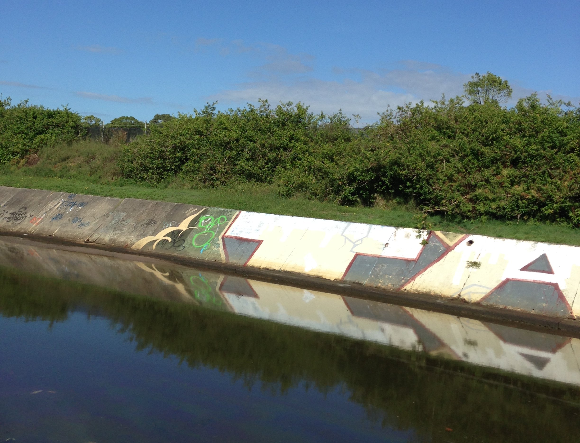
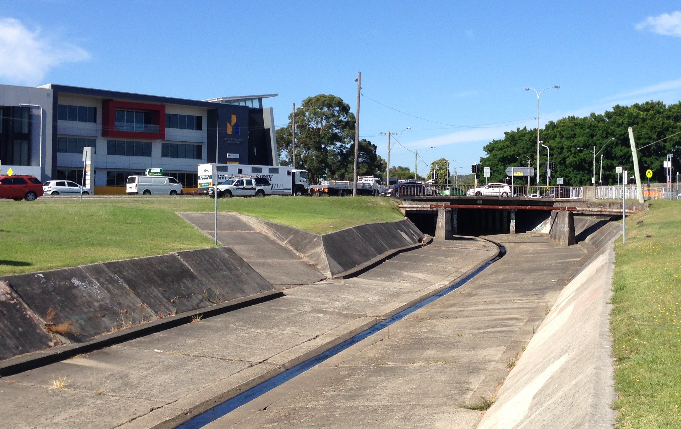
Back in 2014 a change of residence meant that my bicycle commute to work changed to a route that took me alongside long stretches of the concrete drains that spider across the low lying Newcastle suburbs. For 85% of my commute to work I am within 200 metres of one of the concrete drains, or Throsby Creek.
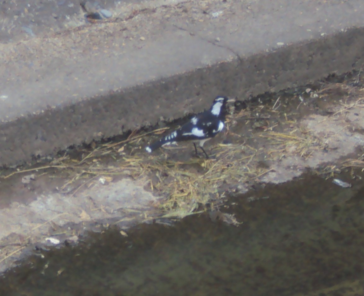
In a recent conversation with a friend when I mentioned this, they responded with some expression of sympathy and sadness that I had to endure such an ugly travelling companion. As I reflected on this reaction I realised that although the drains are not exactly the most aesthetic feature of our city, there are a number of positives.Firstly, cycling alongside the drains offers relative serenity, in comparison to busy roads. Secondly, the drains often attract a variety of bird life – ducks, ibises, some other kinds of birds, the black and white ones, the fast darting ones, as well as those little fluttery ones. (As much as I like birds, you might correctly guess I’m no ornithologist!)
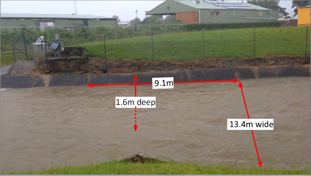
In thinking about the concrete drains I’ve also been pondering their principal purpose – to drain away water. In the downpours of January 2016 I saw this fully in action, and recorded this video of the drain in Broadmeadow near the rescue helicopter base.
It got me thinking. How much water was being carried away each second? Stepping through the frames on the video I was able to see that it took 2.94 seconds for the flow to pass from one concrete seam in the drain to the next. A visit to the drain a few weeks later (when it was dry) to take some measurements revealed the following.
[ Note that all these measurements and calculations are ‘back of the envelope’, ‘ballpark figures’ for the purpose of gaining a broad sense of the capabilities of the drain, and not a precise hydrological survey. ]
I’ve also been pondering the economic benefit of these drains. Prior to their construction from 1895 onwards, the lowlands of Newcastle were regularly turned into a useless boggy swampland. A 1892 description of Broadmeadow states that:
“When there are heavy rains the water comes down in such a way as to flood the streets and property, the water being sometimes 12 and 18 inches deep on the streets.”
Premier Hotel in Broadmeadow surrounded by flood waters in 1892. Photo by Ralph Snowball. University of Newcastle Cultural Collections.
The 1897 Ralph Snowball photograph below looking from Glebe Rd Merewether across to Hamilton graphically illustrates the large plain of unused and unusable land, and with the roads suffering significant water erosion.
The Newcastle lowlands, 1897. Photo taken from intersection of Beaumont St and Glebe Rd looking north towards Hamilton. University of Newcastle Cultural Collections.
Even as construction was progressing the economic benefit of drainage was clear to see, with an 1897 newspaper report on the extension of the system into Adamstown noting that:
“Its construction will prove a great boon to those residing on the lowlands, and should increase the value of property materially.”
Drain construction workers at Broadmeadow, NSW, 6 April 1900. University of Newcastle Cultural Collections.
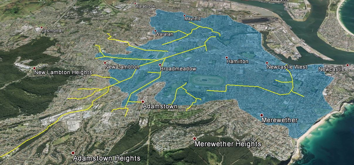
The question then is what is the area of the “lowlands” that are emptied by the drainage system? Browsing the altitude data in Google Earth, and observing the landscape around town, 15 metres above sea level seems to be the inflection point where a gradual rise in elevation across the plains changes to a steeper inclinaton of the surrounding hills and ridges. Using Google Earth I marked with yellow lines the concrete drains, and mapped out in blue the area of the drainage basin that is 15m or less above sea level. This area totalled approximately 1850 hectares. [ KML file viewable in Google Earth ]
[ Note, as before, this mapping is a rough approximation for the purpose of gaining a broad sense of the capabilities of the drainage system, and not a precise hydrological survey. ]
Newcastle concrete drain system. Area shaded blue is 15m or less above sea level.
As an aside, when I first viewed the map of the drains against the shaded lowlands, it immediately struck me that there is a large area centred on Hamilton that has no open concrete drains, and my recollection is that in the June 2007 Pasha Bulker storm, Hamilton was one of the main areas of flooding. Coincidence or not? I don’t know, as I keep reminding you, I’m not a hydrologist.
Nor am I an economist. With that final disclaimer out of the way I can now ask, how much is all that land worth? What is the monetary value of the land made productive by the open concrete drain system? As an example of land values, the NSW Valuer General shows that in 2015 a 424 m2 area of land in Hamilton North had a value of $327,000. This equates to $771 per square meter, or $7.7 million per hectare. If we assume that only 75% of the 1850 hectares is usable (allowing for roads, creeks, etc) then the total land value of the lowlands shaded in the map above is … 10.7 billion dollars!
So the next time you pass one of those ‘ugly’ concrete drains … give a bit of respect.

 While browsing the University of Newcastle’s collection of Ralph Snowball photos, I came across a picture of construction work, with the inscription of “Hamilton Park – 13.10.1911”. It wasn’t immediately clear from the photo what work was being done, but after some searching of Trove I established that it was the construction of sewer mains in the streets of Hamilton. A newspaper article from 3rd August 1911 reports
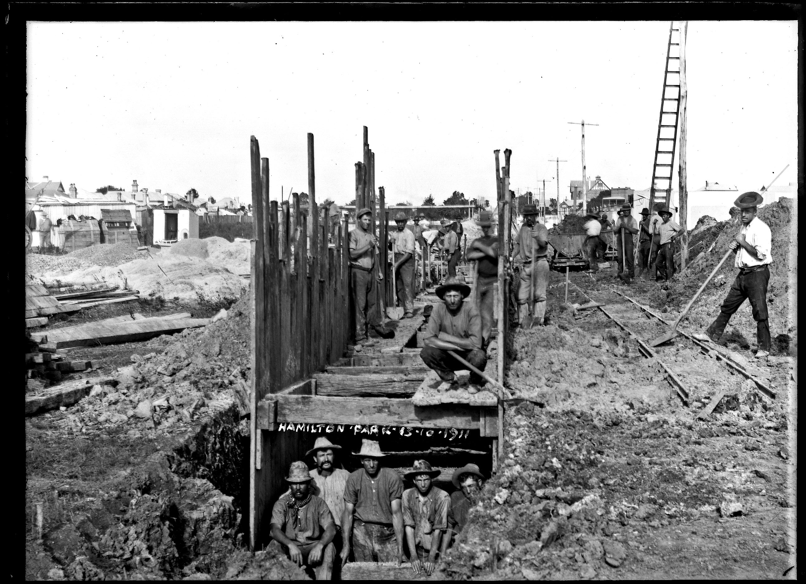
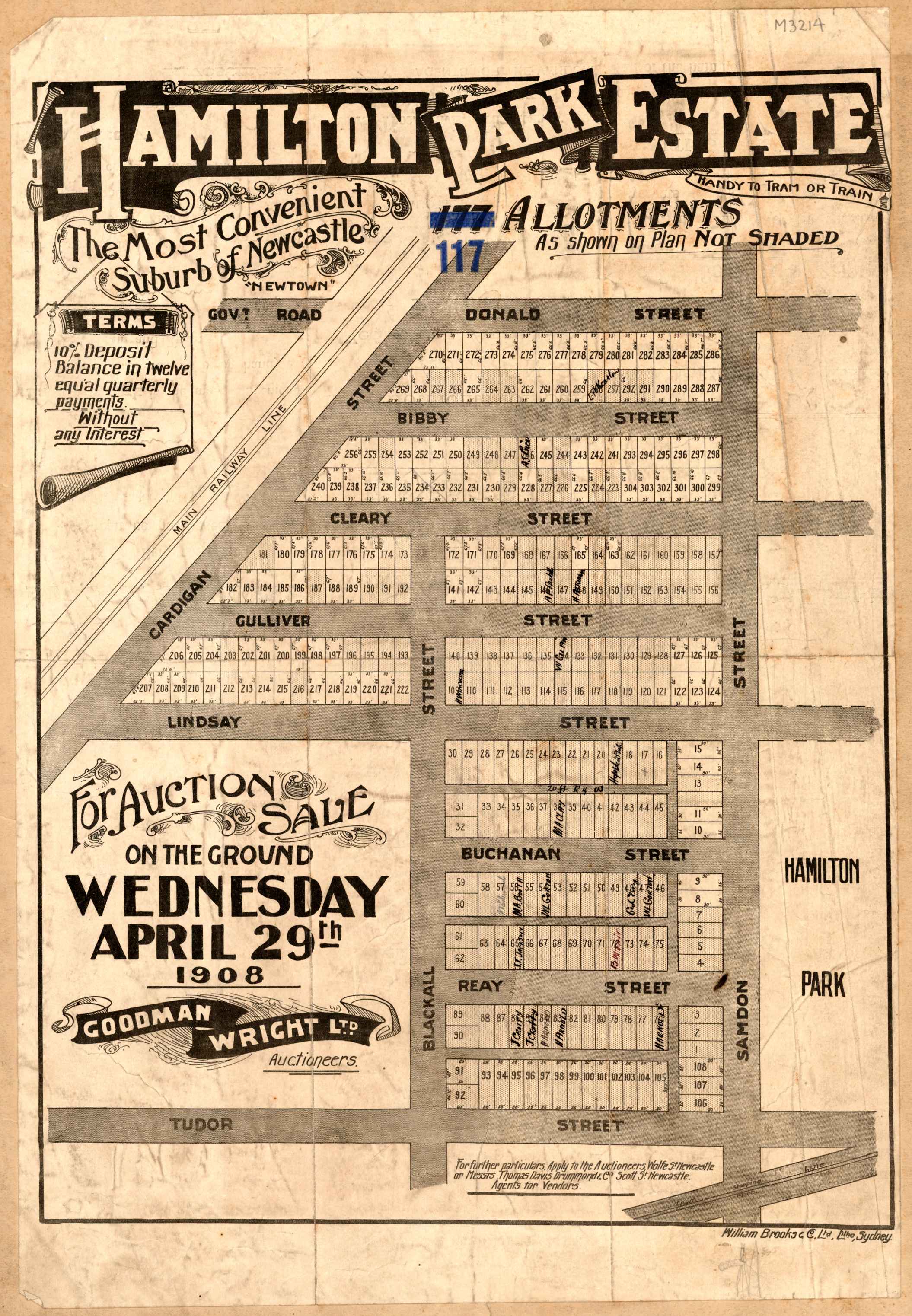
 The 1911 photo is inscribed with “Hamilton Park”, which was the name of a new subdivision of building allotments to the west of Hamilton Park, now Gregson Park.