The University of Newcastle Cultural Collections site has a Ralph Snowball photo with the caption “Construction of the water reservoir, New Lambton, NSW 1917”. In tracking down the location of this photo, thanks to Robert Watson I somewhat surprisingly ended up in a different suburb and a different year.
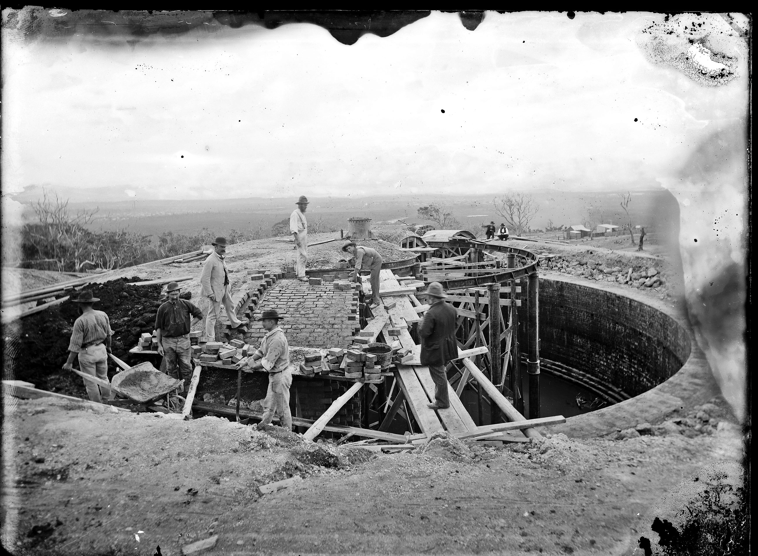
Construction of Glebe Hill Reservoir, 1886. Located at 65 Macquarie St, Merewether. Photo by Ralph Snowball, University of Newcastle, Cultural Collections.
Part 1: Ridgeway Road?
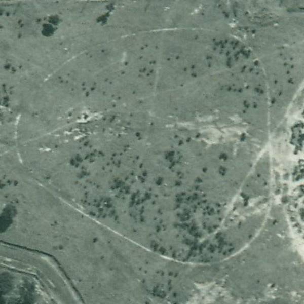
Given that the photo is taken from an elevated position overlooking a flat plain I had always assumed that the location was where the reservoir now is at the top of Ridgeway Road, New Lambton Heights.
Water Reservoir site, corner of Ridgeway Rd and Lookout Rd, New Lambton Heights.
A search of Trove appeared to confirm my assumption, with a 9th January 1917 newspaper article reporting that
“The construction of the New Lambton reservoir was completed on the 3rd instant, and after satisfactory tests were made the reservoir was brought into use.”
- the topography of the land wasn’t right – there is a deep gully below Ridgeway Rd, but in the photo the land slopes down more gently.
- the reservoir in the photo was of brick construction, but the New Lambton reservoir was of reinforced concrete.
- the reservoir in the photo was large (from estimates of the dimensions in the photo I calculated the capacity to be 350,000 imperial gallons) whereas the New Lambton reservoir was only 50,000 gallons.
Visiting the site of the Ridgeway Rd reservoir revealed that the 50,000 gallon 1917 reservoir is still there, covered in ivy, beside the new 1954 steel reservoir. It is clearly not the reservoir in the Snowball photo.
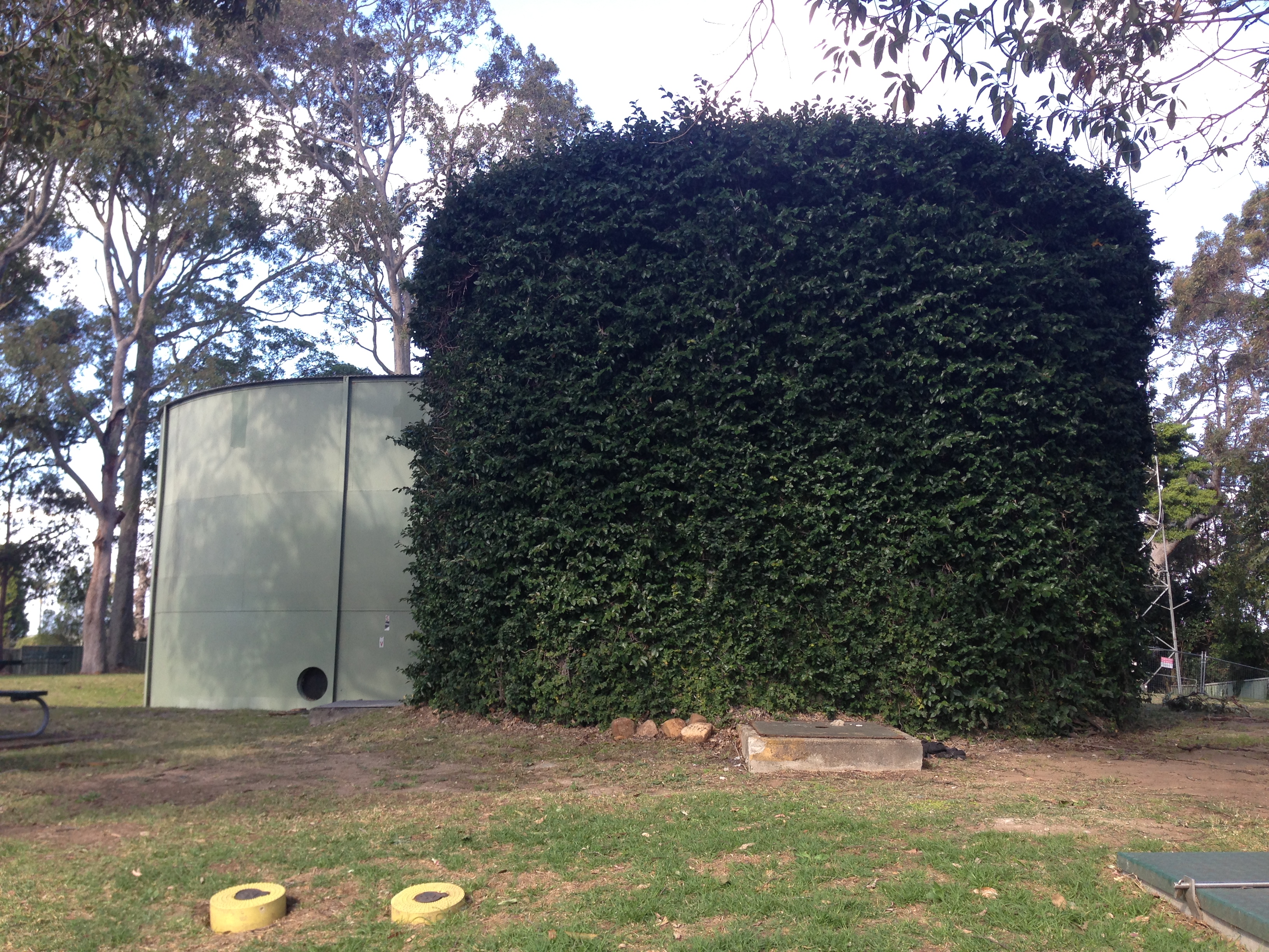
The 1917 ivy covered concrete reservoir, Ridgeway Rd, New Lambton Heights.
On the horizon of the Snowball photo there is a very faint outline that appeared to me to be the outline of Shepherd’s Hill on the coast. What other reservoirs on the hills around the Newcastle would provide a view eastwards over the flatlands towards the coast?
A 1940 map of Newcastle shows reservoir locations as small blue circles. Having ruled out the Ridgeway Rd site [1], I then considered Lambton Reservoir [2], St James Rd Reservoir [3], and Lookout Reservoir [4].
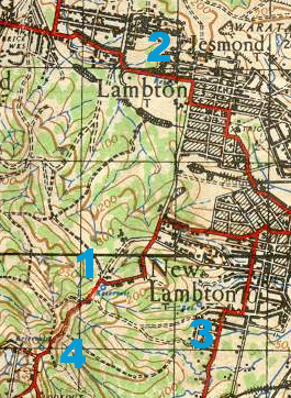
1940 map of Newcastle, showing reservoir locations.
Part 2: Lambton?
Lambton Reservoir was built in 1885 and sits in the middle of Newcastle Road at the top of the hill.
Lambton Reservoir, Newcastle Road.
Interestingly, a drawing of the Lambton Reservoir shows that it is the same design as the reservoir in the Snowball photo, with a central dome and two concentric rings of arches to form the roof.
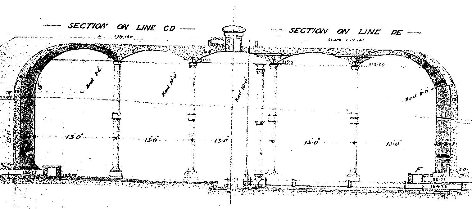
Design of Lambton Reservoir, 1885.
But despite the similarity of design, the topography of the land in the photo doesn’t match. If the photo was of Lambton Reservoir we would expect to see the township of Lambton (including the very prominent Post and Telegraph Office building) before us.
Part 3: St James Road?
The reservoir (marked 3 in the map above) in New Lambton, between St James Rd and Queens Rd was built soon after August 1926. It didn’t seem to match up too well with the shape of the land in the Snowball photo – the St James Rd reservoir appears to have a slight ridge to its right, which is absent in the old photo. Also in 1926 we would expect to see the growing suburb of New Lambton below the reservoir, instead of the large expanse of scrub land that we do see.

Reservoir, between St James Rd and Queens Rd, New Lambton.
Part 4: Lookout?
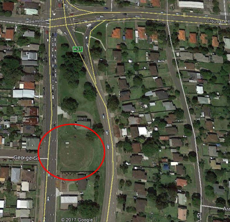
The reservoir marked 4 on the map above was known as the Lookout Reservoir. It also was constructed on 1926, and its location can still be seen in the empty circular space between the two newer above ground steel reservoirs.
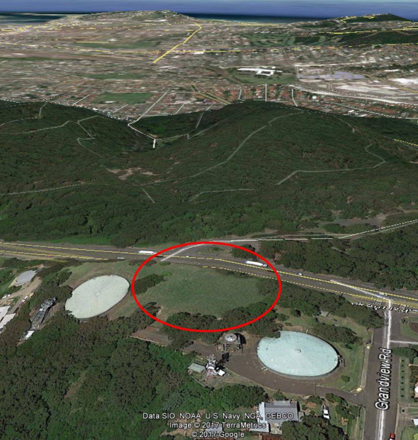
Location of the “Lookout Reservoir”, corner of Grandview Rd and Lookout Rd, New Lambton Heights.
The “Lookout Reservoir” seemed to be a better candidate for the Snowball photo in terms of the shape of the land and size of the reservoir, but it led me to an impossible conclusion … the “Lookout Reservoir” was constructed in 1926, but Ralph Snowball had died in August 1925, before construction had begun!
Part 5: Merewether?
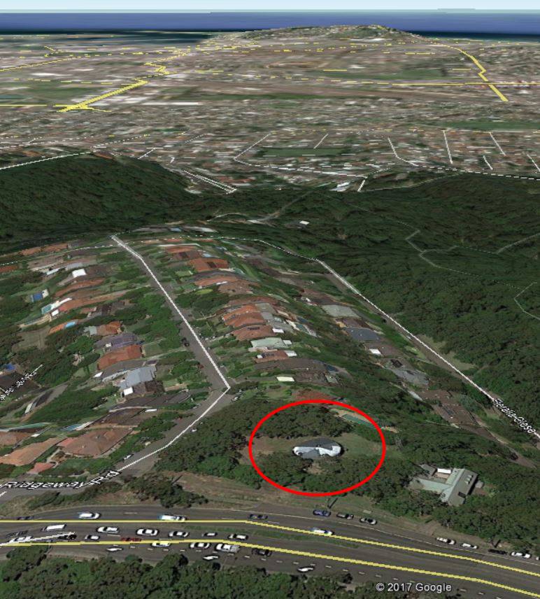
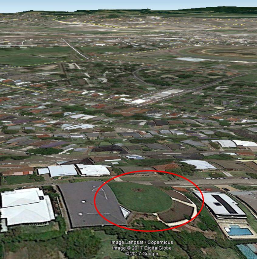
At this point, Robert Watson came to my aid, and with some inspired thinking rescued me from my impossible conclusion. He deduced that the reservoir in the Snowball photo is actually situated in Macquarie St, Merewether.

Location of Glebe Hill reservoir on the 1940 map.
I had led myself astray in too quickly assuming that the Snowball photo was looking east towards the coast. It is in fact looking north-west, across the Broadmeadow flatlands towards Waratah.
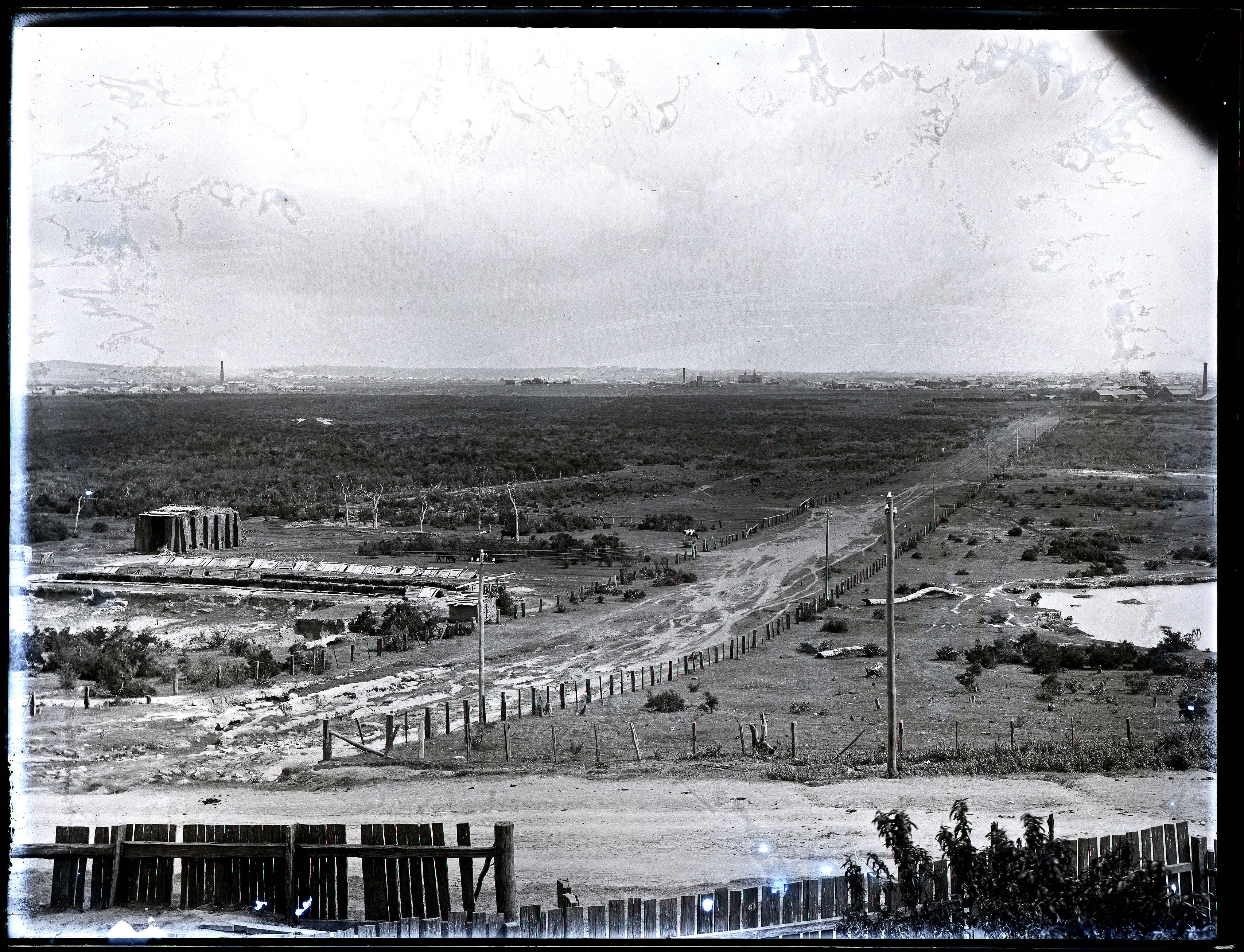
Glebe Hill Reservoir, Merewether.
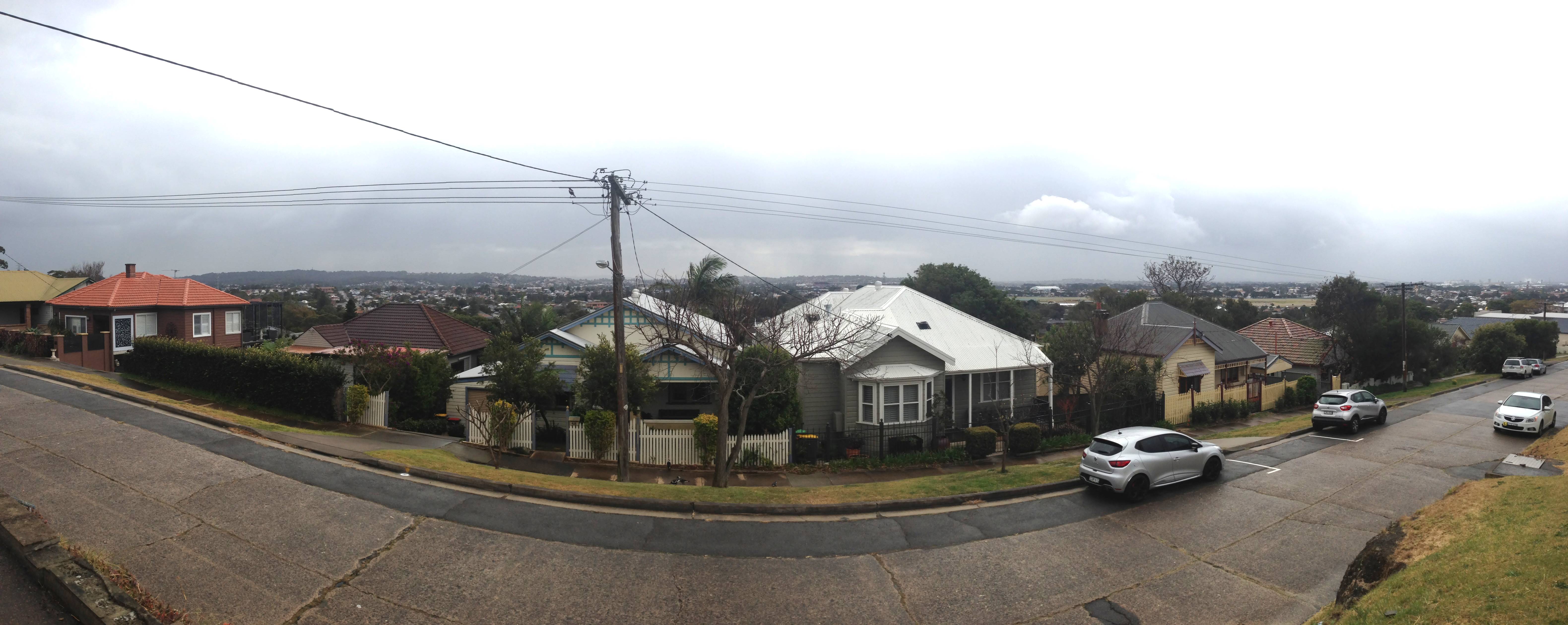
Panorama from the site of the Glebe Hill reservoir.
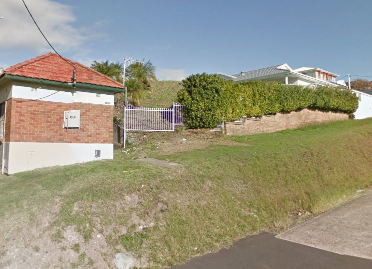
Glebe Hill Reservoir in Macquarie St Merewether is now part of a private residence. Google Street View.
A newspaper article from May 1886 states that the construction of the reservoir began in November 1885, only three months after the Lambton reservoir was completed in August 1885. The article contains a detailed description of the design that matches the photo very closely.
The roof is formed of two concentric arched rings and a dome carried by cast-iron girders, supported by iron columns resting on stone foundations some two feet square.
The reservoir at Lambton is built on the hill above the Public school, a distance of twelve and a half miles from. Buttai. It will hold 402,600 gallons. At fifteen and a third miles from Buttai a 15-inch branch pipe, a mile and a quarter in length, is connected with a reservoir having a capacity of 403,000 gallons, to supply Hamilton, Adamstown, the Glebe, and other towns along the line.
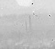
Broadmeadow copper smelter stacks.
These are the stacks of the English and Australia Copper Company smelter at Broadmeadow.
 To the right is a single stack of one of the A.A. Company pits in Hamilton, and the very faint outline of the roof of St Peters Church in Denison St, Hamilton.
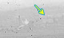 The Glebe Hill reservoir photo is taken from a spot only about 400 metres away from another Ralph Snowball photo taken in 1897, which shows the same landmarks in the distance.
The Newcastle lowlands. 1897. Photo taken from intersection of Beaumont St and Glebe Rd looking north towards Hamilton. University of Newcastle Cultural Collections.

1886 Glebe Hill Reservoir photo (top) and 1897 Glebe Rd photo (bottom)
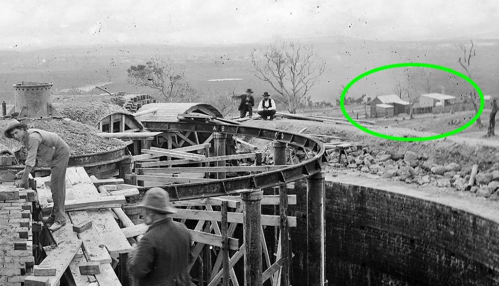
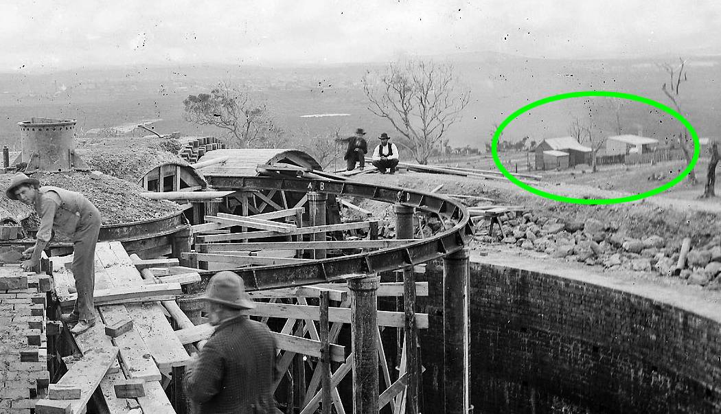
The Glebe Hill reservoir is marked on Corporal Barrett’s 1910 map of Newcastle, situated on Lake Macquarie Rd. Quite possibly the two buildings marked at the end of Henry St are the two buildings we see in the Snowball photograph.
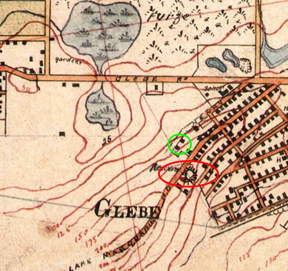
Glebe Hill reservoir, on 1910 map. University of Newcastle Cultural Collections.
Acknowledgements
My thanks to Robert Watson who had a substantial input into the content of this article. Thanks also to Brendan Berghout of Hunter Water, who pointed me towards some useful information on early water supply infrastructure, and who helpfully reminded me that imperial gallons (220 gallons/m3) are not the same as U.S. gallons (264 gallons/m3). It was a casual conversation with Brendan on a bicycle commute to work one morning that was the genesis of this journey of discovery.
 So when I was in Bunnings the other day and