New Lambton Copper Smelter

Mike Scanlon in today’s Newcastle Herald has an article about the naming of Christo Road in Waratah. In the article he quotes from a letter from a reader, Greg Archbold, who says of John Penrose Christoe

“He arrived in Newcastle about 1869 to establish a smelting works at New Lambton where I believe (the old) Goninans is now located. “

This location is indeed correct, although the various suburbs and names mentioned in connection with the smelter makes things a little confusing.  The smelter was the English and Australian Copper Smelting Company, which operated until about 1917.

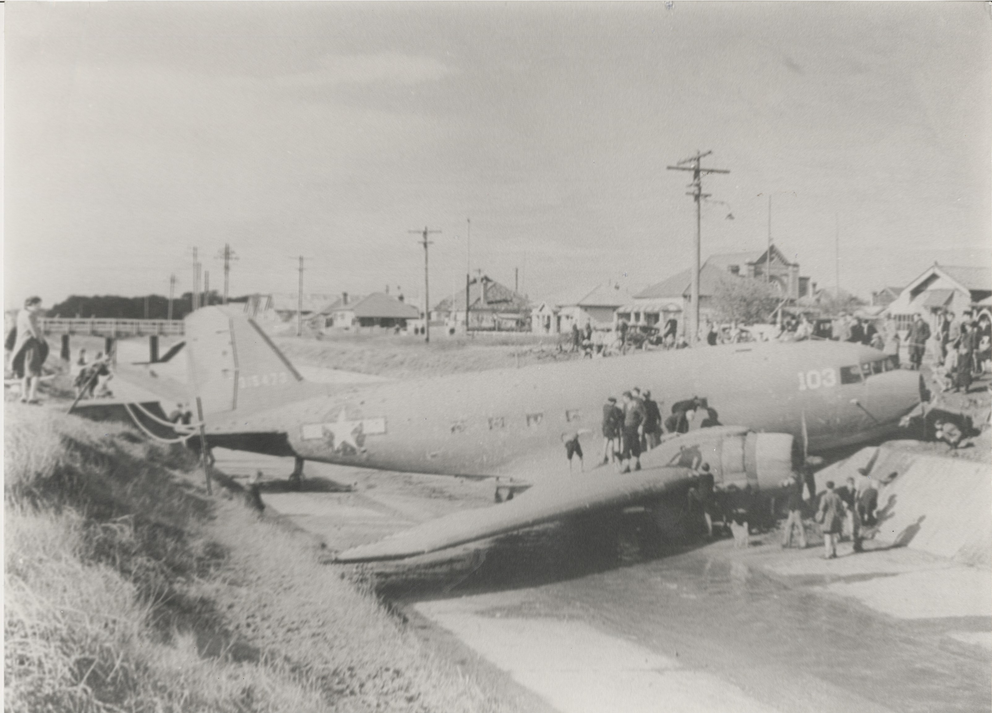
Photograph of Waratah copper smelter by Ralph Snowball, 1906. University of Newcastle, Cultural Collections.

The location of the smelter is now in the modern suburb of Broadmeadow, but at the time the smelter was built, Broadmeadow wasn’t a suburb or town – it was a swamp. So the smelter was variously described as being “within a mile of New Lambton” or “near Waratah”, those being the closest townships.  The association of the smelter with New Lambton was reinforced by the fact that the land the smelter was built on was the leasehold property of Messrs. J. and A. Brown, who owned the New Lambton colliery, and who had an exclusive agreement to supply coal to the smelter. For this reason the works were often referred to as “The New Lambton Copper Smelting Works”.

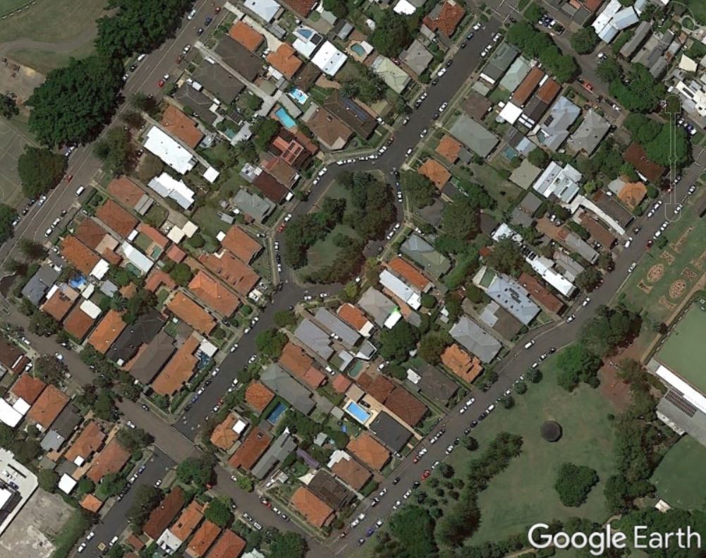
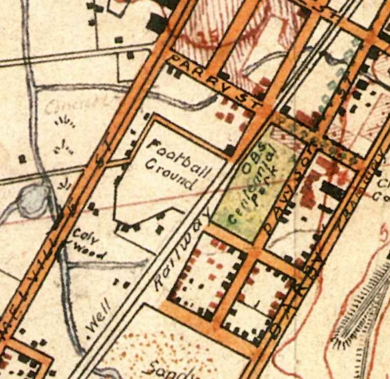
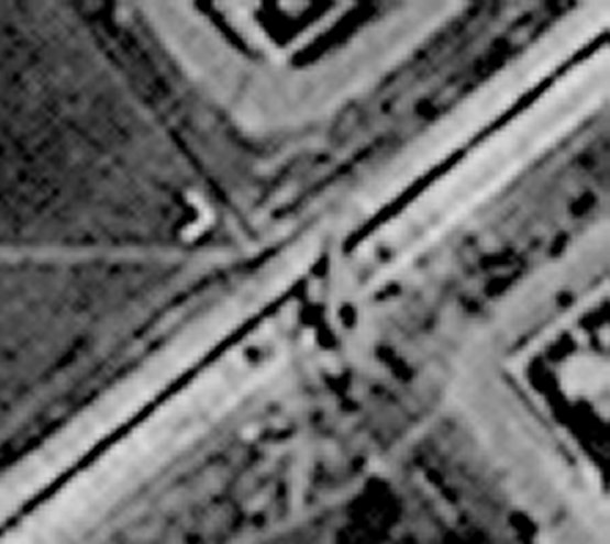
Corporal Barrett’s 1910 map of Newcastle shows the location of the smelter, and also shows that Christo Road was originally called Newtown Road. (Newtown was the original name for Hamilton North.)

1910 Barrett map overlaid on Google Earth, showing the location of the copper smelter near Waratah.

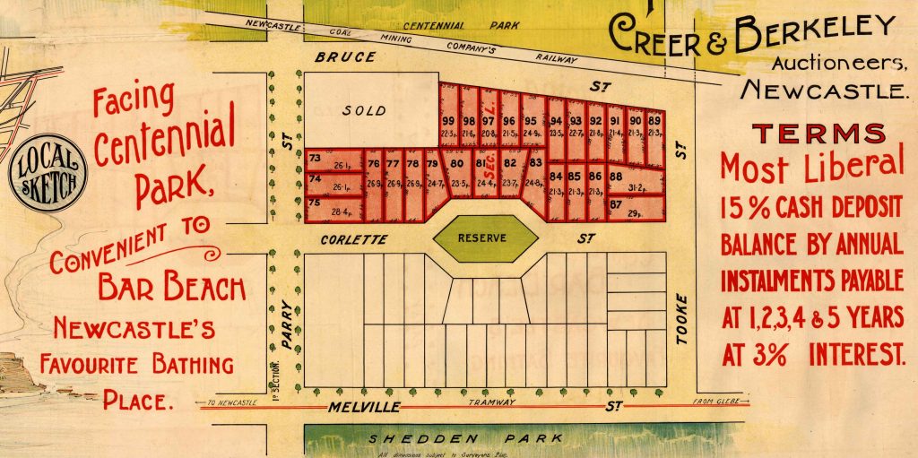
A 1906 real estate poster shows Christo Road mis-spelled as both “Christie Road” and “Christie St”.

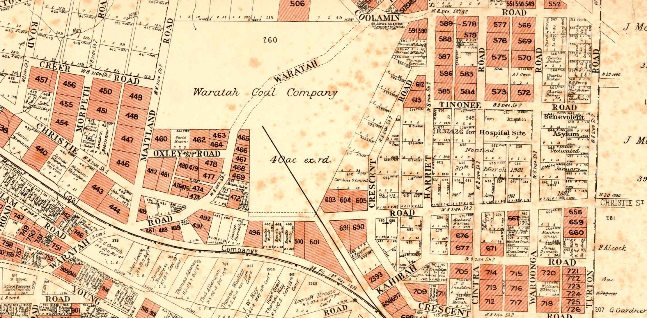
1906 map showing Christo Road as “Christie Road”. University of Newcastle Cultural Collections.

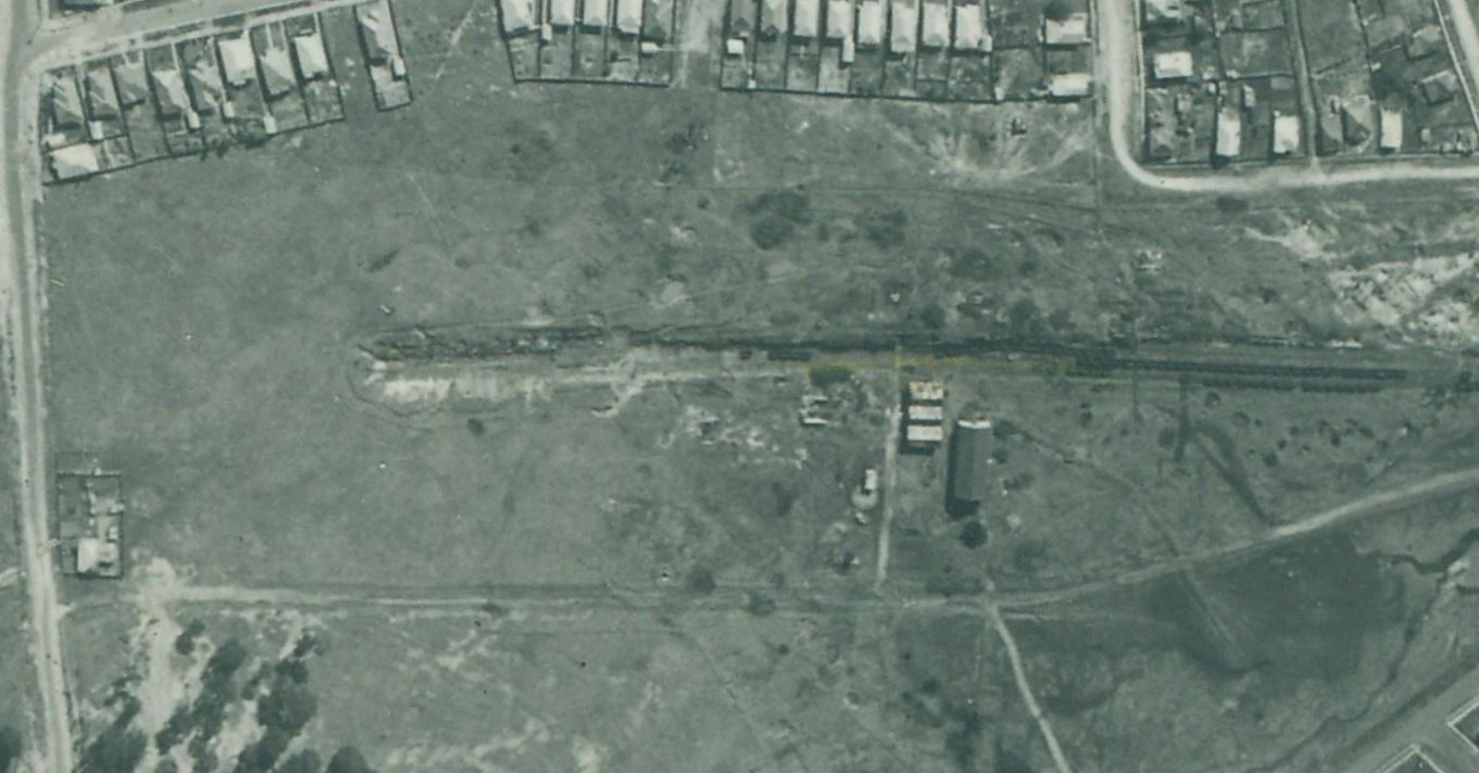
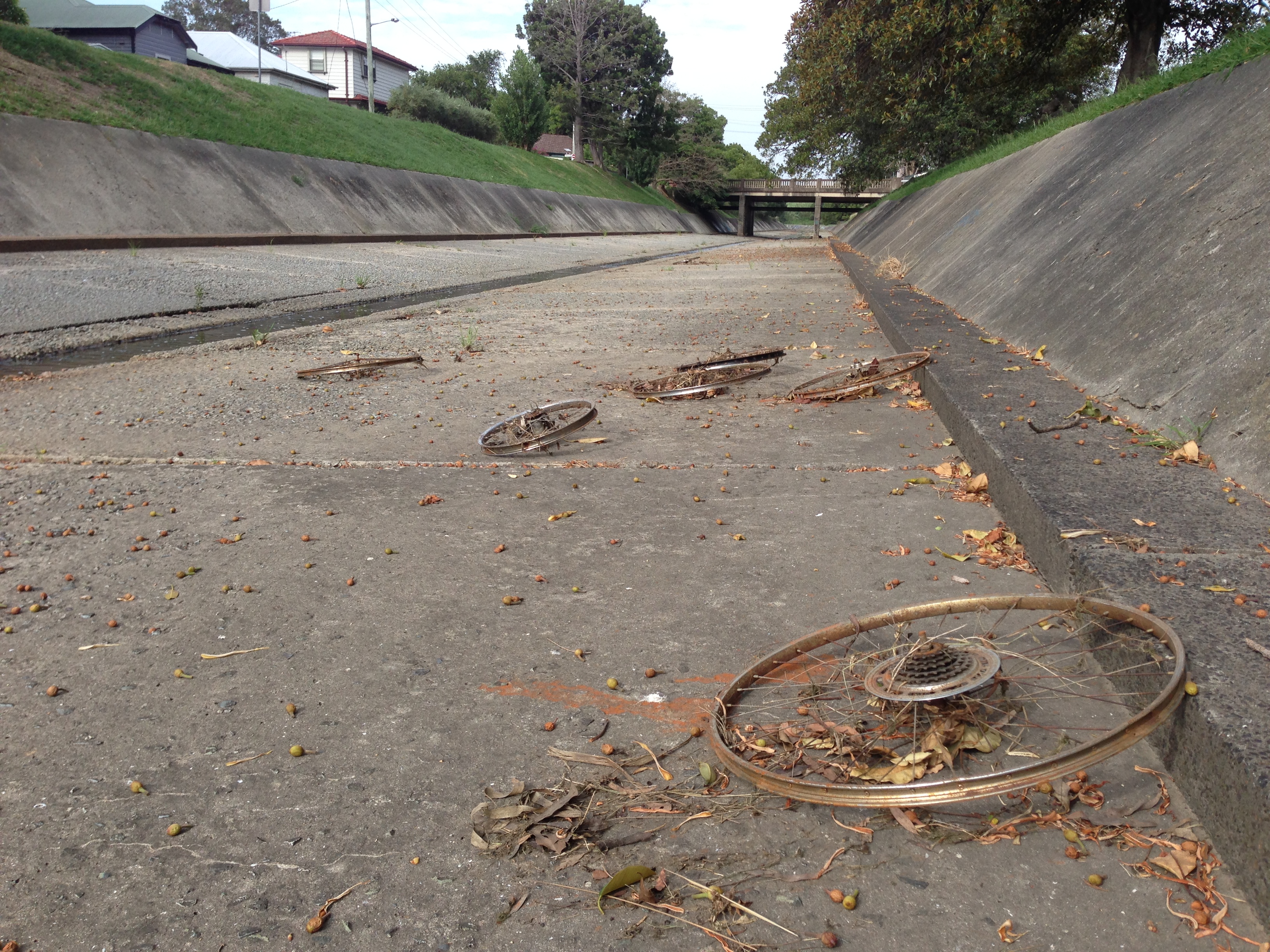
Real estate advertising that doesn’t align with reality is nothing new. The 1906 poster above shows the promise of neatly laid out roads and residential blocks in the Waratah West region near Christo, Creer and Morpeth roads.  However a 1944 aerial photograph of the area I recently obtained from Newcastle Library, shows that 38 years later, there was only Christo Rd and a tiny smattering of houses in the area.

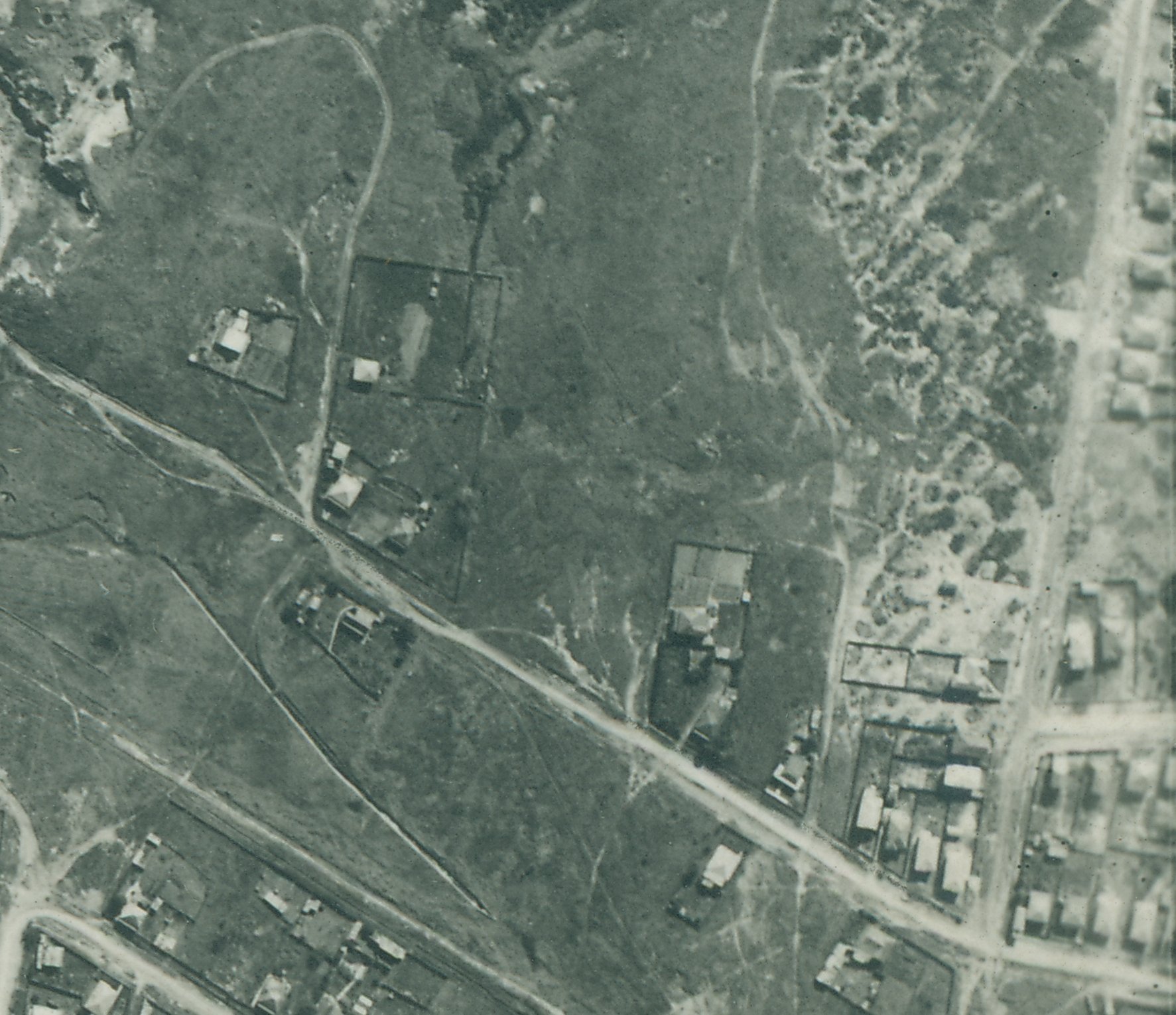
Christo Road Waratah West in September 1944. Newcastle Region Library, Local Studies.

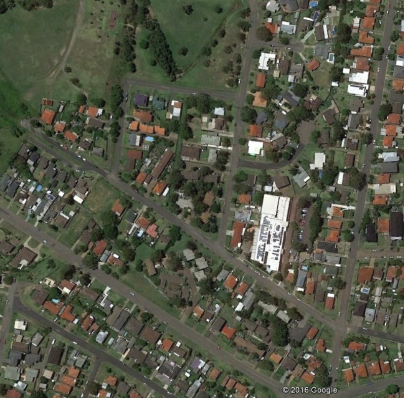
Christo Road Waratah West, 2016.

Update, November 2018

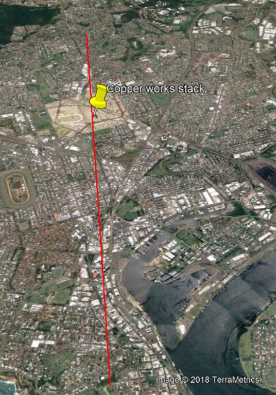
Chris Weeks suggested that the smelter smoke stack can be seen in a 1906 photo from the obelisk.

Smelter smoke stack as seen from Newcastle Obelisk, 1906. University of Newcastle, Cultural Collections.

This is confirmed by drawing a line in Google Earth from the obelisk to the peak of the North Lambton hill (seen in the upper left corner of the photo portion above) and noting that the smelter stack is slightly to the right.


Newspaper articles

Article Date Event DateNotes
6 Nov 1869"The English and Australian Copper Company, who carry on extensive smelting works in South Australia, are about to establish similar works within a mile of New Lambton.
12 Feb 1870Construction of the English and Australian copper smelting works at Broadmeadow has been in progress for three months, and smelting "will be commenced in about two months." (This was a wildly optimistic estimate, as smelting eventually commenced in June 1872, more than two years later.)
The manager is "Mr. Christoe, a gentleman of great experience in copper-smelting."
15 Sep 1870The weather has significantly delayed the opening of the smelter.
"For upwards of two months there was such an accumulation of water at the establishment as to defy the possibility of the works being proceeded with, and thus the company were unexpectedly debarred from carrying out their design in the contemplated time as regards the inauguration of the process of smelting."

The manager of the smelter is Mr. Christoe.
15 Jul 1871Advertisement for a General Manager for the New Lambton Smelting works.
9 Sep 1871250 tons of copper ore have arrived in Newcastle Harbour destined for the New Lambton Copper-smelting Works so "now there is a reasonable hope that this fine and valuable property created here at a great expense, will very shortly become utilised."
6 Feb 1872Mr Christoe supervising operations at the Burwood Copper Smelter, Glenrock lagoon.
18 May 1872Copper ore has been received, but smelting has not yet begun.
18 Jun 1872Lighting the first fires in two of the coppersmelting furnaces of the English and Australian Copper Smelting Company's works near Waratah.
19 Oct 1872"There appears to be an anomaly existing between our copper- smelting establishments, which time only can set at rest ; for while at this establishment five furnaces are idle for want of ore, at the Hunter River Works, five furnaces are idle here from the want of men acquainted with smelting operations to work them."
2 Oct 1917Smelting of ore has ceased.
"The business of the company during the past year had to be conducted under conditions of great risk and anxiety, which finally forced the board reluctantly to instruct the manager in Australia to cease making purchases of ore, to smelt out all copper available, and to close the smelting works, a process that has been carried through."
6 Nov 1919"The long connection of the English and Australian Copper Company, Limited, with the Newcastle district has been finally severed through its having recently sold the land that was the site of the works, known as the Waratah works."
8 May 1920"The chimney stack of the old copper works, which was felled some time ago, gave about 150,000 bricks."

Lambton Colliery, 1944

In a previous article I wrote about finding parch marks in Lewis Oval, and suggested that they were due to the railway cutting and tunnel of the former Lambton Colliery. I recently obtained a scan of a 1944 aerial photograph of Lambton from the Local Studies section of Newcastle Library. By overlaying the photograph in Google Earth I can see that my guess was spot on.

The former Lambton Colliery, September 1944.

The site of the Lambton Colliery, 2016. Google Earth.

The 1944 aerial photo overlaid onto Google Earth.

How long for a ULL ID confirmation?

After years of waiting, the National Broadband Network is finally available at my home address from today.  I had pre-ordered an NBN deal from a different provider than my current phone/ADSL provider which is Optus. My new soon-to-be provider rang me this afternoon to tell me that they are ready to connect me, but to do so they needed me to confirm my ULL ID with Optus.

What is a ULL ID? It seems that it is a 10 digit number (starting with 161) that uniquely identifies the copper line connected to your house. Given the frustrating and time consuming interactions I’ve had with Optus in the past, I wasn’t too excited or hopeful about extracting this information from them.

So how long does it take to confirm a ULL ID with Optus? The answer turned out to be 44 minutes.

Time Duration (minutes) Activity
18:44 – 18:50 6 Try to find a phone number on the Optus website to ring technical support. It is almost unbelievable how hard it is to find a phone number to ring a phone company!
18:50 – 19:04 14 Give up on ringing Optus and have a go with their Live Chat support. After initiating a request for live chat, wait ….

19:04 – 19:10 6 Live chat with service agent for six minutes before she decides that it would be better to ring me and have a vocal instead of written conversation.
19:10 – 19:12 2 Brief conversation with service agent where she understands what the request is and that she will need to transfer me to the technical support team.
19:12 – 19:24 12 Waiting … listening to horrid hold ‘music’.
19:24 – 19:28 4 Brief conversation with technical support agent who reasonably quickly understands what I’m asking for, confirms my details, puts me on hold for a minute or so while he looks up the ULL ID and then supplies me with the ULL ID.

Yay.

TOTAL 44

Lets see how things go now with my new provider in connecting me to the NBN.

Jack of those notifications

At work I recently had a laptop upgrade to a HP EliteBook 850 G3. This also meant moving to Windows 10 after many years of using Windows 7. The transition has been been mostly positive, but one thing that bugged me for quite a while is that every time I inserted or removed my earphones, about two seconds later I’d get an audible alert and on-screen notification like …

“You just unplugged a device from the audio jack.
Bang & Olufsen.”

I don’t need to be told that a device was unplugged, because I was the one who unplugged it! Age may be wearying me, but my memory retention is still definitely longer than two seconds.

I was sure that there must be a way of turning of these sound device notifications, but couldn’t find anything in the sound settings. Eventually I discovered that it is controlled by the Windows 10 “Notifications & actions” app.


In the “Get notifications from these senders” section, turn off notifications for “Bang & Olufsen”. I don’t know why there are two entries – I just turned them both off.

Now I can plug and unplug as much as I want without Mr Bang or Mr Olufsen trying to impute that I have a brain the size of a goldfish.

Corlette St and the Newcastle Cricket Ground

Mike Scanlon had an interesting article in yesterday’s Newcastle Herald about the appearance of the famous English cricketer W.G. Grace at a cricket match in Newcastle 125 years ago, on Friday 5th February 1892. The Newcastle Morning Herald had a report of the match on the following day.

“The match between 12 members of Lord Sheffield’s team of cricketers and 20 members of clubs in the Newcastle district was commenced on the Newcastle Cricket Ground yesterday.”

The only surviving remnant of the Newcastle Cricket Club is the odd little reserve in the middle of Corlette St in Cooks Hill.

Corlette St, Cooks Hill. Google Maps.

Corlette St, Cooks Hill. Google Earth.

Corlette St originally only extended as far south as Parry St. T. S. Parrott’s 1893 map shows an unlabelled rectangle in the area between Parry and Tooke Streets.

Corlette St, Cooks Hill. 1893.

Corporal Barrett’s 1910 map shows the area marked as a “Football Ground”.

Corlette St, Cooks Hill. 1910. University of Newcastle, Cultural Collections.

By 1917 the sporting ground had gone, and the area had been subdivided by the A.A. Company and was being sold off at an auction on 1st December 1917.

Corlette St, Cooks Hill. 1917. University of Newcastle Cultural Collections.

Confirmation that this is the site of the W.G. Cricket match comes in a short newspaper piece spruiking the auction.

“The sites are portion of the A.A. Company’s Cook’s Hill Estate, which embraces the old Newcastle Cricket Ground area.”

Drain Plane Again

A couple of years ago I posted an article and some photos of a Douglas C47 transport aircraft that ended up in the storm water drain beside the Broadmeadow aerodrome during World War 2.

Last year I was examining an old black and white aerial photograph of the Broadmeadow area, and spotted something interesting …

… could that be the crashed C47 in the drain?

The aerial photograph has an information panel along the bottom, and in the  white shape next to “RUN 5” there is some very faint writing.

The writing is too faint to decipher with any certainty in this “RUN 5”  photograph, but in a similar photograph from “RUN 7” the date of the photograph is clearly 3rd September 1944.

This is just three weeks after the 10th August 1944 crash of the aircraft, and confirms that it is indeed the C47 plane we can see in the aerial photograph.

Photograph of the crashed Douglas C47 transport plane, from the Newcastle Morning Herald, 12/8/1944. New Lambton can be seen in the background.

Newspaper articles

Article Date Event DateNotes
11 Aug 1944
10 Aug 1944
A D.C. 47 Army transport plane, with 25 men on board, skidded 200 yards on a wet runway, hurtled through a fence and then crashed into a stormwater channel at Broadmeadow aerodrome.
12 Aug 1944
10 Aug 1944
Photo. The Douglas C47 transport plane in the stormwater channel at District Park aerodrome, Broadmeadow, where it landed in bad weather on Thursday.